An official website of the United States government
Here’s how you know
Official websites use .gov A
.gov website belongs to an official government
organization in the United States.
Secure .gov websites use HTTPS A
lock (
) or https:// means you’ve safely connected to
the .gov website. Share sensitive information only on official,
secure websites.
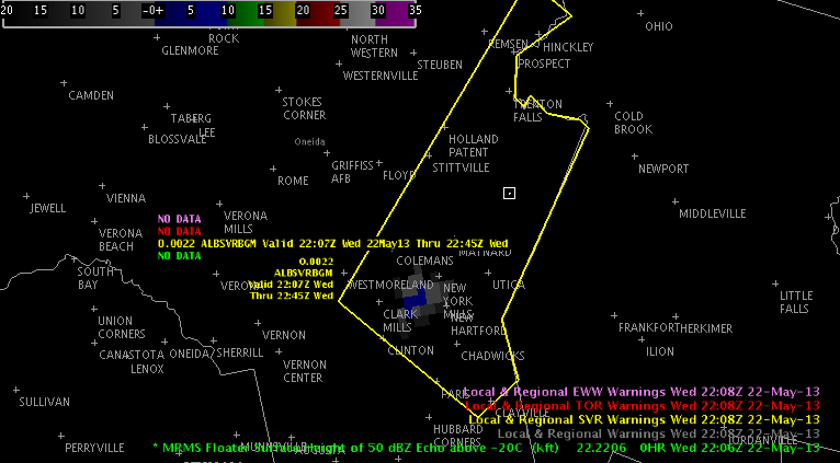
As of 22 UTC isolated convection is occurring across upstate NY. Most of the cells are rather benign. However, one stronger cell has developed across Oneida Co. in BGMs forecast area, which has the potential to produce severe hail with some development of the 50 dBZ core above the -20C isotherm.
Additional development is occurring along the interface of the lake breeze off Lake Ontario and a moist theta-e axis, which extends north from the mid-Atlantic into upstate NY. This cell recently has begin to show some potential for hail.
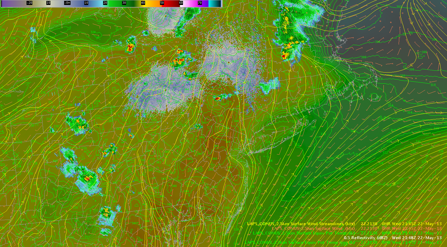
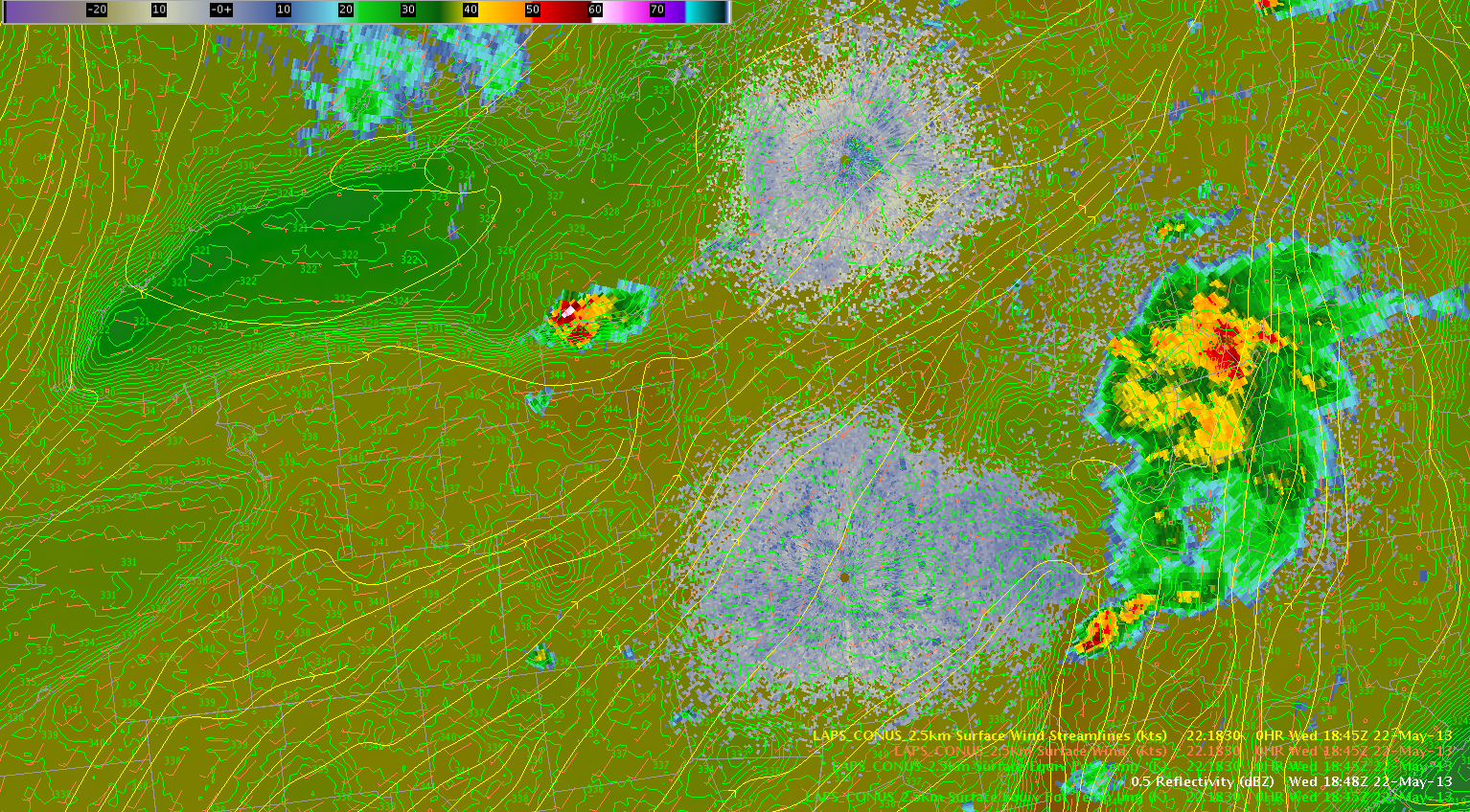
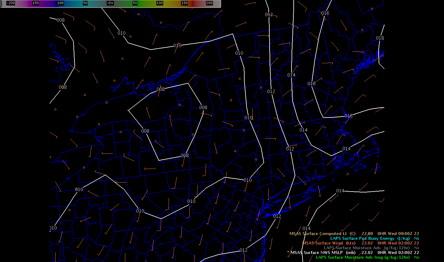
Isolated to scattered thunderstorms should continue to occur over upstate NY along the theta-e axis. Additionally, the surface streamline analysis per the LAPS shows some convergence across the northern portion of the BGM and eastern portion of the BUF forecast areas, which should help focus the convection. A modest hail threat will continue along the moist axis during the next few hours, especially closer to the Mohawk River valley and Lake Ontario closer to a belt of stronger westerly deep layer shear over southern ON.
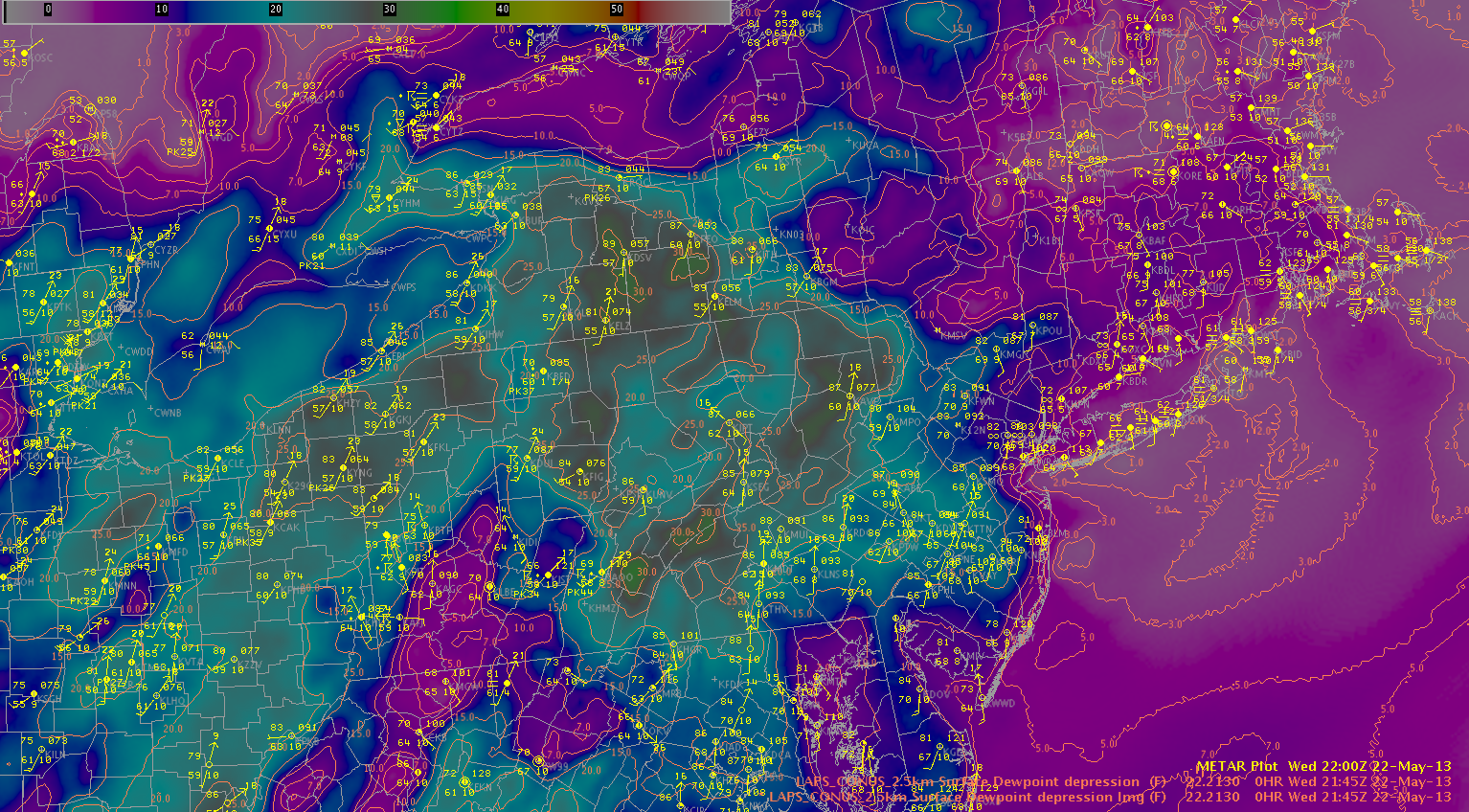
Dry air continues to intrude from the southwest evidenced by large dewpoint depressions (~25-30F) across central PA and western NY. Thunderstorms have developed across the higher terrain of PA and are tracking northeast toward western NY. The higher dewpoint depressions correspond to higher downdraft CAPE values, and this could lead to an increasing wind threat over the next few hours for west-central NY.
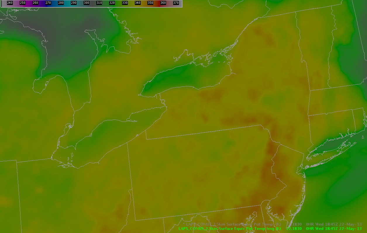
At the current time, one convective complex pushes to the east into New England from New York, with a stronger storm noted moving into Ulster County NY. Behind this complex, a stable layer is noted with lower Theta-E values shown on LAPS imagery.
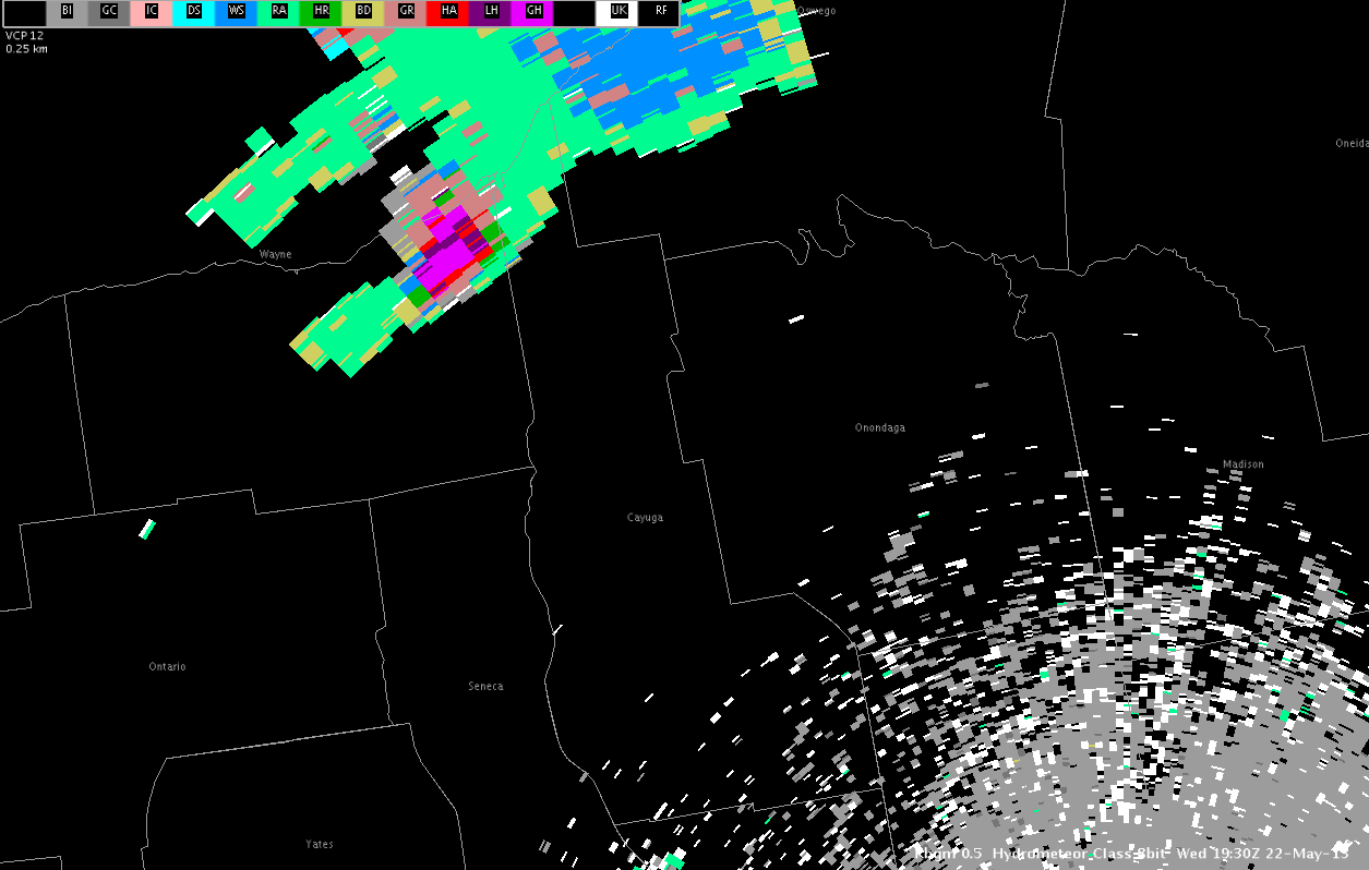
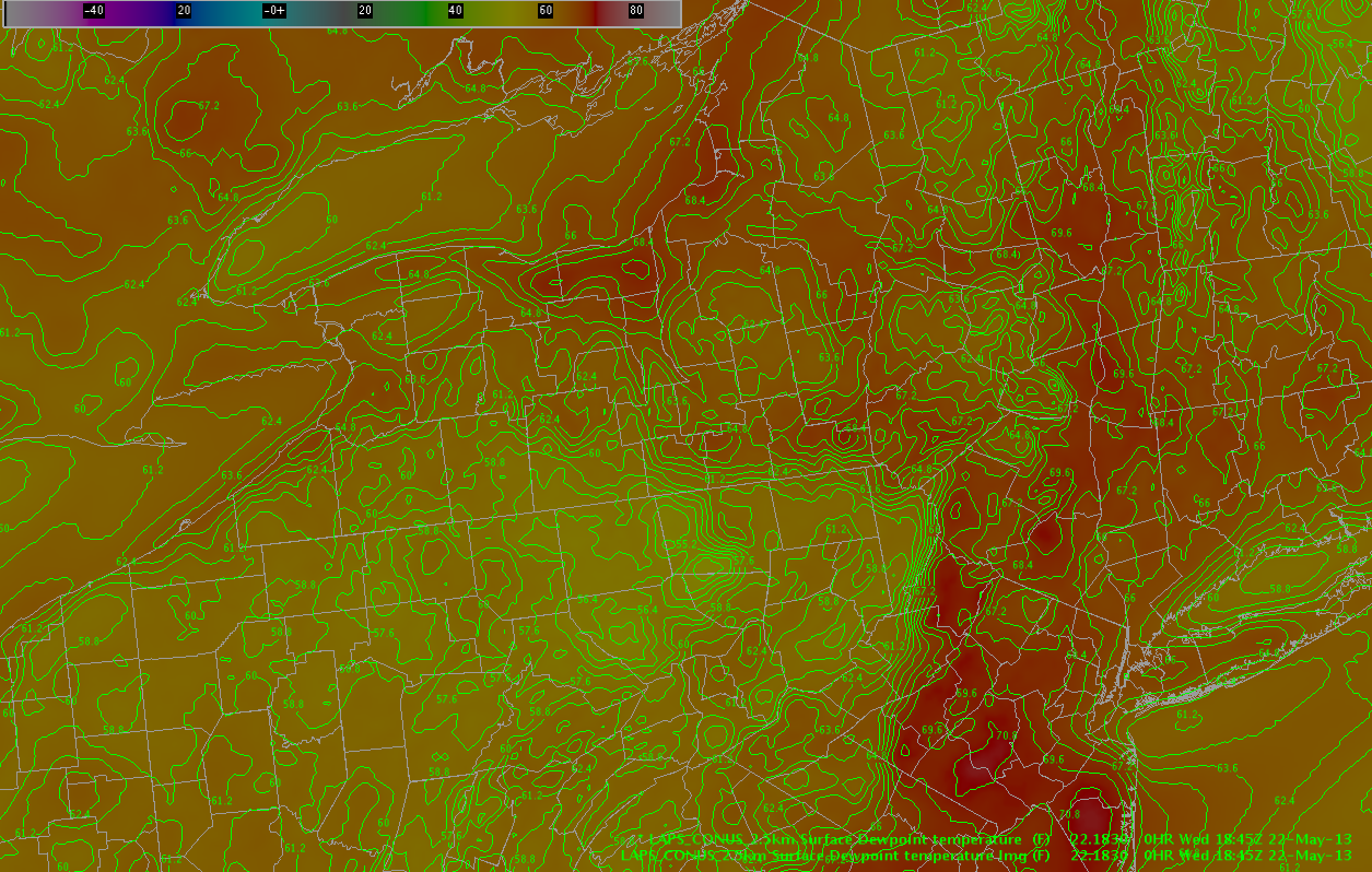
An isolated storm is also noted in northern Wayne County NY. This second storm continues to exhibit severe potential with an HSDA signature of large hail and MESH values exceeding 2 inches.
This storm is located along a convergence boundary well noted in LAPS forecast fields, with dew points in the mid to upper 60s noted south of the lakefront.
This supercell storm is expected to continue to pose a threat of severe hail and perhaps a tornado or two as it moves to the east in an environment characterized by rich moisture and unseasonably warm temperatures that have reached the low 80s, even in the presence of modest 6 km shear of 30 kts. The environment to the south is moderately unstable, characterized by RAP indicated instability values of SBCAPE approaching 2000 J/KG. In addition, a gradual increase in mid level rotation has been noted in recent scans, with storm splitting noted and both storms showing mid level rotation.
Farther to the south, in areas of weaker deep layer shear, convection is expected to increase in coverage through the afternoon hours along two particular moisture gradients noted on the LAPS dew point fields. The first boundary is located from north to south from Wayne County NY to Bradford County PA. The second boundary is located from west to east southeast from Erie County NY to Bradford County PA. Cu clouds are increasing in coverage across western NY with a few echoes beginning to appear. One of these echoes is located in Erie County NY, another two are located in Chemung and Tioga Counties. The main threat through the evening hours should be large hail… with some gusty winds in stronger storms.
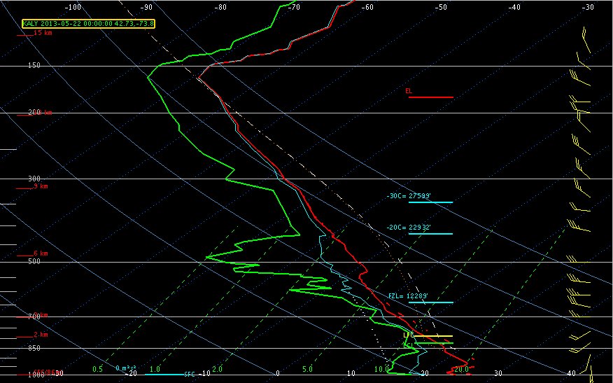
The 00Z ALY sounding did indicate SBCAPE on the order of 1007 J/KG, but CINH was already increasing to around 202 J/KG, so it is likely that most storms will be elevated in nature above a low level inversion and rooted from 850mb on up. Moderate westerly wind shear profiles 25-35 kts are combining with MUCAPE values near 1800 J/KG which enough for storm clusters to continue in advance of a approaching shortwave. Main threat should be large hail, though localized downbursts are possible with any storms that can get rooted more into the boundary layer.
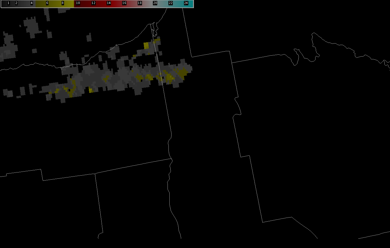
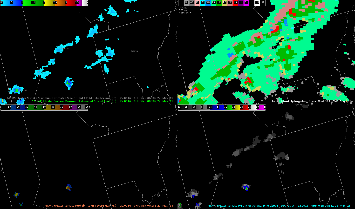
The probability of severe hail and HDCA algorithms all underestimated hail size quite a bit when ping pong (1.5″ diameter) hail fell in Hamilton Co NY. The MESH was the only parameter that recorded near 1.5″ diameter half potential.
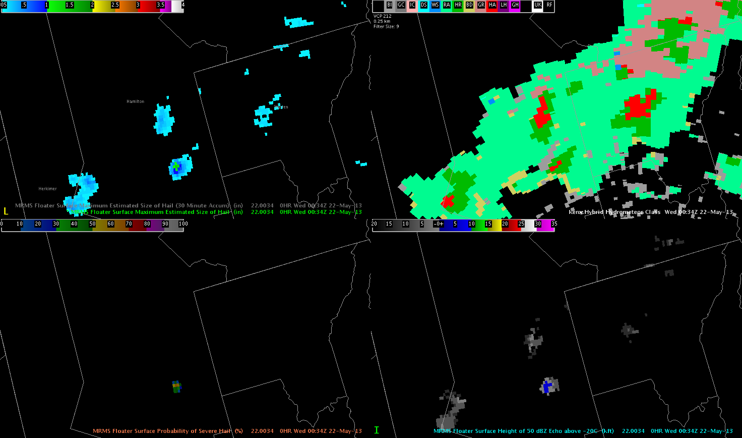
About 20 mins later, another ping pong hail report came in from Hamilton Co and the MESH again outshined the HDSA algorithm which only showed only regular hail(HA).
Storms should maintain for the next several hours, before waning with boundary layer cooling continue to increase and instability aloft weakening somewhat.
An healthy looking low pressure area has moved towards SW OK with lots of convection already ongoing.
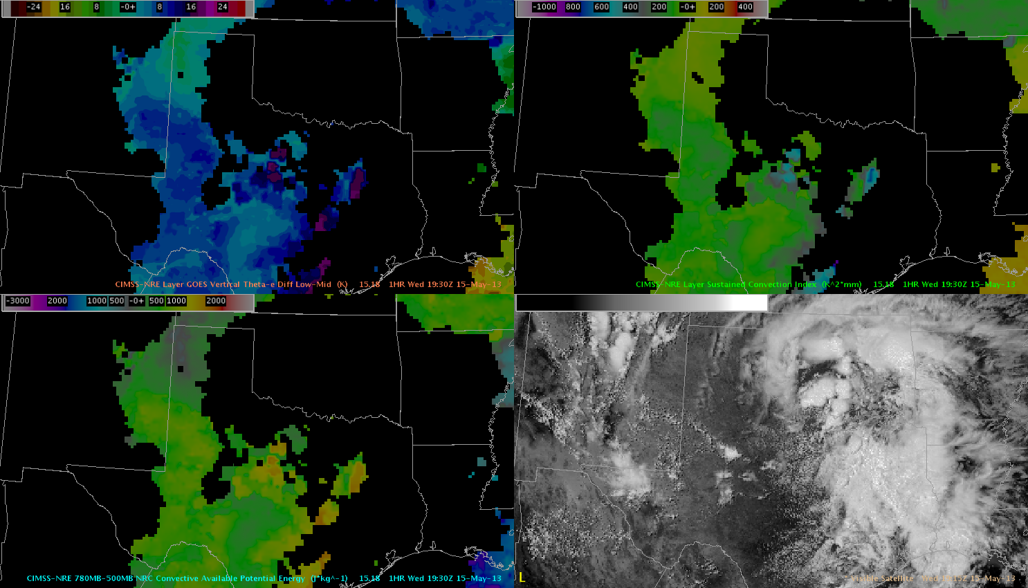
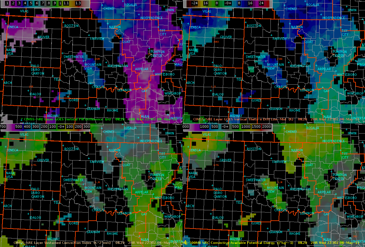
upper left: GOES Vertical Theta-e Diff low-mid, upper right: Sustained Convection Index, lower left: CAPE and lower right: VIS
The main swath of unstable air is visualized nicely with that product, showing a tongue of very unstable air expanding from the far W-Gulf coast towards S-Oklahoma. The ‘sustained convection index’ highlights that area, where strong and longer lived updrafts might evolve betimes (and given agitate Cu field development, it won’t take that long for that). NRE CAPE field has 1500 J/kg just south of OK and with ongoing diabatic heating, we expect a further increase during the following hours. So, using the NRE product the focus for strong/sustained convection clearly shifts in the Dallas/Fort Worth area and south.
Also using the theta-e diff low-mid product, conditions for at least isolated to scattered initiation towards the Lubbock area seems to be plausible, given westward expanding plume of unstable air and interaction with others mesoscale features at the surface. In fact, there currently evolves an east-west aligned theta-e tongue just south of Lubbock, which overlaps nicely with evolving showers and thunderstorms. Helge
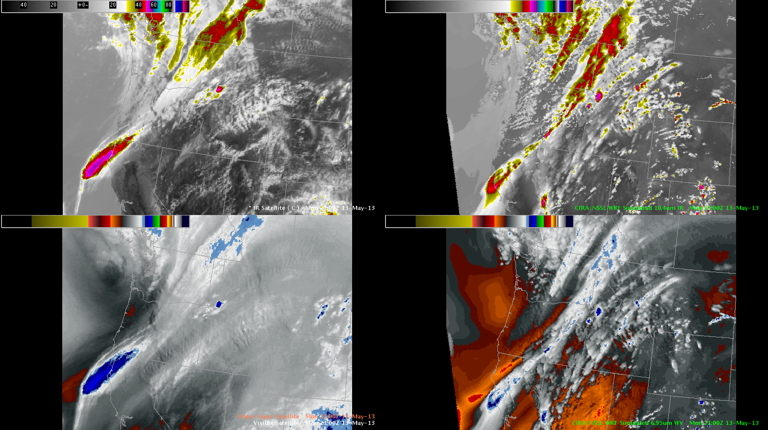
A shortwave trough is moving through central Washington and Oregon with scattered coverage of storms initiating over northeast Oregon and the Idaho panhandle this afternoon.
CIMSS Nearcast Product is depicting a weakly unstable environment averaging 500 to 1000 J/KG along a corridor stretching from eastern Oregon through northern Montana with storms initiating off the higher terrain and continuing to track along the axis of instability within this corridor. RAP analysis is indicating roughly 60 to 70 kts of 0-6km shear collocated with axis of instability…which is likely inhibiting deep growth and organization at this time due to the imbalance of high shear and weak instability.
Initial look at synthetic WRF IR and WV show relatively good agreement with GOES IR/WV…albeit slightly more progressive by about 50 to 100 mi. Strongest storm so far was analyzed quite well by the WRF in northeast Oregon with only a slight southern displacement from real time location. In general though…the model captured the initiation and future trend of this storm with relatively high accuracy. Additionally…the model is showing future intensification further east off the higher terrain through the evening…although the slightly more progressive system in the model may mean a later initiation and intensification of this activity by an hour or two.
However…once the convection does initiate…slightly less shear collocated with an area of 1000J/kg could allow the storms to become better organized than current trends. The synthetic imagery portrays this situation across western and central Montana 23Z through 01Z. Current surface observations show a relatively dry boundary layer in this area with dew points averaging in the low 40s and downslope winds. Main threat from any storms in this region will be mainly downbursts but better storm organization will allow for a continued severe hail threat as well.
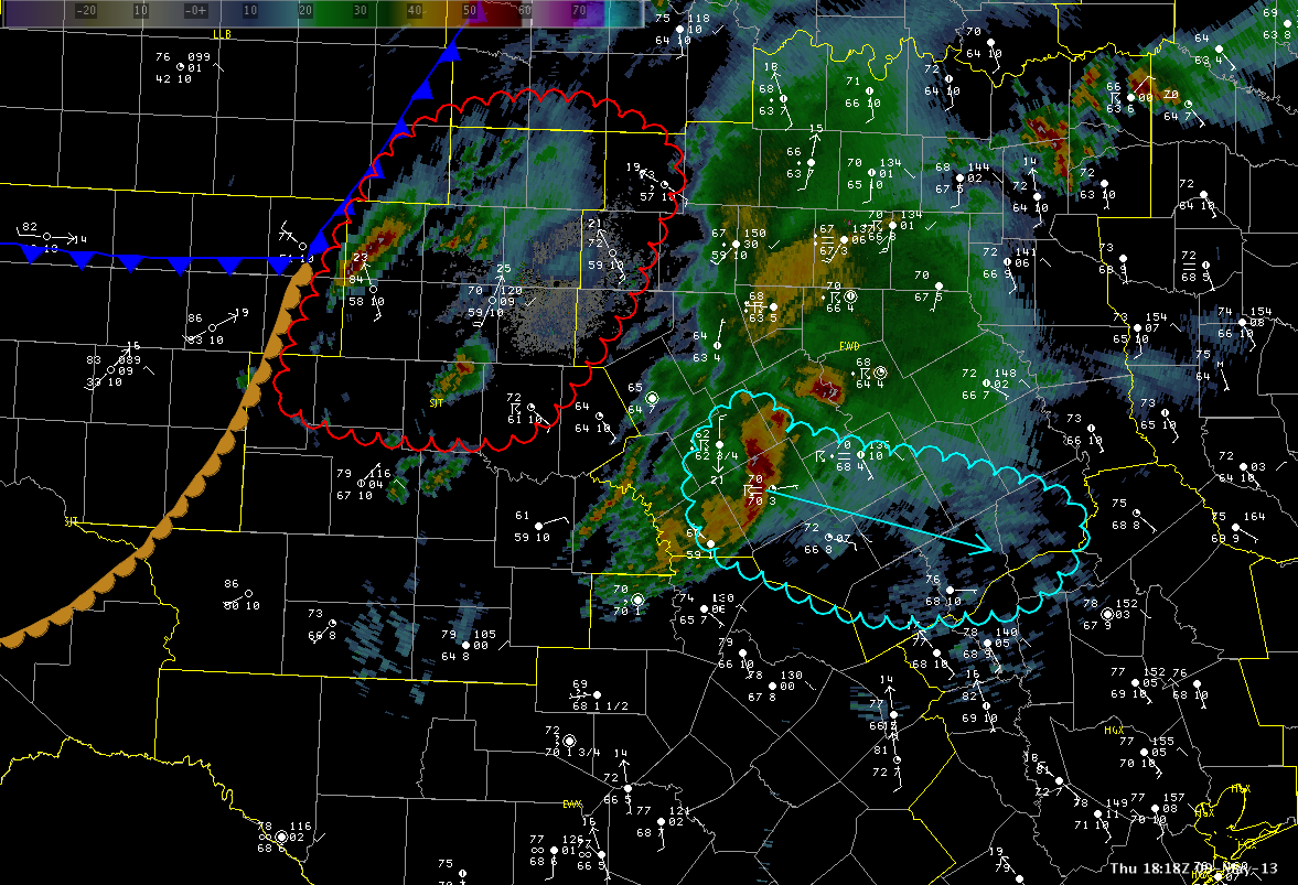
There are two main area of concerns over the next two to three hours. The first is across the southern FWD CWA. A strong to marginally severe storm is currently tracking ESE and is indicated in the image below in cyan. This storm is moving into an environment of 2000 J/kg of surface CAPE but is going to feel the effects of some inhibition. This should allow the storm to maintain its intensity with some growth possible if CIN values decrease with further heating and destabilization this afternoon.
Further to the west in the SJT CWA, some clearing as allowed temperatures to warm into the middle 80s with dewpoints in the upper 50s to lower 60s. This leads to CAPE values of 3000-4000 J/KG given steep mid-level lapse rates near 7.5 C/Km. This area is also near the surface front/dryline and this will serve as an additional surface focus for convection. With an uncapped airmass, this area will likely be the best area for supercells and large hail. This region is in red in the image below. The HWT will have one team in the FWD CWA and one in SJT.
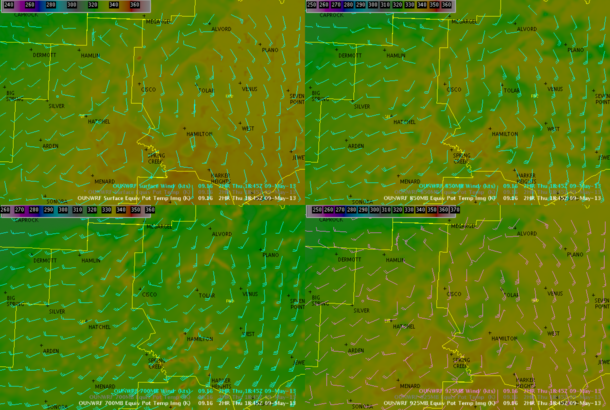
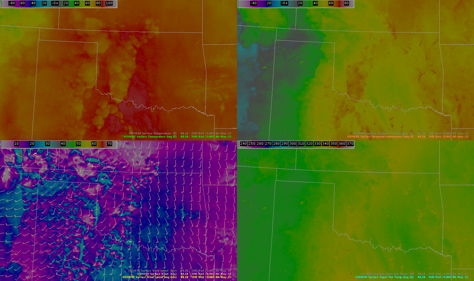
The 16z run of the OUNWRF has captured the increasing moisture and temps with its mid-level theta-e fields quite nicely…with theta e values at 850 and 700mb increasing 10 to 12 K over a 2 hour period, primarily pooled near the pseudo-triple point mentioned above across the northern portion of SJT’s CWA.
OUNWRF Theta E fields and Winds (sfc, 850, 700, 925)
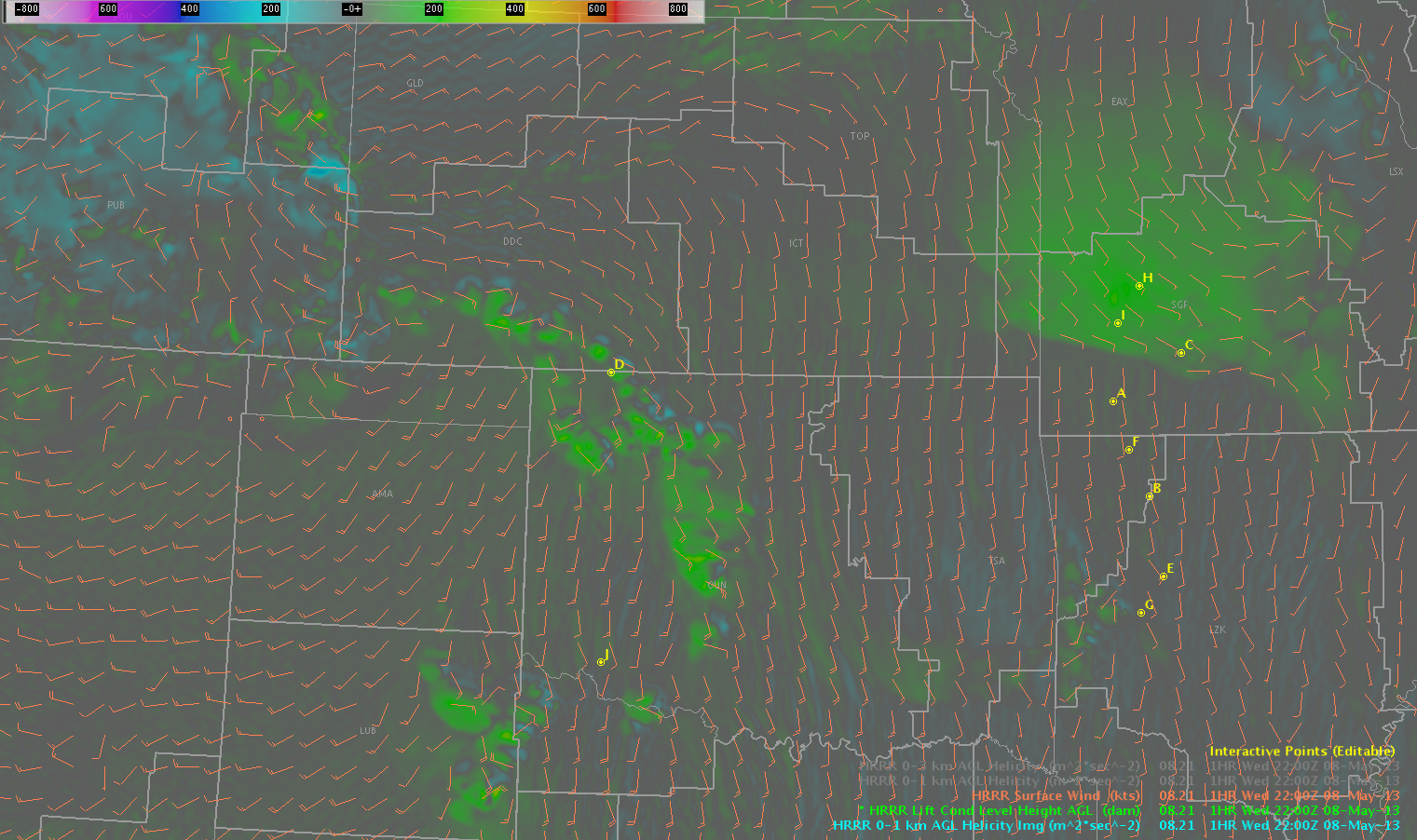
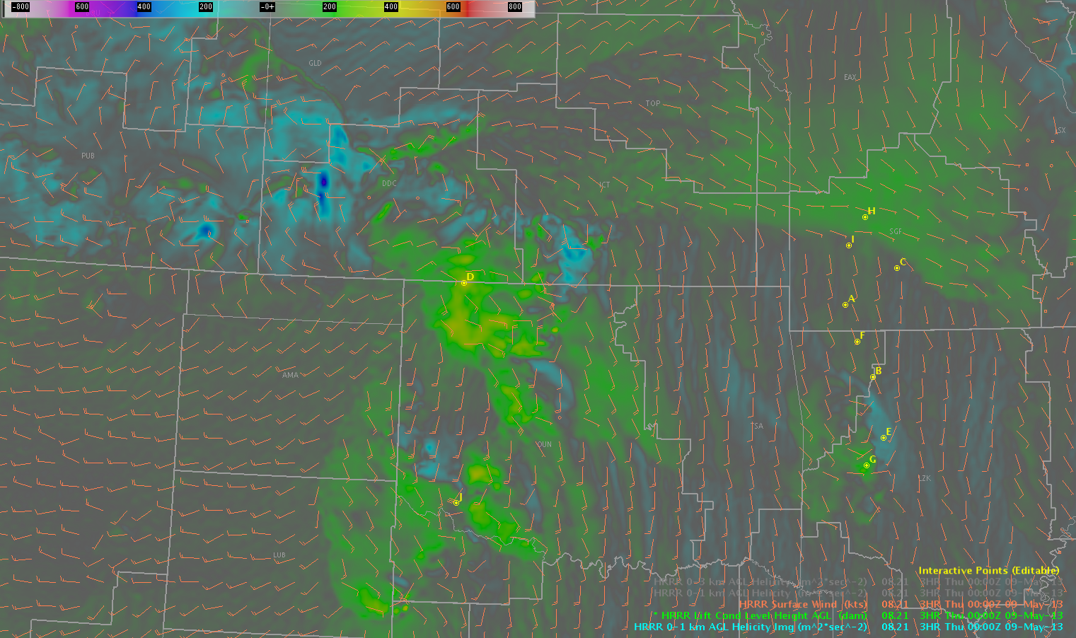
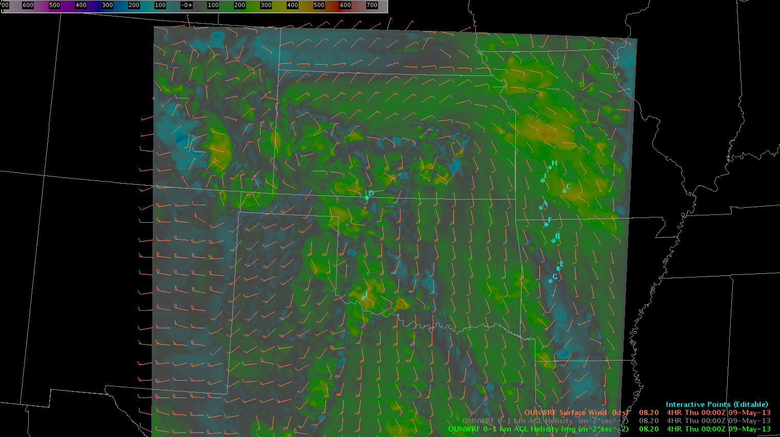
Winds are backing in two sections of the area that we are concerned about today. Both the OUNWRF and HRRR data indicate that 0-1km helicity is continuing to increase in two locations.
HRRR 0-1km SRH at 2200Z.HRRR 0-1km SRH at 0000Z.OUNWRF 0-1km SRH at 2200Z.OUNWRF 0-1km SRH at 0000Z.
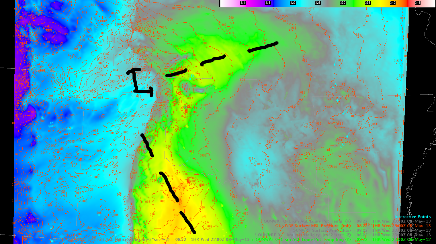
Near points D (OK/KS border) and J (OK/TX border), winds are backing at the surface. Looking at an OUNWRF MSLP, the front over southern Kansas is evident (as well as a change in air mass, as indicated by theta-e). Ahead of the dryline, there is another trough that digs south-southeast into Texas, with winds backing well ahead of the dryline.
OUNWRF Theta-e and surface MSLP at 2300Z.
RAP/HRRR/OUNWRF data indicates that LCL values will decrease with time over the next few hours. However, dewpoint depressions on surface obs remain quite large in both of these focused locations (about 20F in SW Oklahoma, and about 10-15 degrees ahead of the storms in southern Kansas).
We do not currently have the 1km LAPS forecast data available in AWIPS. However, what we are seeing on the internet appears to show that the line of supercells moving into the SW OUN CWA will continue to strengthen. This will be as it moves into the southern area highlighted above — perhaps an area that will be potentially favorable for a bit of an enhanced tornado threat.
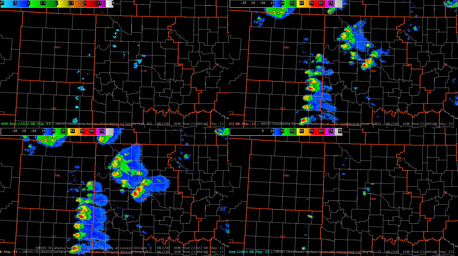
First, here is a look at the current MRMS data, which shows a line of very strong discrete cells along the dryline near and SW of southwestern Oklahoma. Additional convection (some cellular, some multi-cellular) curves up along the warm front and back toward the triple point into Kansas.
MRMS and MESH data, indicating the mode of storm development at around 22Z.
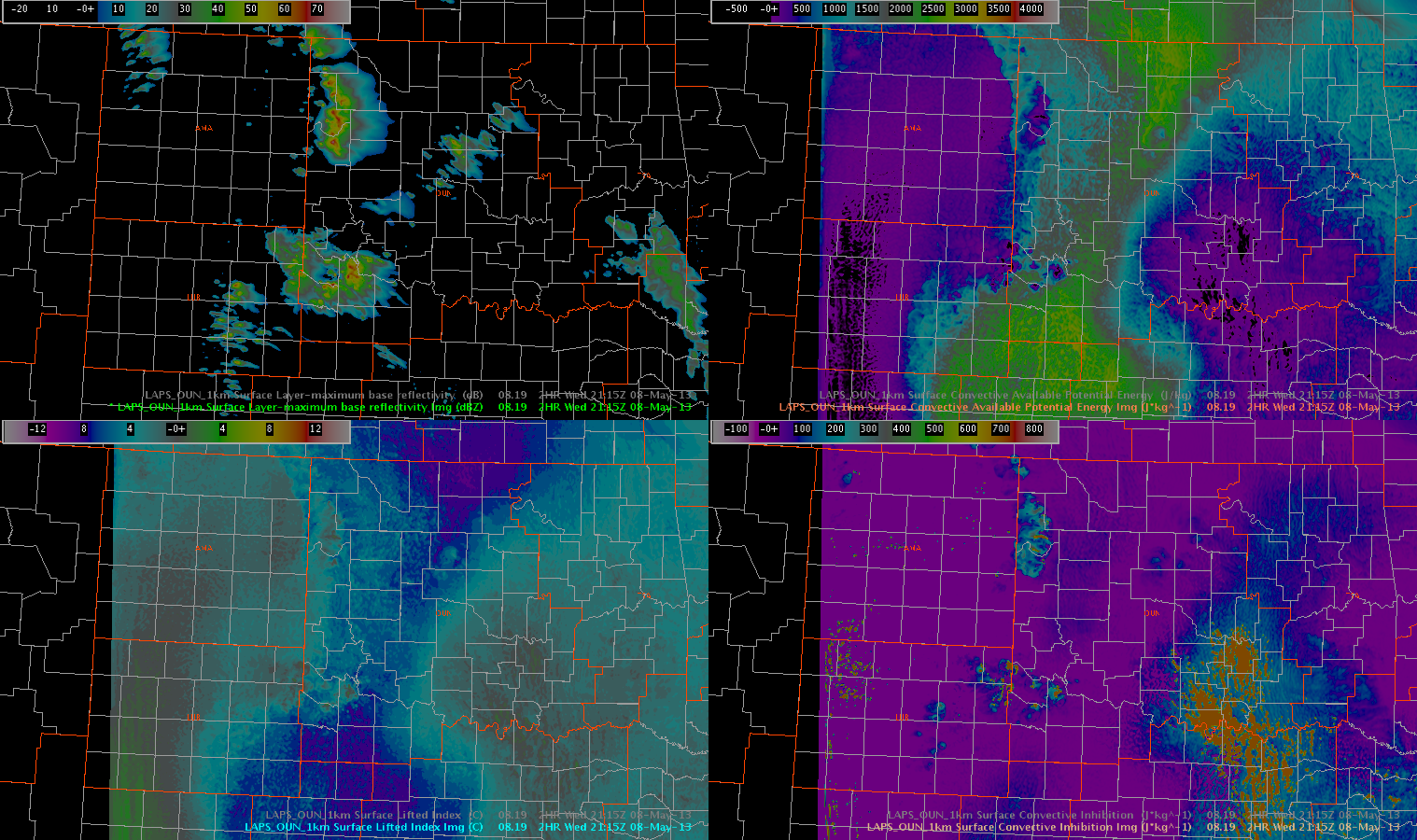
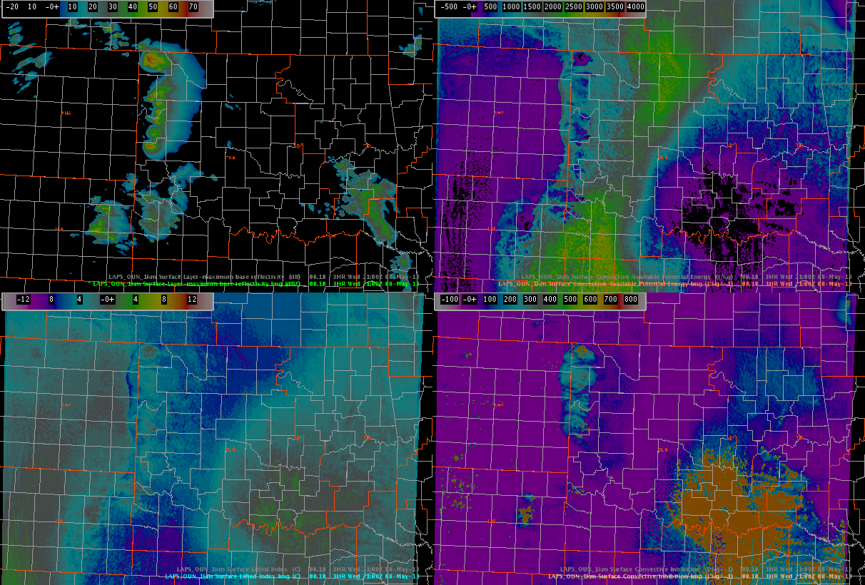
The 19Z LAPS forecast (1km OUN domain) appears to correctly capture some of the convection in Oklahoma and up into Kansas, but it did not accurately depict the mode of convection along the dryline. While the LAPS forecast shows several areas of convective clusters, the radar analysis shows a line of discrete supercells.
LAPS forecast data, with the top left showing simulated reflectivity. The other panes seem to correctly indicate the areas of significant instability with little-to-no inhibition.
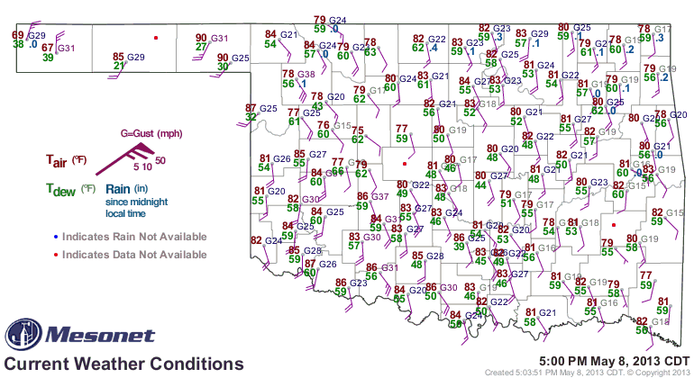
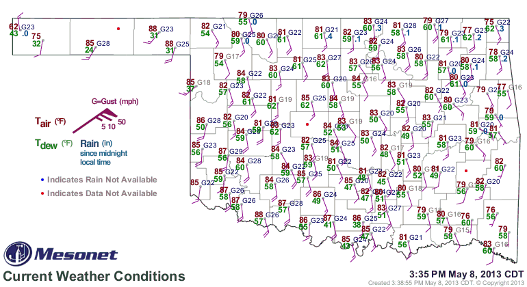
Obs from the Oklahoma Mesonet show that a bulge on the dryline has developed in NW Oklahoma near the panhandle, with a wind shift (SE to SW) also evident on several mesonet stations.
22Z Oklahoma Mesonet surface data.
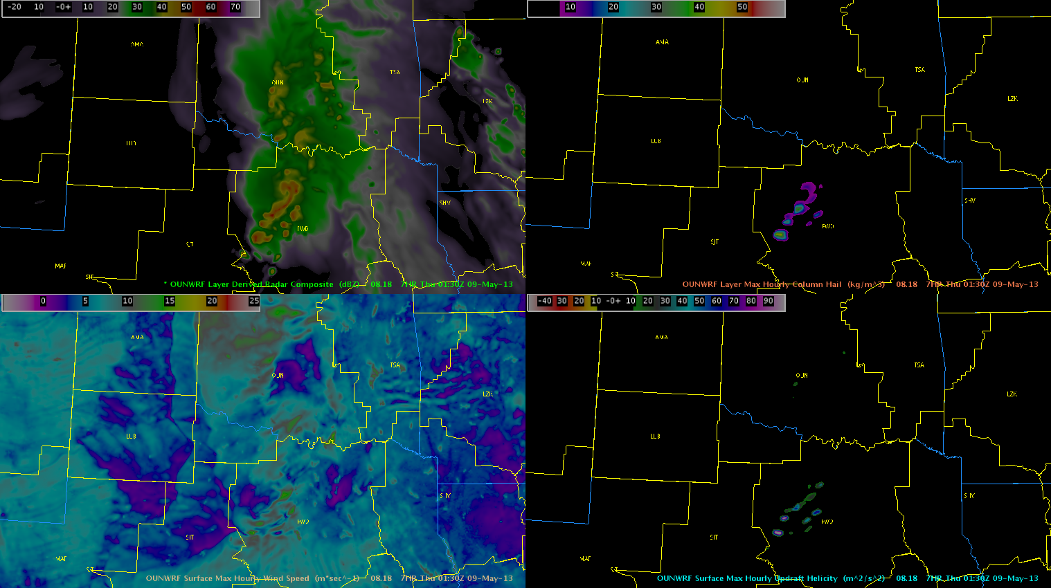
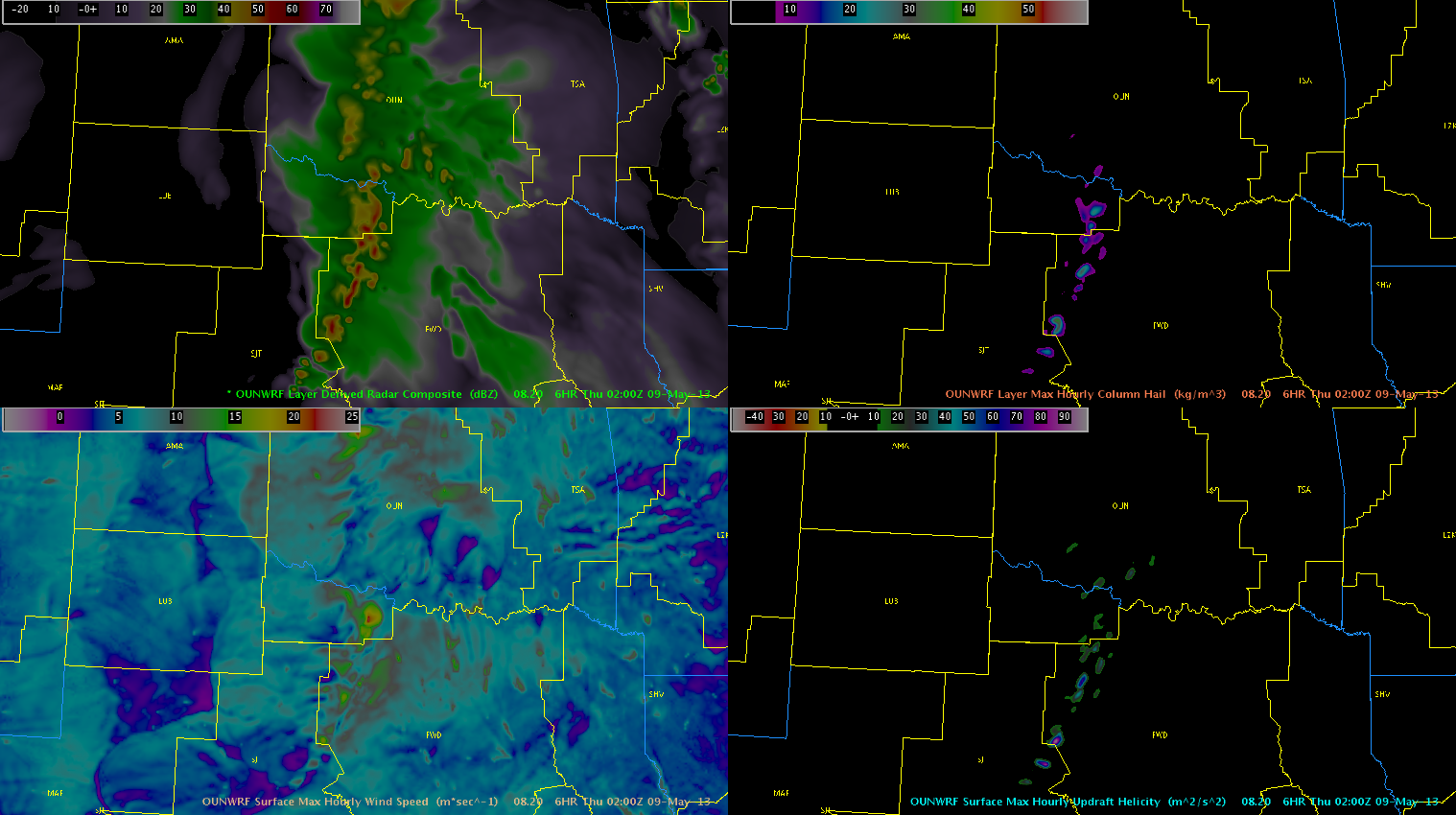
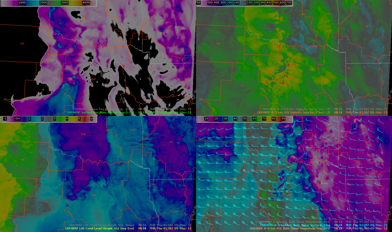
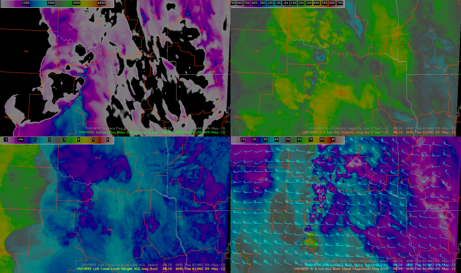
The 18Z and 20Z OUNWRF runs were examined to determine how the convection is expected to evolve tonight. Here are screen captures from 0130Z on the 18Z run, and 0200Z on the 20Z run.
18Z OUNWRF at 0130Z.20Z OUNWRF at 0200Z.
Although most of the intense convection is currently moving into the OUN forecast area, both runs of the OUNWRF show that by this evening, the storms in Oklahoma will weaken. While both runs show an intensification in the Dallas/Fort Worth CWA, with concentrated areas of max column hail and max updraft helicity, the timing is quite a bit different. The 18Z run was much faster, while the 20Z run has the storms just getting into the CWA by 02Z. The storm mode appears to be somewhat of a congealing of the discrete cells, perhaps into an MCS or several clusters.
Here are some of the convective parameters in the same two model runs.
OUNWRF 18Z run at 0130Z.OUNWRF 20Z run at 0200Z.’
As the storms strengthen as they move through northern Texas, they will be in an environment with low LCLs (under 1km) and perhaps some enhanced -03km helicity (though this signal was a bit stronger on the 18Z run than the 20Z run). However, SBCAPE will be very low by this time of day. In general, these parameters do not look as favorable (by later in the evening) in Oklahoma as they do in Texas.
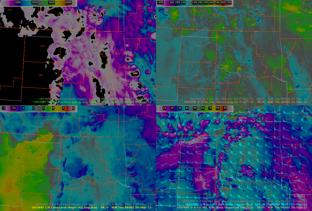
As mentioned above, as the environment continues to evolve through the evening, it was noted that surface winds have shown signs and will start to back along/ahead of the dryline, and especially along and north of the KS/OK border, as the sfc low track north/northeast. This has resulted in an increased signal in the 0-3 Helicities, evident on both the 21z run of the RAP and the 20z run of the OUNWRF. Forecast soundings from central and western/southwestern OK and southern KS continue to support modest LCLs, with dry/stable boundary layers. However with 0-3km helicities increasing from the 60s and 70s into pockets of 200-300 m^2/s^2 by 00z. We believe that if LCLs continue to lower with increasing moisture, we could see our environment become slightly more conducive to tornadic development. Especially across northern OK/southern KS and into central and southern OK.
High 50s/low 60s dew points are continuing to pool across western OK as observed on the OK mesonet.
2035z Mesonet
The OUNWRF appears to be capturing the current dewpoints correctly over Oklahoma, especially in the area where convection is developing. However, the temps ahead of the convection appear to be too high on the OUNWRF. It is possible that this is contributing to the over-development of convection on the OUNWRF (as seen spatially on the simulated reflectivity products).
LAPS analysis from the 1 km OUN domain continues to do a decent job with the placement of the composite reflectivity across western OK. Interestingly enought the 21z LAPS shows a clean swath of 2200 to 2600 J/Kg SBCAPE spreading northward across western north Texas, with another pocket of 2000 to 2500 J/Kg SBCAPE near the OK/KS border, which would be nearer the sfc low which continues to churn E/NE across the TX panhandle.
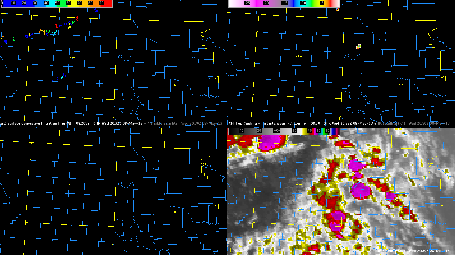
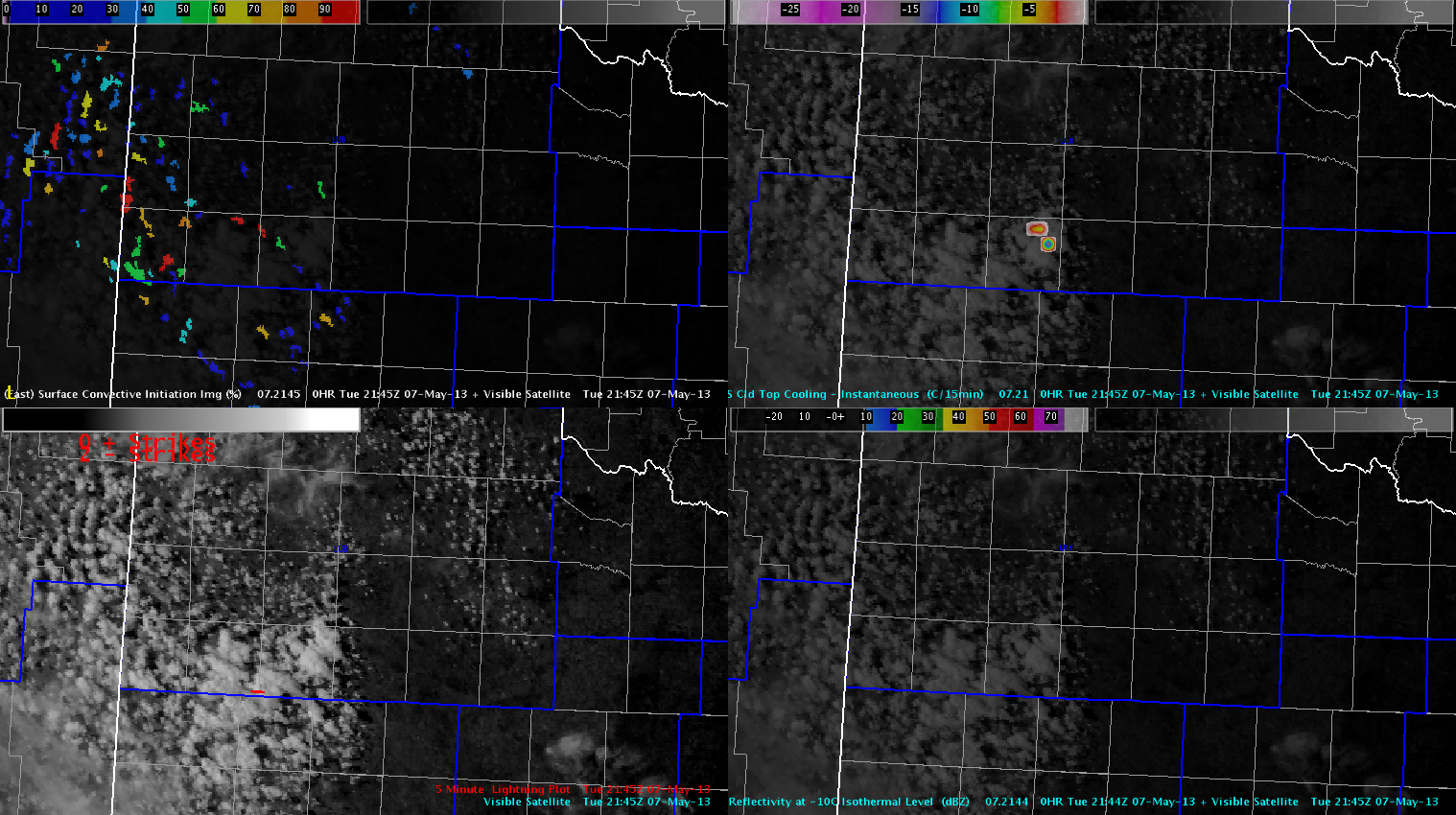
Early convection this afternoon developed in a sct to bkn area of cumulus, with scattered cirrus/stratus spread across Panhandles through western OK. This has resulted in little to no response from the both the GOES-CI and CTC products due to the contamination from the cirrus and stratus. The screen capture below shows the area of intense convection developing over Oklahoma, with little to no apparent signals in the CI/CTC products. This was also the case for several time steps before this image was saved.
CI, CTC, IR
Nearcast products from CIMSS/GOES have also struggled with the presence of clouds before convective initiation. This is evident from loss of data across western OK and the TX panhandle.
PW Diff, Te Diff low-mid, Convection Index (K^2mm), 780-500mb CAPE
With multiple scans of CI/CTC showing iminent or ongoing convective initiation over Lubbock’s area, will localized one desk at the LUB wfo. This will give the testbed an opportunity to evaluate some of the PGLM products available in the LUB LMA. The image below from 2145 UTC shows where storms are developing in extreme south central parts of the CWA.
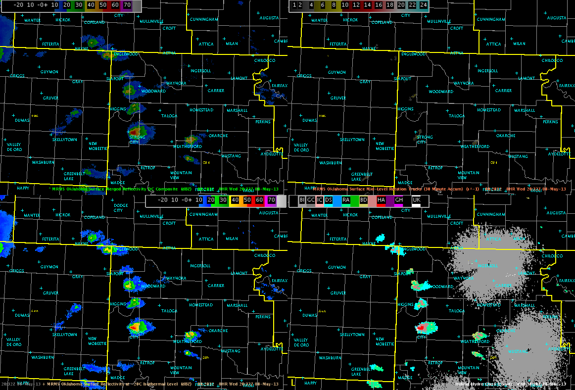
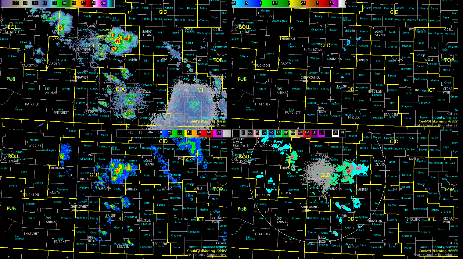
Radar trends show activity is also on the uptick at DDC, with ongoing supercells over GLD’s area. Will keep two teams stationed at these locations to optimize this marginal severe weather setup. The image below is a four panel of MESH products and composite reflectivity over the DDC and GLD CWAs.
Will continue to monitor trends, but all areas appear to be covered at this time.