
An healthy looking low pressure area has moved towards SW OK with lots of convection already ongoing.
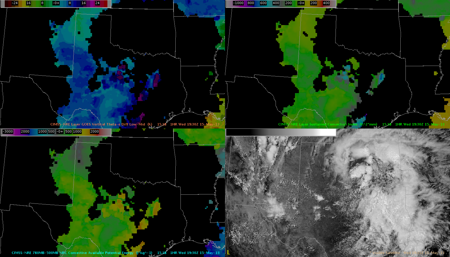 upper left: GOES Vertical Theta-e Diff low-mid, upper right: Sustained Convection Index, lower left: CAPE and lower right: VIS
The main swath of unstable air is visualized nicely with that product, showing a tongue of very unstable air expanding from the far W-Gulf coast towards S-Oklahoma. The ‘sustained convection index’ highlights that area, where strong and longer lived updrafts might evolve betimes (and given agitate Cu field development, it won’t take that long for that). NRE CAPE field has 1500 J/kg just south of OK and with ongoing diabatic heating, we expect a further increase during the following hours. So, using the NRE product the focus for strong/sustained convection clearly shifts in the Dallas/Fort Worth area and south.
Also using the theta-e diff low-mid product, conditions for at least isolated to scattered initiation towards the Lubbock area seems to be plausible, given westward expanding plume of unstable air and interaction with others mesoscale features at the surface. In fact, there currently evolves an east-west aligned theta-e tongue just south of Lubbock, which overlaps nicely with evolving showers and thunderstorms. Helge