Slight Risk West and East

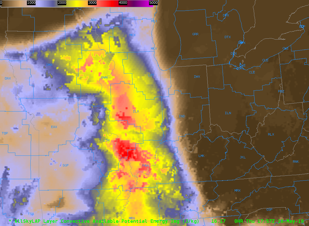
Operating across the CONUS today with one team of forecasters located in Idaho/Montana in MSO and the other in Illinois (ILX).  The forecasters have also been encouraged to investigate the environments nearby their official CWAs including the ongoing MCS currently crossing the Chicago CWA.

SPC Day 1 outlook for 16 May 2019

For those in Illinois, the environment remains supportive of development  off of outflows from the ongoing MCS or other possible convection.   Though it remains likely that the MCS will continue to remain strong and pose  a threat for strong winds at least across the NE section of the CWA.

All Sky LAP CAPE

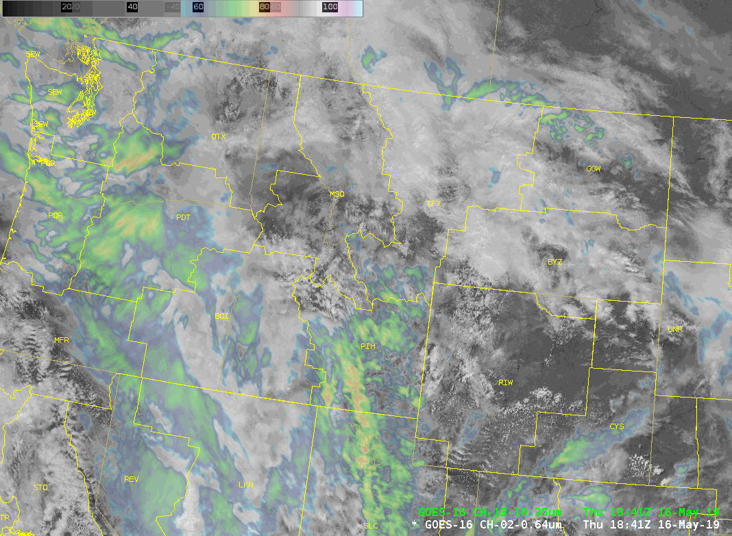
For Idaho, it currently remains rather calm, but the CAMS have consistently latched onto expected convection later in the day including supercell storms.

Sandwich IR/VIS product for Western United States


-Kristin


Tags: None

Today’s Experimental Operations – May 2, 2019

Today’s operations will be focused over the SJT (San Angelo), FWD (Dallas/Fort Worth), and EWX (Austin/San Antonio) county warning areas.  Focus is once again ahead of an outflow boundary left over from overnight storms.  To keep with the theme this week, storms are again on-going at the start of the operations period with a severe thunderstorm watch in place over a portion of the operations area.  Supercells will be possible today but the scenario will be messy with storm interactions and mergers likely.   The main threats today are hail and high winds but a few tornadoes are possible.

Tags: None

Today’s Experimental Operations – May 1, 2019

Today’s operations will be focused over the OUN (Norman), SJT (San Angelo), and FWD (Dallas/Fort Worth) county warning areas.  We are highlighting operations south of a remnant outflow boundary that has been left from storms that occurred overnight/early this morning roughly in the area of the Red River Valley.  Storms are currently on-going at the start of operations, with a severe thunderstorm watch over the operations areas that stretches from central OK all the way down to SW Texas.  Supercells will be the primary storm mode to start but might transition to a linear system later in the operations period.  The main threats today are large hail and high winds but tornadoes are still possible (lower probabilities than yesterday though).

Tags: None

EWP Operations Update – Thursday 6/5 – 2:45 pm

Today, we started operations in the Boulder and Pueblo CWAs, anticipating the development of severe storms in upslope flow in the lee of the Rockies.  Our hope is to have the Boulder group (Anderson and Fowle) monitor the Colorado lightning mapping array during the event.

Given the paucity of cumulus clouds in the Pueblo CWA, we believe that convective initiation will hold off until later.  Also, lightning activity is increasing in the Huntsville lightning mapping array as an MCS approaches from the west-northwest.  Thus, we have decided to re-localize the Pueblo group (Pelczynksi and Satterfield) to Hunstville.

-G. Garfield

Week 4 Coordinator

Tags: None

EWP Operations Update – Wednesday 6/4 – 6:00 pm

After a few hours of operation in the Louisville, KY (LMK) CWA, it became apparent that severe weather is unlikely there.  Thus, we chose to move that team (Fowle & Anderson) west toward Springfield, MO, where a mesoscale discussion had been issued for hail and wind.

However, not long after that, it became apparent that the capping inversion would hold there.  So, we decided to move again – this time, to the Cheyenne, WY CWA, where convection is ongoing.  Our hope is that we will be utilize the outer extent of the Denver lightning mapping array.

-G. Garfield
Week 4 Coordinator

Tags: None

EWP Operations Update – Wednesday 6/4 – 3:32 pm

0604_day1Today, we have decided to split our focus in two areas.

The first is associated with yesterday’s wave, in the Mississippi / Ohio valleys.  Weak to moderate instability will combine with moderate to strong deep-layer shear for the potential of severe storms.  The primary threat will be large hail and damaging winds, though an isolated tornado may occur.  High, thin cirrus is interrupting the GOES-R products somewhat, but there is still enough clearing to warrant a CWA selection in this region.  Thus, forecasters Fowle and Anderson are operating in the Louisville, KY (LMK) CWA.

The second is associated with upslope flow in the lee of the Rockies.  Residual low-level moisture, steep lapse rates, and an upper-level wave will combine to produce a low-end threat of hail and damaging winds.  Given our desire to evaluate lightning data, we have elected to operate in the Boulder, CO (BOU) CWA.  Forecasters Pelczynski and Satterfield are operating there now.

-G. Garfield

Week 4 Coordinator

Tags: None

EWP Operations Update – Tuesday 6/3 – 5:27 pm

0602_md_2225z

Operations continue in Hastings and North Platte.  Currently, a line of severe thunderstorms – including a briefly tornadic supercell near Ord – extends through central Nebraska, just north of the warm front.  At the moment, it appears that this activity will not pose a great tornado threat, owing to the cool / stable air just north of the boundary.

In the near term, storms are likely to develop west and south of North Platte.  The storms to the south of North Platte will likely have the greatest chance of producing tornadoes, given the backed surface winds and extreme instability / low LCLs ahead of the development.

-G. Garfield


Tags: None

EWP Operations Update – Tuesday 6/3 – 2:40 pm

0603_day1Today, there is a moderate risk for severe storms across much of the Central Great Plains.  A warm front / outflow boundary is positioned over southern and central Nebraska, arcing to the northwest toward Wyoming.  High-resolution model guidance suggests that convective initiation will occur within the next hour over much of Nebraska, as the upper-level wave approaches.

Given the ongoing convection in N Nebraska, we have elected to choose the more quiescent environment over W/C Nebraska for operations today.  We are now operating in the North Platte and Hastings CWAs.

-Gabe Garfield

Week 4 Coordinator

Tags: None

EWP Operations Update – Monday 6/2 – 2:37 pm

Overview:
Today is the first day of operations for the 4th (and final) week of the EWP Big Experiment.  Thus, we will begin operations in training / orientation mode.

Forecast:

In the upper troposphere, relatively zonal flow exists across the CONUS.  Thus, significant moisture return has commenced, finally solving the moisture problem the Plains has seen this spring season.  Vertical wind shear is relatively weak, but the presence of a strong elevated-mixed layer will augment instability and the associated probability of severe weather – especially west.

Two areas of probable severe convection exist: one in the Upper Mississippi / Ohio valley region and the other in the Southern Plains.  Given the presence of upper cloudiness to the east, and the lack of a lightning mapping array, we have elected to operate in the Southern Plains today.  We have localized the forecasters to two domains: Norman and Wichita.

Gabe Garfield
Week 4 Coordinator

Tags: None

EWP Operations Update – Thursday 5/22 – 1:10pm

Our forecasters are set up in Baltimore/Washington D.C. (LWX) to take advantage of the DCLMA as this region currently has relatively few clouds conducive to stronger surface heating than previously anticipated. Adjusted 12z sounding with current surface temperatures show a large region in LWX with minimal CIN to hinder further convective development.

Super-Rapid Scan visible imagery from 1706z-1820z over the East/Central US.

Our second team is currently situated in Nashville, TN (OHX) as we wait for the remaining cap to erode over this area in the next few hours. We only anticipate isolated severe storms in the northern part of the CWA but would like to use this opportunity to really look at some of the GOES-R pre-CI products to see how they fare in a still capped area. On the plus side, if storms do fire here and move to the southeast, we may get some activity in the NALMA. On our final day of Super-Rapid Scan operations, we also wanted to get both of our forecaster teams in domains where they could leverage these data.

12z  ROAB sounding from Nashville, TN.
12z ROAB sounding from Nashville, TN.

We’re watching the WTLMA and COLMA regions closely as well and are ready to jump out west if absolutely necessary.

-Darrel Kingfield
EWP Week 3 Coordinator

Tags: None