
Our forecasters are set up in Baltimore/Washington D.C. (LWX) to take advantage of the DCLMA as this region currently has relatively few clouds conducive to stronger surface heating than previously anticipated. Adjusted 12z sounding with current surface temperatures show a large region in LWX with minimal CIN to hinder further convective development.

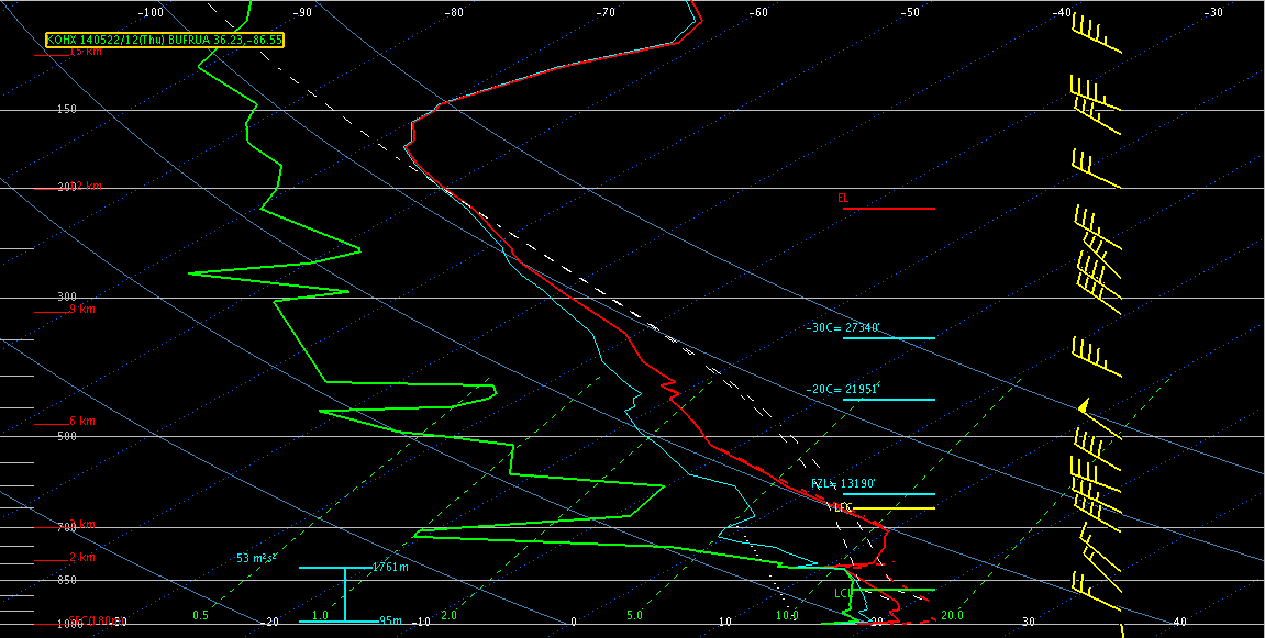
Our second team is currently situated in Nashville, TN (OHX) as we wait for the remaining cap to erode over this area in the next few hours. We only anticipate isolated severe storms in the northern part of the CWA but would like to use this opportunity to really look at some of the GOES-R pre-CI products to see how they fare in a still capped area. On the plus side, if storms do fire here and move to the southeast, we may get some activity in the NALMA. On our final day of Super-Rapid Scan operations, we also wanted to get both of our forecaster teams in domains where they could leverage these data.
We’re watching the WTLMA and COLMA regions closely as well and are ready to jump out west if absolutely necessary.
-Darrel Kingfield
EWP Week 3 Coordinator