
 Today, we have decided to split our focus in two areas.
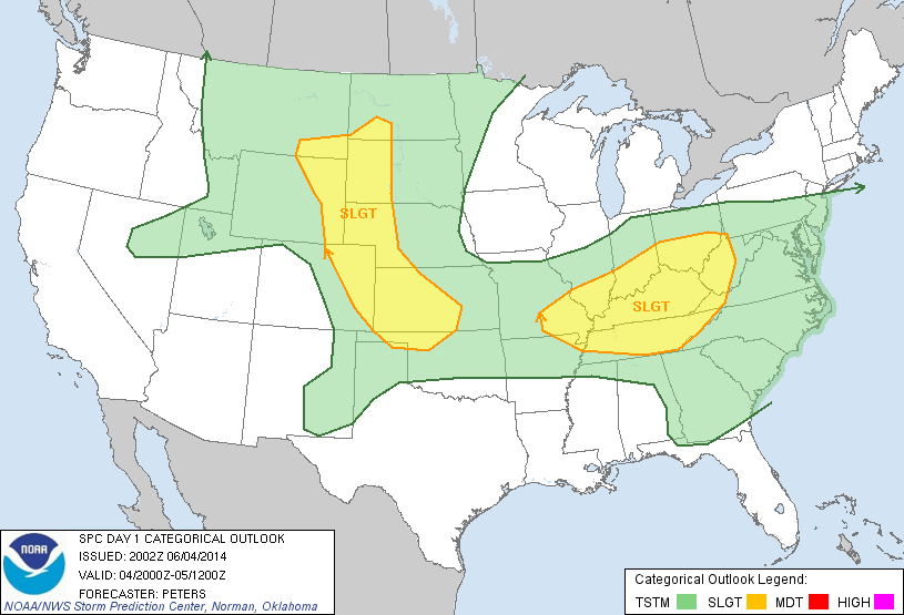
The first is associated with yesterday’s wave, in the Mississippi / Ohio valleys. Weak to moderate instability will combine with moderate to strong deep-layer shear for the potential of severe storms. The primary threat will be large hail and damaging winds, though an isolated tornado may occur. High, thin cirrus is interrupting the GOES-R products somewhat, but there is still enough clearing to warrant a CWA selection in this region. Thus, forecasters Fowle and Anderson are operating in the Louisville, KY (LMK) CWA.
The second is associated with upslope flow in the lee of the Rockies. Residual low-level moisture, steep lapse rates, and an upper-level wave will combine to produce a low-end threat of hail and damaging winds. Given our desire to evaluate lightning data, we have elected to operate in the Boulder, CO (BOU) CWA. Forecasters Pelczynski and Satterfield are operating there now.
-G. Garfield
Week 4 Coordinator