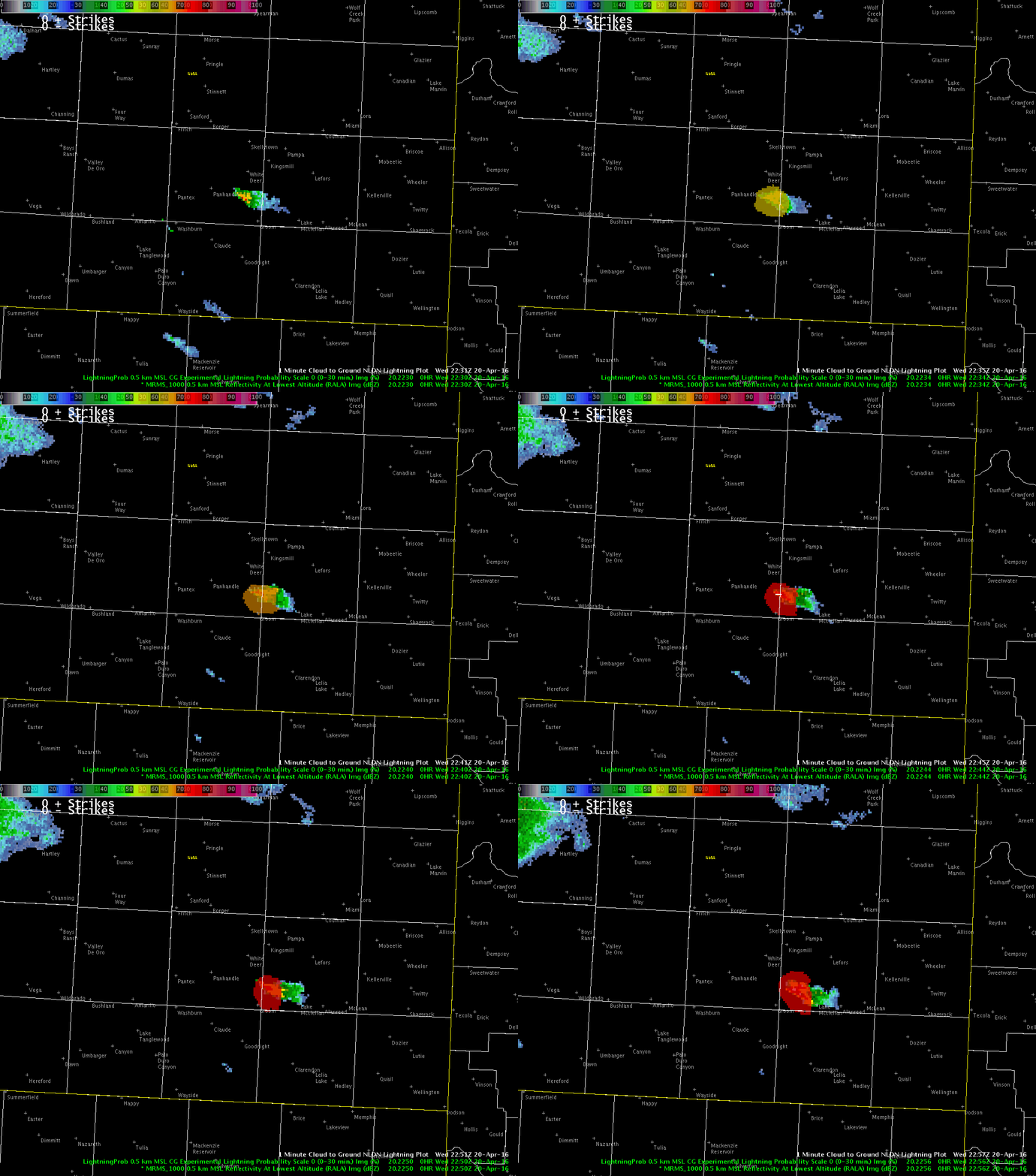
Below is an animation of MRMS radar 0.5 km reflectivity with the experimantal CG lightning probability and NLDN CG overlaid. Notice that the experimental CG lightning probability rises to 58% 14 minutes before the first CG strike detected by NLDN. Probablities increased to 67% 5 minutes before the strike, and 72% approximately 2 minutes before the strike. This has potential significant value for providing lead time to outdoor events. In addition, the National Weather Service in Amarillo recently began experimenting with Aviation Weather Warning for lightning for Rick Husband Airport, and this experimental product could potentially allow the office to provide a better service to aviation customers. Other offices provide lightning warnings to airports and likely could potentially benefit from this. I will be watching this product closely throughout the rest of this experiment to see how much lead time it normally provides and how frequent false alarms are. My first impression is very positive.
-dryadiabat


