3..2..1..INITIATION – EWP Operations Update – Wednesday 5/21 – 2:10pm

We were greeted post-EFP briefing with an explosion of development across across the Ohio Valley and out west in Colorado. Forecasters were quickly allocated to work out of the Indianapolis, IN (IND) to diagnose the rapidly developing cumulus field from Montgomery Country westward.

0.5 deg reflectivity from KIND from 1813z - 1929z on May 21, 2014
0.5 deg reflectivity from KIND from 1813z – 1929z on May 21, 2014

Our second team is working out of the Boulder/Denver, CO (BOU) CWA diagnosing the rapidly developing convection from N/S near the Front Range Mountains.

Super-Rapid Scan visible imagery from 1917z-1929z

With a Severe Thunderstorm Watch issued for the Ohio Valley and a Tornado Watch issued in CO/WY region until 9pm, it looks like a busy afternoon ahead.

WW #164 from the Storm Prediction Center.
WW #165 from the Storm Prediction Center.

-Darrel Kingfield
EWP Week 3 Coordinator

Tags: None

EWP Operations Update – Tuesday 5/20 – 6:20pm

We moved our CYS team to the Chicago, IL (LOT) CWA as the convection in the CYS region wasn’t providing many severe reports. Our forecasters are deep into warning operations now, using GOES-R CI, ProbSevere, NearCast, MR/MS, and base data to interrogate and gauge storm severity. I feel like we may be going through Super-Rapid scan withdrawals though. 🙁

MR/MS Reflectivity at Lowest Altitude product - 2206z - 2346z.
MR/MS Reflectivity at Lowest Altitude product – 2206z – 2346z.

-Darrel Kingfield
EWP Week 3 Coordinator

Tags: None

EWP Operations Update – Tuesday 5/20 – 4:40pm

Both CYS and DVN domains are contained within Severe Thunderstorm Watches and have warned storms ongoing. Right now large hail is the main threat with these storms and our student volunteers are hard at work forwarding reports to our forecasters. We’ll be moving the LAPS domain into the DVN region shortly.

Severe Thunderstorm Watch #160
Severe Thunderstorm Watch #161
MR/MS Merged Reflectivity over both domains at 2130z.
EWP Operations - May 20th at 4:40pm
EWP Operations – May 20th at 4:40pm

-Darrel Kingfield
EWP Week 3 Coordinator

Tags: None

EWP Operations Update – Tuesday 5/20

Our forecasters this afternoon are only four feet from each other in the HWT, but they are operating four CWAs apart in Cheyenne, WY (CYS) and Quad Cities, IA/IL (DVN).

Our CYS team is leveraging Super-Rapid Scan, LAPS domain placement from yesterday, and the potential for lightning detection from the few active Northern Colorado LMA sites in their diagnosis of convective potential and current analysis of developing convection in Albany and Platte Counties.

Super-Rapid Scan Imagery over WY from 1923z-1941z.

Our DVN team is performing a mesoscale analysis of the region around IA/IL/WI where the highest potential for severe weather and its associated hazards are expected. As destabilization is forecast to occur in the next hour or so, hopefully we will see some cells in this area by 22z.

EFP Day 1 Probability of Severe Thunderstorms

-Darrel Kingfield
EWP Week 3 Coordinator

Tags: None

EWP Operations Update – Monday 5/19

Forecasters are getting acclimated to AWIPS-2 as we sit and wait for convective initiation ahead of a shortwave trough in SE Wyoming and W Nebraska. We are currently operating from the Cheyenne (CYS) and North Platte (LBF) CWAs.

The downgrade of the “SLGT” risk to a “SEE TEXT” at the 20z SPC Day 1 Outlook and the “WATCH UNLIKELY” Mesoscale Discussion will not dampen our spirits.

2000z SPC Day 1 Outlook for May 19.
Mesoscale Discussion summary issued at 2012Z.
Mesoscale Discussion graphic issued at 2012Z.

KCYS is showing the first 40+ dBZ echo of the day in Goshen County, WY and with the airmass over the region continuing to destabilize, we are holding out hope that we will see some isolated convection in both CWAs in the next few hours.

First 40+ dBZ echo in Goshen County, WY.

-Darrel Kingfield
EWP Week 3 Coordinator

Tags: None

EWP Day 4: Operations Update

The final day of week 1 is already in progress and a complicated forecast it is (due primary to overnight convection).  Our initial thought was to play in the moderate risk associated with the low pressure and warm front, but with the presence of ongoing convection and the desire to utilize many of the GOESR products meant for the pre-CI and CI environment we decided to shake it up. One group of forecasters (Rudge/Bickford) remains in the moderate risk in Des Moines (DMX) CWA while the other pair (Maples / Thoren) is operating in the Wichita (ICT) CWA and looking for possible development ahead of the surface cold front/dryline.  While some convection is already ongiong in the north and eastern DMX CWA, expectation is that supercell storms (and tornadoes) will develop in the area clearing farther west.  Severe activity in the ICT CWA is a bit more uncertain and timing is likely a later this afternoon and evening if it were to occur.

SPC Day 1 Outlook
SPC Day 1 Outlook
Current Watches over operation domain
Current Watches over operational domain

Super-Rapid Scan (1 min imagery) is in it’s first day of operations.  The animated gif (click to show animation) below shows the Cu development along the cold front into the ICT domain and clearing in the western DMX domain.

Super-rapid scan visible satellite on 8 May 2014

-K. Calhoun, Week 1 Coordinator

Tags: None

Operations Update

Forecasters are hard at work examining the experimental products in both the Norman and Cheyenne CWAs.

With upper-level support in place for the first time this week, both the Colorado region and Oklahoma region are already seeing convection and (nearly) severe storms.  Severe Thunderstorm Watches have been issued for both regions of focus today with storms developing shortly after operations in the testbed began.

Colorado / Wyoming / Nebraska Watch

ww0123_radar


The pGLM lightning data is looking good over the Colorado region, but currently the OKLMA appears to be having some systematic problems.

Darrel is trouble-shooting visualization of the Lightning Jump Algorithm in AWIPS2 so that it can be viewed in either region. (currently limited to the floater domain which is only over OK)

-K. Calhoun, Week 1 Coordinator

Tags: None

May 20 2013 Early Afternoon Discussion – Focus OK

Sct TS development over south central OK as of 19z. Tor watch issued for most of eastern OK to account for expected development this afternoon. Latest obs indicate cold front draped over central OK with dry line extending back into SW OK with upper level low over Dakotas. Strong southerly flow over eastern OK pushing dew pts well into the 70s as of mid day, with sharp contrast west of dry line, with dew pts remaining in the 50s over the pan handle of OK. MU CAPE over eastern OK around 4000 j/kg already and blk shear around 75 kts. 17z OUN sounding shows deep low level moisture with capping around 850mb, which should weaken within the next couple of hours. 16z OUN WRF indicates development to close proximity with on going convection attm, with further super cell development this afternoon as the current cells push east and north into the more unstable atmo.

1kmRefl_F00230

1kmRefl_F00330 1kmRefl_F00515


Tags: None

EWP Week 2 underway

Forecasters have begun operations, localized as the Missoula, MT County Warning Area.  Todays initial focus is familiarization with AWIPS2 and the experimental products (where to load, new procedures, etc).

Surface temperatures are reaching the low-to-mid 80s across MT, with a bit of downslope flow on the southern end continuing to dry out the region.  A few small storms / showers have begun to form in NE Oregon and across central Idaho. Expectation is for these to expand in area and strength (marginally severe) across the late afternoon and evening. Once storms form, they are expected to move E-NE.  Hail and winds are the primary concern today.

SPC mesoscale discussion graphic for 2pm CDT on 13 May 2012


K. Calhoun (EWP Week 2, coordinator)

Tags: None

EWP2013 7 May 2013 2330 UTC Mesoscale Discussion

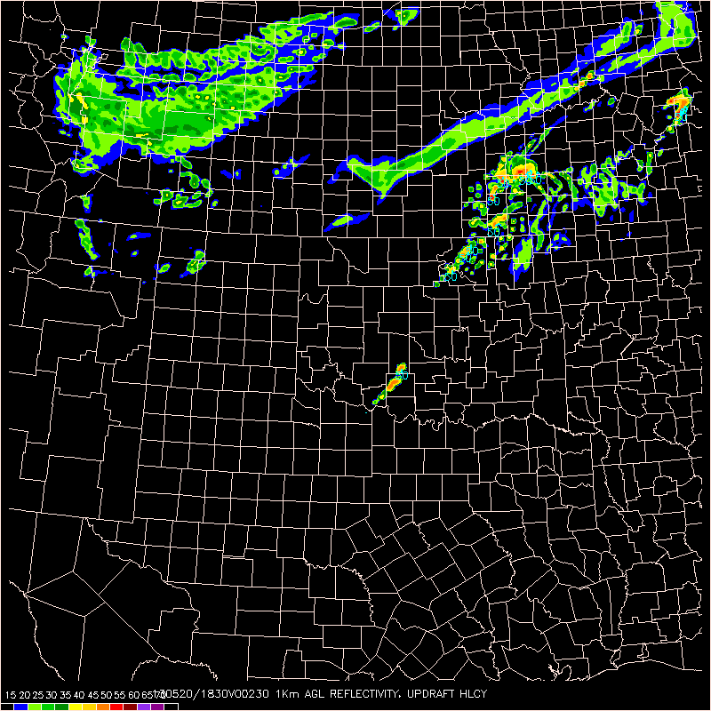
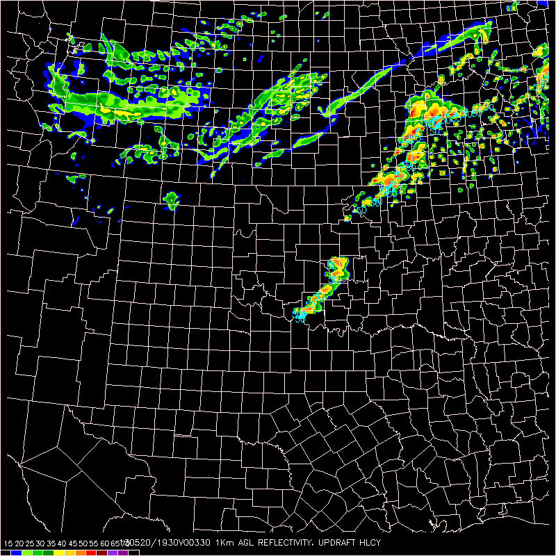
We continue to monitor isolated to widely scattered supercells extending from NW KS through SW KS/NW OK, with more isolated activity near LUB.4-panel_MD_Update_05072013

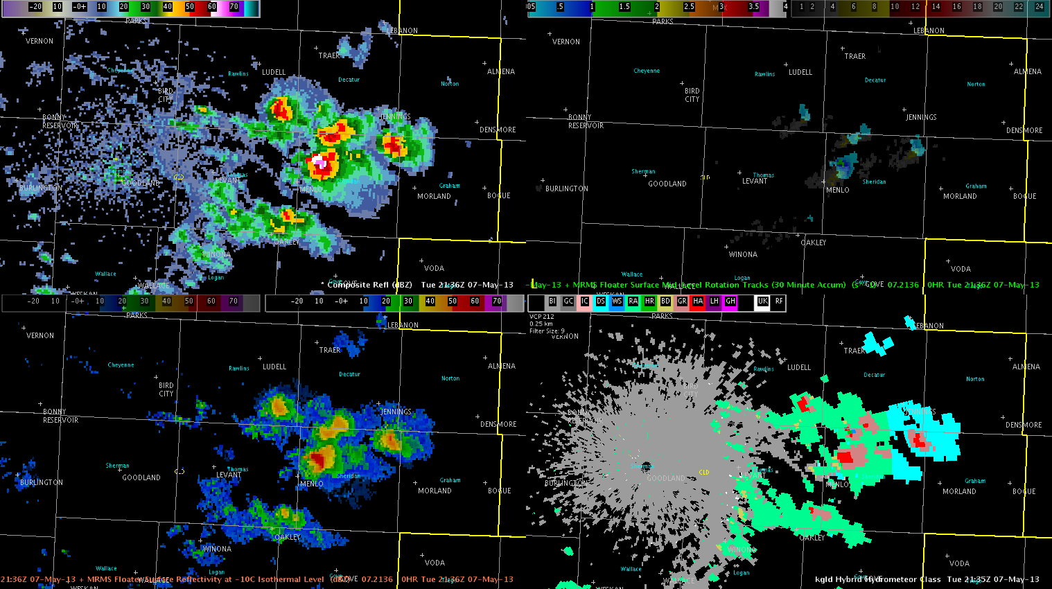
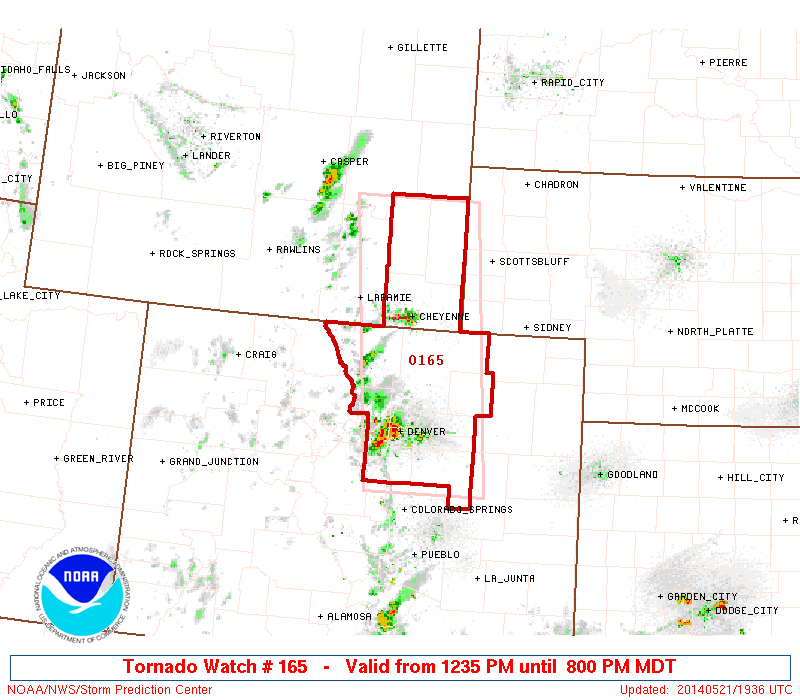
Recent sfc obs show area of backed winds over NW KS on northeast fringe of a broad lee trough drifting eastward from CO. Here, pooling moisture has contributed to modest instability per recent mesoanalysis with impressive wind fields, albeit somewhat weak in the upper levels. Some meager low level rotation has resulted from this area of backed surface flow, with a few reports of weakly rotating wall clouds. As LCLs decrease this evening, a very narrow window for tornadic development will exist, but low level shear will continue to limit this threat.

Further south, large hail and damaging winds have been the main threats with a few reports of up to golf ball sized hail. Deeply mixed boundary layer has resulted in high based storms within impressive steep mid level lapse rates favorable for hail production. Also, with inverted V nature of area soundings, would not be surprised if very strong winds are occurring with the most severe storms.

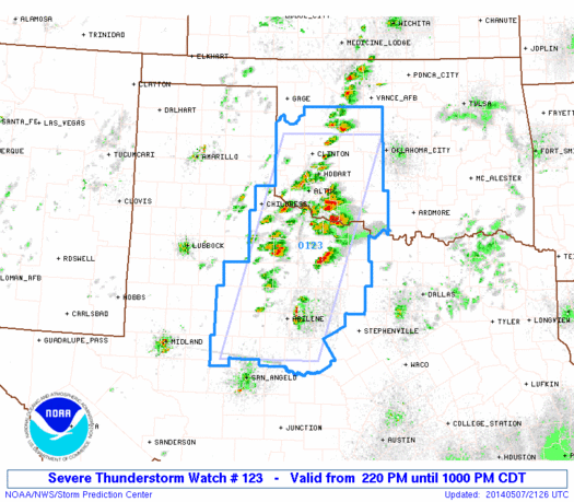
Even further south, areas in and around Lubbock have seen very isolated storm development this evening. One single slow moving supercell has been located near the border of Garza and Crosby counties. This storm also developed in a very localized area of backed surface winds, with enhanced surface convergence. Also, surface heating likely played a role in convective initiation, with temperatures climbing into the mid to upper 80s. This development was preceded by multiple CI and CTC signals, though they tended to be sporadic and indicated there may be many more storms than actually developed.

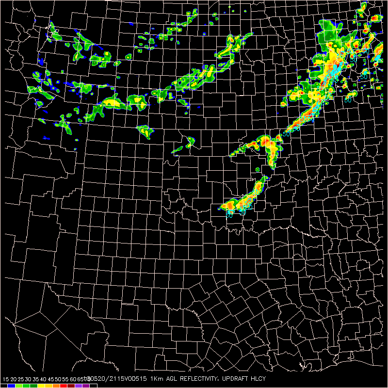
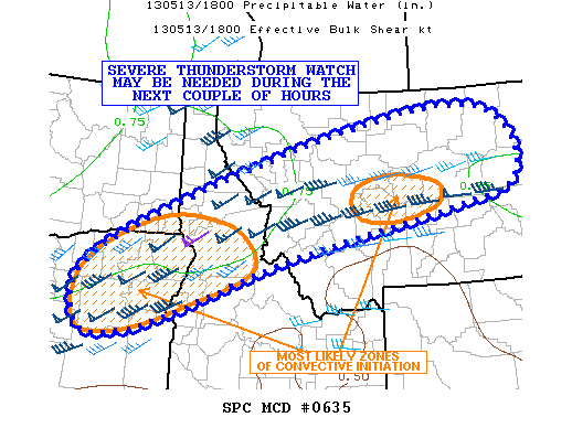
Heading into the evening, expect severe storms will generally persist through around 02z to 03z. Most activity appears to be diurnally driven. On exception to this will be parts of NW/N Cntrl KS, where an eastward propagating cluster may develop later this evening. Taking a look at Nearcast products, we observe that instability has taken a bit of a hit over the entirety of the area with ongoing convection, as has moisture depth. It still appears the most favored areas for persistent severe convection and supercellular activity will be over NW KS in Goodland’s CWA, eventually migrating into Hasting Nebraska’s area of responsibility.Nearcast_050713

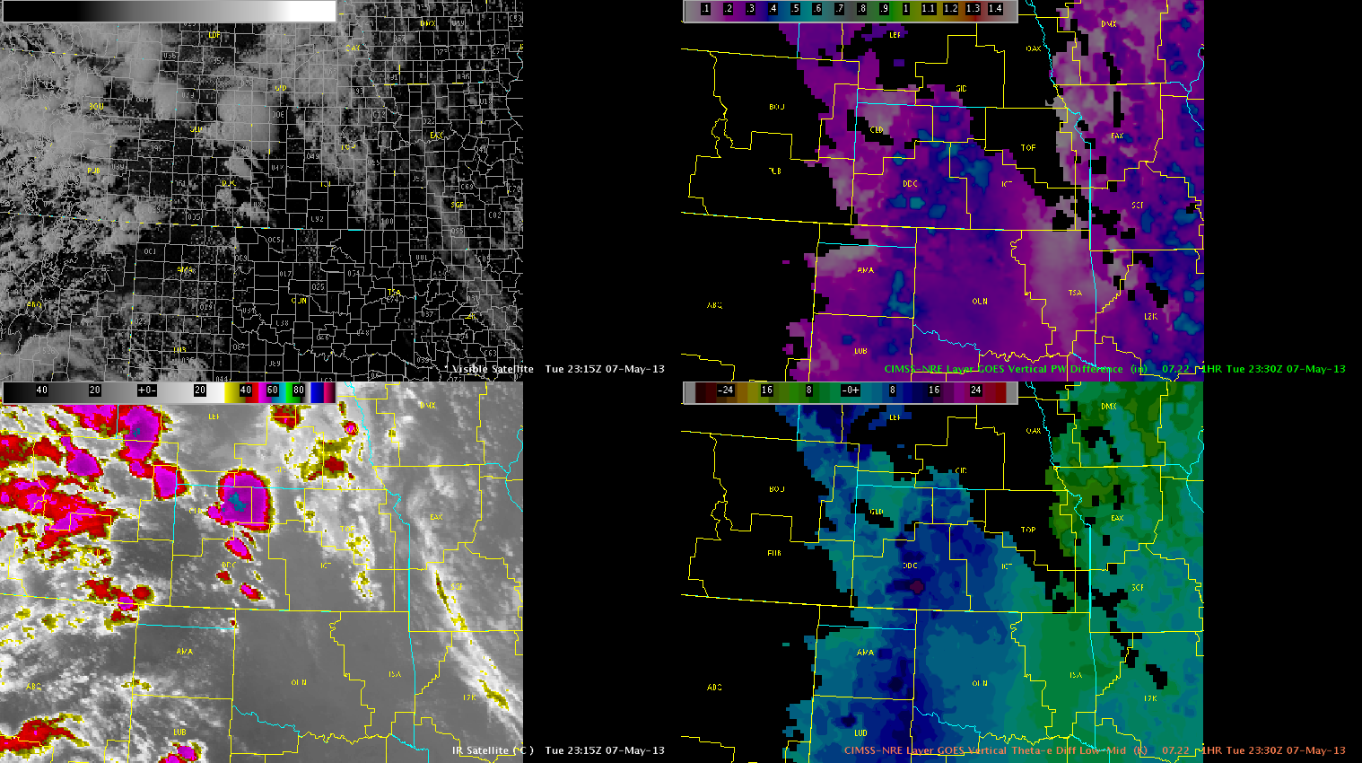
Lubbock’s convection has diminished in the last hour, and will discontinue operations there. Will keep operations at DDC and GLD active through end of day as activity is expected to continue.

Austin

Tags: None