
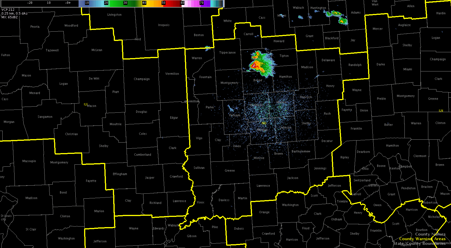
We were greeted post-EFP briefing with an explosion of development across across the Ohio Valley and out west in Colorado. Forecasters were quickly allocated to work out of the Indianapolis, IN (IND) to diagnose the rapidly developing cumulus field from Montgomery Country westward.
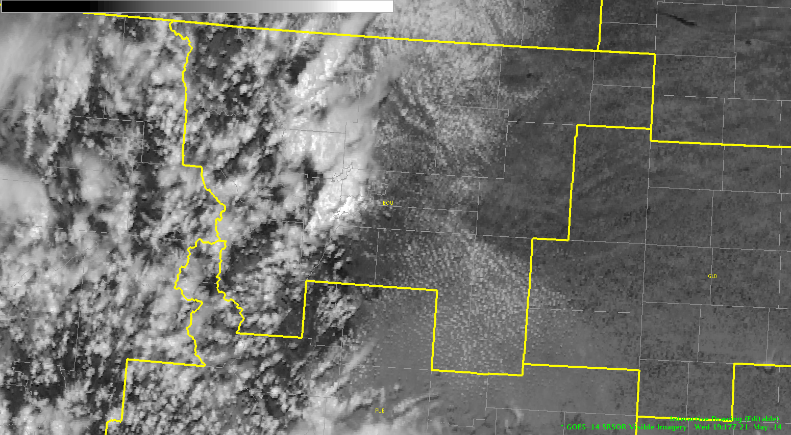
Our second team is working out of the Boulder/Denver, CO (BOU) CWA diagnosing the rapidly developing convection from N/S near the Front Range Mountains.
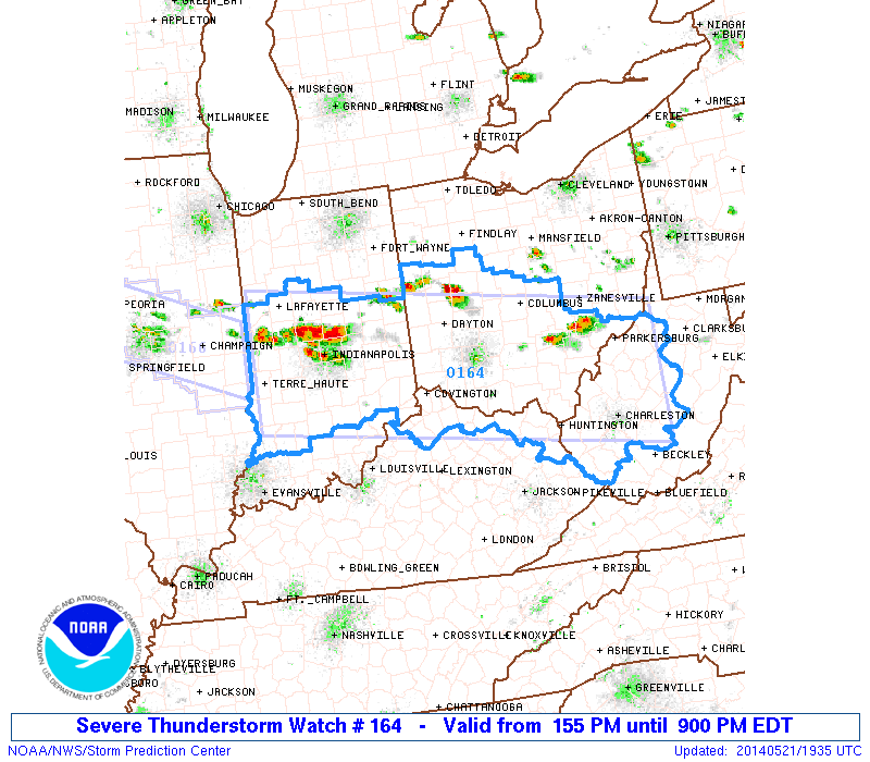
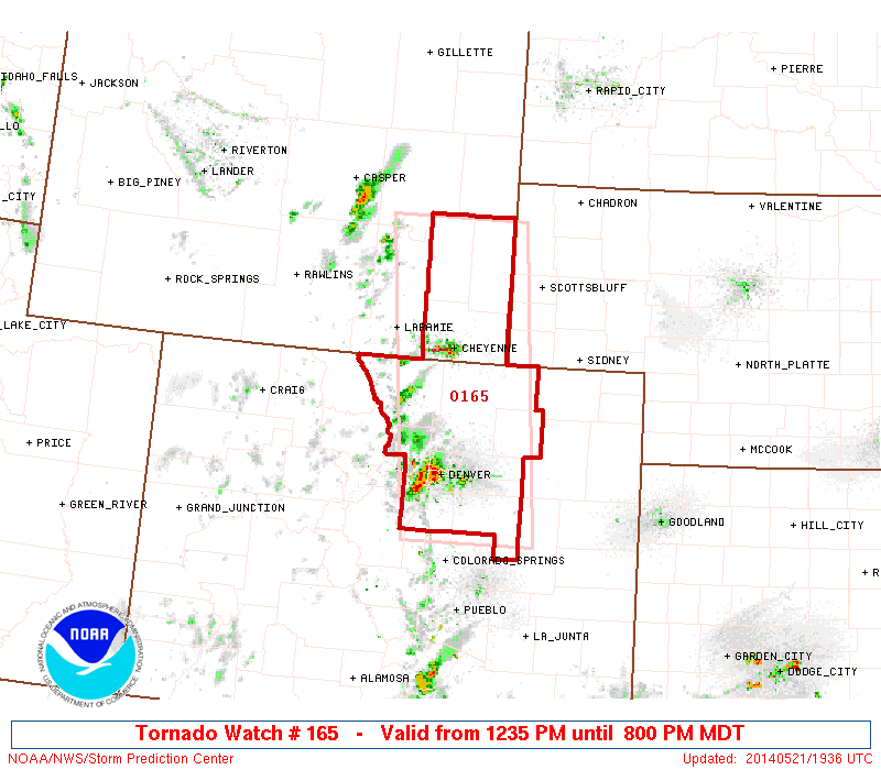
With a Severe Thunderstorm Watch issued for the Ohio Valley and a Tornado Watch issued in CO/WY region until 9pm, it looks like a busy afternoon ahead.
-Darrel Kingfield
EWP Week 3 Coordinator