
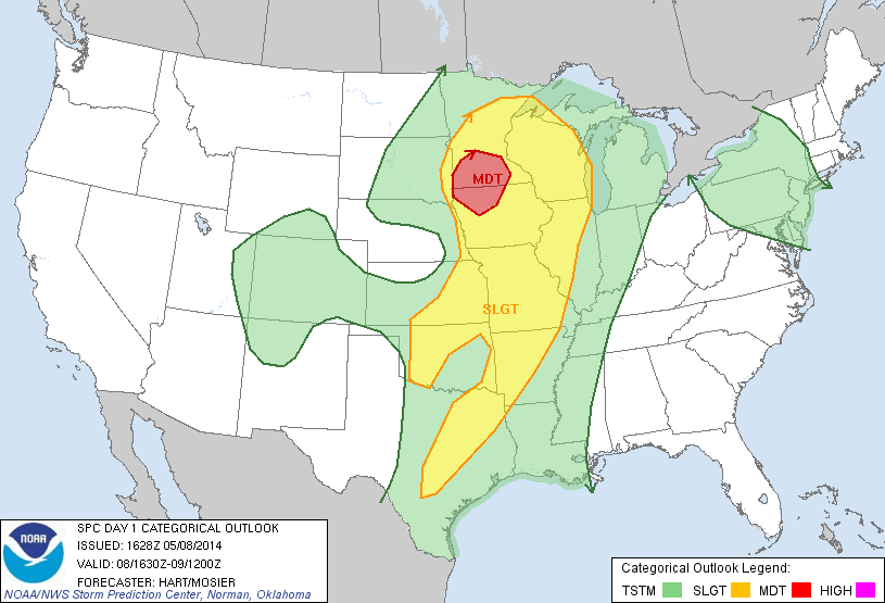
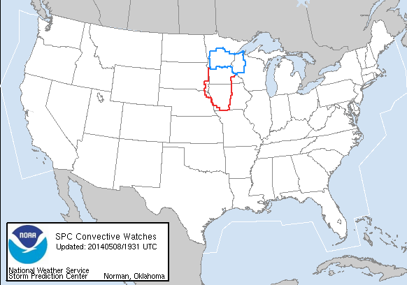
The final day of week 1 is already in progress and a complicated forecast it is (due primary to overnight convection). Our initial thought was to play in the moderate risk associated with the low pressure and warm front, but with the presence of ongoing convection and the desire to utilize many of the GOESR products meant for the pre-CI and CI environment we decided to shake it up. One group of forecasters (Rudge/Bickford) remains in the moderate risk in Des Moines (DMX) CWA while the other pair (Maples / Thoren) is operating in the Wichita (ICT) CWA and looking for possible development ahead of the surface cold front/dryline. While some convection is already ongiong in the north and eastern DMX CWA, expectation is that supercell storms (and tornadoes) will develop in the area clearing farther west. Severe activity in the ICT CWA is a bit more uncertain and timing is likely a later this afternoon and evening if it were to occur.
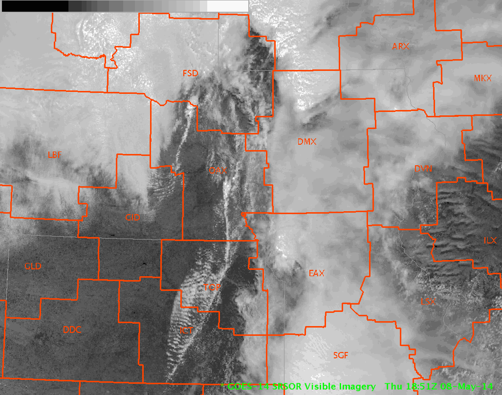
Super-Rapid Scan (1 min imagery) is in it’s first day of operations. The animated gif (click to show animation) below shows the Cu development along the cold front into the ICT domain and clearing in the western DMX domain.
-K. Calhoun, Week 1 Coordinator