
First, here is a look at the current MRMS data, which shows a line of very strong discrete cells along the dryline near and SW of southwestern Oklahoma. Additional convection (some cellular, some multi-cellular) curves up along the warm front and back toward the triple point into Kansas.
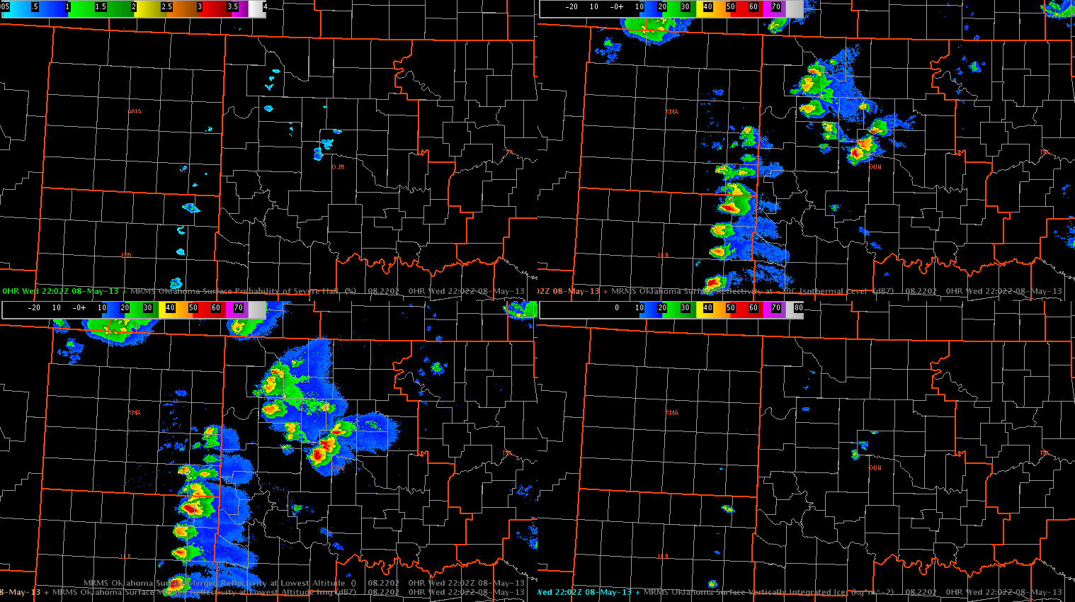
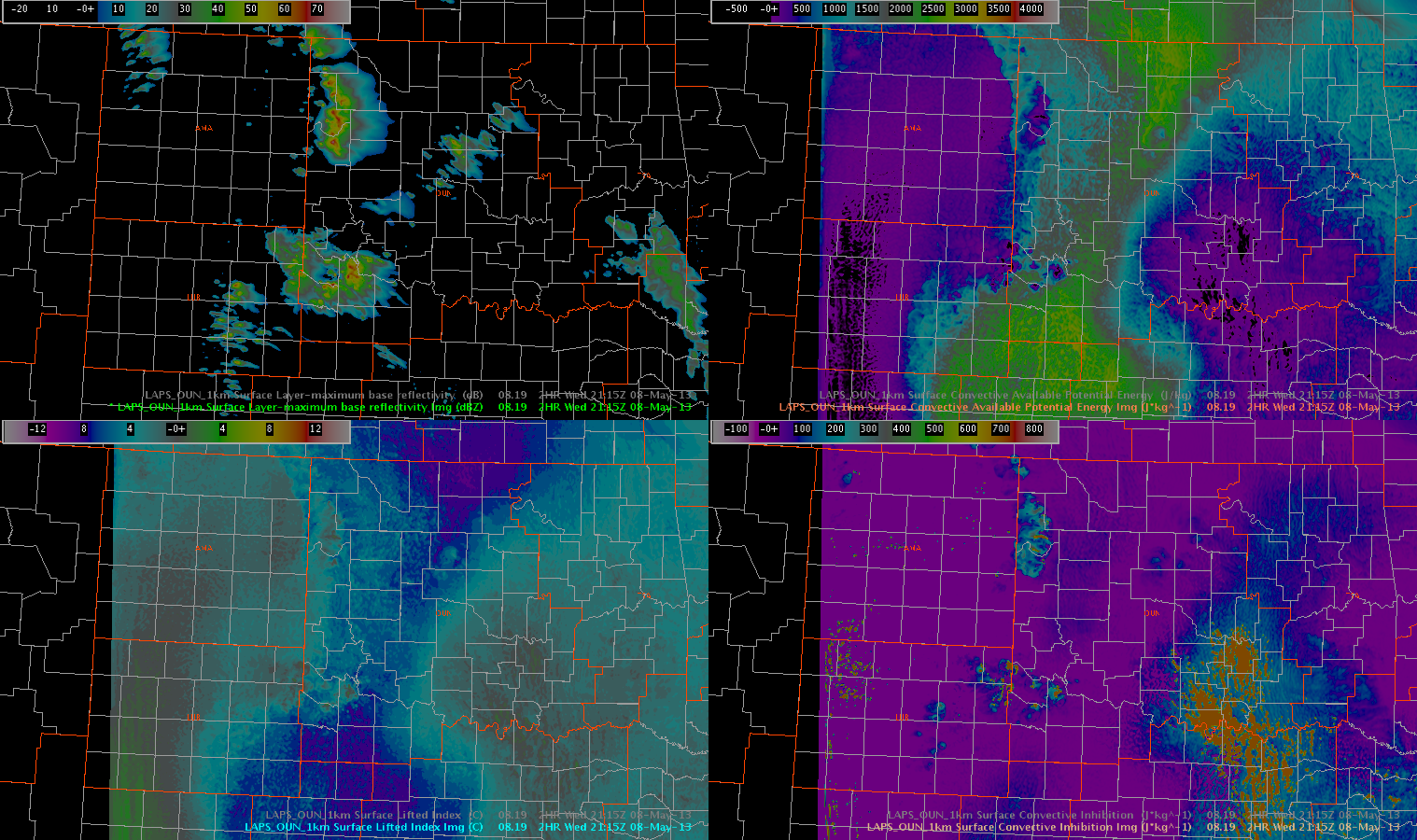
The 19Z LAPS forecast (1km OUN domain) appears to correctly capture some of the convection in Oklahoma and up into Kansas, but it did not accurately depict the mode of convection along the dryline. While the LAPS forecast shows several areas of convective clusters, the radar analysis shows a line of discrete supercells.
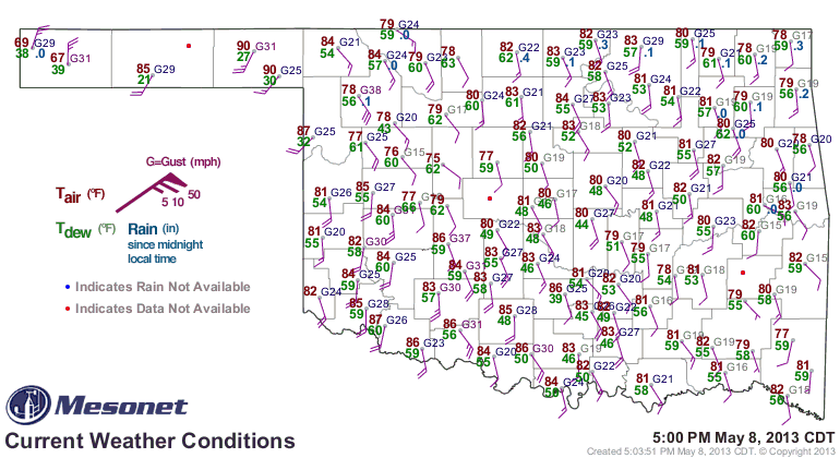
Obs from the Oklahoma Mesonet show that a bulge on the dryline has developed in NW Oklahoma near the panhandle, with a wind shift (SE to SW) also evident on several mesonet stations.
The 18Z and 20Z OUNWRF runs were examined to determine how the convection is expected to evolve tonight. Here are screen captures from 0130Z on the 18Z run, and 0200Z on the 20Z run.
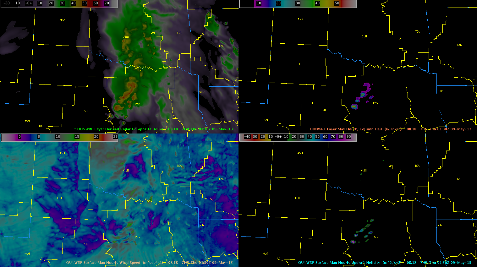
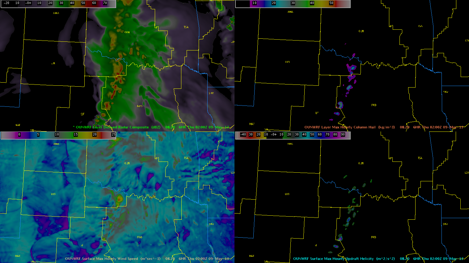
Although most of the intense convection is currently moving into the OUN forecast area, both runs of the OUNWRF show that by this evening, the storms in Oklahoma will weaken. While both runs show an intensification in the Dallas/Fort Worth CWA, with concentrated areas of max column hail and max updraft helicity, the timing is quite a bit different. The 18Z run was much faster, while the 20Z run has the storms just getting into the CWA by 02Z. The storm mode appears to be somewhat of a congealing of the discrete cells, perhaps into an MCS or several clusters.
Here are some of the convective parameters in the same two model runs.
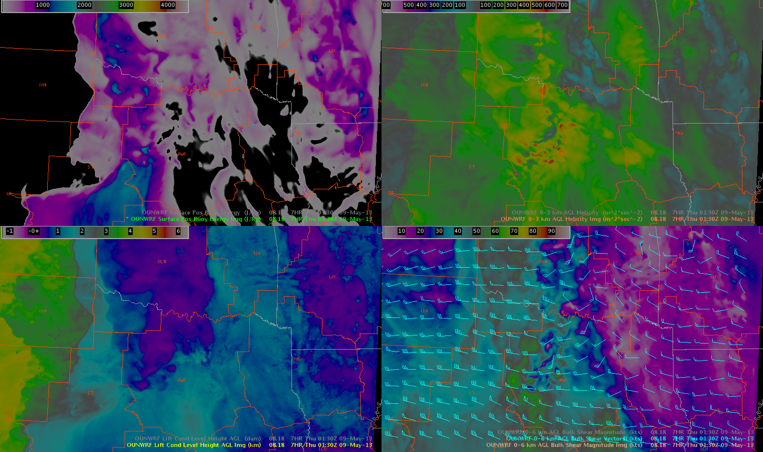
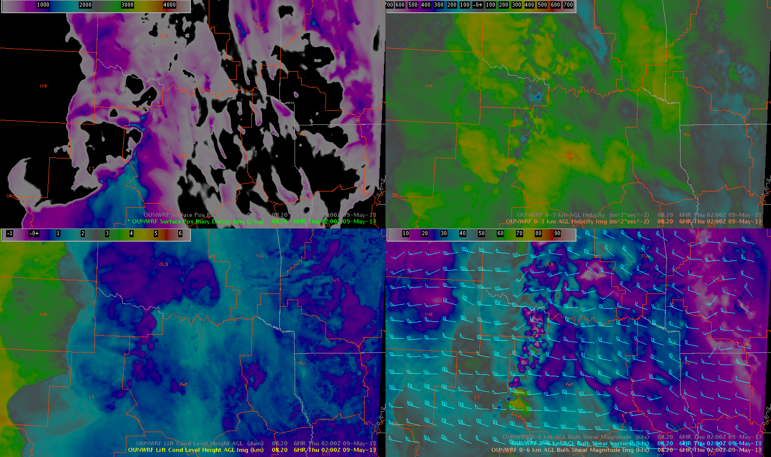
As the storms strengthen as they move through northern Texas, they will be in an environment with low LCLs (under 1km) and perhaps some enhanced -03km helicity (though this signal was a bit stronger on the 18Z run than the 20Z run). However, SBCAPE will be very low by this time of day. In general, these parameters do not look as favorable (by later in the evening) in Oklahoma as they do in Texas.
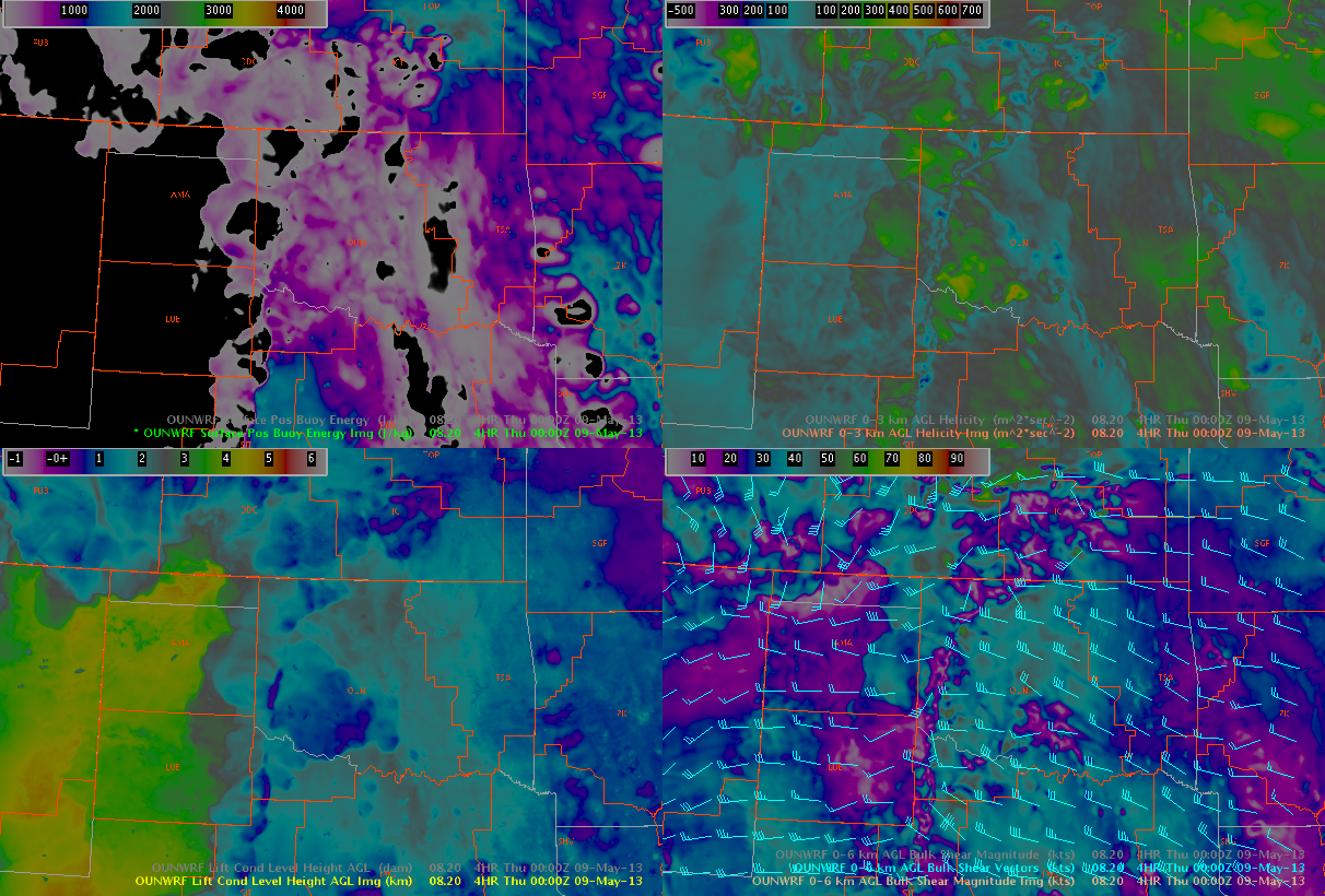
As mentioned above, as the environment continues to evolve through the evening, it was noted that surface winds have shown signs and will start to back along/ahead of the dryline, and especially along and north of the KS/OK border, as the sfc low track north/northeast. This has resulted in an increased signal in the 0-3 Helicities, evident on both the 21z run of the RAP and the 20z run of the OUNWRF. Forecast soundings from central and western/southwestern OK and southern KS continue to support modest LCLs, with dry/stable boundary layers. However with 0-3km helicities increasing from the 60s and 70s into pockets of 200-300 m^2/s^2 by 00z. We believe that if LCLs continue to lower with increasing moisture, we could see our environment become slightly more conducive to tornadic development. Especially across northern OK/southern KS and into central and southern OK.
–Hatzos/Kurtz