
With multiple scans of CI/CTC showing iminent or ongoing convective initiation over Lubbock’s area, will localized one desk at the LUB wfo. This will give the testbed an opportunity to evaluate some of the PGLM products available in the LUB LMA. The image below from 2145 UTC shows where storms are developing in extreme south central parts of the CWA.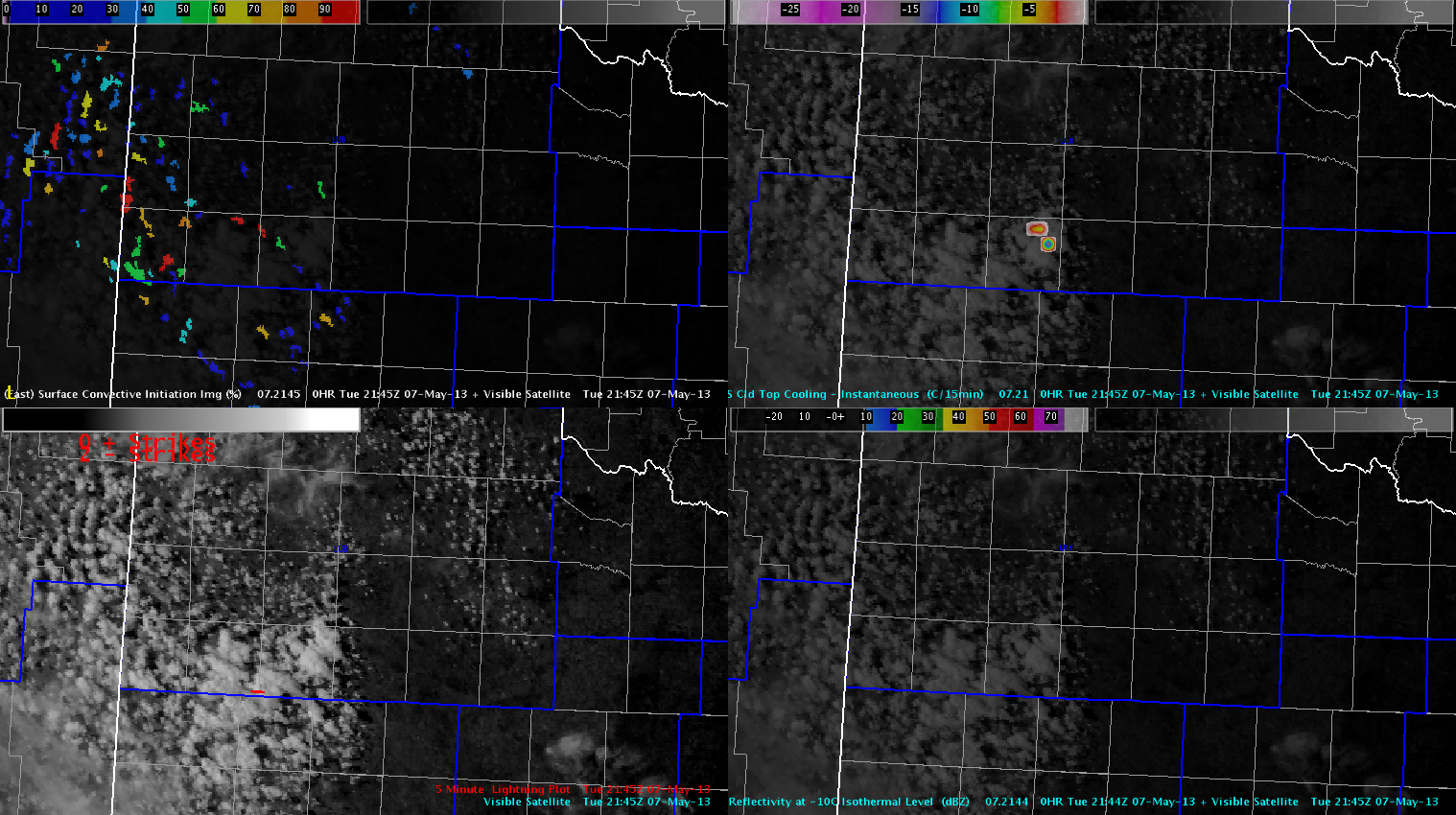
Radar trends show activity is also on the uptick at DDC, with ongoing supercells over GLD’s area. Will keep two teams stationed at these locations to optimize this marginal severe weather setup. The image below is a four panel of MESH products and composite reflectivity over the DDC and GLD CWAs.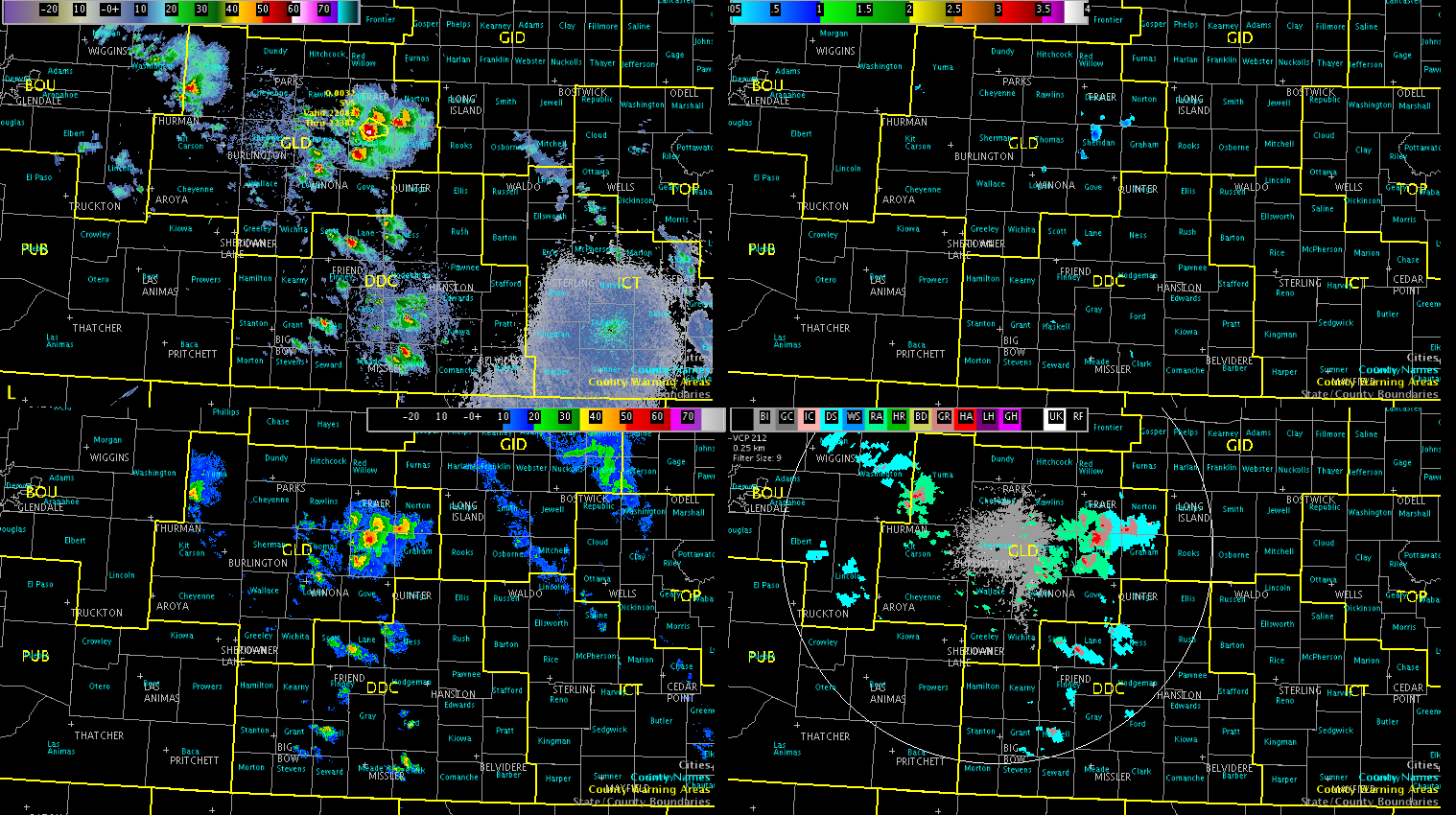
Will continue to monitor trends, but all areas appear to be covered at this time.
Austin