
Winds are backing in two sections of the area that we are concerned about today. Both the OUNWRF and HRRR data indicate that 0-1km helicity is continuing to increase in two locations.
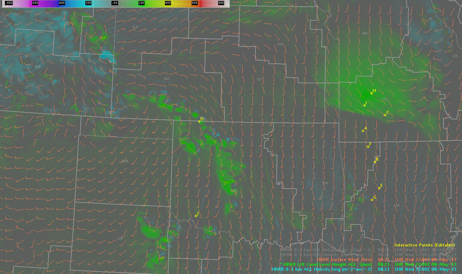
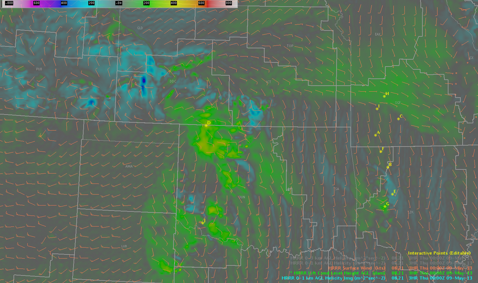

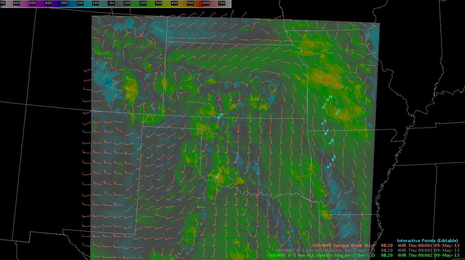
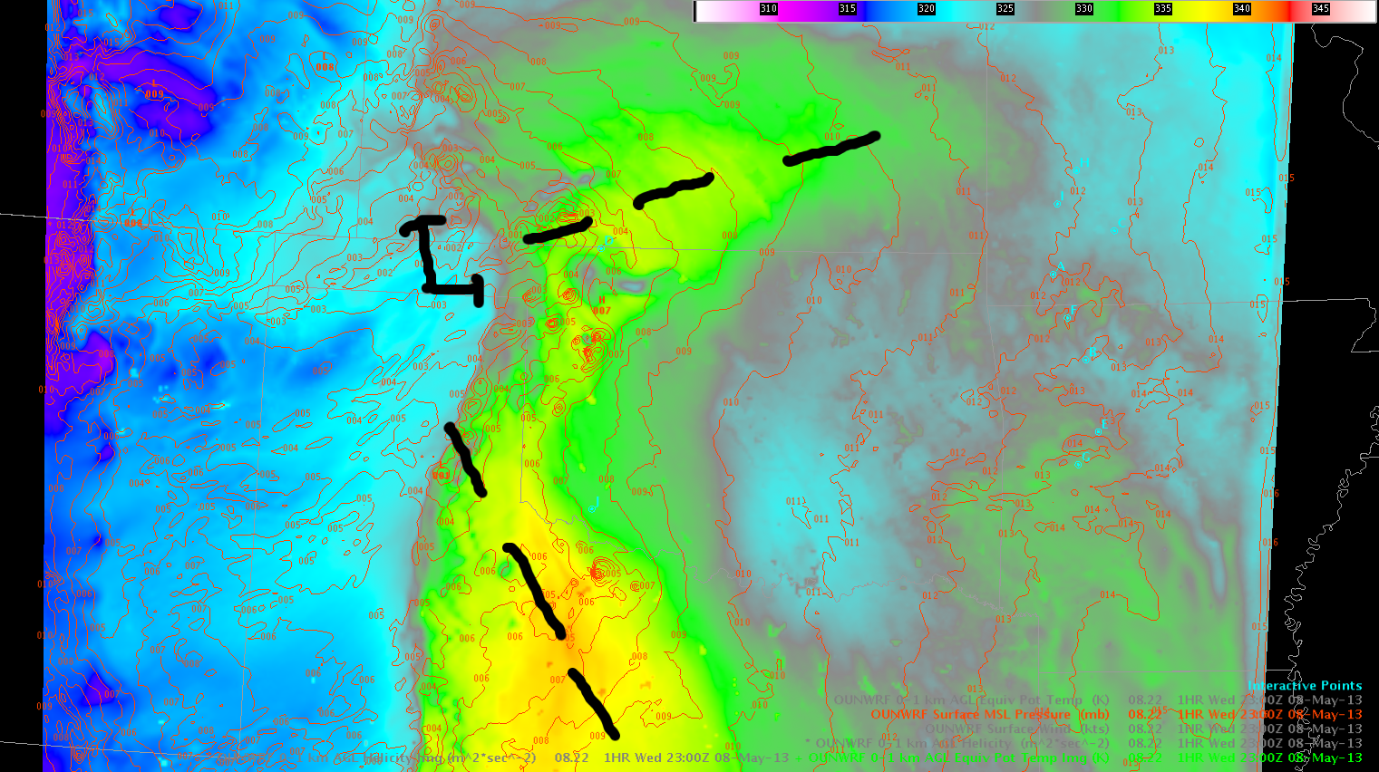
Near points D (OK/KS border) and J (OK/TX border), winds are backing at the surface. Looking at an OUNWRF MSLP, the front over southern Kansas is evident (as well as a change in air mass, as indicated by theta-e). Ahead of the dryline, there is another trough that digs south-southeast into Texas, with winds backing well ahead of the dryline.
RAP/HRRR/OUNWRF data indicates that LCL values will decrease with time over the next few hours. However, dewpoint depressions on surface obs remain quite large in both of these focused locations (about 20F in SW Oklahoma, and about 10-15 degrees ahead of the storms in southern Kansas).
We do not currently have the 1km LAPS forecast data available in AWIPS. However, what we are seeing on the internet appears to show that the line of supercells moving into the SW OUN CWA will continue to strengthen. This will be as it moves into the southern area highlighted above — perhaps an area that will be potentially favorable for a bit of an enhanced tornado threat.
–Hatzos