
We are actively monitoring convection across western OK and the TX panhandle. At 4 pm our area of operations will be the OUN CWA.
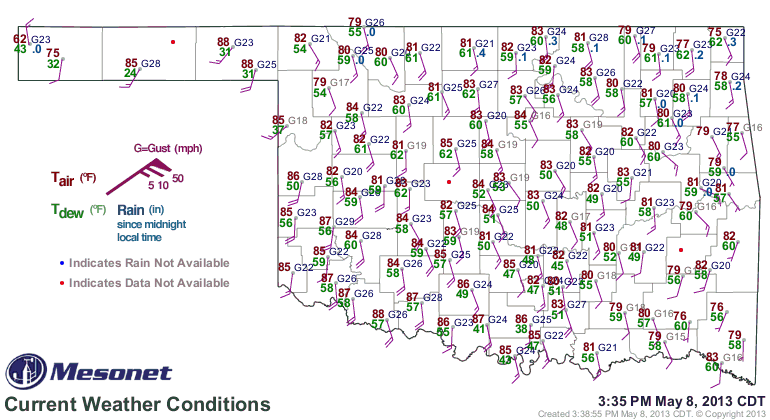
High 50s/low 60s dew points are continuing to pool across western OK as observed on the OK mesonet.
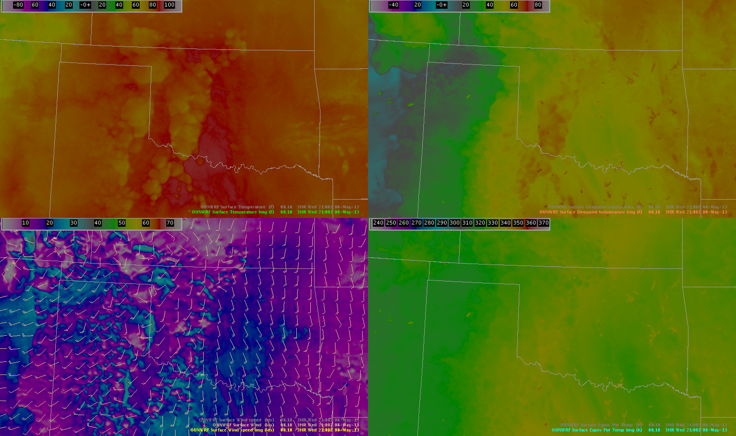
The OUNWRF appears to be capturing the current dewpoints correctly over Oklahoma, especially in the area where convection is developing. However, the temps ahead of the convection appear to be too high on the OUNWRF. It is possible that this is contributing to the over-development of convection on the OUNWRF (as seen spatially on the simulated reflectivity products).
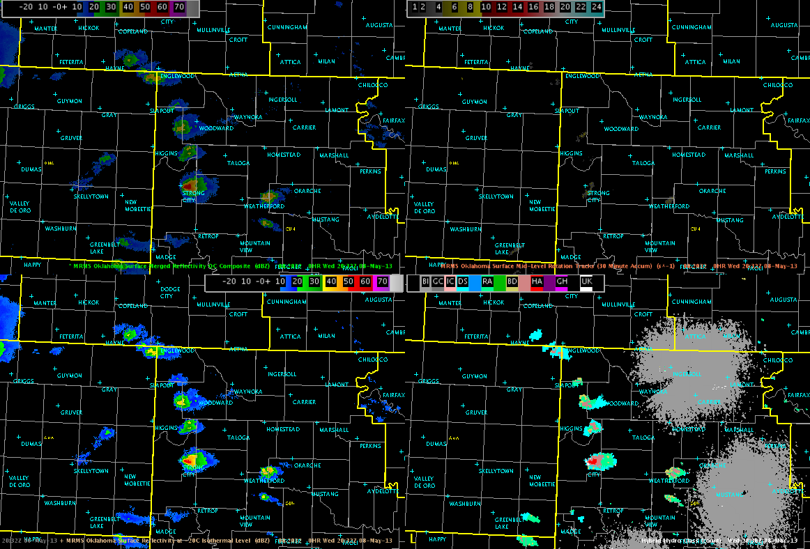
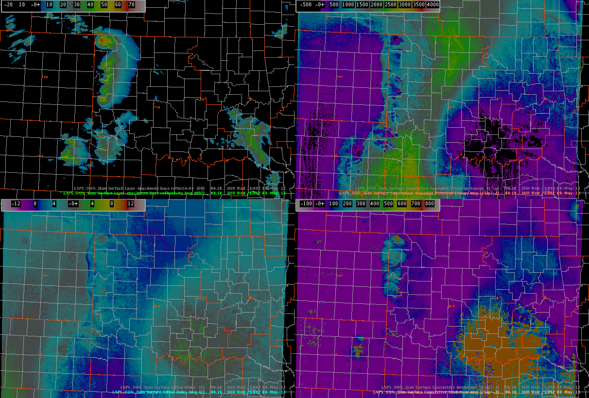
LAPS analysis from the 1 km OUN domain continues to do a decent job with the placement of the composite reflectivity across western OK. Interestingly enought the 21z LAPS shows a clean swath of 2200 to 2600 J/Kg SBCAPE spreading northward across western north Texas, with another pocket of 2000 to 2500 J/Kg SBCAPE near the OK/KS border, which would be nearer the sfc low which continues to churn E/NE across the TX panhandle.
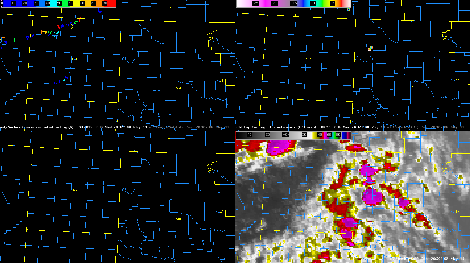
Early convection this afternoon developed in a sct to bkn area of cumulus, with scattered cirrus/stratus spread across Panhandles through western OK. This has resulted in little to no response from the both the GOES-CI and CTC products due to the contamination from the cirrus and stratus. The screen capture below shows the area of intense convection developing over Oklahoma, with little to no apparent signals in the CI/CTC products. This was also the case for several time steps before this image was saved.
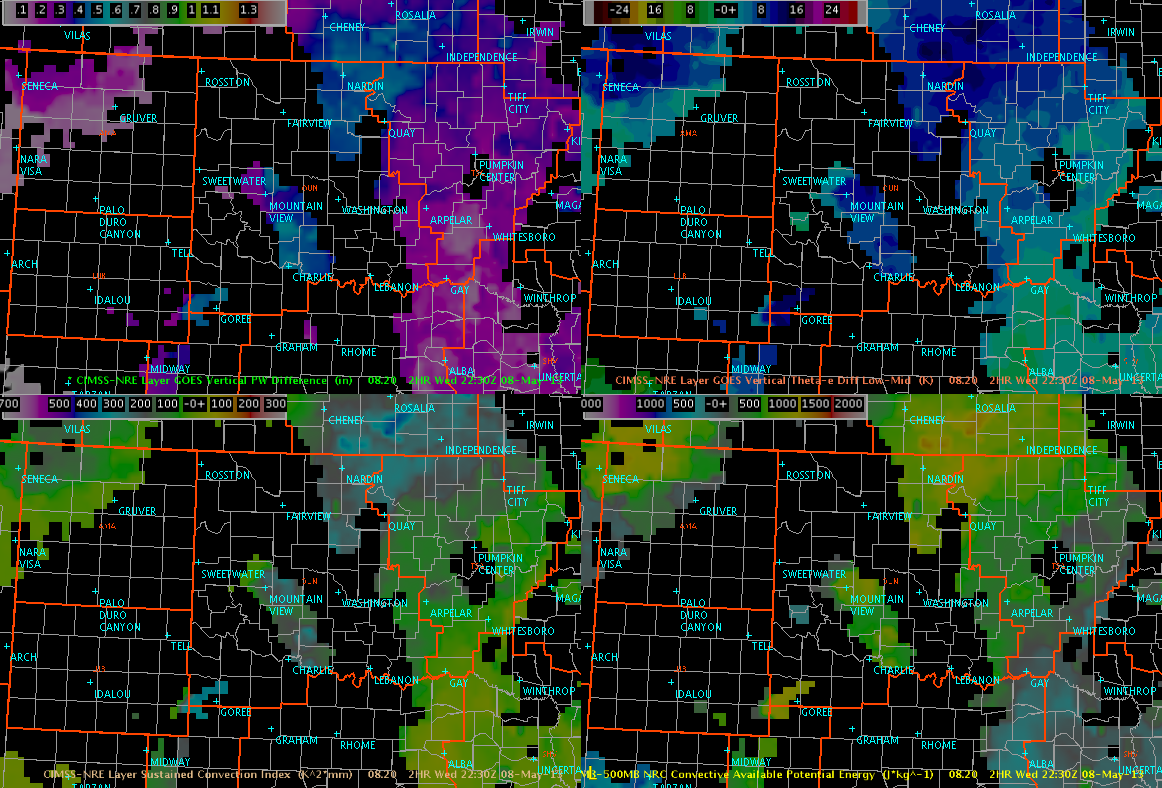
Nearcast products from CIMSS/GOES have also struggled with the presence of clouds before convective initiation. This is evident from loss of data across western OK and the TX panhandle.
Kurtz/Hatzos