
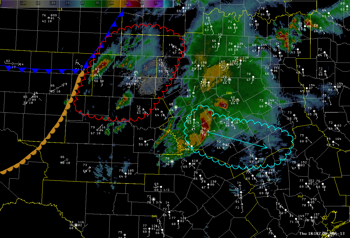
There are two main area of concerns over the next two to three hours. The first is across the southern FWD CWA. A strong to marginally severe storm is currently tracking ESE and is indicated in the image below in cyan. This storm is moving into an environment of 2000 J/kg of surface CAPE but is going to feel the effects of some inhibition. This should allow the storm to maintain its intensity with some growth possible if CIN values decrease with further heating and destabilization this afternoon.
Further to the west in the SJT CWA, some clearing as allowed temperatures to warm into the middle 80s with dewpoints in the upper 50s to lower 60s. This leads to CAPE values of 3000-4000 J/KG given steep mid-level lapse rates near 7.5 C/Km. This area is also near the surface front/dryline and this will serve as an additional surface focus for convection. With an uncapped airmass, this area will likely be the best area for supercells and large hail. This region is in red in the image below. The HWT will have one team in the FWD CWA and one in SJT.
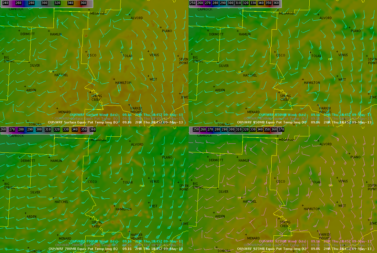
The 16z run of the OUNWRF has captured the increasing moisture and temps with its mid-level theta-e fields quite nicely…with theta e values at 850 and 700mb increasing 10 to 12 K over a 2 hour period, primarily pooled near the pseudo-triple point mentioned above across the northern portion of SJT’s CWA.
Hampshire/Kurtz