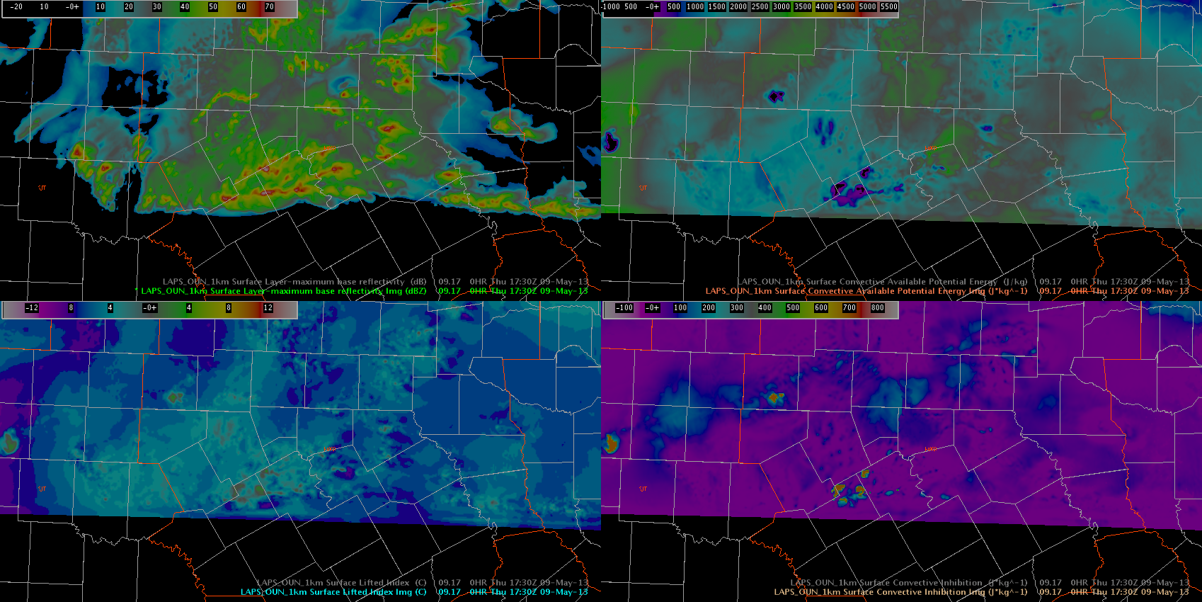
The OUNWRF does fairly well when storms are within the domain, however, as we are situated in FWD’s CWA today, it appears that the southern domain boundary has a significant impact on convection. The images below are of the 1 KM Lapse, which is extrapolated in time with the WRF. The first image shows a clear delineation of the southernmost boundary. The second image, only 15 minutes later, shows deep convection developing along a phony boundary generated by the southern limit of the domain. This obviously wouldn’t be a problem in the 2.5 km products, but would more likely be an issue for the OUNWRF domain if operating in north Texas.
Image 1