Tornadic Storm Fires Off Old MCS Outflow Near Floydada, TX

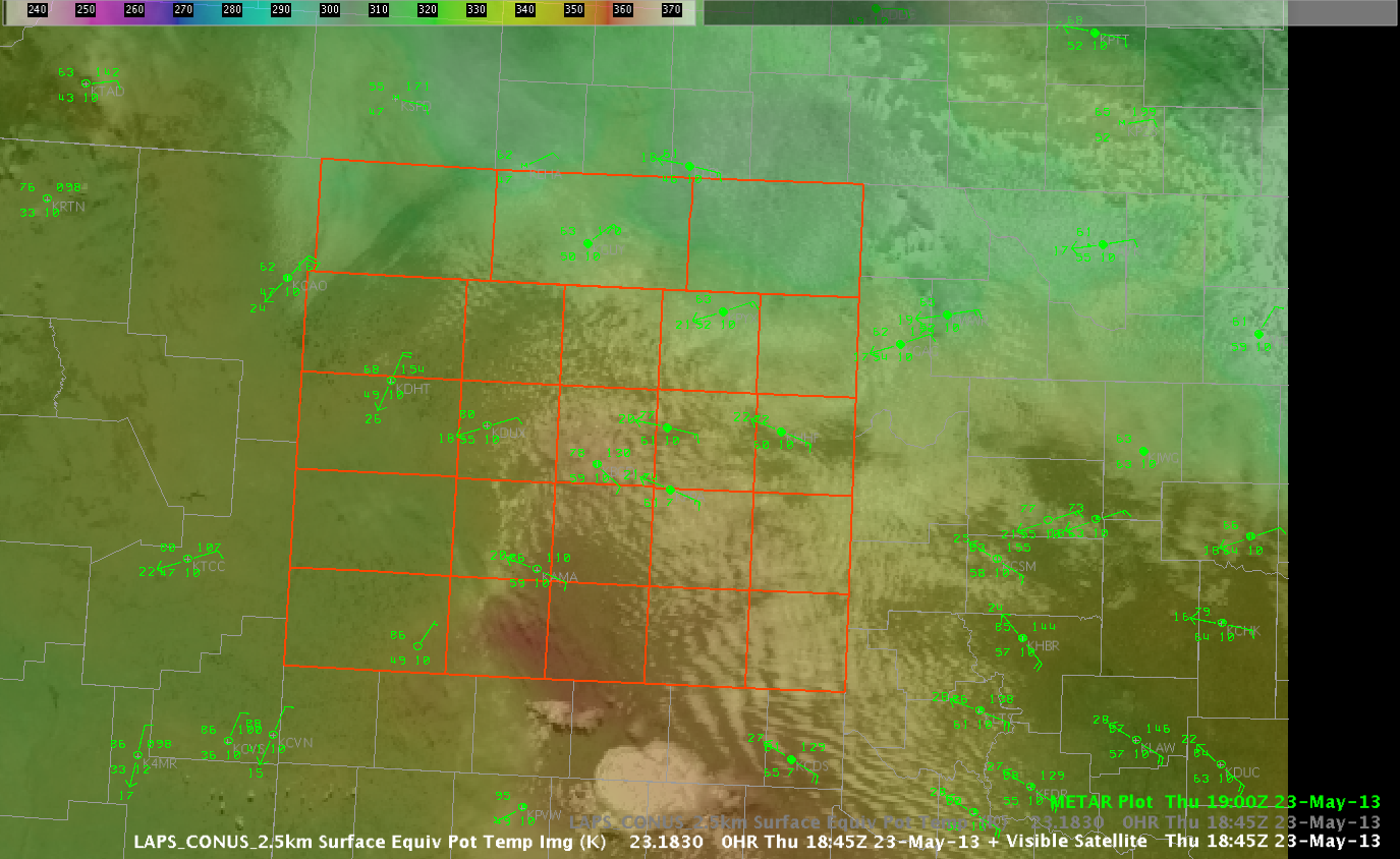
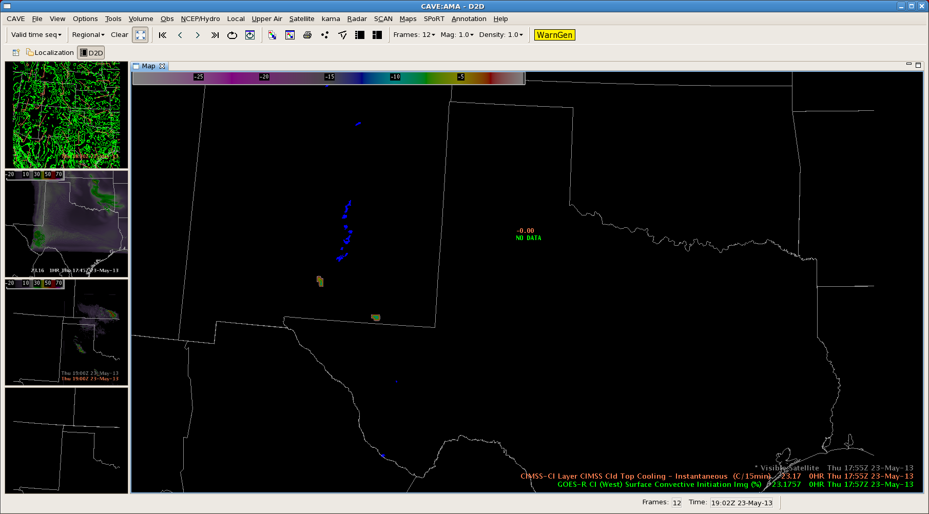
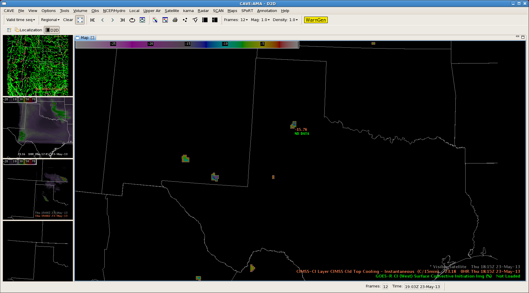
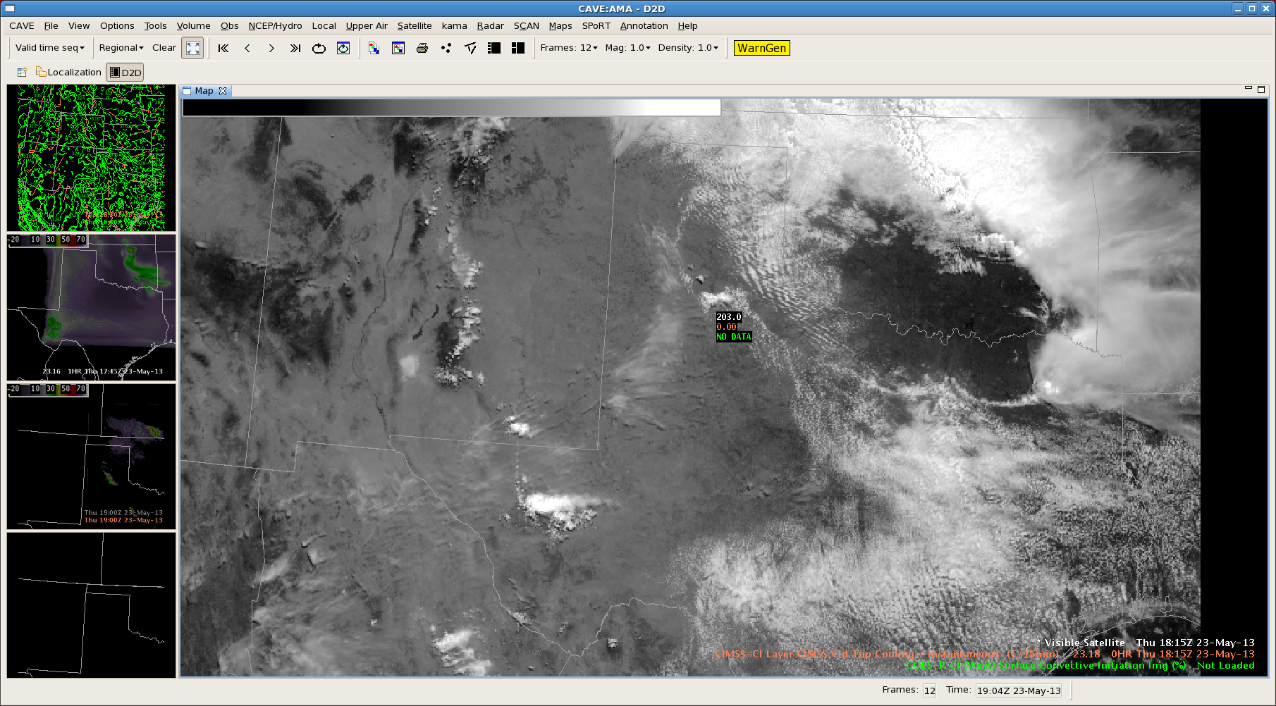
Strong convergences initiated northeast of Lubbock, TX near Floydada in Floyd County.  CTC product caught -16-17K/15 min around 18:15 UTC on this storm. Tornado warning was issued 19:21 UTC which resulted in 1 hr/6 min lead time if you had warned initially off the CTC projection.

LUBCTC

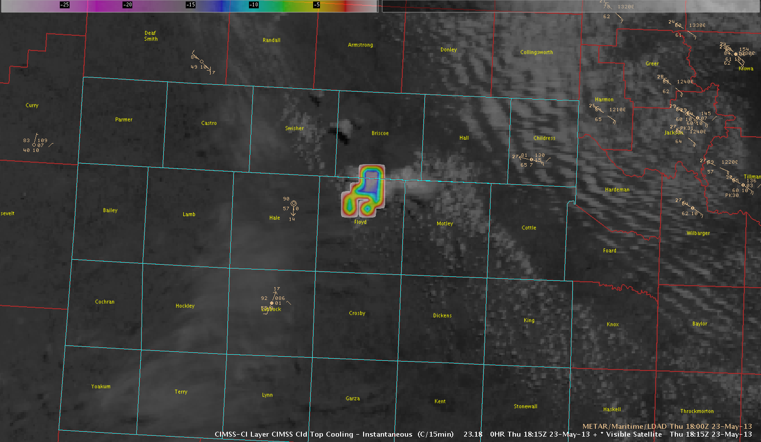
CTC product W/Visible Satellite

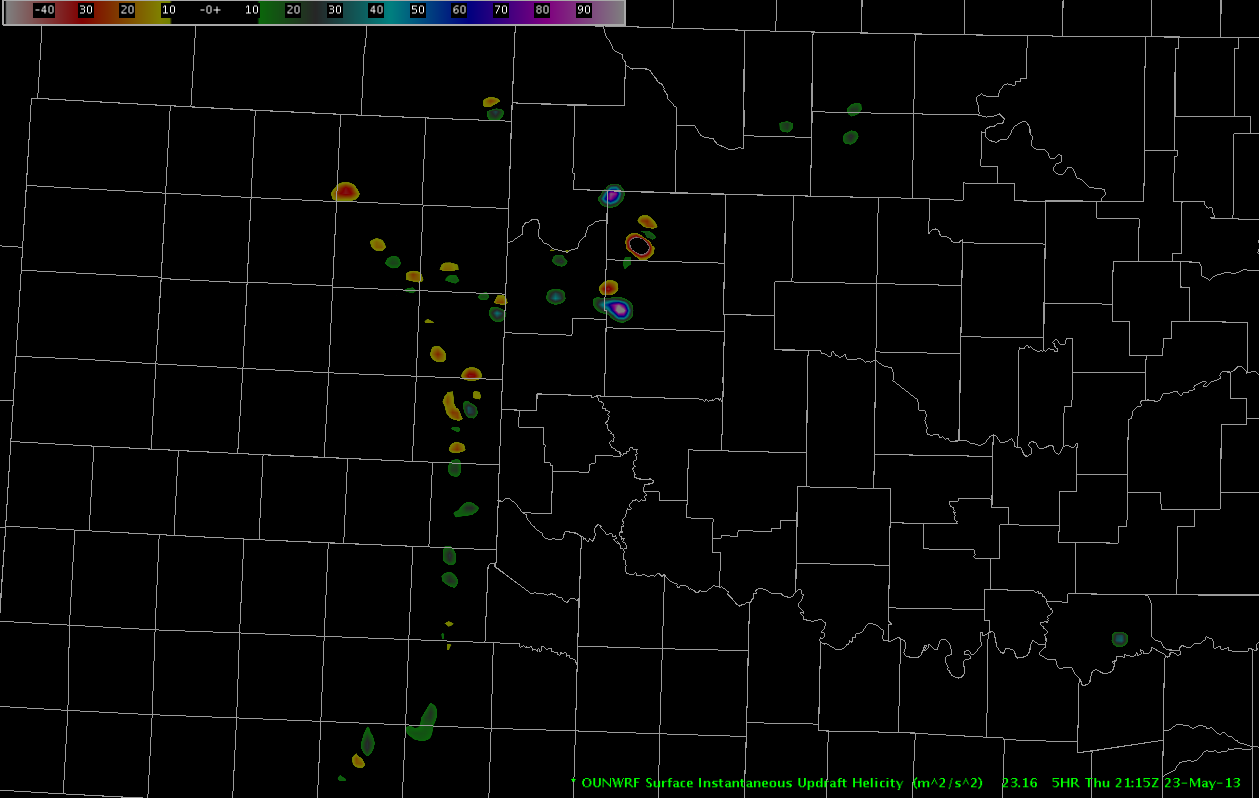
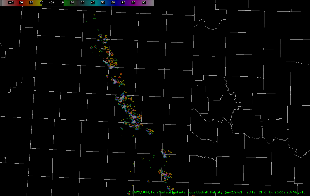
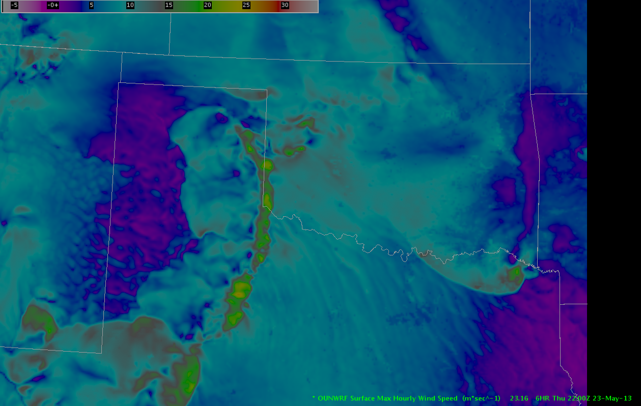
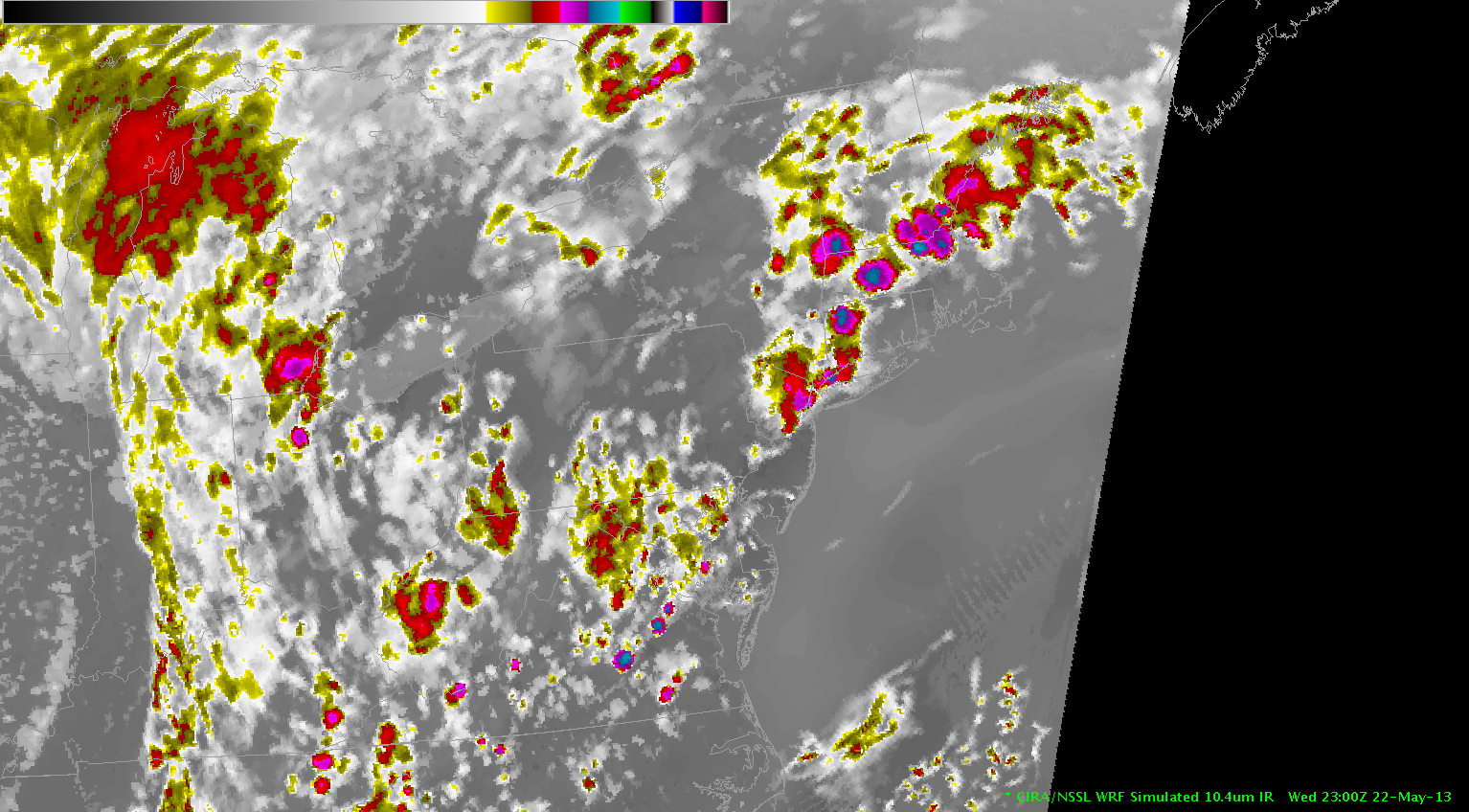
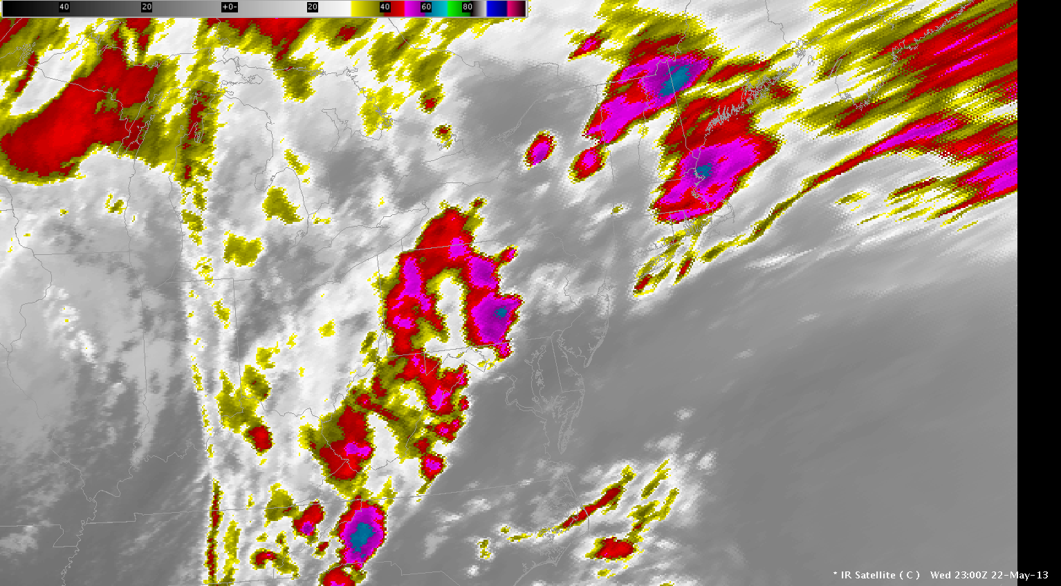
The OUN_WRF progged Surface Merged Reflectivity Composite also nailed the point of storm initiation around 1900 UTC(See image below).

OUN_WRF19Z

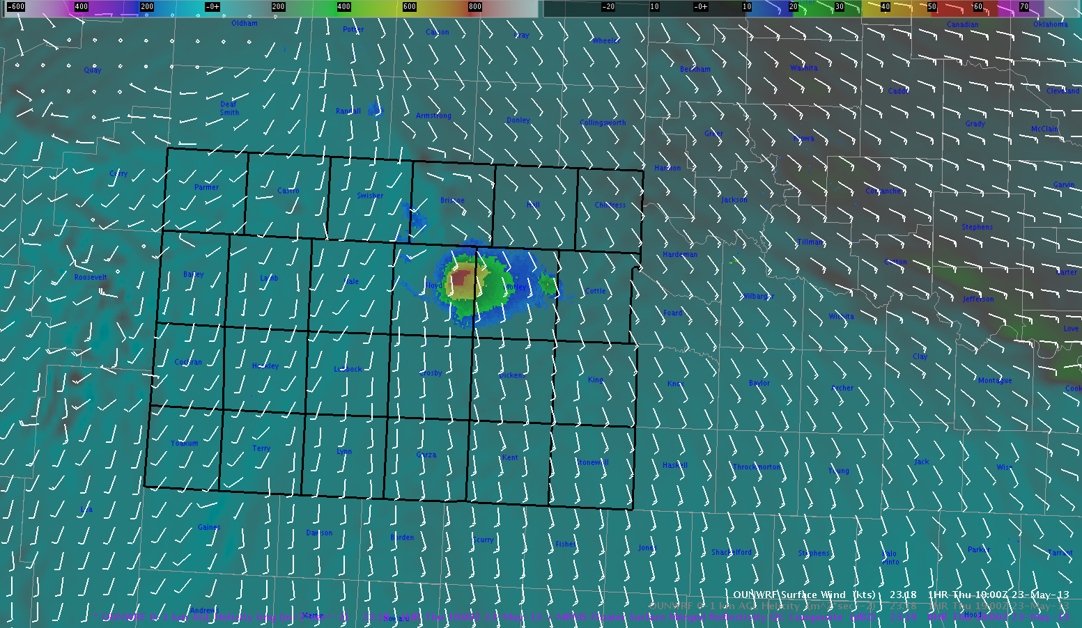
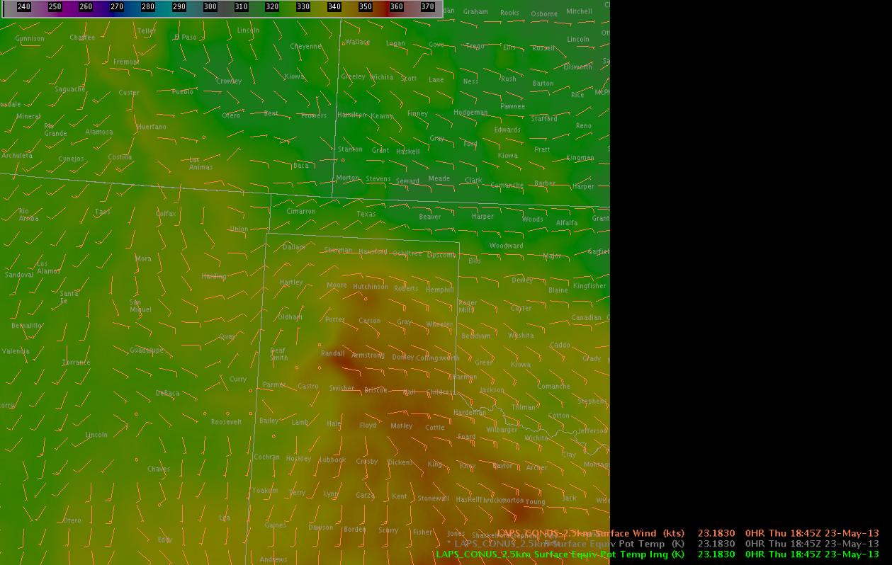
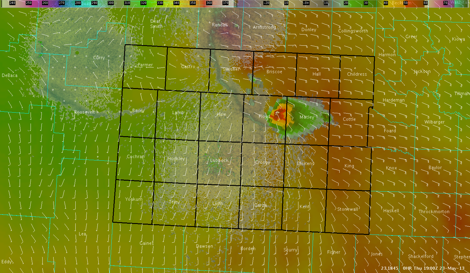
Below is the 1900 UTC 2.5KM Theta-E image clearly indicate moisture converging near the point where this supercell developed up through Floyd and Brisco counties northeast of Lubbock. Also, the wind fields verify that there was like good moisture convergence in this same area.

2.5KMLAPS19Z

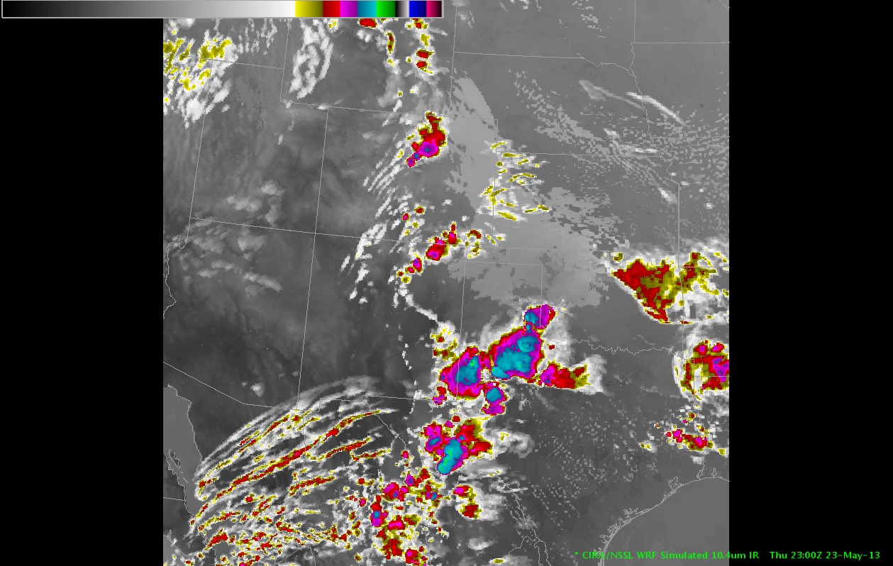
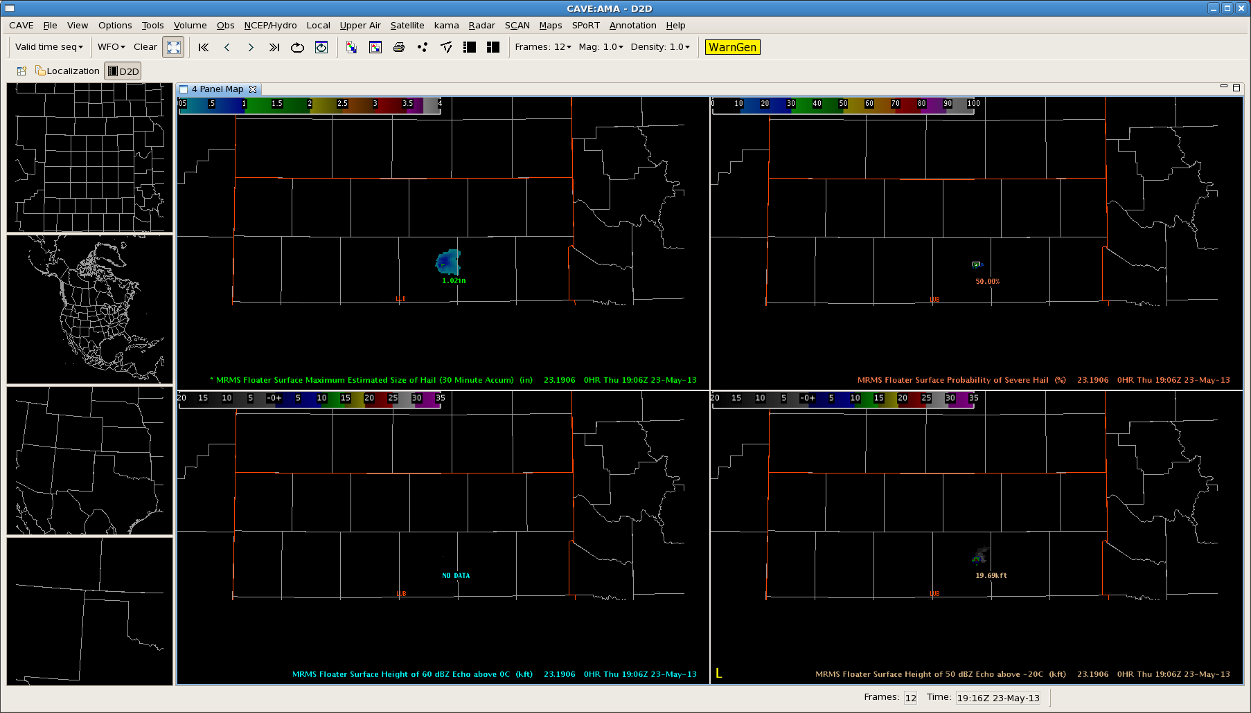
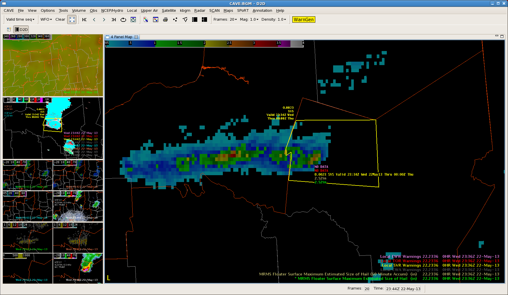
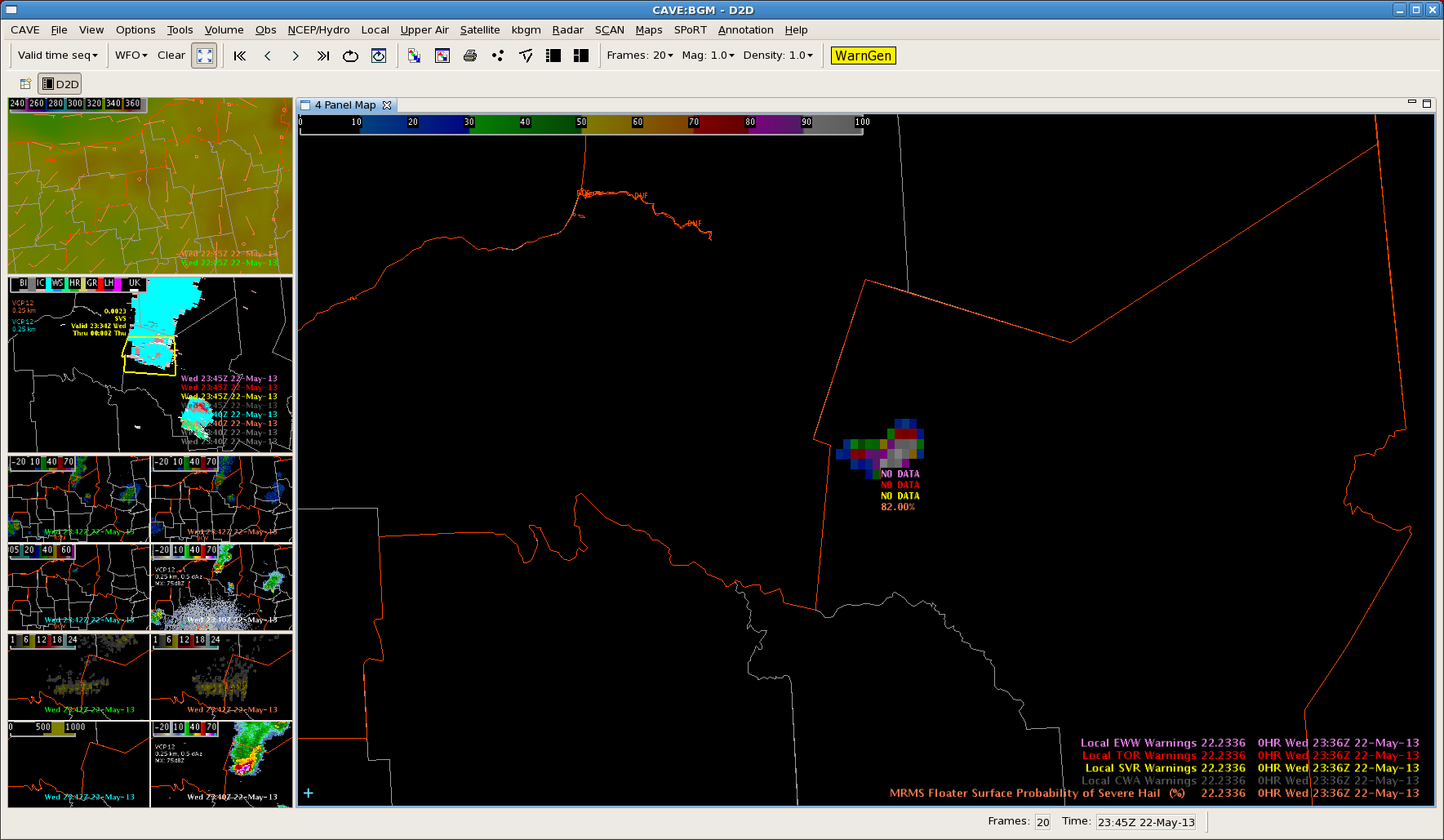
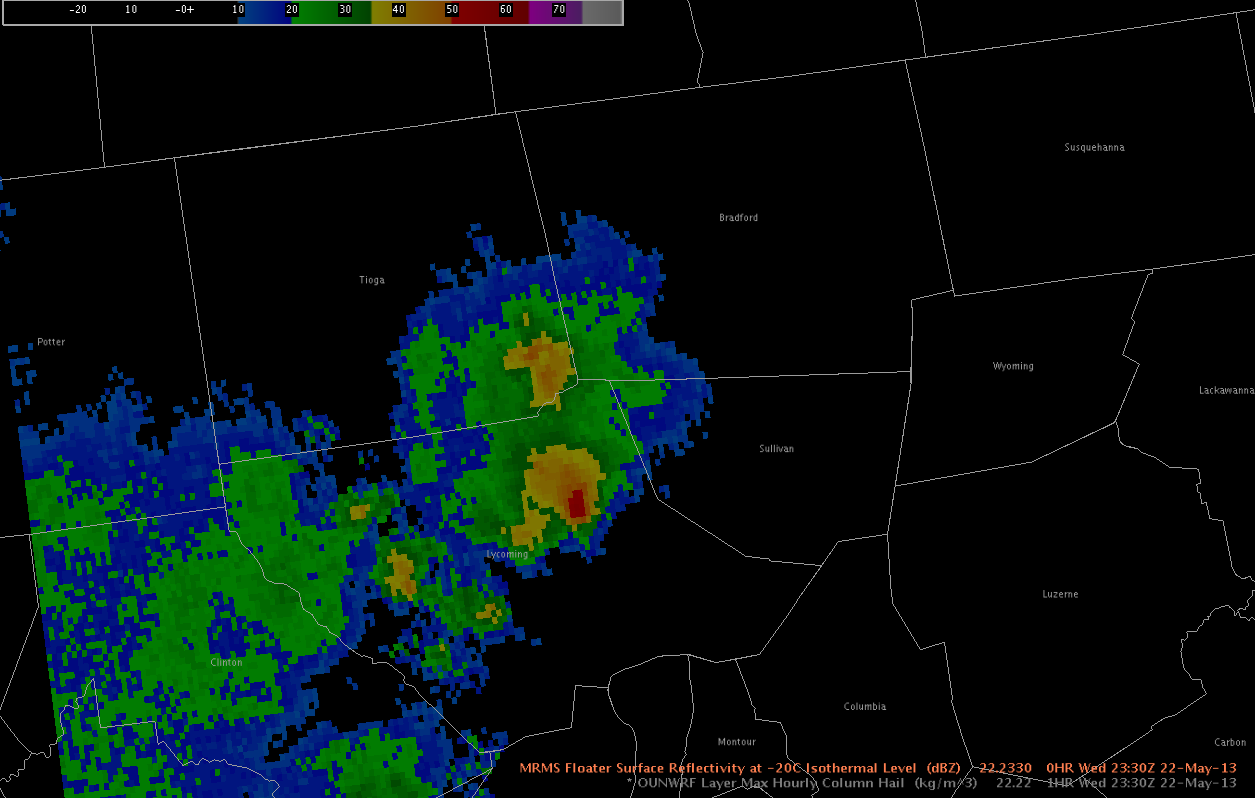
Some of the MRMS (MESH/30 min MESH swath) and HSDA (0.5 degrees showing potential for large hail as well) real-time data gave quick indications that this atmosphere was volatile and showed the storms potential with little latency at 1900 UTC.

LUB4-PanelMRMS_HSDA19Z

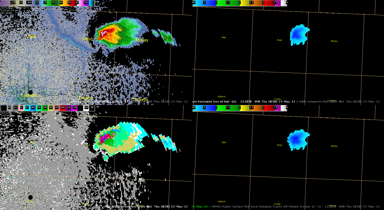
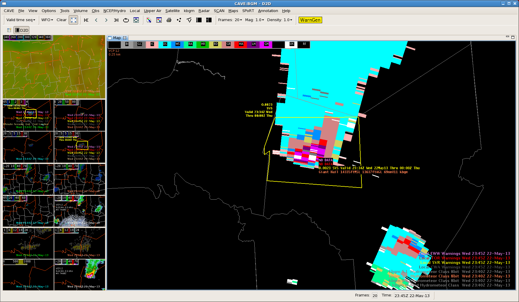
This storm has already produced quarter-size hail at 1923Z and a few land spouts (weak tornadoes).


Tags: None

Howdy Y’all! From the TX Panhandle!

Well, there’s a severe thunderstorm down in the Lubbock CWA and all is quiet here on the northern front…way down south in the TX panhandle that is.  Anyway, an outflow boundary has moved across the area and appears to be settling in west-central portions of the TX panhandle so far.  The image below shows the latest GOES-15 Vis image combined with the 2.5km LAPS theta-e (1845 UTC).  METAR observations are laid atop the image (1900 UTC).  Hopefully, you can notice the reddish colors in the southwest part of our CWA just south of the Amarillo area.   A strong theta-e ridge extends from the Lubbock area into the southern portions of our area per the LAPS data.  So, we’ll be watching that area and the leading edge of the cu field in assoc/w the outflow for development.

LAPS 2.5km Surface Theta-e combined with GOES-15 Vis imagery.  METAR obs are included.
LAPS 2.5km Surface Theta-e combined with GOES-15 Vis imagery. METAR obs are included.


Kris

Tags: None

EWP Mesoscale Discussion May 23 2000 UTC

Morning convection has departed the OUN area… and a cooler outflow air mass is now in place across much of Oklahoma.  Warm, humid air is located to the east of a dryline and to the west of the outflow boundary with dew points approaching the mid 60s all the way to the I27 corridor.  East winds are observed ahead of the dryline on LAPS imagery bringing an upslope component to the surface flow.

Convective initiation has begun to develop in Floyd County TX…  and coverage is expected to increase as the afternoon continues along an axis of rich theta-E air indicated on LAPS imagery stretching from Moore County TX to a maximum in Randall County TX and to the south-southeast towards Jones County TX.

1845ZThursThetaEWinds

Early convection has been noted to be fairly robust…  with a -17 C/15 minutes cloud top cooling noted with the Floyd County storm and a MESH exceeding 1 inch about 30 minutes later and now with a MESH of 1.73 inches.

OUN WRF indicates a bigger threat of storm splitting which would suggest the main threat to be large hail…  while the 1 KM LAPS shows robust updraft helicity in the Texas panhandle, suggesting risk of tornadoes in the warm sector air just west of and along the outflow boundary.   One brief touchdown was recently reported near Cedar Hill and mid level rotation tracks have noted to be increasing in strength.

OUNWRFhelicity2115Z

Thurs2000ZLAPShelicity

Simulated satellite imagery and short term models indicate that convection will develop quickly by 23Z along much of the dry line and moving slowly to the east.  In addition to the hail and tornado threat…  as the line congeals into a convective system in the evening hours…  a wind threat is likely to develop as well.

ThursSimSat2300Z

OUNWRFWindThreat

– Sears/McCormick

Tags: None

Initialization in TX Panhandle

Texas panhandle is the area of main focus for the first part of this afternoon. Analyzing CI, as seen below, indicated development was expected to quickly form by 19z.

Image 1 – CIMSS CTC prior to CI around 18z.

beforeCI

Image 2 – Cloud Top Cooling at the time of CI over the central parts of Texas panhandle around 1815z. Values right around -17oC.

afterCI

Image 3 – Vis sat around 1815z, with CI. Vis at 1845z shows the explosion of the storm in the panhandle, with the CTC product thus providing around a 30 mins lead time.

visafterCI

Image 4 – With the radar products unavailable at this time, using MESH and probability of severe hail to show the development of the storm to severe levels.  The CI on CTC developed around an hour prior to the MRMS products reaching severe levels.
meshprobsvrafterCI

Tags: None

EWP Status for 23 May 2013: 1-9 pm Shift

EWP Status for 23 May 2013: 1-9 pm Shift

Action in the TX Panhandle and W OK on Thursday for our last operations shift of EWP2013.  A mid morning MCS over OK may leave an outflow boundary in the eastern PH. As the uppre level ridge axis moves to the east, a more favorable deep layer shear profile will emerge, with a chance of supercells.  Large hail will be the main threat, but tornadoes cannot be ruled out.  Good opportunities for CI produvt and PGLM product evaluation also exist.

Possible CWAs:  Lubbock, Amarillo, Norman

G. Stumpf, Week 3 Coordinator


Tags: None

Large Hail in Eastern Oswego County, NY…

A very impressive-looking storm produced severe hail in Oswego and Oneida Counties earlier today.  A report of golf ball size hail was received at 2310 UTC near the town of Central Square, which was the largest hail report received while the storm was in the BUF CWA.  Below is an image of MRMS and KYTX radar data at that time.  The MRMS reflectivity at -20C had reached values as high as 71 dBZ at this time!  Additionally, MRMS MESH values had reached a maximum of 3.31 inches.  Interestingly, the HSDA did not indicate the presence of large or giant hail, although there were areas of UK, or uknown classification.

MRMS data valid 2310 UTC and KTYX radar data valid 2312 UTC.  Upper left - MRMS merged reflectivity QC composite, upper right - MRMS reflectivity at -20C Isothermal level, lower right - MRMS MESH, lower left - KTYX Hybrid Hydro Class (HSDA)
MRMS data valid 2310 UTC and KTYX radar data valid 2312 UTC. Upper left – MRMS merged reflectivity QC composite, upper right – MRMS reflectivity at -20C Isothermal level, lower right – MRMS MESH, lower left – KTYX Hybrid Hydro Class (HSDA)

While severe thunderstorm warnings had been ongoing with this storm since 2144 UTC, the steady increase in MESH and reflectivity values at -20C prompted me (the warning forecaster) to issue a new thunderstorm warning with a mention of 2-inch hail.  Granted, we never got reports that large, although that doesn’t necessarily mean it didn’t happen.  Anyway, this was the theme on this day…where the MESH appeared to overestimate the size of hail to an extent, and probably more so as the hail became larger, while the HSDA underestimated the size, or else due to some issues with the algorithm was assigning a UK classification.

Kris and Eric

Tags: None

WRF Simulated Satellite at 23 UTC

The WRF simulated satellite image forecast for 23 UTC (top) compared well with the observed IR satellite (bottom) with respect to the mid-level boundary location across Indiana.  However, it did not handle to convection well which formed over PA.  Instead it showed more convection east of the higher terrain across MD and northern VA.

23zWRFsimIRsat

23zIRsat

Tags: None

BGM Warning Using HSDA and MRMS

Isolated severe thunderstorm progressing across north central NY early this evening. MRMS and HSDA along with the local storm reports were utilized in issuing a warning for this storm as it moved from BUF CWA to BGM. MRMS 60 min accum indicated strengthening of the storm as it progressed through the BUF CWA, with reports of between 1 and 2 inches. Both the MRMS and HSDA were both indicative of this.

Issued a severe warning with the increasing trend, mentioning up to 2 inch hail and possible wind damage, with hail being the bigger threat.

Image 1 – Reflectivity with initial warning. Guidance enabled the warning to be issued with plenty of time before even reaching the CWA.

BGMREFLEC

Image 2 – MESH values with 60 min accum indicates hail sizes between 2 and 3 inches. Reports since the warning has been issued have confirmed up to 2.5 inches.

BGNMRMSMESH

Image 3 – Severe hail probability bringing in 80-90% over areas reporting severe hail.

BGMPROBHAIL

Image 4 – HSDA indicating large to giant hail.

BGMHSDA

Tags: None

EWP Mesoscale Discussion 2330 UTC

A severe threat continues in Oswego and Oneida counties…  where an intense thunderstorm continues to move eastward, and golfball sized hail was recently reported in Central Square.  The storm continue to move into a region of theta-E characterized  by values of greater than 342 K…  and lower dew point depressions near 10 K.

2340BR1

Farther to the south…  dry air continues to dominate much of the southern portion of the BUF CWA and the southwestern portion of the BGM CWA.  Convection has tried to develop throughout the cumulus field throughout the afternoon…  but the substantial convection to this point has been confined to a narrow ribbon of moisture rich air just south of Lake Ontario, as previously discussed.

One exception is near Sullivan County PA in the southern portion of the BGM CWA…  where a small region of higher moisture is indicated by the LAPS analysis.  In addition to a threat of strong winds…  as DCAPE values exceed 800 J/kg in a region with dew point depressions approaching 30 degrees F in some cases…  a marginal severe hail threat is also evolving for the BGM area in Sullivan and Bradford Counties in the next couple of hours where LAPS is indicating higher surface dew points.  Recent radar trends indicate that reflectivity above 0 C has increased in recent scans as well.

2245DPDWed

2330Reflect-20C

– Zimmerman/McCormick

Tags: None