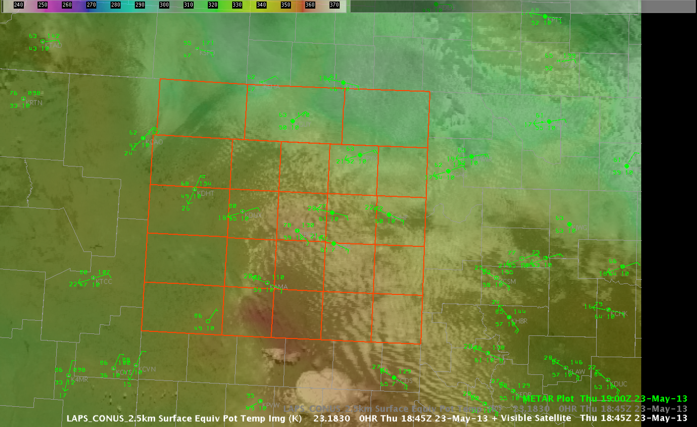
Well, there’s a severe thunderstorm down in the Lubbock CWA and all is quiet here on the northern front…way down south in the TX panhandle that is. Anyway, an outflow boundary has moved across the area and appears to be settling in west-central portions of the TX panhandle so far. The image below shows the latest GOES-15 Vis image combined with the 2.5km LAPS theta-e (1845 UTC). METAR observations are laid atop the image (1900 UTC). Hopefully, you can notice the reddish colors in the southwest part of our CWA just south of the Amarillo area. A strong theta-e ridge extends from the Lubbock area into the southern portions of our area per the LAPS data. So, we’ll be watching that area and the leading edge of the cu field in assoc/w the outflow for development.

Kris
