
A severe threat continues in Oswego and Oneida counties… where an intense thunderstorm continues to move eastward, and golfball sized hail was recently reported in Central Square. The storm continue to move into a region of theta-E characterized by values of greater than 342 K… and lower dew point depressions near 10 K.
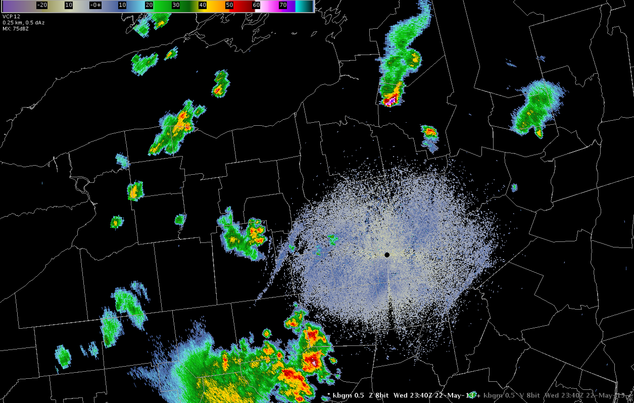
Farther to the south… dry air continues to dominate much of the southern portion of the BUF CWA and the southwestern portion of the BGM CWA. Convection has tried to develop throughout the cumulus field throughout the afternoon… but the substantial convection to this point has been confined to a narrow ribbon of moisture rich air just south of Lake Ontario, as previously discussed.
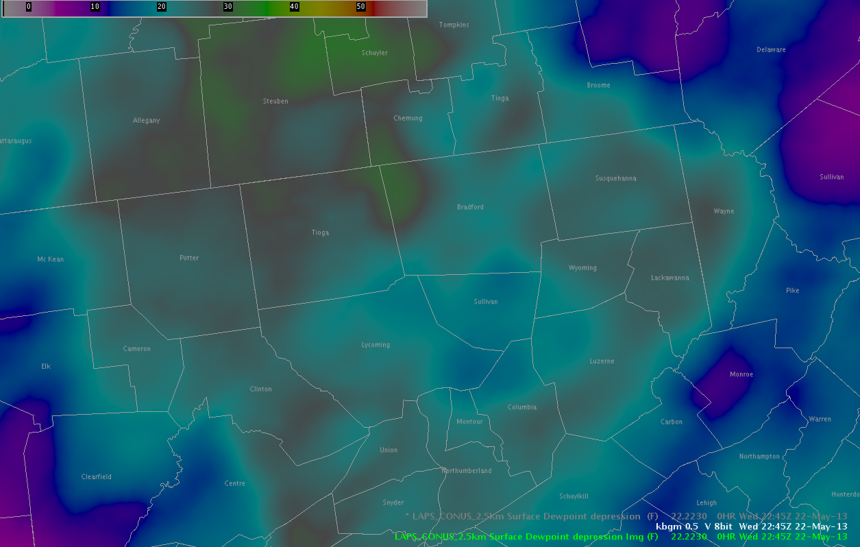
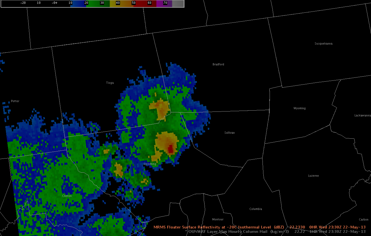
One exception is near Sullivan County PA in the southern portion of the BGM CWA… where a small region of higher moisture is indicated by the LAPS analysis. In addition to a threat of strong winds… as DCAPE values exceed 800 J/kg in a region with dew point depressions approaching 30 degrees F in some cases… a marginal severe hail threat is also evolving for the BGM area in Sullivan and Bradford Counties in the next couple of hours where LAPS is indicating higher surface dew points. Recent radar trends indicate that reflectivity above 0 C has increased in recent scans as well.
– Zimmerman/McCormick