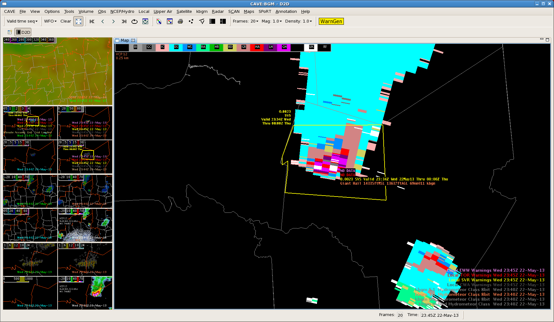
Isolated severe thunderstorm progressing across north central NY early this evening. MRMS and HSDA along with the local storm reports were utilized in issuing a warning for this storm as it moved from BUF CWA to BGM. MRMS 60 min accum indicated strengthening of the storm as it progressed through the BUF CWA, with reports of between 1 and 2 inches. Both the MRMS and HSDA were both indicative of this.
Issued a severe warning with the increasing trend, mentioning up to 2 inch hail and possible wind damage, with hail being the bigger threat.
Image 1 – Reflectivity with initial warning. Guidance enabled the warning to be issued with plenty of time before even reaching the CWA.

Image 2 – MESH values with 60 min accum indicates hail sizes between 2 and 3 inches. Reports since the warning has been issued have confirmed up to 2.5 inches.
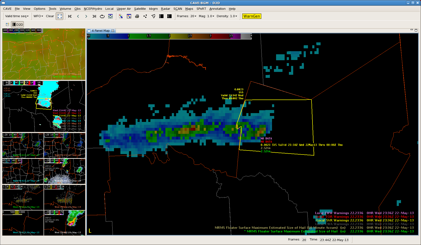
Image 3 – Severe hail probability bringing in 80-90% over areas reporting severe hail.
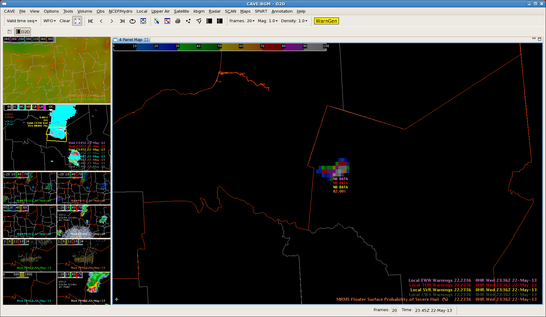
Image 4 – HSDA indicating large to giant hail.