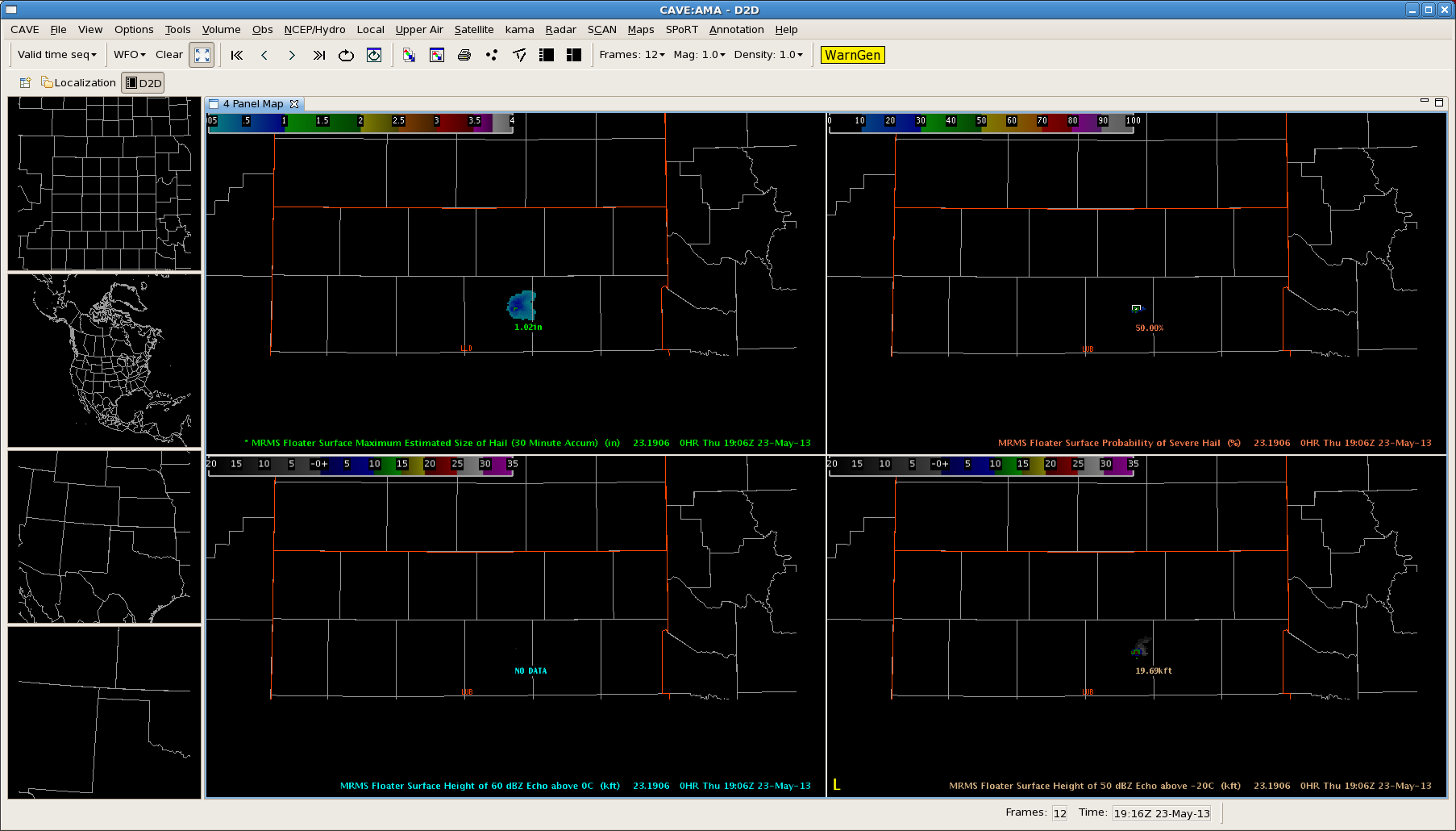
Texas panhandle is the area of main focus for the first part of this afternoon. Analyzing CI, as seen below, indicated development was expected to quickly form by 19z.
Image 1 – CIMSS CTC prior to CI around 18z.
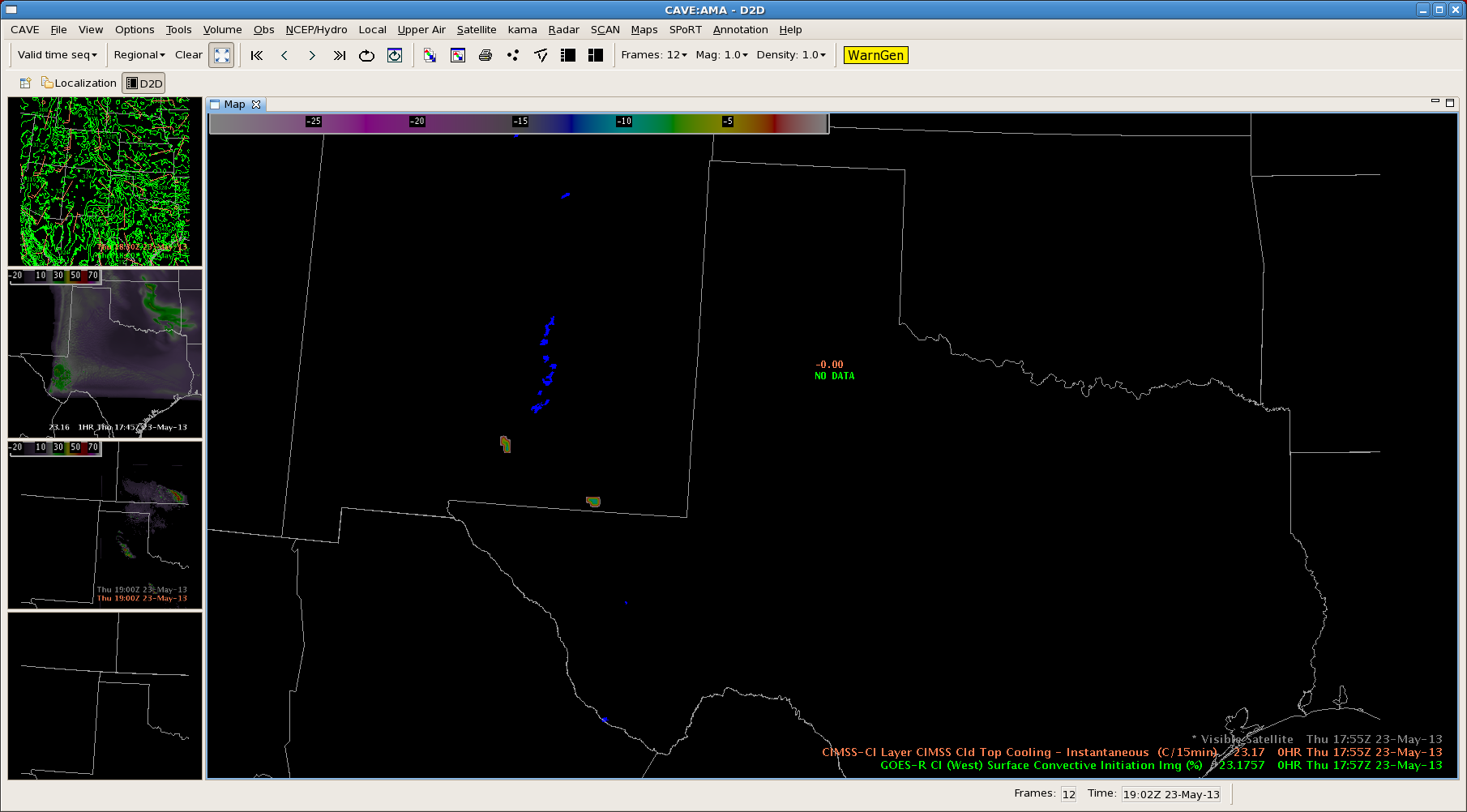
Image 2 – Cloud Top Cooling at the time of CI over the central parts of Texas panhandle around 1815z. Values right around -17oC.
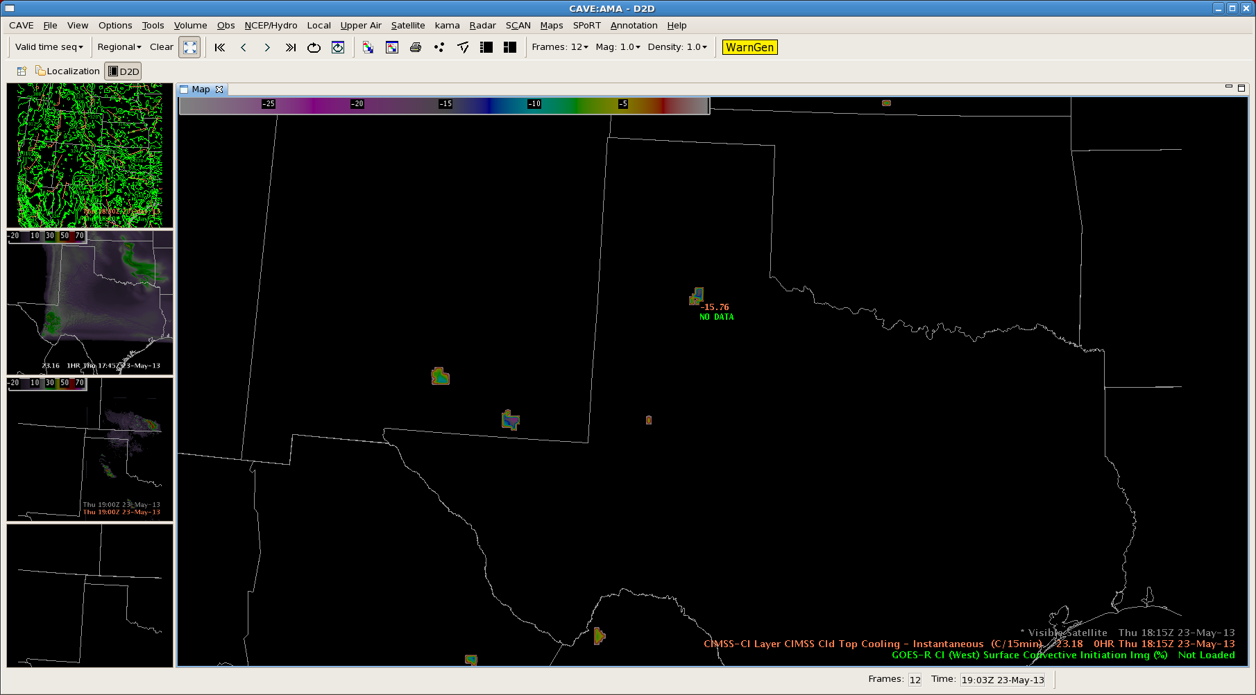
Image 3 – Vis sat around 1815z, with CI. Vis at 1845z shows the explosion of the storm in the panhandle, with the CTC product thus providing around a 30 mins lead time.
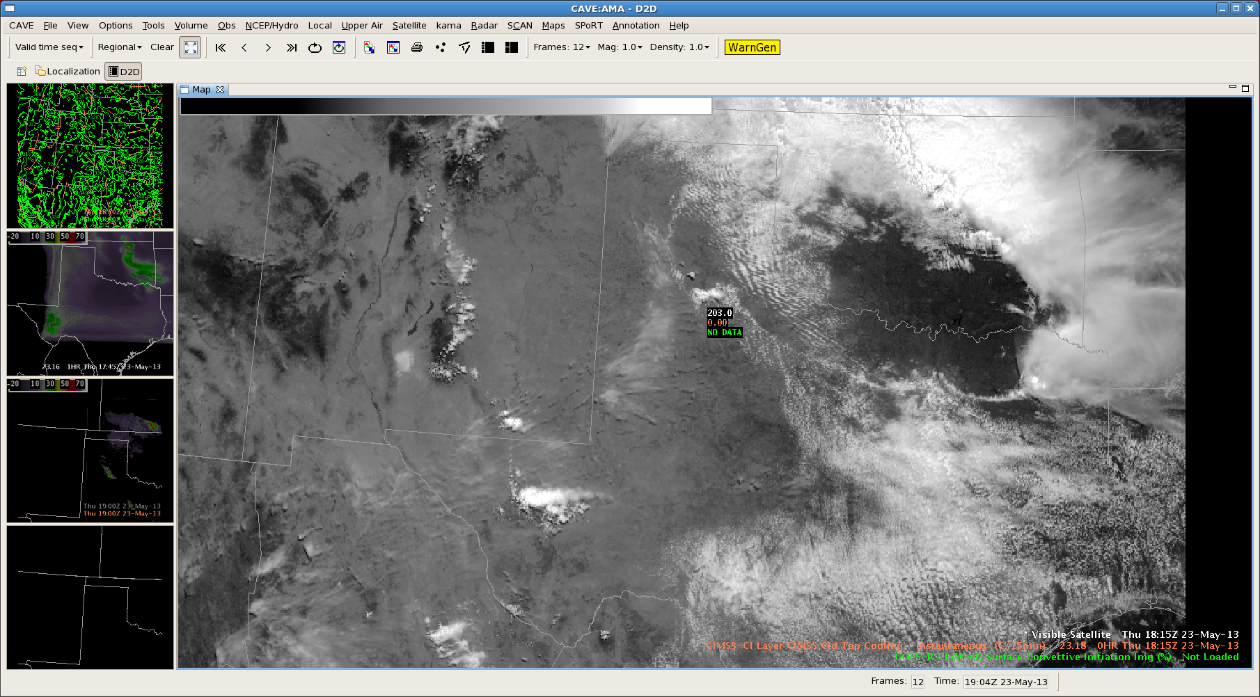
Image 4 – With the radar products unavailable at this time, using MESH and probability of severe hail to show the development of the storm to severe levels. The CI on CTC developed around an hour prior to the MRMS products reaching severe levels.