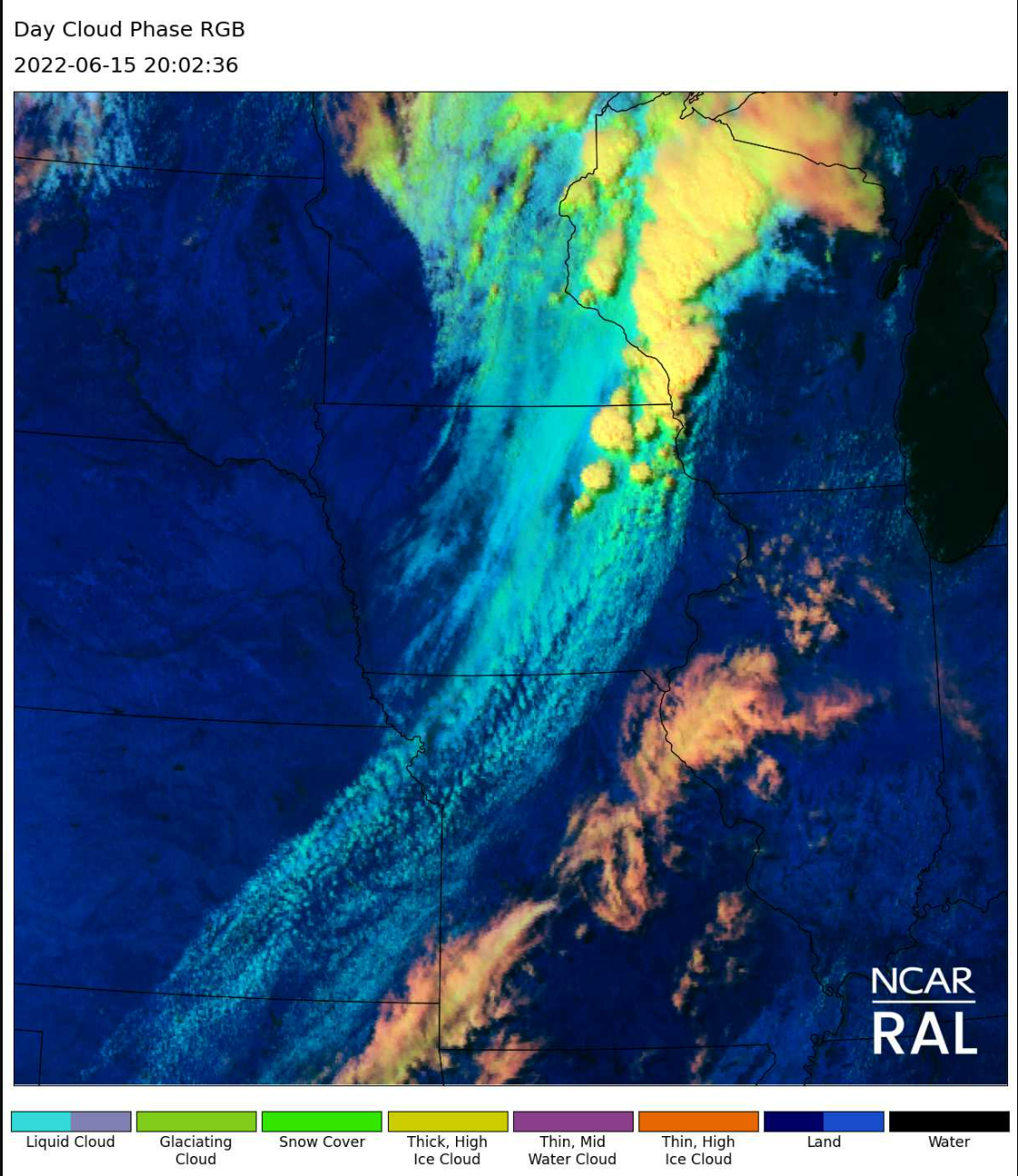
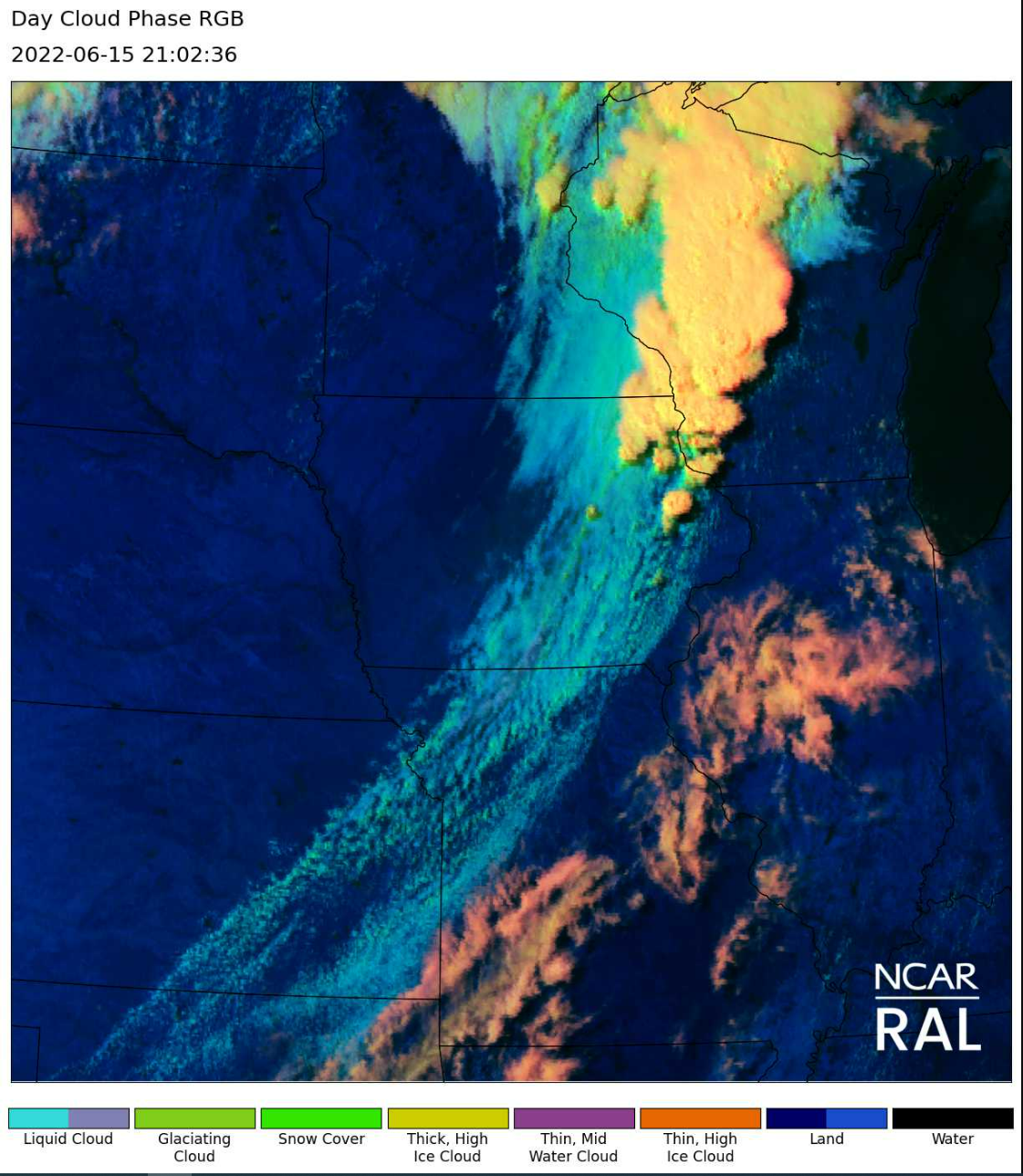
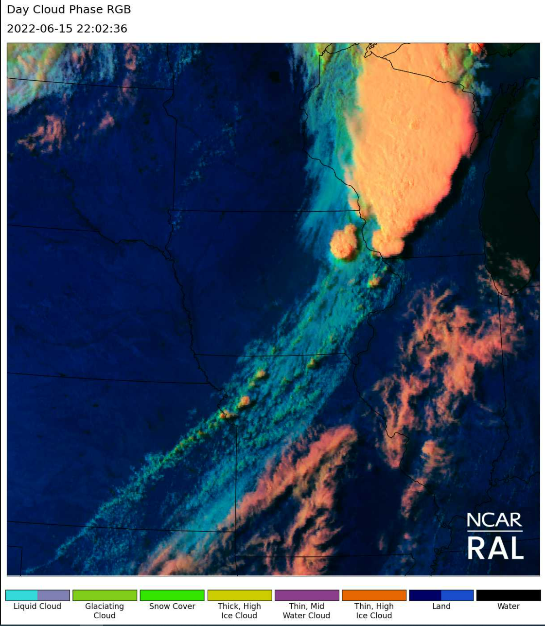
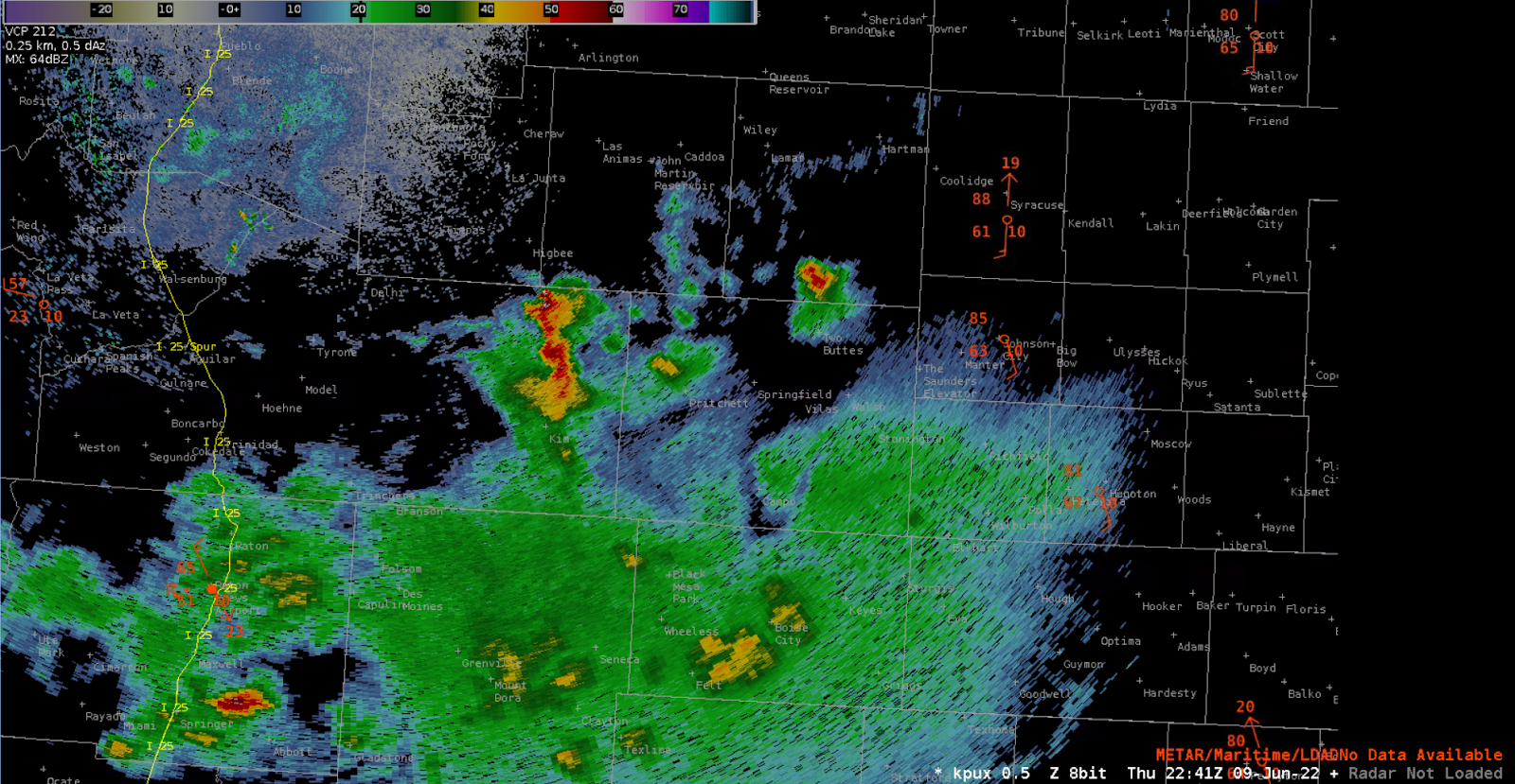
Today’s experience landed us in MKX monitoring convective development potential across the western portion of the CWA, with a line of storms ultimately moving in from the west, and some risk of discrete cells persisting even after we ceased the experiment.
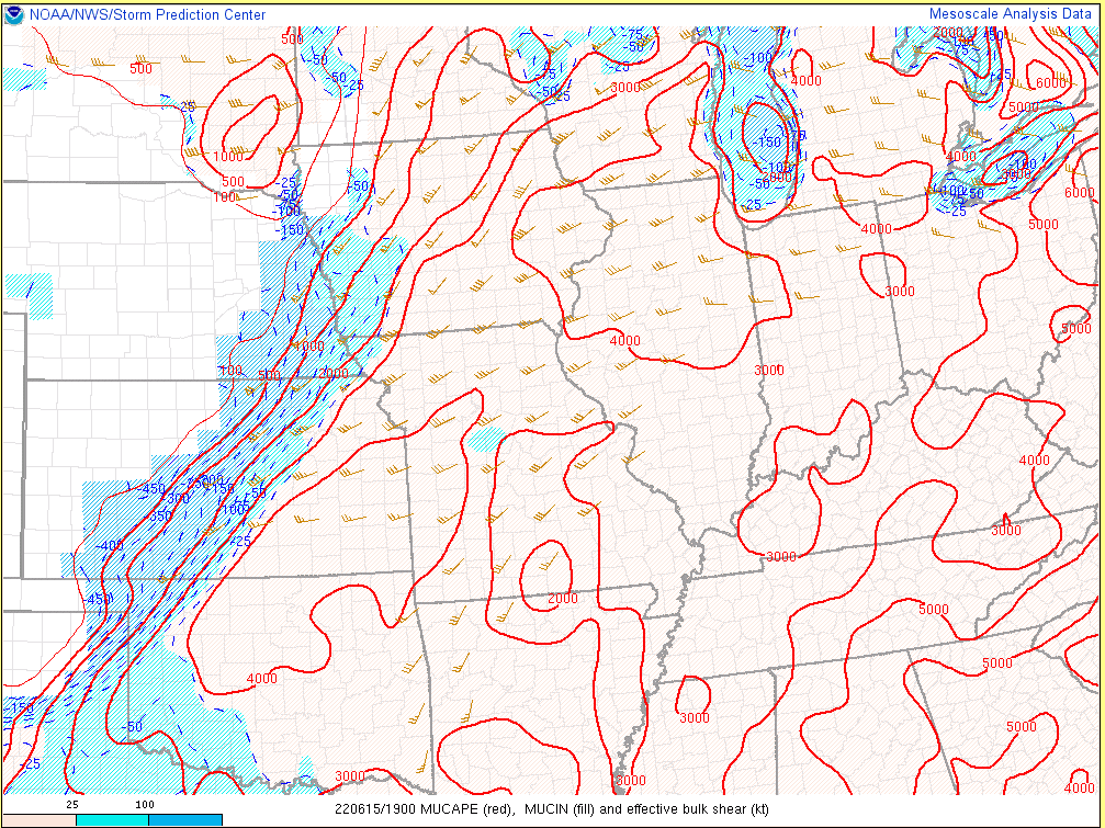
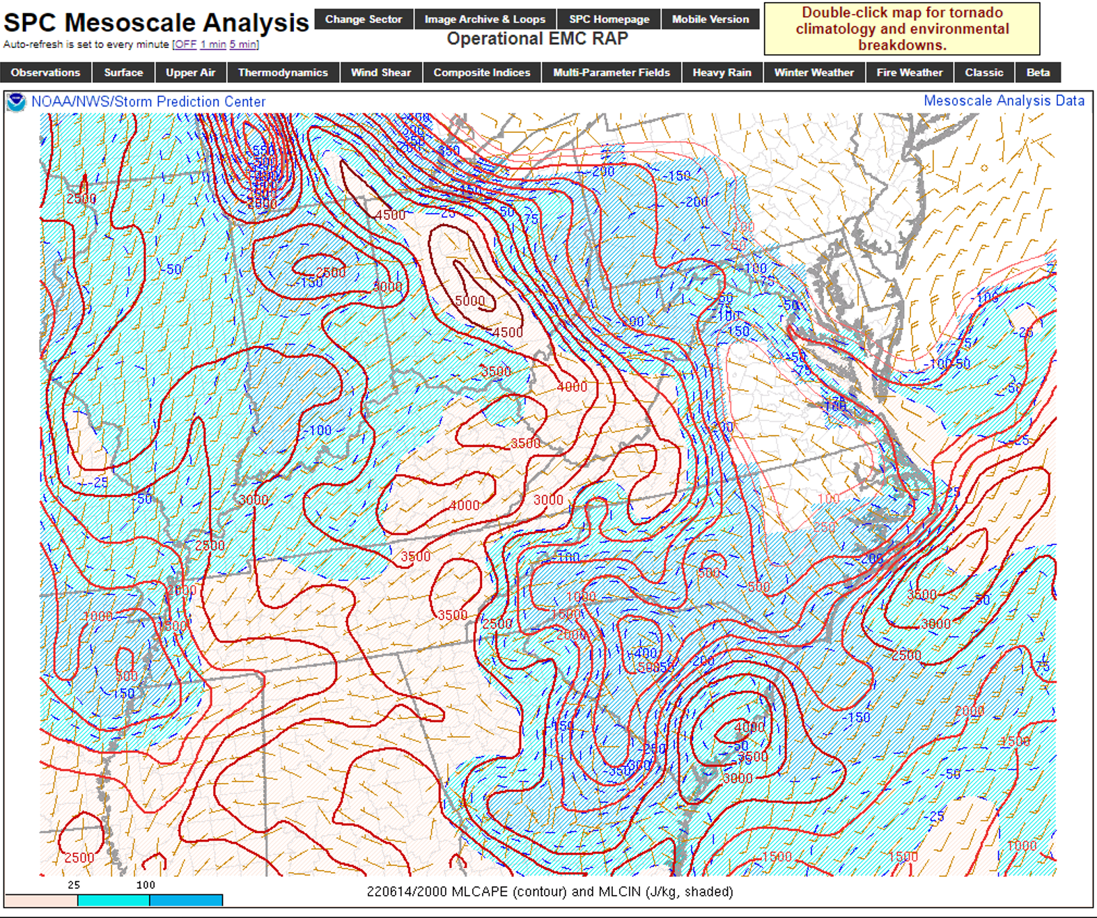
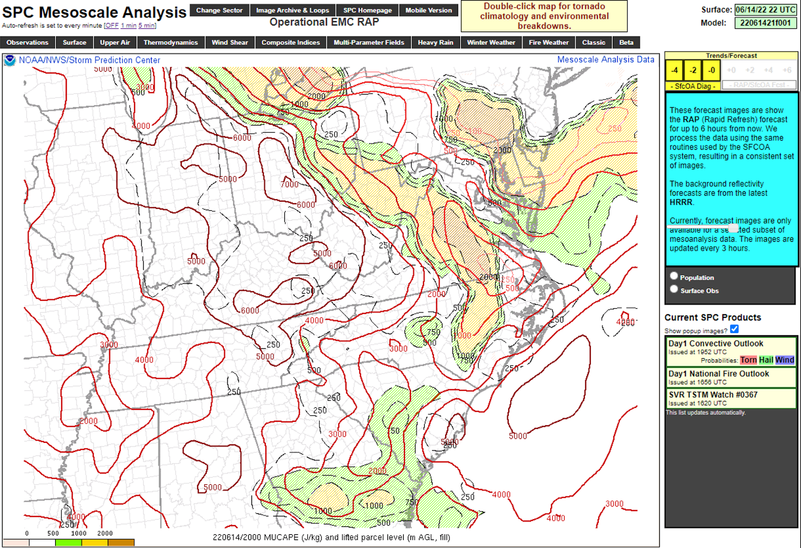
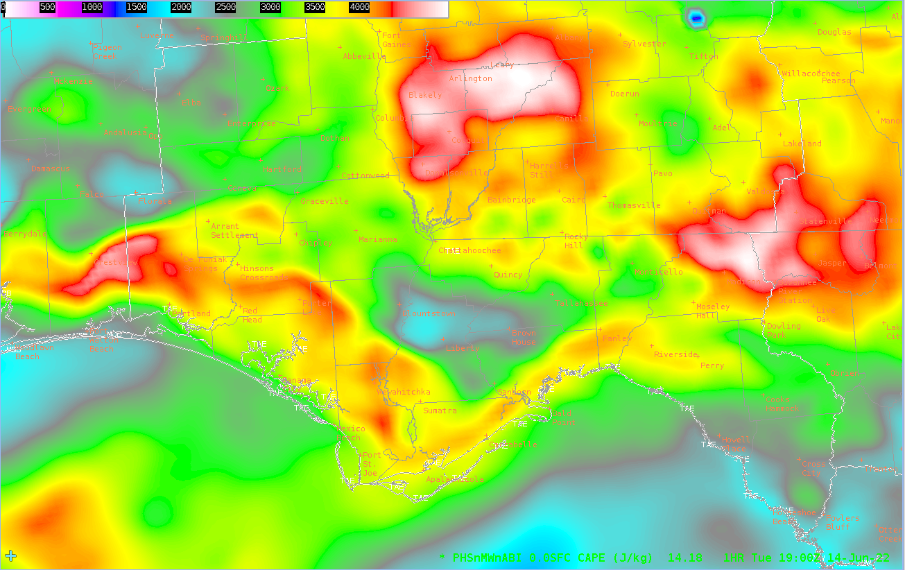
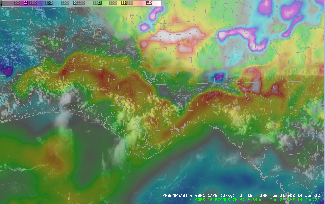
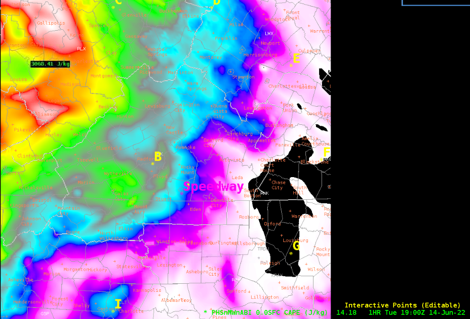
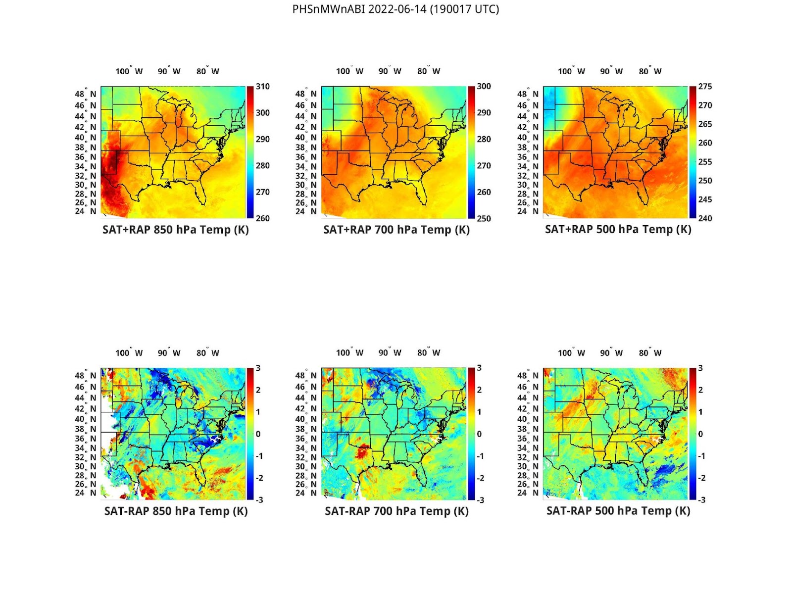
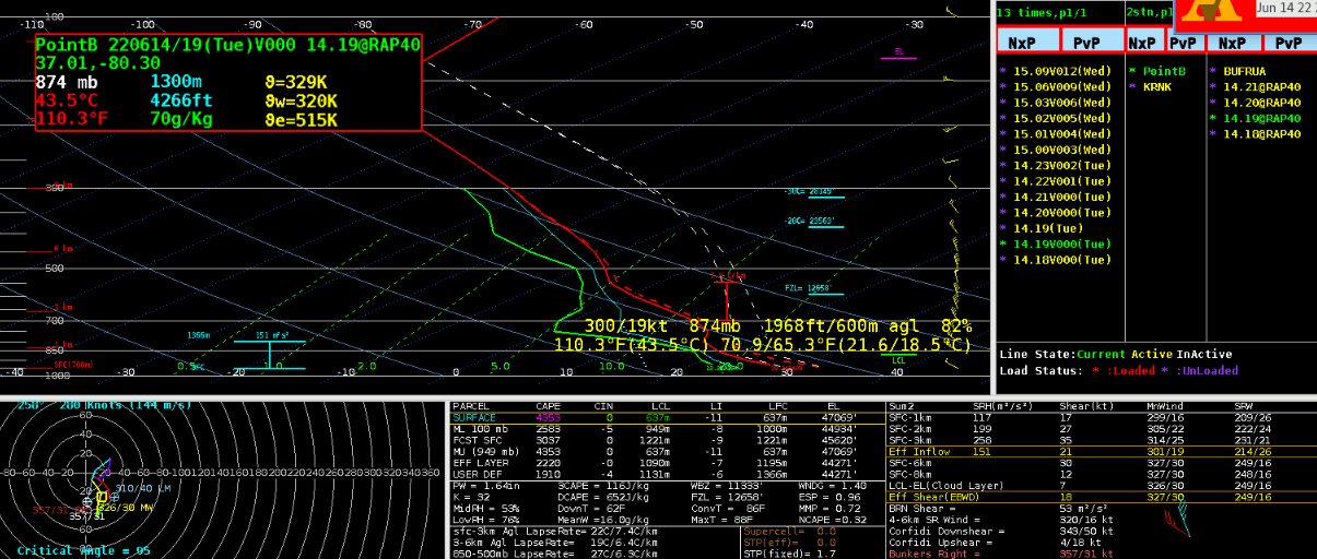
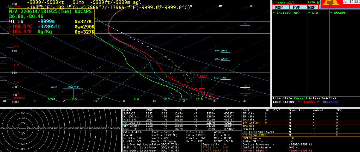
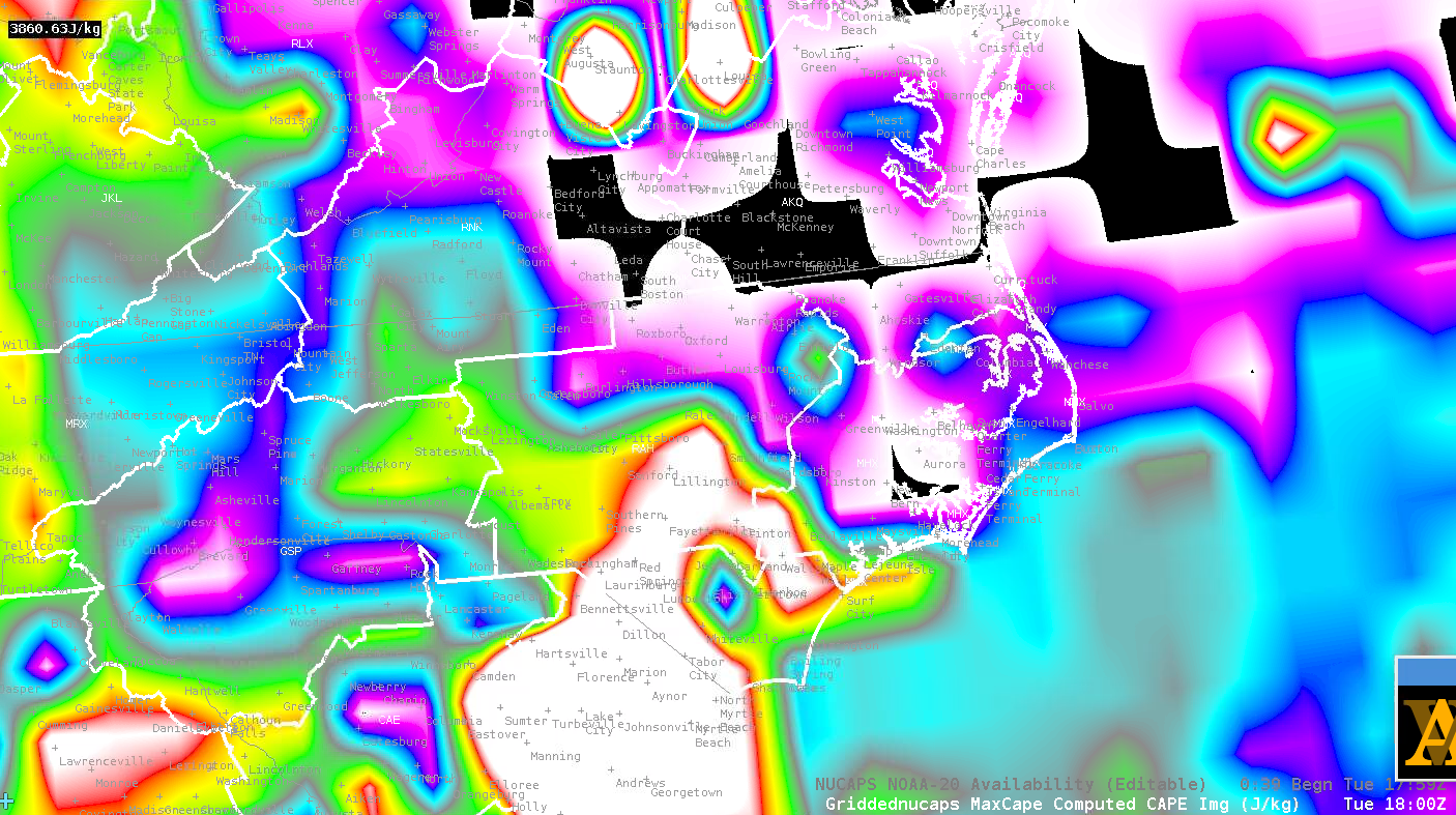
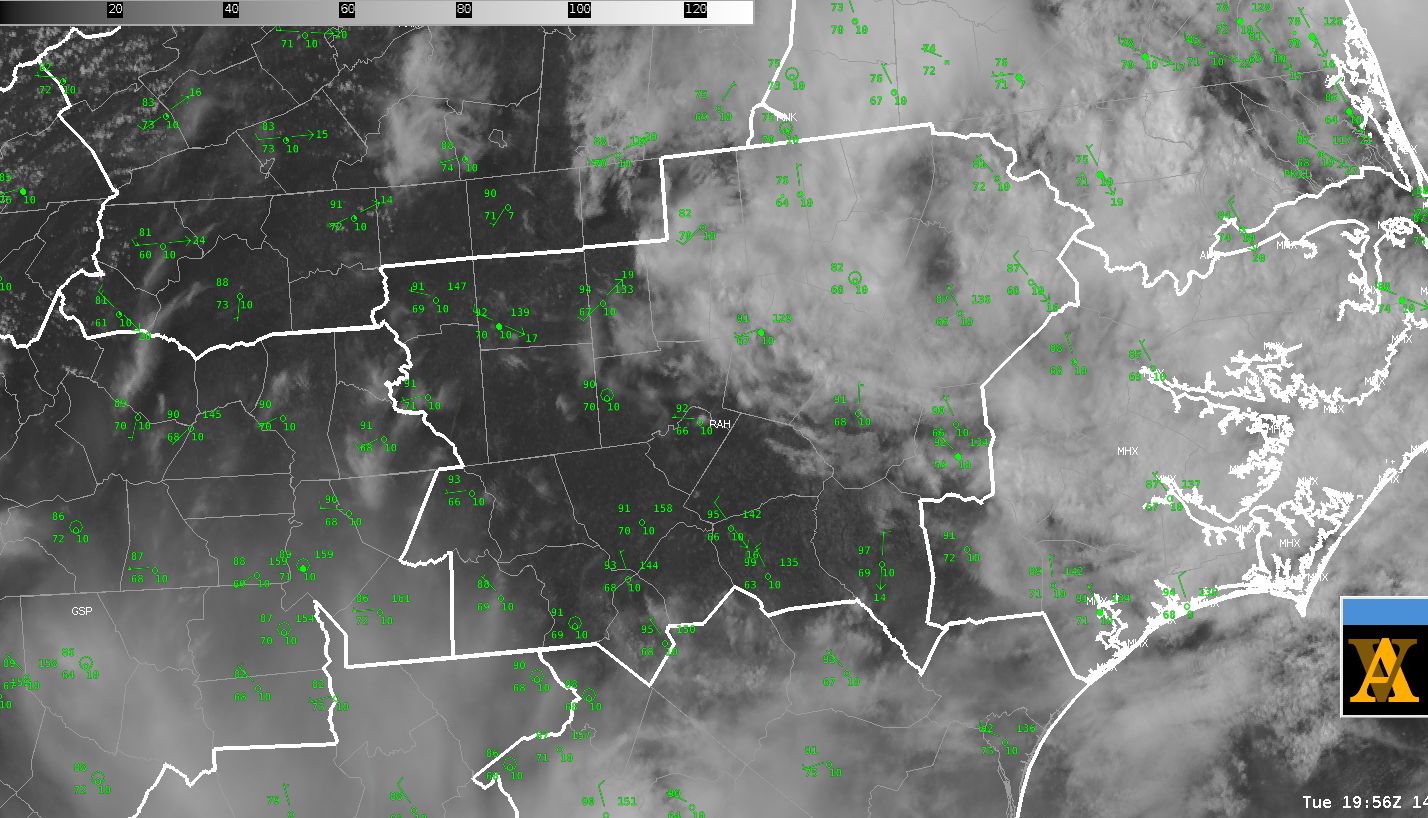
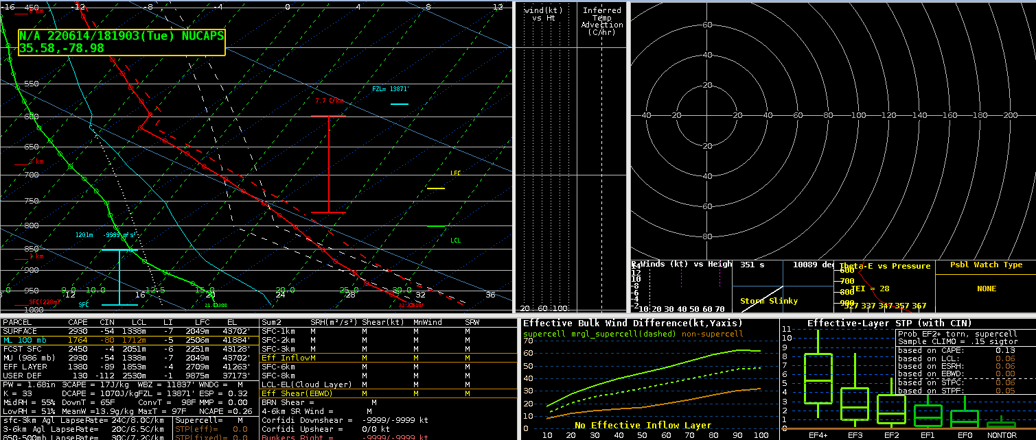
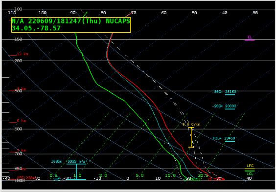
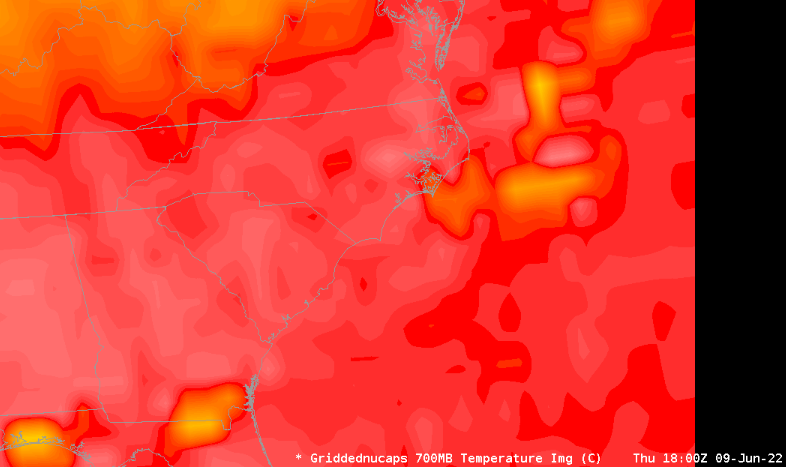
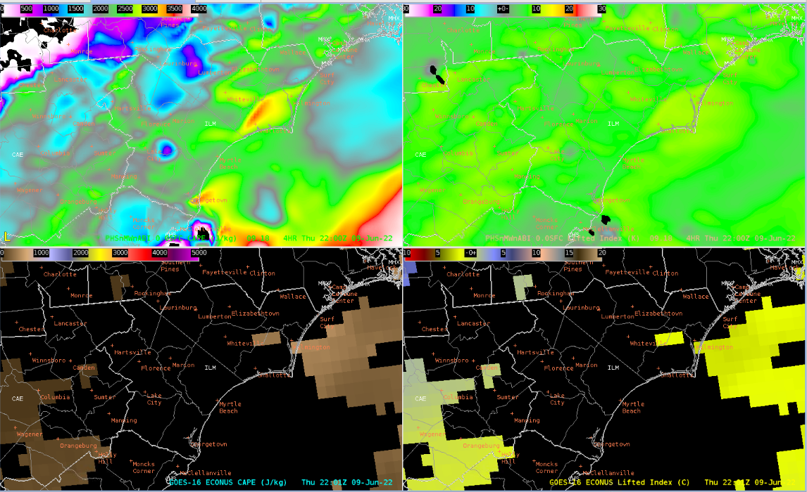
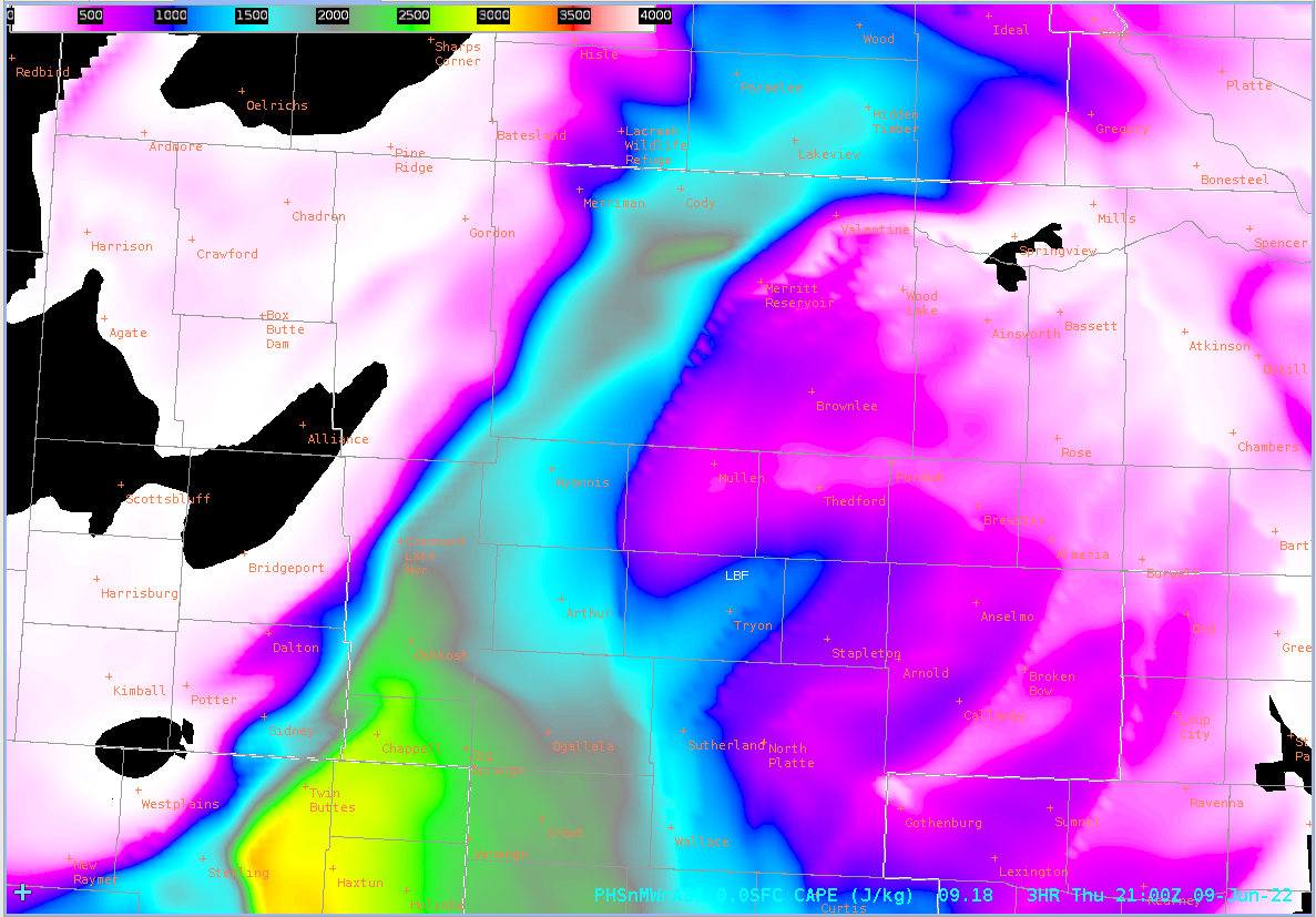
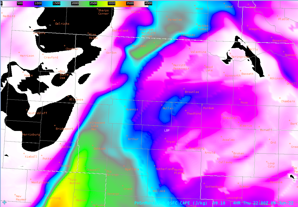
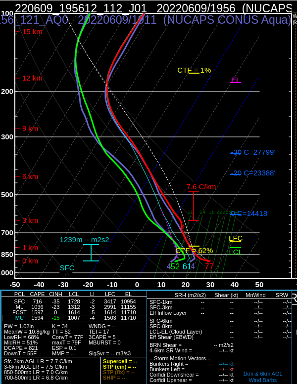
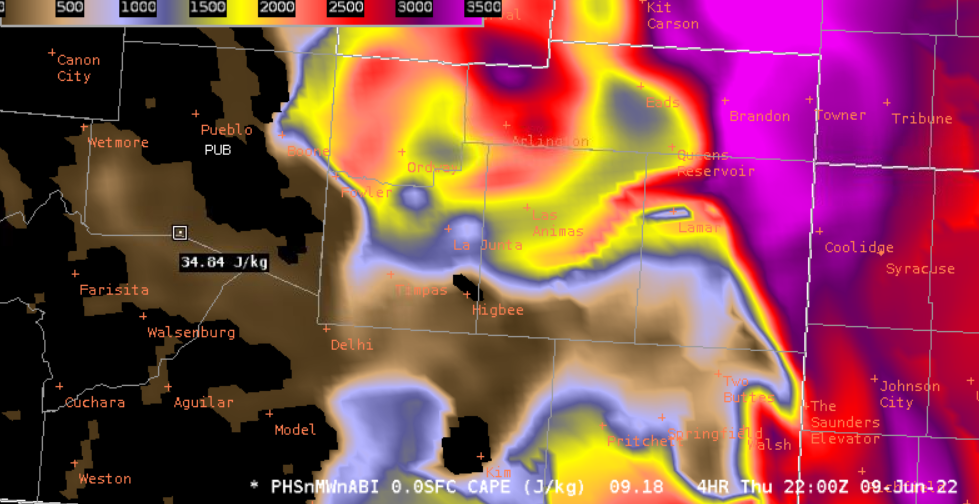
I took the opportunity today to set up procedures overlaying PHSnABI indices (CAPE) with satellite imagery (e.g. Day/Cloud Phase or Viz), to see how well it corresponded with convective development. Unfortunately I didn’t grab a screenshot, but it was a nifty display that I hope to use again. PHSnABI suggested that CAPE in some areas of the CWA was not as high as the SPC mesoanalysis or RAP suggested. We tried to investigate this using a combination of NUCAPS and model soundings and RAOB, but couldn’t figure out a reason for the CAPE depression before incoming storms grabbed our attention. Notably, the indices derived only from GOES agreed with PHSnABI about this depression, though we couldn’t figure out if it was correct. It seems likely the GOES ABI was driving the PHSnABI result.
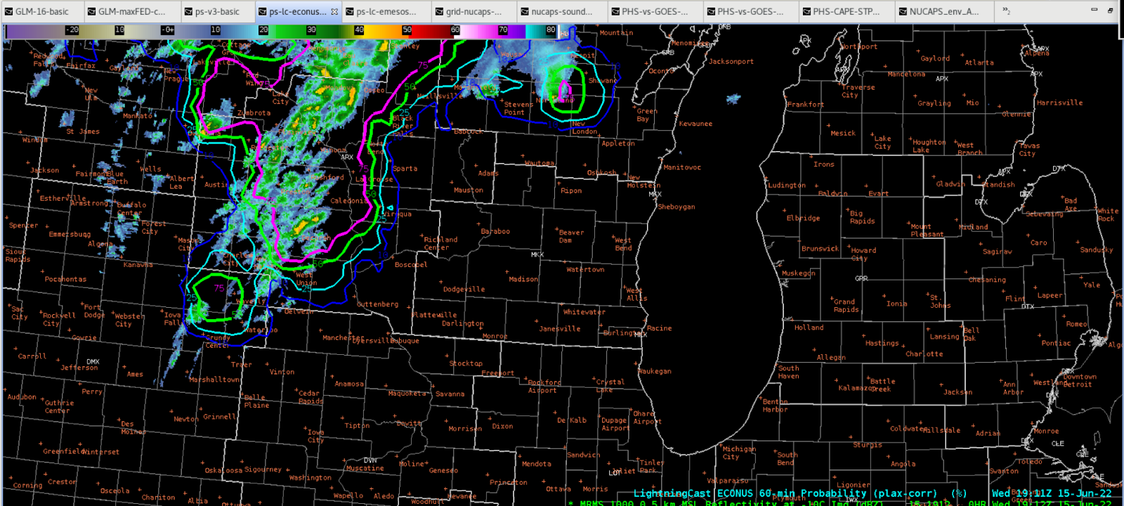
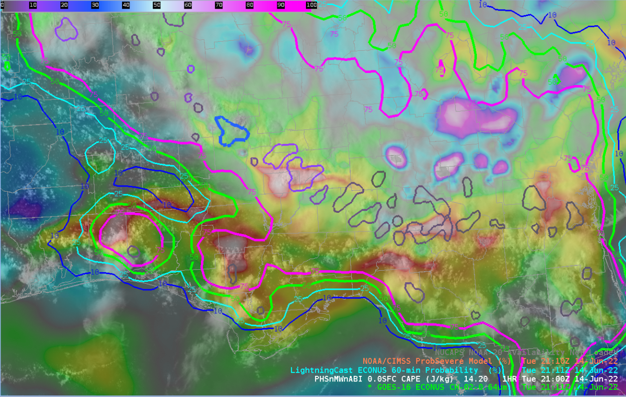
My main takeaway the rest of today is how useful ProbSever, ProbTor, and LightningCast can be with approaching/developing convection.
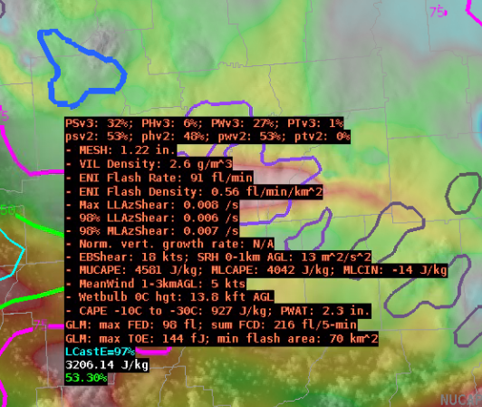
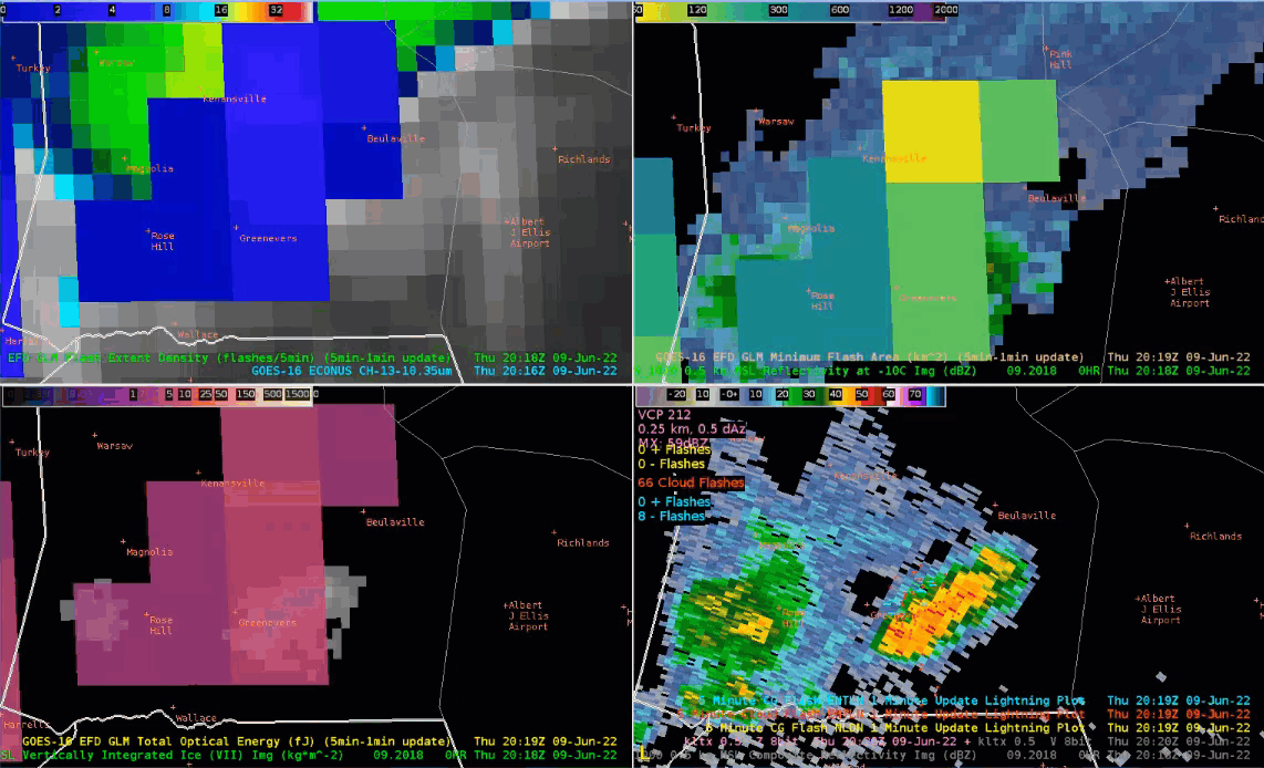
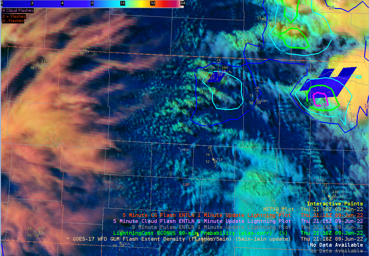
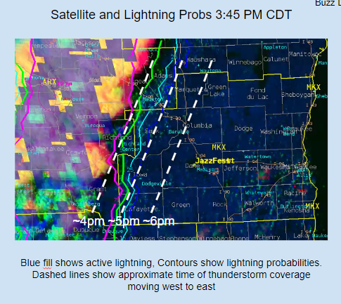
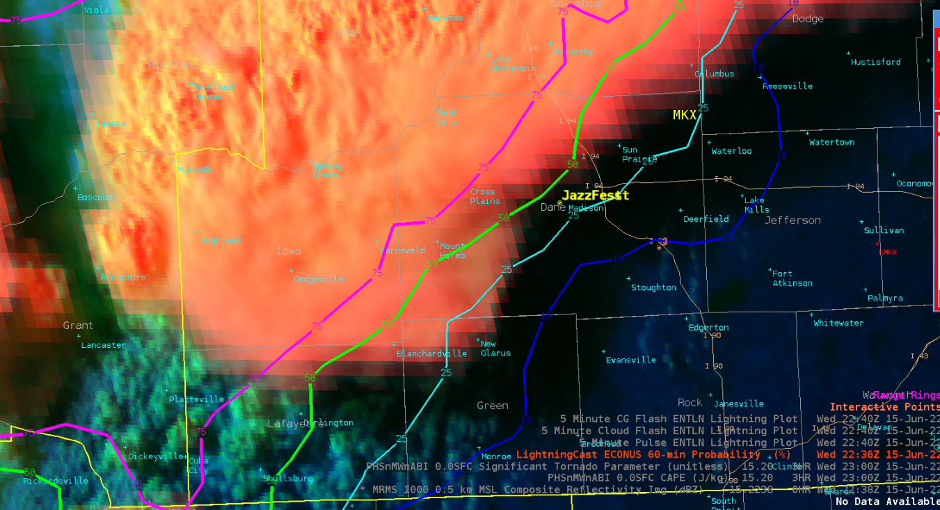
LightningCast, combined with GLM data, was useful for IDSS imagery to depict position and potential of lightning (example DSS slide using these graphics provided below). Storms never made it to our decision point prior to leaving the experiment, but lightning threat was usefully communicated to the simulated JazzFest event.
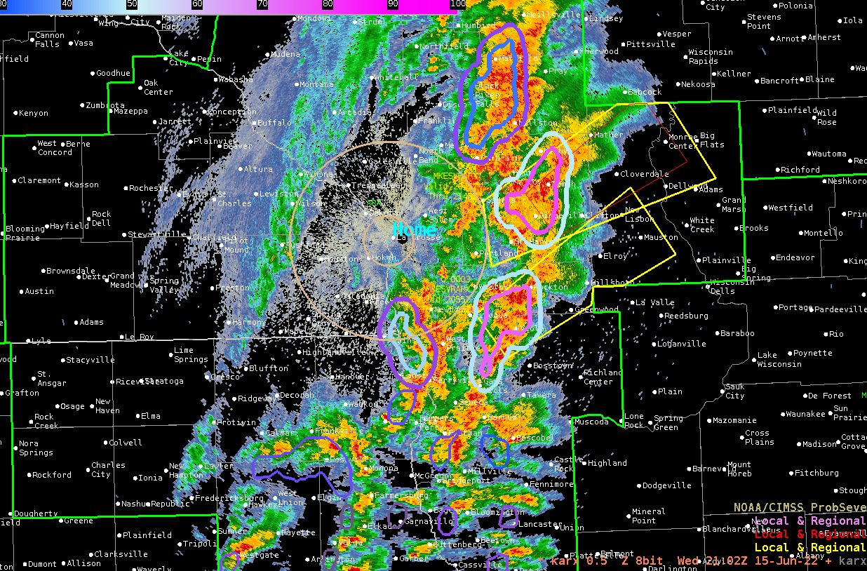
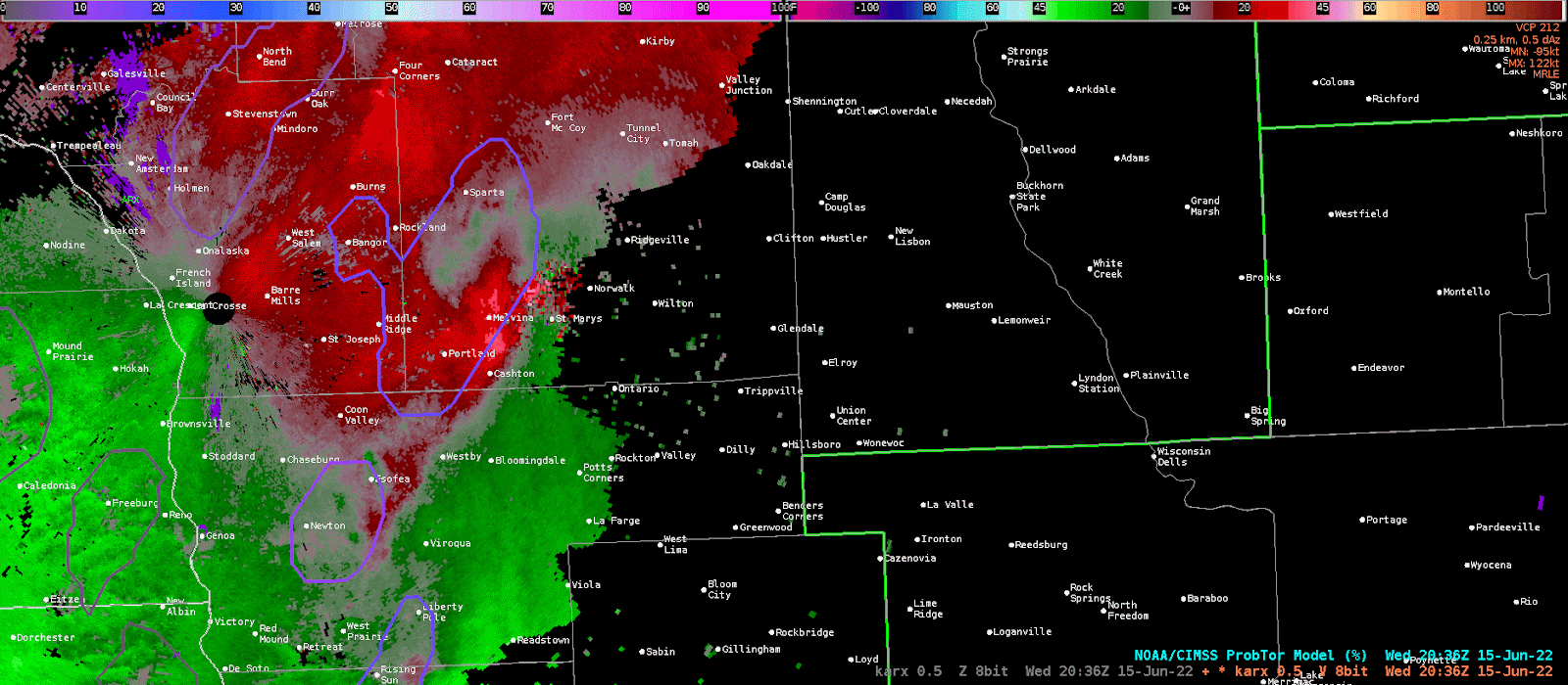
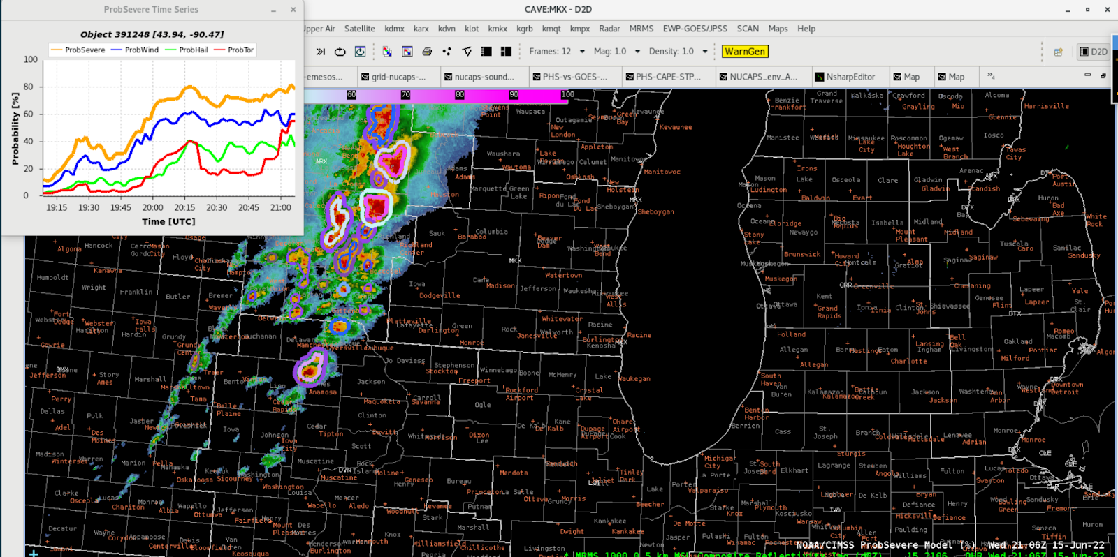
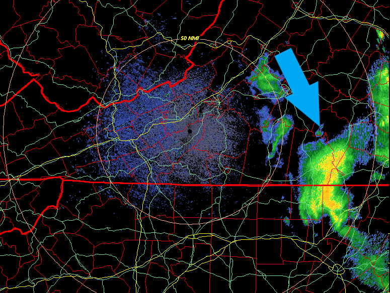
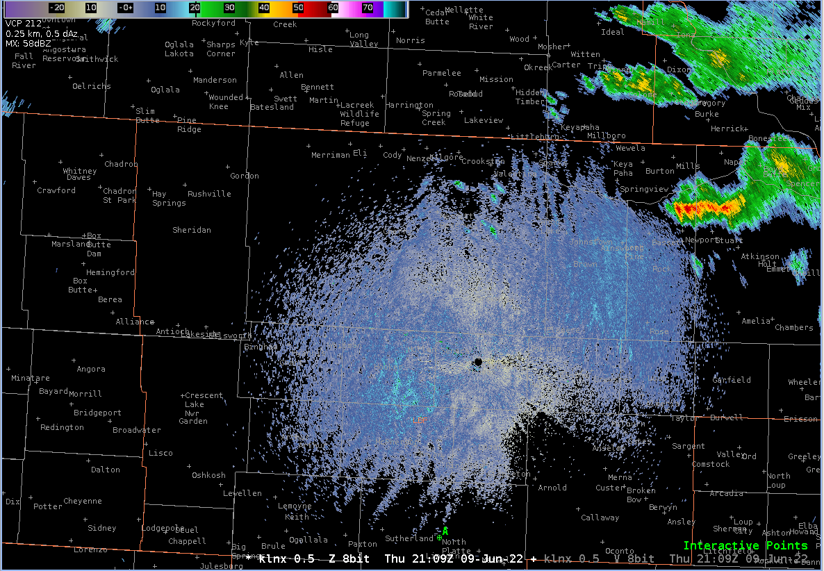
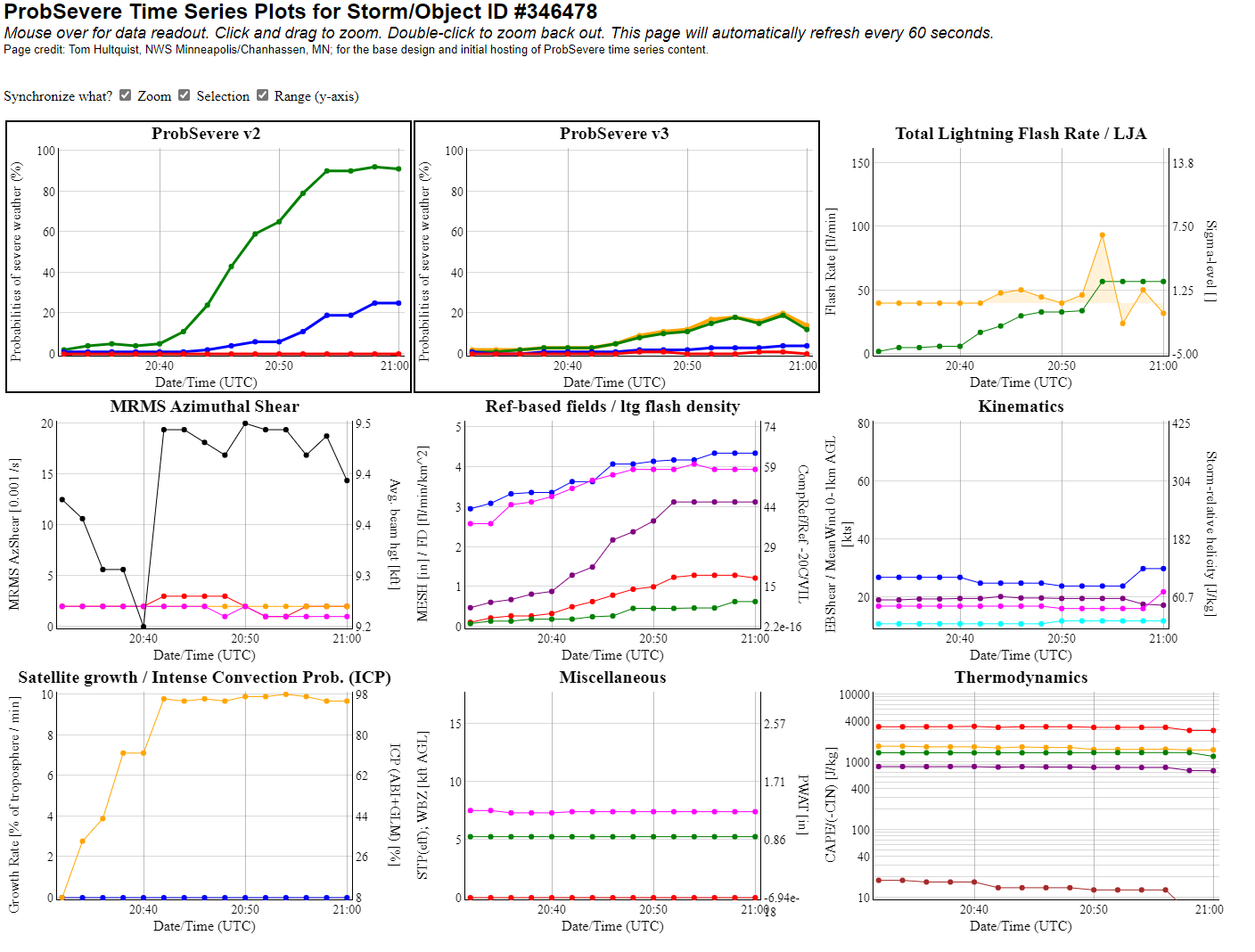
As convection developed, we also practiced relying on probSevere and probTor for lead time in anticipating warnings. The following shows an example where the probTor trends corresponded well with ARX’s actual decision to issue a tornado warning.
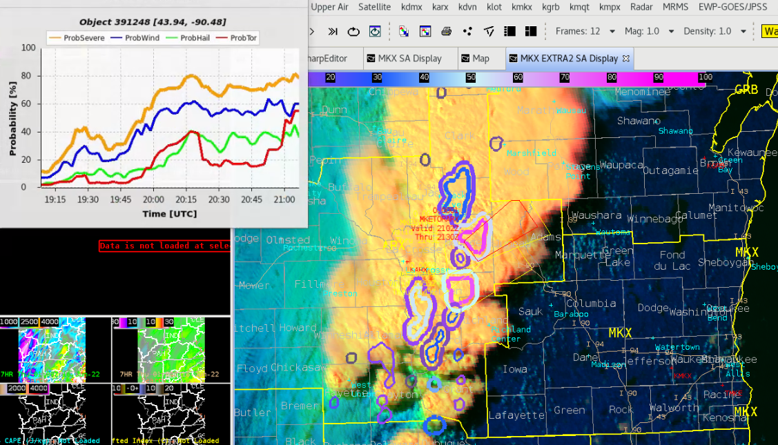
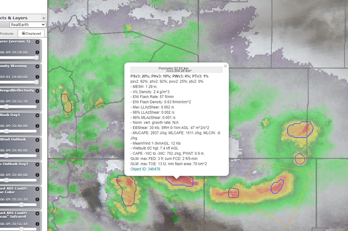
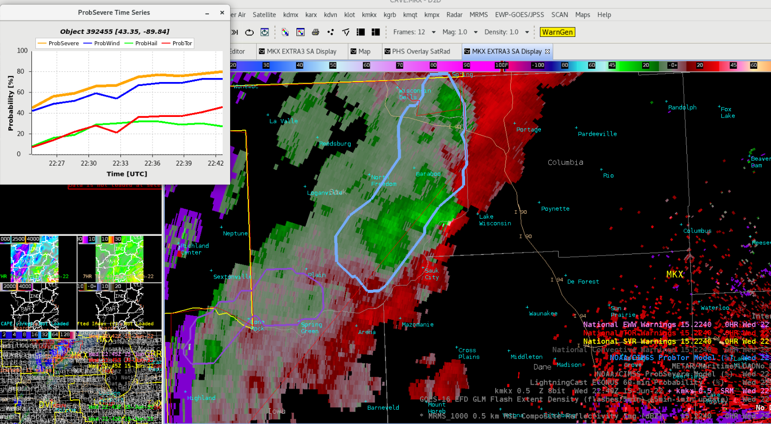
SImilarly, intensification of the convective line appeared to be well detected. In fact, depending on what threshold of the probSevere parameters is relied on (probably depends on environment and other factors), the escalating value could have given useful lead time for a severe issuance decision.
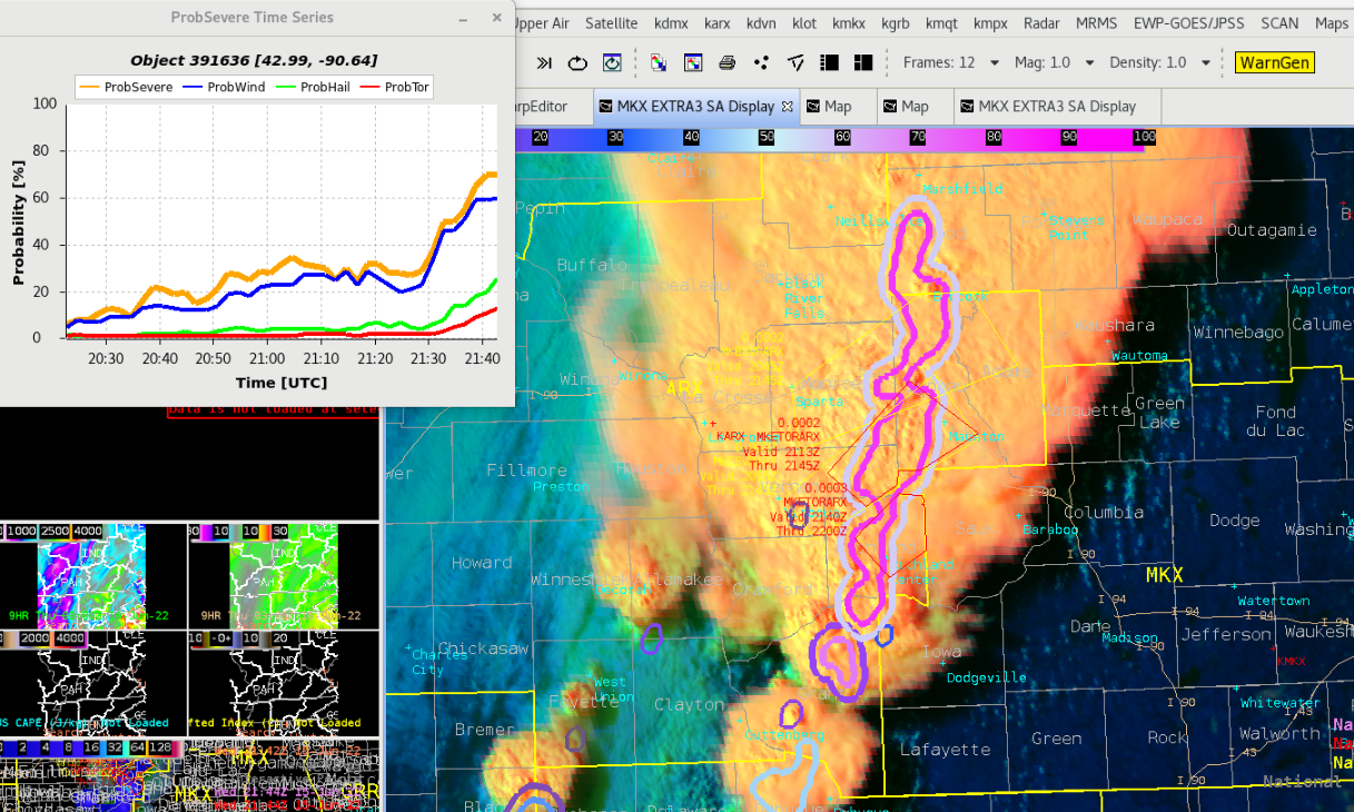
Although the main mode appeared to be a line of convection, there were positions along the line where tornado risk seemed to increase (evidenced by radar velocity). It was reassuring to see probTor pick up on the gradually increasing risk of tornadoes as well.
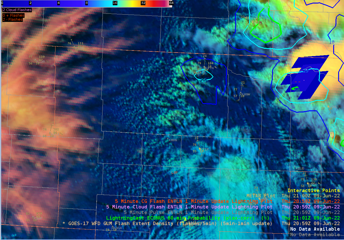
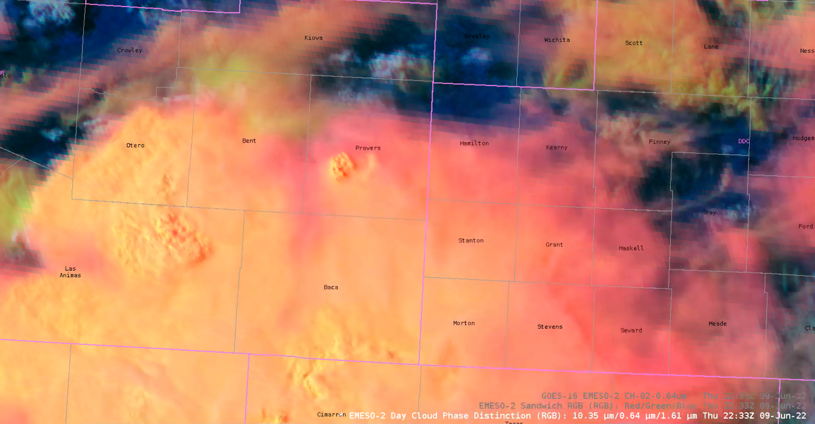
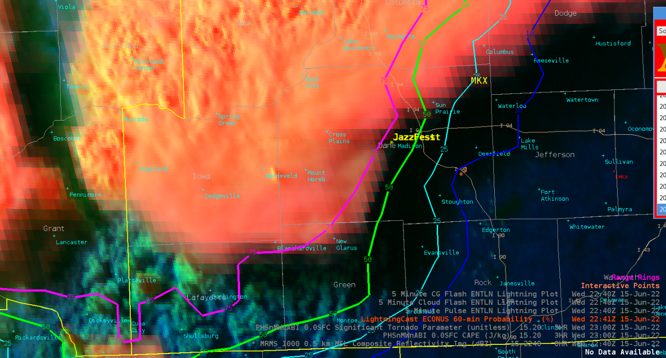
And one final note… lightningCast is fairly impressive in how it produces calibrated estimates of lightning occurrence using only a single time step of satellite imagery (though it uses several bands of the ABI). Naturally lightningCast has difficulty where a developing tower is obscured by an anvil overhead, as we saw in this example. But it was neat to see lightningCast immediately respond with a broader swath of high lightning probabilities the very first time that a tower poked above the anvil that previously obscured it. The fact that it was hidden probably means lightning could have been occurring below the anvil with lower than ideal lightningCast probabilities (though non-zero, to its credit), but it was neat to see the immediate adjustment to the probability contours with new imagery.
– Buzz Lightyear