
The most common mesoanalysis tool is the SPC (RAP) Mesoanalysis Page
While there was no new convection in the operational period for the RNK CWA, satellite based products did show their utility as a cross check with the SPC Mesoanalysis. Since the SPC Meso-a page starts with a RAP model background field, the ability to QC check this data will be helpful in gauging the accuracy of hourly RAP and HRRR model fields. In this way, you can gauge whether the Mesoanalysis and hourly updating fields are either on track or likely vary in meaningful ways from satellite derived data. Having this data will be especially useful in locations that do not have frequent or any aircraft vapor soundings.
Mid-level lapse rates
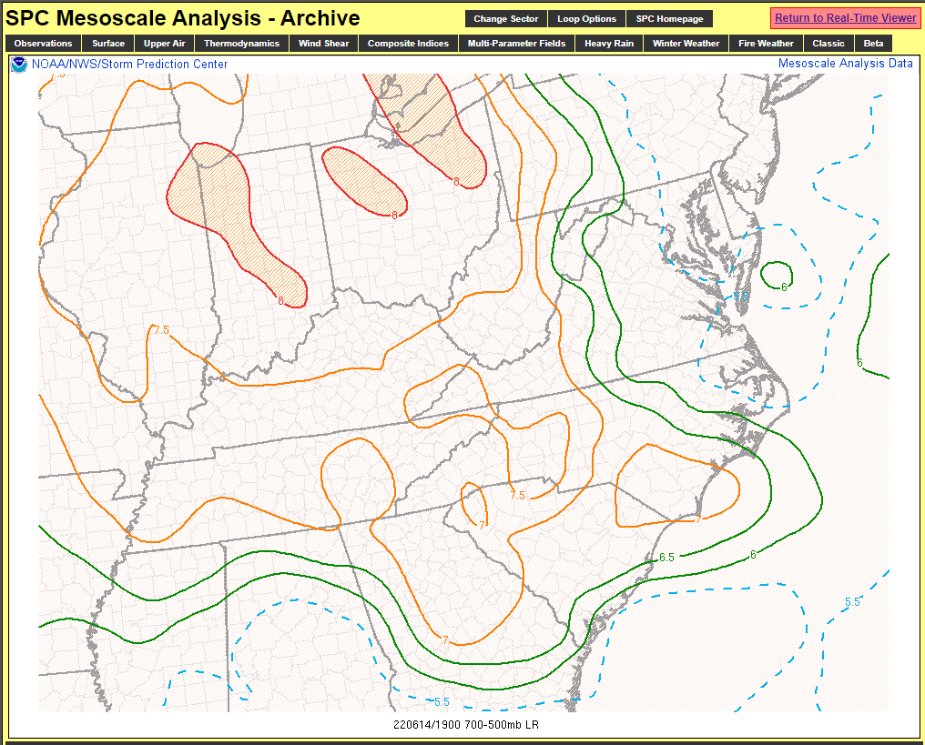
SPC Meso-A 700-500 mb lapse rates at 19z 6/14

NUCAPS 700-500 mb lapse rates at 1819z 6/14
Excluding the likely unreliable data in the region of lingering cloud cover across central Virginia, the NUCAPS data roughly ranged from 6.5C to 7.6C/km across the RNK CWA, which is fairly close to the SPC Meso-A 700-500 mb lapse rates. Within the past few years, maximum 2-6 km AGL lapse rates were added to the SPC Meso-A page. The question I had was, with its good mid-level moisture sampling, would a NUCAPS sounding be a good QC check for the SPC max 2-6 km AGL LR field? Examples are shown below.
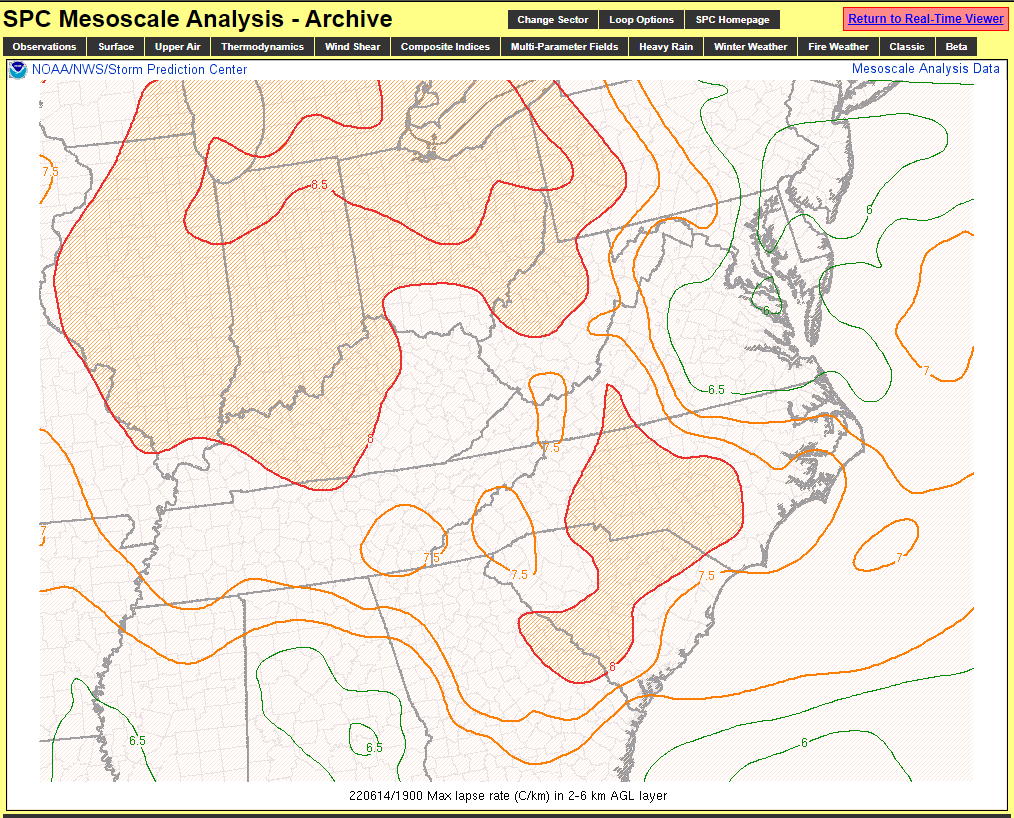
SPC Meso-A Max lapse rate (C/km) in 2-6 km AGL layer at 19z 6/14

NUCAPS sounding near Martinsville, VA at 1819z 6/14
As you can see from the SPC mesoanalysis graphic, there was a region of 7.5 C/km to 8.4 C/km maximum lapse rates in the 2-6 km AGL layer. The NUCAPS sounding above sampled a layer of 7.9 C/km lapse rates from just below 700 mb to just below 500 mb, which verifies the SPC Meso-A field.
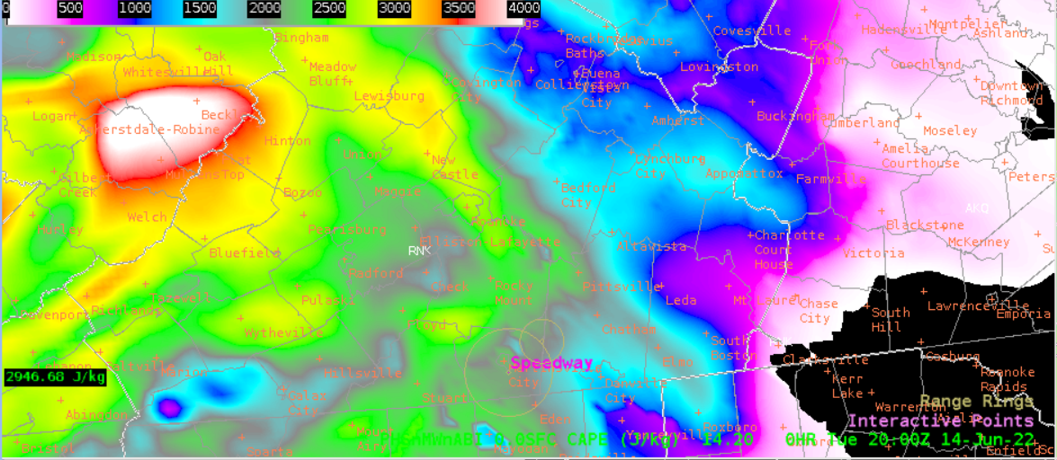
CAPE analysis

SPC Meso-A SBCAPE and SBCIN at 20z 6/14
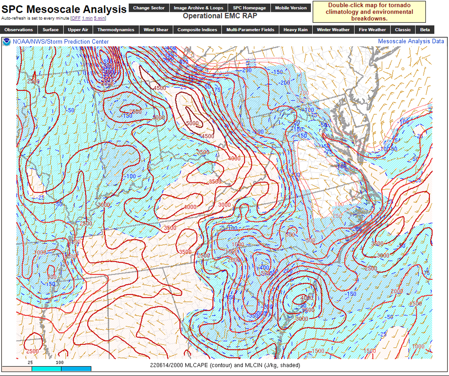
SPC Meso-A MLCAPE and MLCIN at 20z 6/14
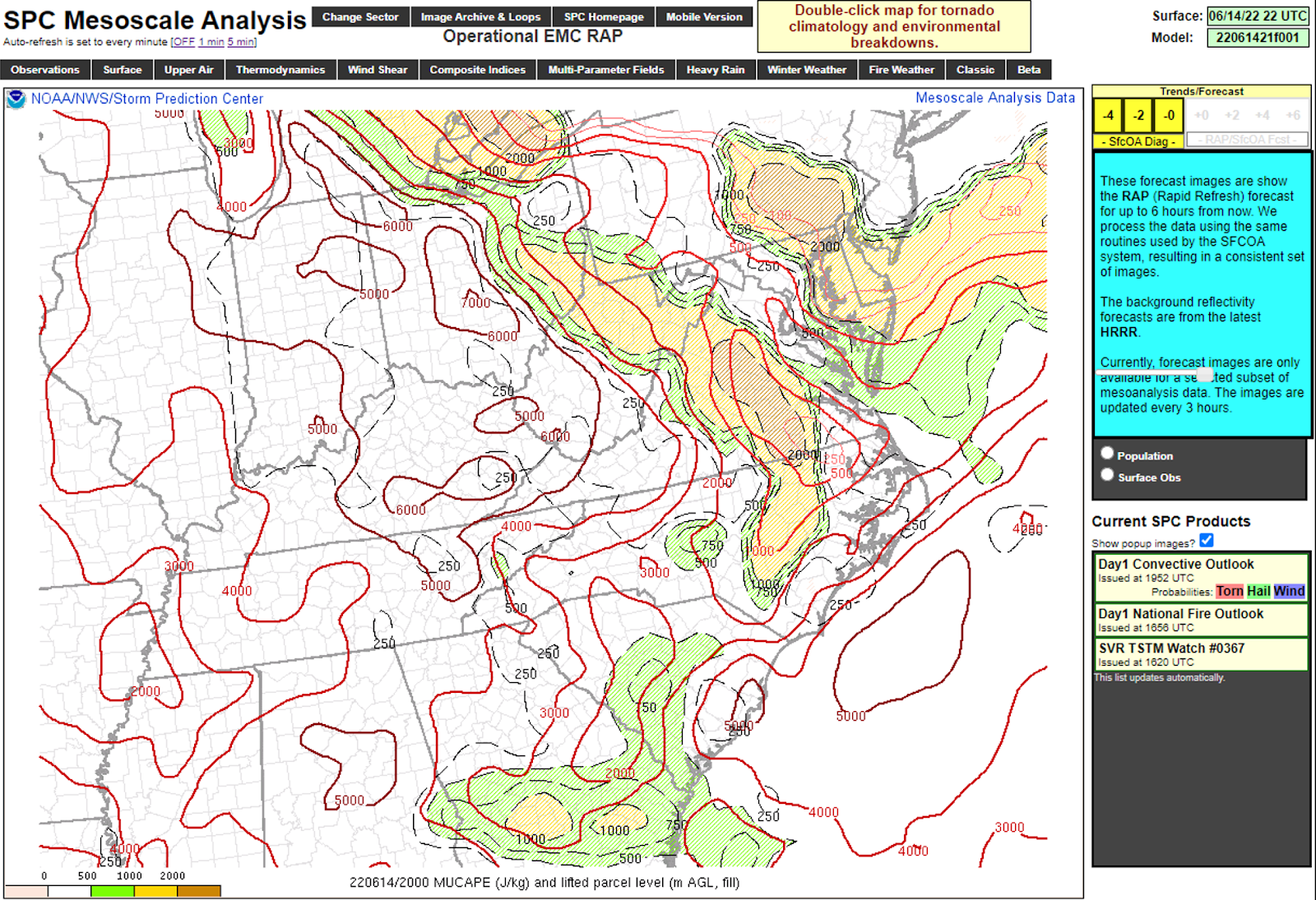
SPC Meso-A MUCAPE and LPL at 20z 6/14
Here we’ll compare the SPC Meso-A graphics to the PHS initialization at the same hour.
PHS SFC CAPE at 20z 6/14
In general, the CAPE values on the satellite derived initialization is less aggressive the SPC Meso-A SBCAPE, but the distribution is similar, showing a west to east gradient, with lower values east where there remained lingering debris cloud cover. The MLCAPE and MUCAPE fields show a similar west-east gradient in CAPE, while SBCIN and MLCIN are also maximized in the cloud cover area across central VA.
The gridded NUCAPS MAXCAPE field was from the 18z hour per 1819z sounding availability, and was noisier data as would be expected due to unreliable retrievals under thick cloud cover.
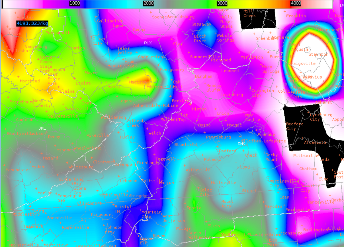
Gridded NUCAPS MAXCAPE at 18z 6/14
Excluding the bullseye to the northeast, the distribution on the NUCAPS compares favorably to the SPC Meso-A MUCAPE field. Furthermore, recalling the NUCAPS 1819z sounding near Martinsville, MUCAPE values over that area on the SPC Meso-A field vs. the NUCAPS sounding match up well. While the time difference between the NUCAPS and SPC Meso-A fields is something to take into consideration when using the data, the less than 2-hour difference between them helps in this case. Furthermore, if we were using the NUCAPS data to compare to the SPC Meso-A graphics, we would’ve done a direct 18z check as well.
– Hurricane84