An official website of the United States government
Here’s how you know
Official websites use .gov A
.gov website belongs to an official government
organization in the United States.
Secure .gov websites use HTTPS A
lock (
) or https:// means you’ve safely connected to
the .gov website. Share sensitive information only on official,
secure websites.
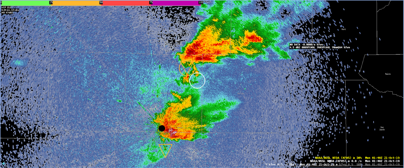
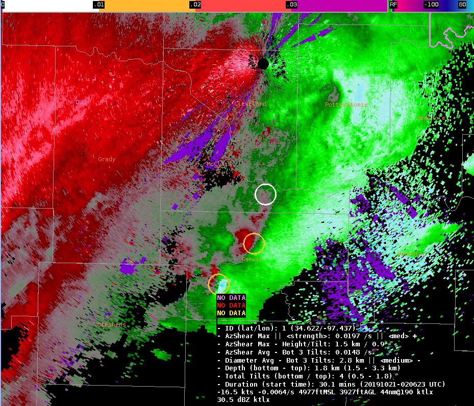
The NMDA gave me a nice heads up to the new updraft that was forming on SE flank and already showing signs of rotation. At first I thought it was a “false alarm”, but upon further inspection, I could see new rotating updraft on higher tilts.
0.5 deg tilt4.0 tilt
It looks like this updraft ultimately played pivotal role (or was at least in the area of) new tornadogenesis about 15-20 min later.
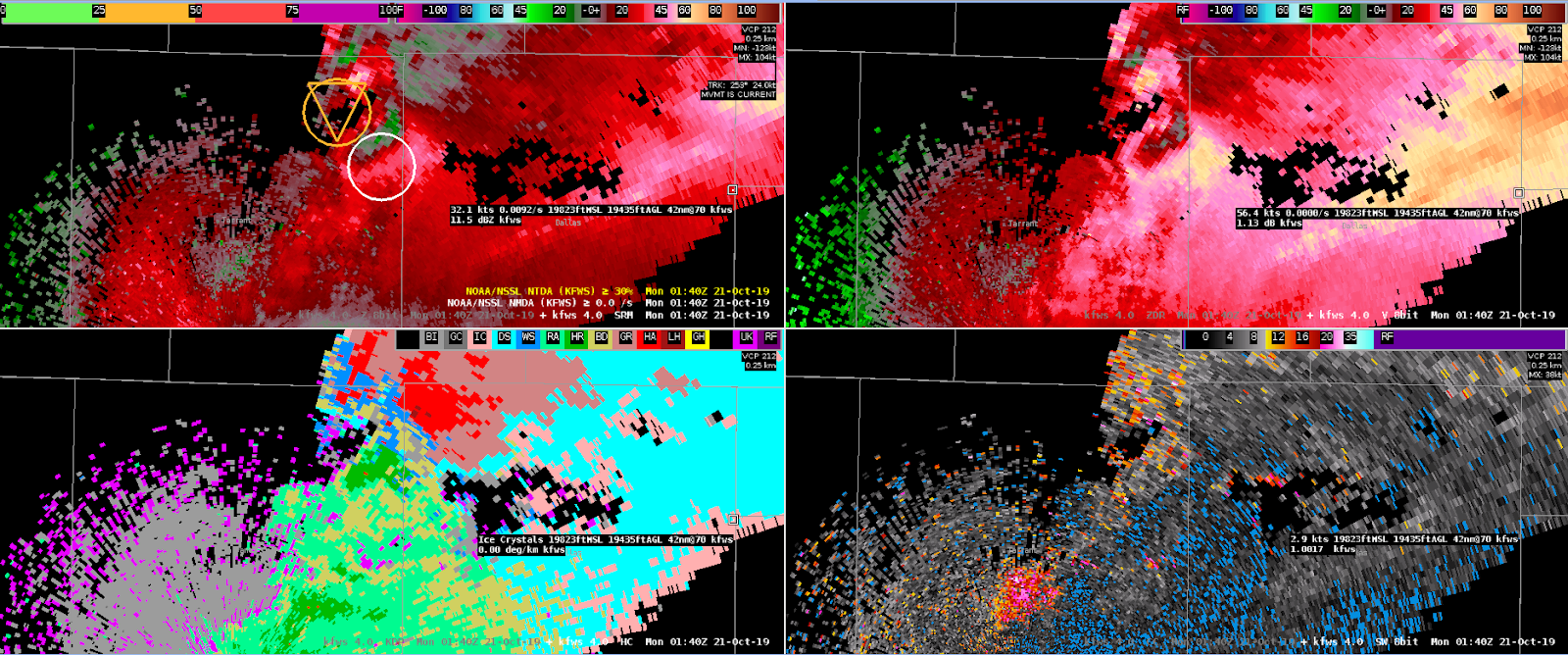
0220Z – Two NTDAs in Close Proximity
ID20 was the main object. Lat/Lon is 32.491/-96.916 ID33 came along second and is at 32.514/-96.889 This is about 4km apart
These seem a little close together and could clutter up display. Also, these didn’t seem to be two separate areas of low level rotation, but both part of the parent circulation.
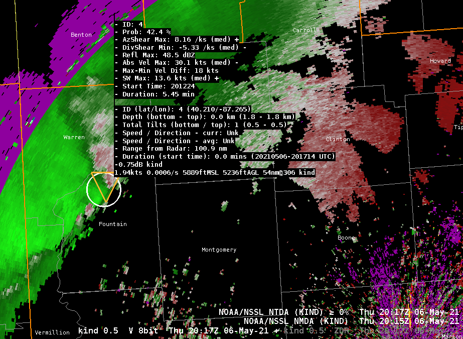
A line segment coming into the far NW corner of the Indianapolis CWA (Warren and Fountain counties) has shown consistent weak detections on both the NTDA/NMDA algorithms. While not terribly impressive on reflectivity, the cell at the northern end of this line does show signs of a rear inflow jet on velocity data, and the NTDA/NMDA detections have been on the northern gradient of this area of slightly enhanced inbound flow. The 0217Z scan has shown the highest NTDA probability so far, with 42%.
KIND 0.5° V and NTDA/NMDA detections at 2017Z in Fountain County, Indiana.
The lack of a tight circulation, or any higher wind speeds (abs vel max of only 30 knots) is likely keeping this feature from receiving a higher probability. Given the mesoscale environment and the way this storm is behaving, this seems reasonable, as a tornado does not appear imminently likely. With that said, it is definitely good performance by the algorithms to be continuously and (mostly) consistently tracking this feature on its way inbound into Indiana.
–Insolation
2115Z
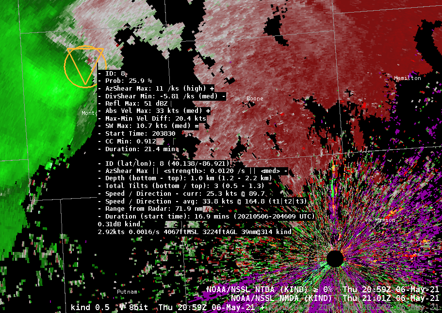
The line segment moving ESE through the Indianapolis CWA has become a mature outflow-dominant feature. Given the environment, which is characterized by somewhat dry boundary layer conditions, the overall tornado potential is not expected to be very high. With that said, this line segment has occasionally had areas where there have been small-scale surges, in addition to a fairly persistent area of weak/broad rotation at the northern end of the segment. The NMDA/NTDA algorithms have done a very good job tracking these features as they appear and disappear, with generally low probabilities (no greater than 40%) which seem reasonable for the environment.
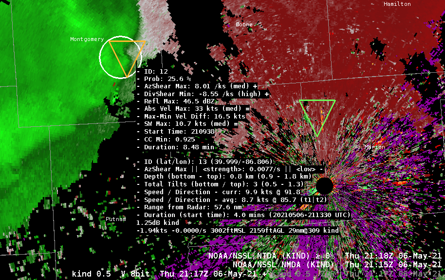
KIND 0.5° V and NTDA/NMDA detections at 2059Z in Montgomery County, Indiana. This detection (orange on both NTDA/NMDA) seems to be a reasonable depiction based on the longevity of the feature and its position with respect to the gust front / precipitation.KIND 0.5° V and NTDA/NMDA detections at 2117Z in Montgomery County, Indiana. A small nub / surge has developed along the outflow / UDCZ, and has been identified by both algorithms with lower-end probabilities (NTDA) and AzShear values (NMDA).
–Insolation
2208Z
The convection over the IND forecast area has weakened significantly, and the velocity fields are characterized by a long arc of outflow with no strong values. It is likely that this gust front is producing marginally strong winds (40 MPH) based on radar appearance.
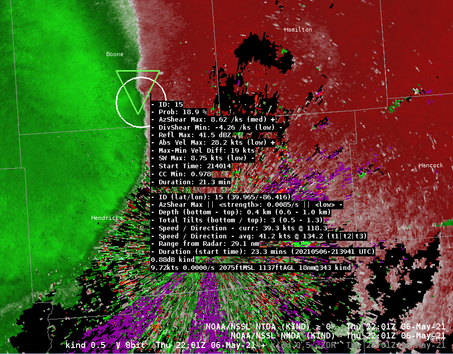
Nonetheless, there has been one consistent kink on the line, which has persisted since the 2117Z image posted earlier in this blog. While this feature is very weak, and certainly not worthy of a tornado warning, both algorithms have fairly impressively continued to track it with low-end detections.
KIND 0.5° V and NTDA/NMDA detections at 2201Z in Boone County, Indiana. The velocity signature here is very weak, but there is a very slight increase in inbounds/outbounds at this portion of the line. This feature has persisted for almost an hour, and has tracked well with both algorithms.
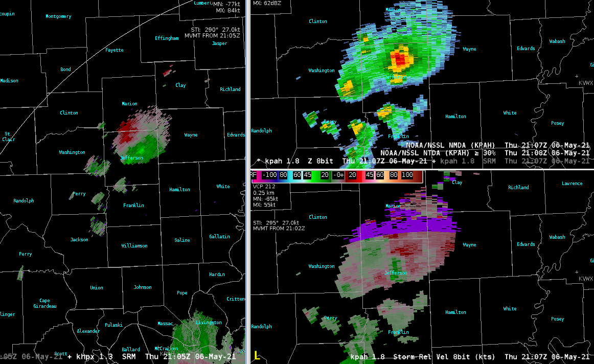
Here is a storm with respectable storm top divergence shown to the left (HPX at 2105 UTC today). The right 2 panels show evidence of weak 2D shear if anything else. Glad to see there is no NMDA detection on this. However, at 2106 UTC there was a very weak detection with this at VWX that lasted 2 scans then disappeared.
We got to do a real-time case this afternoon. A fairly classic cold core aloft with steep lapse rates, a deep mixed layer and dewpoint depressions of 15F or greater. Based on cloud heights in the surface observations we’re probably looking at LCLs on the order of 5000-6000 ft AGL. Not terribly favorable for tornadoes, but perhaps a chance for the NMDA to shine before thermodynamics takes over with very strong downdrafts that might congeal into a cold pool.
At the left is coincident NTDA and NMDA detections coincident with a respectable kink in the convergence line. The 0.5 degree cut corresponds to an approximate height of just over 2000 ft AGL. The NMDA is triggered off the 0.5 to 1.3 degree cuts, even though there is still a weak couplet above this at 2.4 degrees (that’s probably just a bit below the AzShear threshold).
The right column is much later when the outflow has begun to outpace the convection. As seen in other cases, we see a lot more NMDA and NTDA detections overall, but the sliders are very helpful by allowing us to filter out the false detections (lower 20s percent chance threshold in this case for NTDA).
It should be noted that the ProbTor showing zero percent during this time and I think this has a lot to do with its awareness of the unfavorable thermodynamic environment.
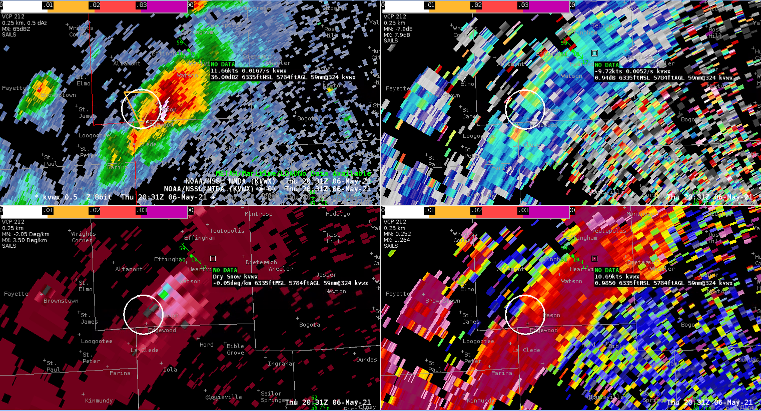
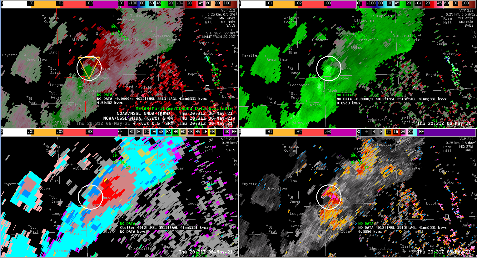
Another small supercell formed along the line moving through central Illinois, taking on characteristics very similar to the storm which produced a tornado to the north earlier in the day. As of this writing, the SPC storm report page indicates two storm reports with the new storm; a tornado near Altamont and another tornado near Mason. Both are located in Effingham County, IL.
The NTDA began showing low probability detections about the time of the first tornado, and then continued to track the storm with increasing tornado probabilities as it moved to the southeast. Probabilities maxed out around 40% around the time of the second tornado. The NMDA also showed several detections through this time.
This performance is noteworthy because the quality of the radar data wasn’t great. The storm was located around 60 nm away from the radar (KVWX–Evansville), with the radar having to shoot through a hail and rain core. Thus, TBSS and slide lobe contamination were an issue. Given that forecasters were aware of the tornado potential from the earlier storm, it’s very possible that these directions could have resulted in a Warning being issued when it otherwise would not have.
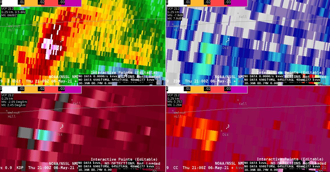
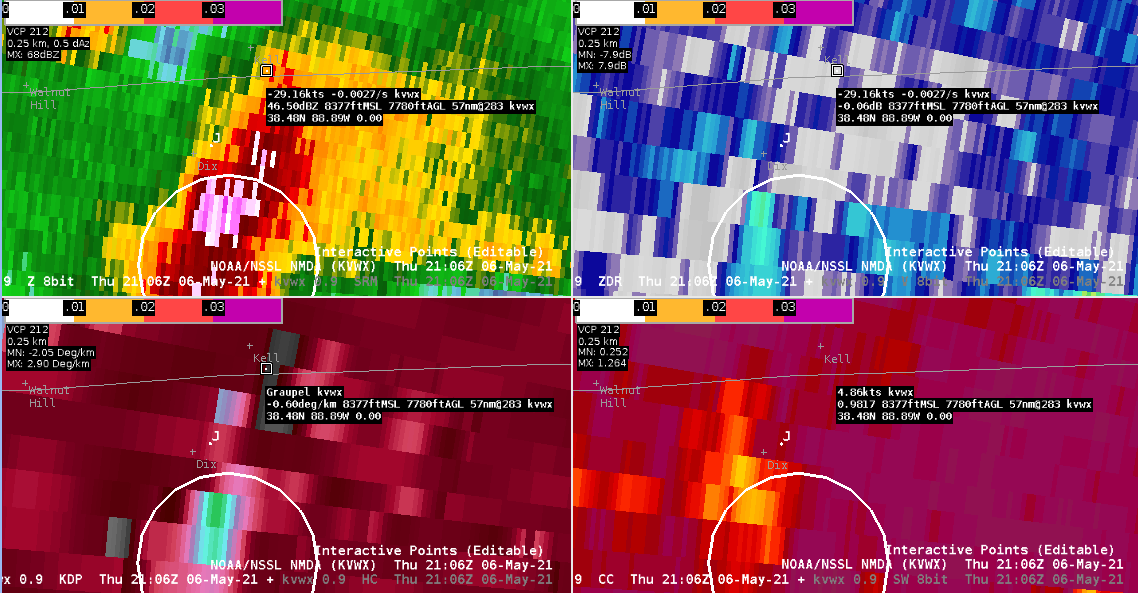
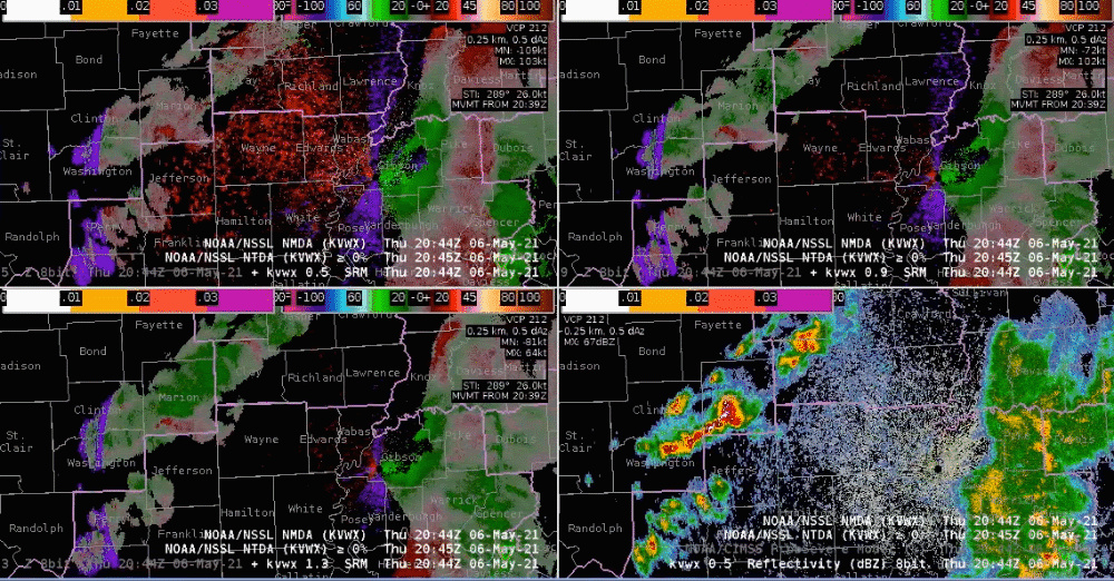
A stronger cell began to move into Jefferson County, IL around 2044Z. There were some indications of hail on the base data, including a core of 70 dBZ and a slight drop in CC to 94%. Based on the lat/lon of the Local Storm Report, the 1” diameter hail would have occurred around the time of the two 0.5 degree scans at 2100Z and 2106Z (though the time of the LSR stated 2113Z). While the NMDA was not present prior to the storm passing over the hail report location, it was an indication of a stronger updraft and would have been a nudge to issue a SVR as I was still on the fence looking at the base data alone.
4 panel of 0.5 deg Z, ZDR, KDP, and CC at 2100Z. Point J is the location of the hail report4 panel of 0.5 deg Z, ZDR, KDP, and CC at 2106Z. Point J is the location of the hail report. Weak NMDA present.Loop of lowest 3 tilts of SRM, 0.5 Z, and NMDA, NTDA as the storm passed through Jefferson County
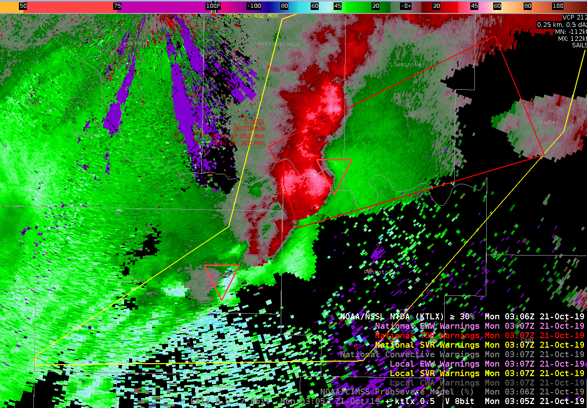
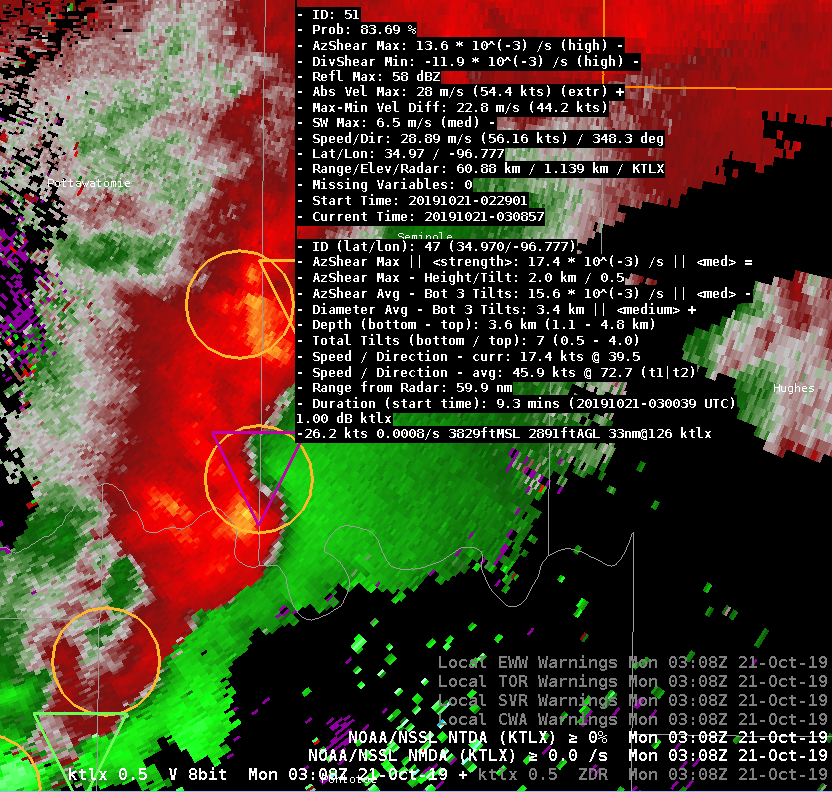
NTDA and NMDA performed well with a strong QLCS as it tracked through central OK. Issued a SVR at 0254Z (Figure 2) as the QLCS was still in it’s developing stage. The NMDA confirmed what I was seeing in base data, in that several decent meso’s were embedded in the line. NMDA detection and tracking were consistent and persistent with the meso features prior to issuance (Figure 1), and increased my confidence that a severe thunderstorm warning was warranted.
NTDA picked up on a TDS signature embedded within the QLCS at 0229Z, with this feature persisting through at least the next hour. Confidence became high enough to issue a tornado warning at 0305Z as the circulation tightened with strong gate to gate shear evident in base SRM data. The algorithm tripped on the high side at 0250Z with probs of >80% for several scans, but no gate to gate shear appeared until 0305Z when the tor warning was issued. The NTDA maxed out with tor probs of 87% at 0310Z (Figure 3). A tornado was reported at 0313Z 3 miles NE Konawa, OK.
Figure 1. NMDA objects were persistent and consistent with detection and tracking of mesocyclones within a developing QLCS at 0233Z. Note detected duration of the southernmost mesocyclone is 30 minutes.Figure 2. Severe warned QLCS with embedded QLCS tornado warned storm. NTDA is overlaid.Figure 3. NTDA peaked at 87% at 0310Z.
A storm moving northeast through the southeastern corner of the OUN CWA began to take on QLCS-like characteristics (or perhaps hybrid supercell). This is at a fair distance from the radar (between 45 and 50 nm), and at a marginal viewing angle. The NMDA first showed a moderate strength meso on the 0403Z scan, followed by a NTDA detection with a 31% probability on the following scan. Both algorithms tracked this well, with the NTDA showing increasing tornado probabilities as a mesovort became more evident on radar. This would be a challenging warning situation due to the distance from the radar, marginal viewing angle, and hybrid nature of the storm. I suspect that in “real life”, both algorithms could have resulted in a faster lead time on the storm, or perhaps nudged someone to move from a SVR to TOR.
Initial NMDA moderate strength detection. NTDA trips with probs >30% on the next scan.A few scans later showing stronger mesovort.
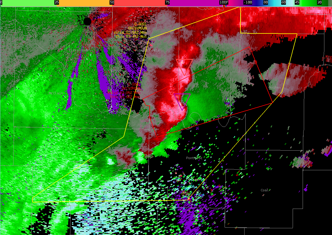
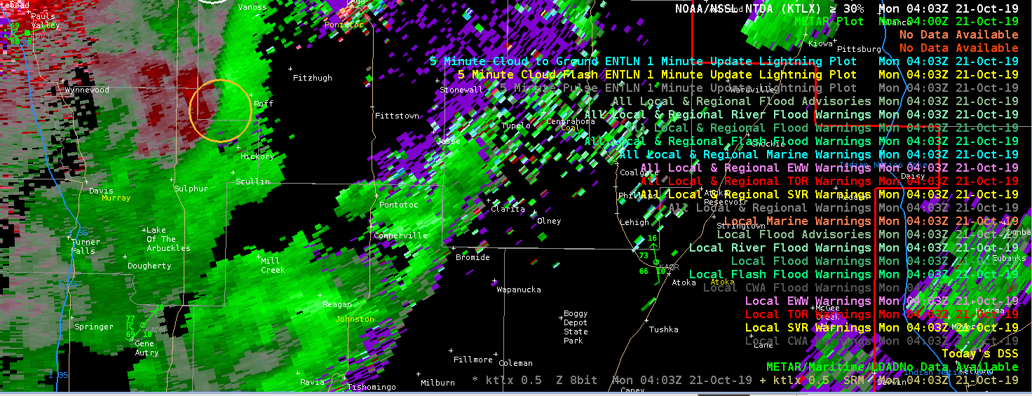
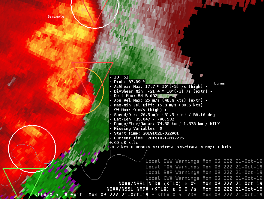
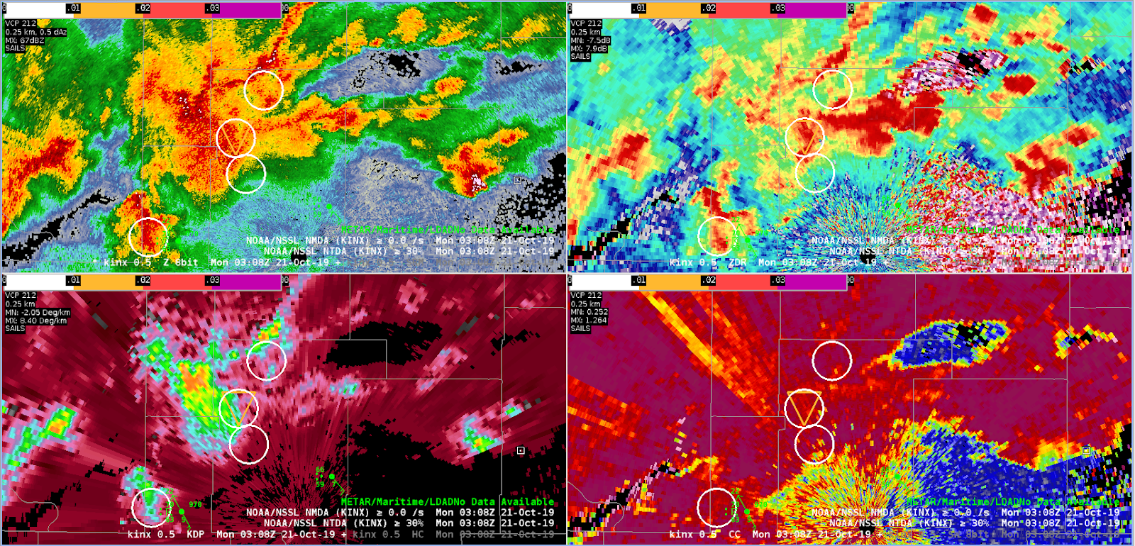
Two intermingled supercells combined into a LEWPy QLCS as they moved out of Pottawatomie County OK into Seminole County OK. The southern mesocyclone became quite strong, with NTDA probabilities well into the 80% range, successfully drawing your eye to the feature (and tracking it fairly consistently in terms of geography).
KTLX 0.5° V with NTDA/NMDA detections at 0308Z. Note the purple triangle with the dominant circulation on the QLCS.
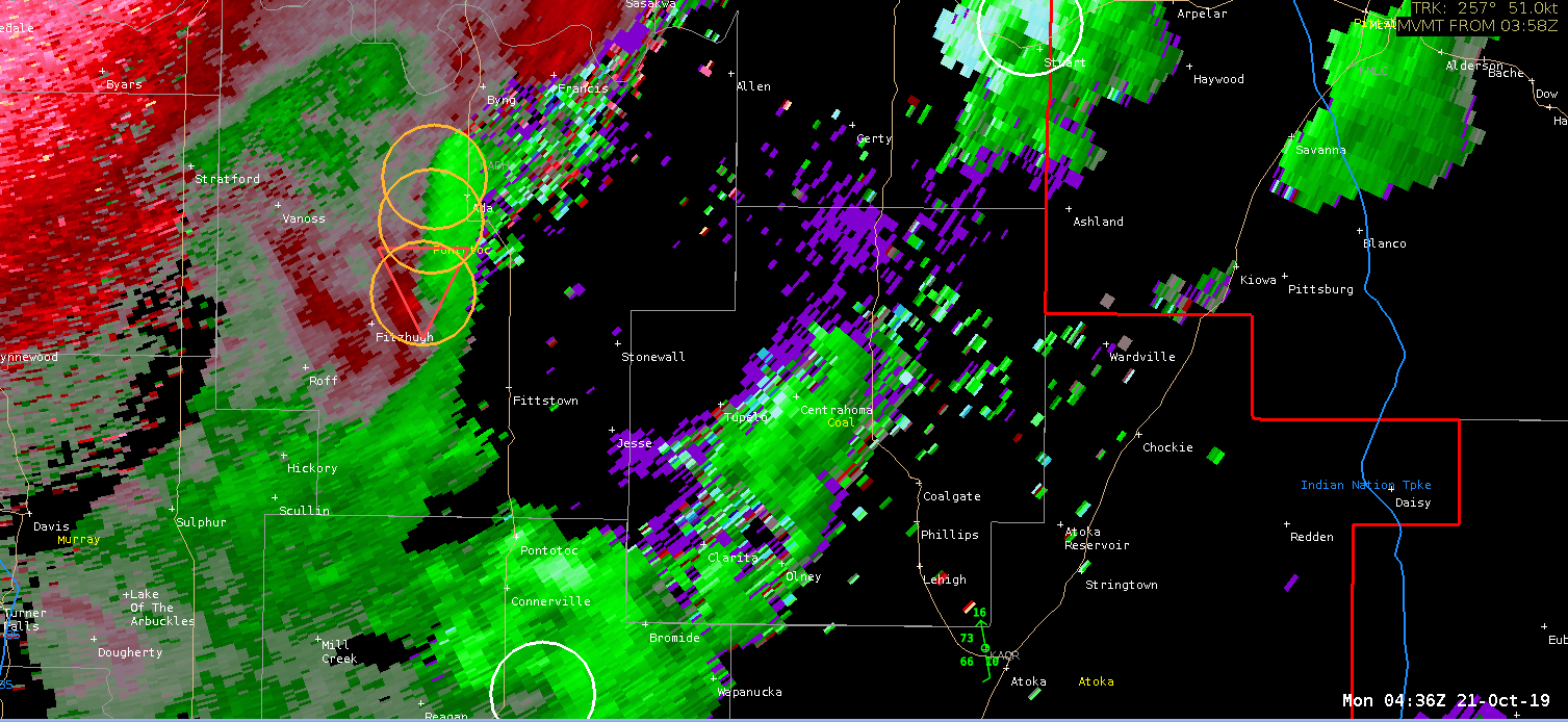
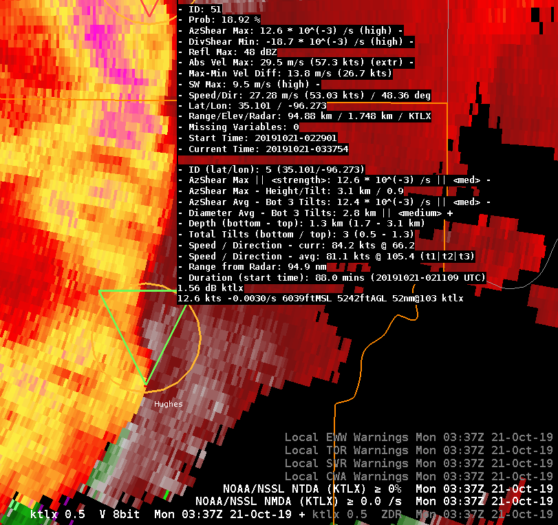
In the following 10-15 minutes, it appeared that a tornado developed, or at least a stronger/tighter circulation. This circulation then occluded, falling back one or two miles behind the gust front / updraft-downdraft convergence zone (UDCZ). It was noted that NTDA continued to show >50% probabilities, but was tracking the UDCZ instead of the likely-tornadic circulation. A similar behavior was seen in other recent cases, including with the end of the life cycle of the Montgomery County (Dayton) OH EF4. We looked at the plots of the azimuthal shear on this particular storm, and the highest AzShear values were indeed located with the UDCZ instead of the tight circulation. Both features are, of course, in very close proximity to each other.
KTLX 0.5° V with NTDA/NMDA detections at 0322Z. Note the red triangle showing the location of the NTDA detection on the UDCZ, while the occluded likely-tornadic circulation is just to the southwest of the red triangle.
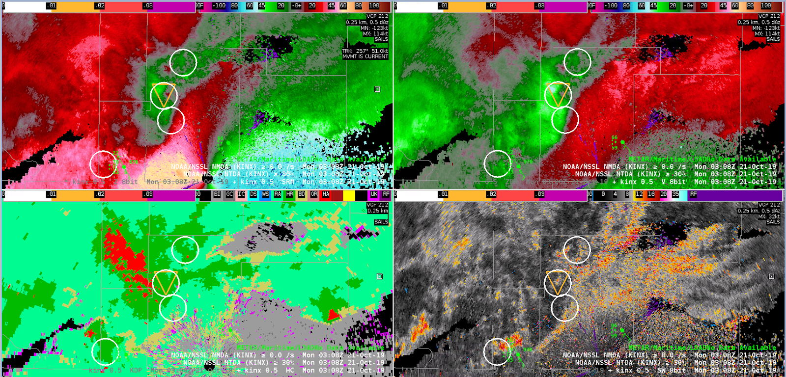
In the next 10-15 minutes after that, after the occluded circulation washed out, the entire line became much more outflow-based — with few significant signs of wrapping up. I think NTDA handled this transition quite nicely. It continued to track a low-probability object through Hughes County just north of a slight surge in the line, which is great to be aware of, but correctly identified that this line did not appear particularly likely to be tornadic at this time. In the experiment, a decision was made to transition warnings to SVR for this QLCS segment at this time.
KTLX 0.5° V with NTDA/NMDA detections at 0347Z. Note the green triangle showing a low-end NTDA detection just north of a not-very-impressive surge in the line.
A supercell merger took place northwest of the Tulsa (INX) RDA. Mergers are always tricky; often there is no way to know whether it will be constructive or destructive in nature, but one should always “beware the merger!” when making warning decisions. In this case, the merger takes place, and a small area of enhanced rotation becomes evident on velocity. It would be tempting to issue a Tornado Warning in this case, but the weaker NMDA and NTDA output might give me pause to wait another scan or two. If I waited, the next few scans would show a weakening trend in the velocity fields. I suspect that if I had gone with a warning, I would quickly come to regret it.