
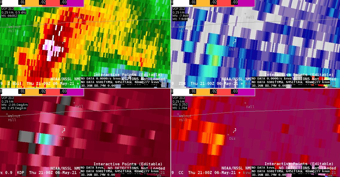
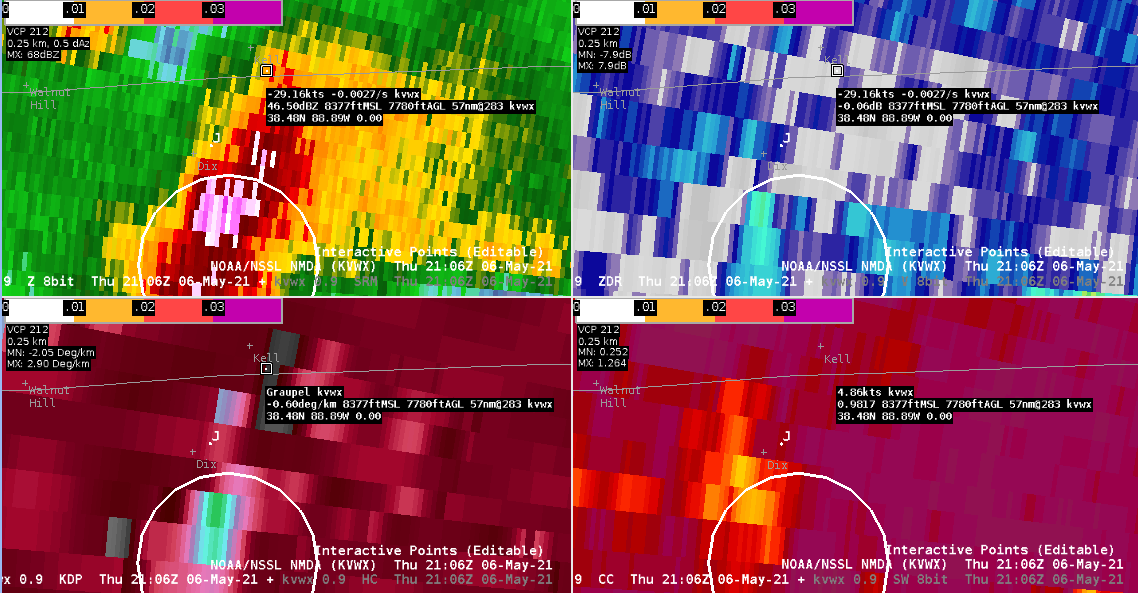
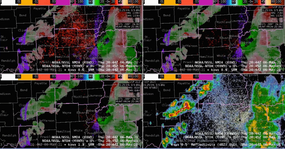
A stronger cell began to move into Jefferson County, IL around 2044Z. There were some indications of hail on the base data, including a core of 70 dBZ and a slight drop in CC to 94%. Based on the lat/lon of the Local Storm Report, the 1” diameter hail would have occurred around the time of the two 0.5 degree scans at 2100Z and 2106Z (though the time of the LSR stated 2113Z). While the NMDA was not present prior to the storm passing over the hail report location, it was an indication of a stronger updraft and would have been a nudge to issue a SVR as I was still on the fence looking at the base data alone.
– Angelica Schuyler