

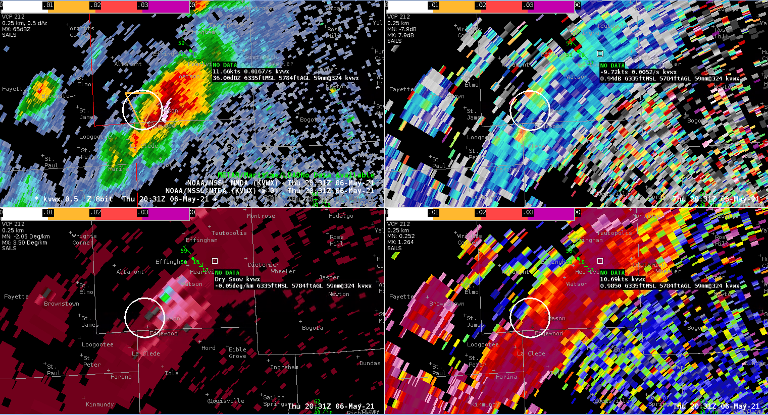
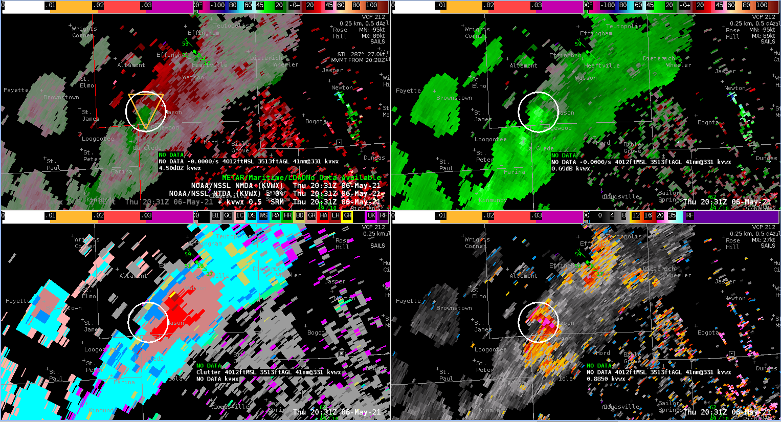
Another small supercell formed along the line moving through central Illinois, taking on characteristics very similar to the storm which produced a tornado to the north earlier in the day. As of this writing, the SPC storm report page indicates two storm reports with the new storm; a tornado near Altamont and another tornado near Mason. Both are located in Effingham County, IL.
The NTDA began showing low probability detections about the time of the first tornado, and then continued to track the storm with increasing tornado probabilities as it moved to the southeast. Probabilities maxed out around 40% around the time of the second tornado. The NMDA also showed several detections through this time.
This performance is noteworthy because the quality of the radar data wasn’t great. The storm was located around 60 nm away from the radar (KVWX–Evansville), with the radar having to shoot through a hail and rain core. Thus, TBSS and slide lobe contamination were an issue. Given that forecasters were aware of the tornado potential from the earlier storm, it’s very possible that these directions could have resulted in a Warning being issued when it otherwise would not have.
– Rabbit