
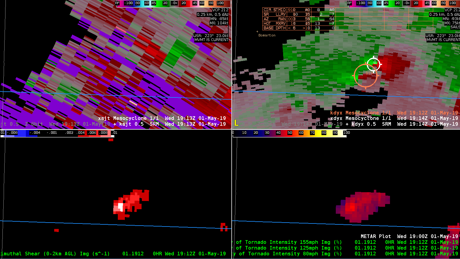
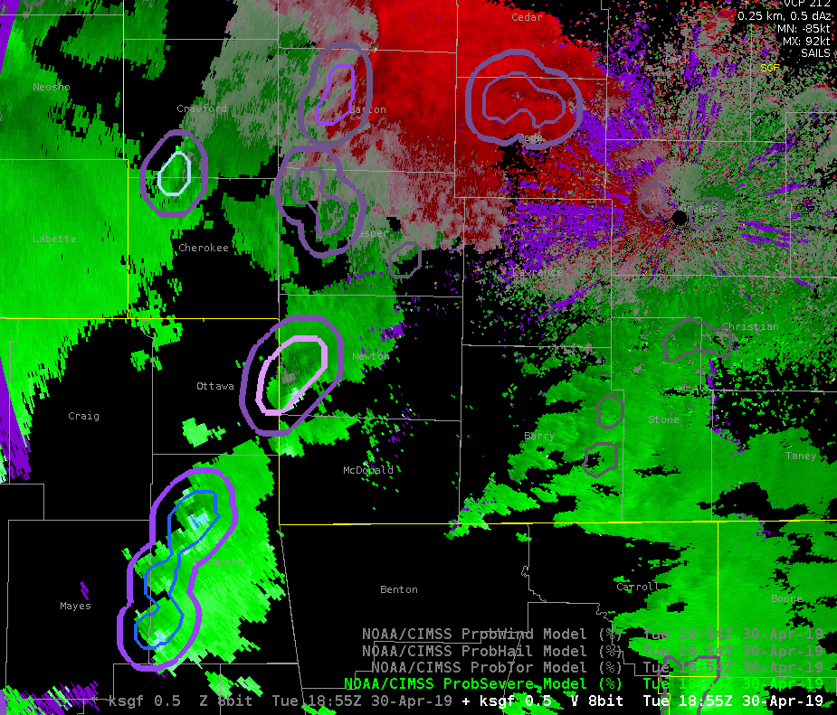
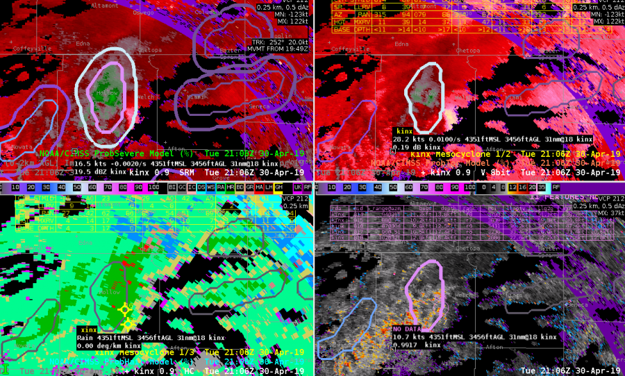
Merged 0-2km AZ-Shear was struggling with detection of second meso. Old MDA just broad-brushed both meso’s and NMDA identified the northern meso but failed to identify the second meso. – Jake Johnson
Official websites use .gov
A
.gov website belongs to an official government
organization in the United States.
Secure .gov websites use HTTPS
A
lock (
) or https:// means you’ve safely connected to
the .gov website. Share sensitive information only on official,
secure websites.

Merged 0-2km AZ-Shear was struggling with detection of second meso. Old MDA just broad-brushed both meso’s and NMDA identified the northern meso but failed to identify the second meso. – Jake Johnson
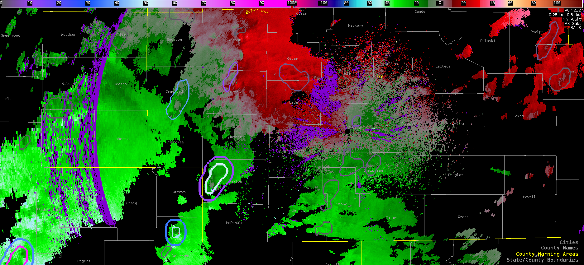
Here a strengthening southern supercell invaded the personal space of its “more aged” northern neighbor. The merger did not change the ProbTor values of the original, stronger storm (90%) but did eventually show a slightly lower value (87%) despite the southern storm becoming more intense in rotation. There were only subtle differences noted in the ingredients and nothing stood out as to why the Prob values dropped.
As for the new mesocyclone algorithm (xmda) the strength rank jumped to 25 (max value) at 23:32. It is difficult to follow the individual storms in the attribute table since they jump from page to page and are ordered by ID versus strength. Having the cell ID color coded at certain values (e.g. above 10 colored yellow, above 15 colored blue, etc.) would help more quickly discriminate the strongest mesocyclones, especially if you have to move to another page. ProbWind (lower right panel) continues to be very high for these supercells (consistently >90%) although no wind reports were received by SGF.
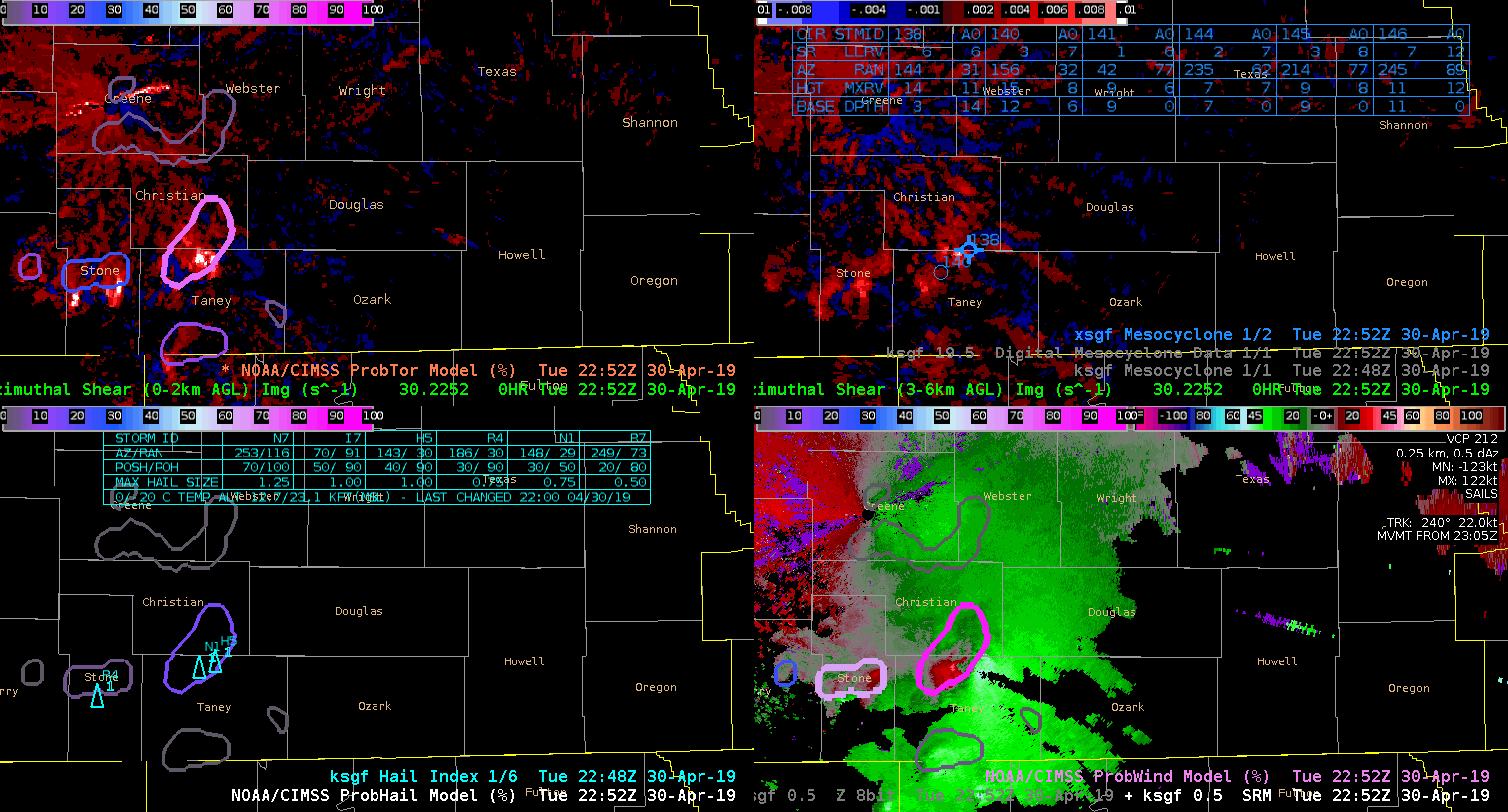
0-2km AzShear/ProbTor (UL), 3-6km AzShear/xmda (UR), HI/ProbHail (LL), Z/SRM/ProbWind (LR)
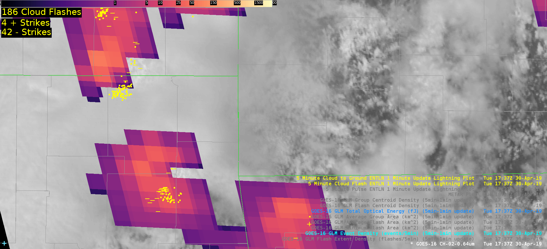
This rapidly developing supercell displayed a GLM lightning decrease as it intensified. This was a good example of optical attenuation due to an updraft core. ENTLN network is displayed, showing that there was a tremendous of CG and IC flashes despite low GLM values. Shown is the TOE product.
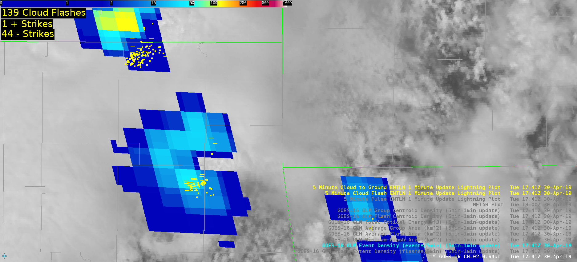
The same storm and lightning minimum shown in Event Density.
ProbTor was occasionally too aggressive. Only one of these storms was really concerning at this time given the environment and radar tilts further up in the volume. On a day like this, it would likely be prudent to increase the probtor threshold above 3%
Prob Tor contours showing a new probtor threshold of 10% instead of 3%. This was edited on the fly in the localization file of the procedure itself. This view shows a less cluttered display given the amount of rotating storms this day.
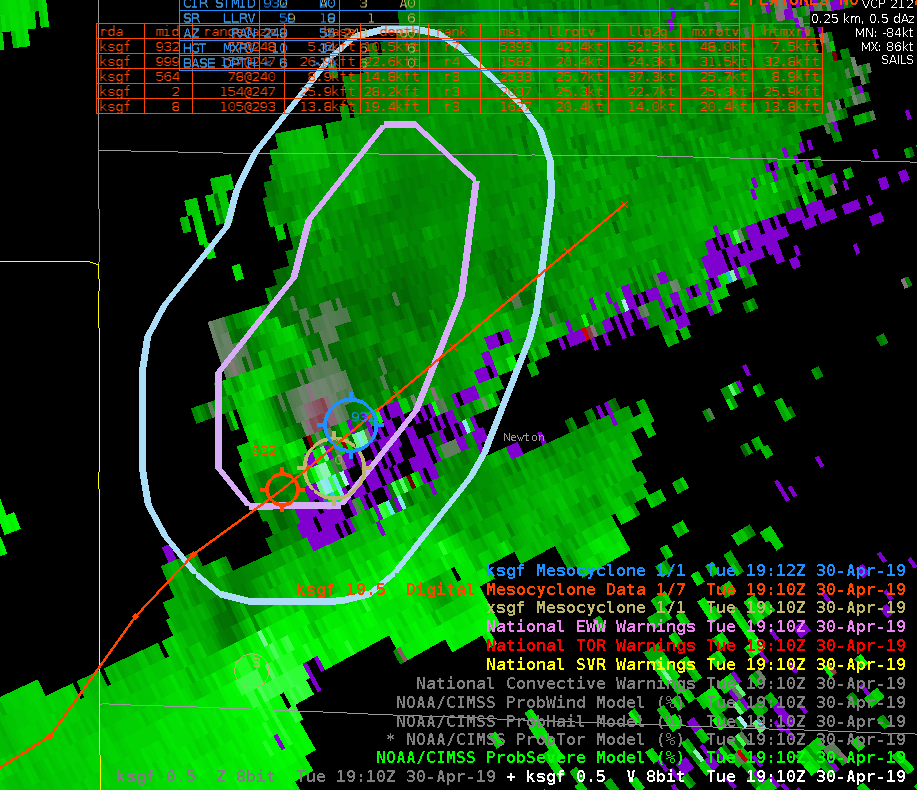
Comparison of MDA products over a weak low topped supercell, as well as showing the probsevere contours. ProbTor was at 47% at the time, prompting the issuance of a Tor Warning.
It can be a bit hard to see from the color scale, but take a look at the bottom left screen. The NMDA is shown there. One thing that I have noticed about it is it was able to better track the Mesocylone compared with the normal one. However, I have not gotten to test this extensively yet.
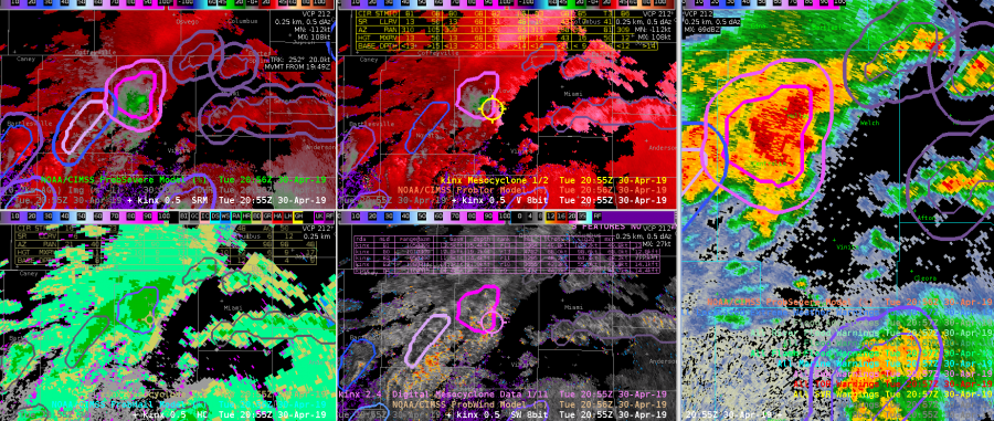
Notice in the time-step below that the NMDA is the able to hold onto the mesocyclone when the normal one cannot.
South Beach
A severe thunderstorm pushed through the northern portion of the CWA and I had a tornado warning in effect in anticipation of tornadoes along the eastern most portion of the bowing line. Unfortunately, the NMDA was not initially identifying mesocyclones along that portion of that line. It was only until well after the warning was issued that the NMDA identified anything along that portion of the line.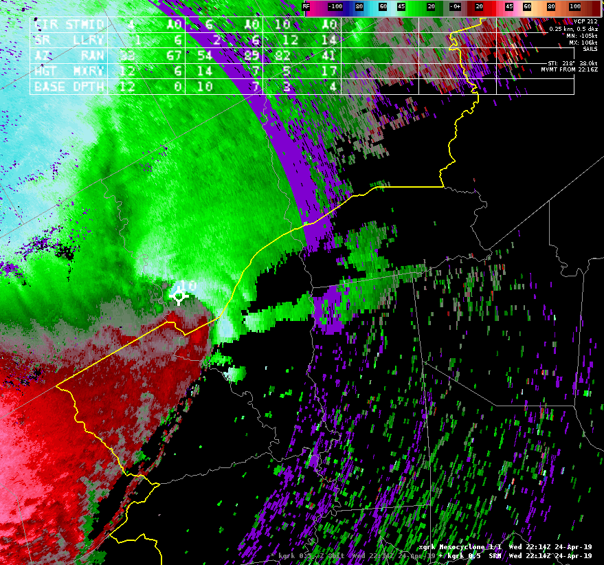 Sandor Clegane
Primary area of interest on this storm is the western-most mesocyclone highlighted by the NMDA. Unfortunately, the NMDA identifies this rotation with several different names, making it difficult to track through time. Sandor Clegane