
0358Z
Two intermingled supercells combined into a LEWPy QLCS as they moved out of Pottawatomie County OK into Seminole County OK. The southern mesocyclone became quite strong, with NTDA probabilities well into the 80% range, successfully drawing your eye to the feature (and tracking it fairly consistently in terms of geography).
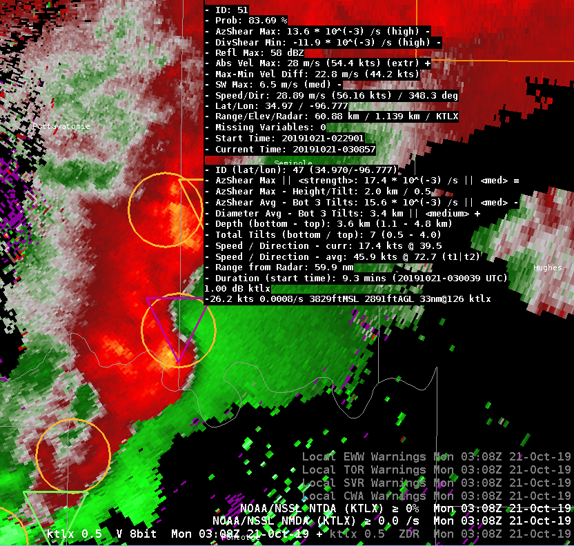
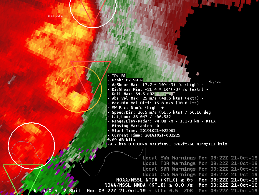
In the following 10-15 minutes, it appeared that a tornado developed, or at least a stronger/tighter circulation. This circulation then occluded, falling back one or two miles behind the gust front / updraft-downdraft convergence zone (UDCZ). It was noted that NTDA continued to show >50% probabilities, but was tracking the UDCZ instead of the likely-tornadic circulation. A similar behavior was seen in other recent cases, including with the end of the life cycle of the Montgomery County (Dayton) OH EF4. We looked at the plots of the azimuthal shear on this particular storm, and the highest AzShear values were indeed located with the UDCZ instead of the tight circulation. Both features are, of course, in very close proximity to each other.
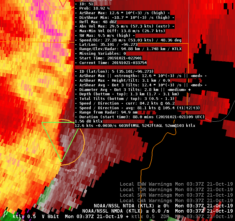
In the next 10-15 minutes after that, after the occluded circulation washed out, the entire line became much more outflow-based — with few significant signs of wrapping up. I think NTDA handled this transition quite nicely. It continued to track a low-probability object through Hughes County just north of a slight surge in the line, which is great to be aware of, but correctly identified that this line did not appear particularly likely to be tornadic at this time. In the experiment, a decision was made to transition warnings to SVR for this QLCS segment at this time.
–Insolation