
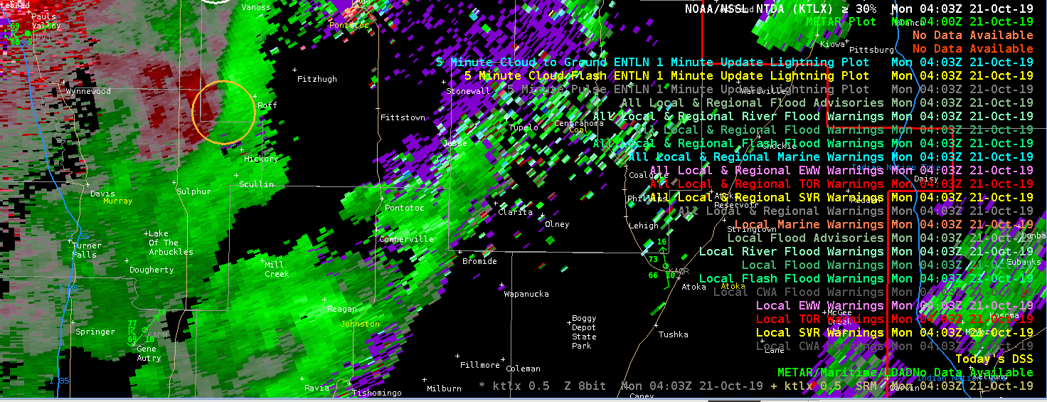
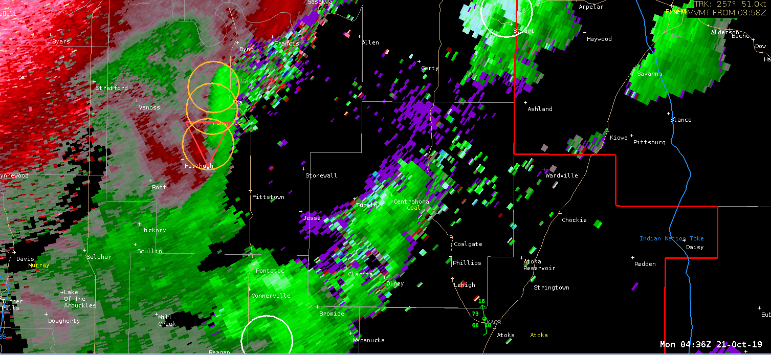
A storm moving northeast through the southeastern corner of the OUN CWA began to take on QLCS-like characteristics (or perhaps hybrid supercell). This is at a fair distance from the radar (between 45 and 50 nm), and at a marginal viewing angle. The NMDA first showed a moderate strength meso on the 0403Z scan, followed by a NTDA detection with a 31% probability on the following scan. Both algorithms tracked this well, with the NTDA showing increasing tornado probabilities as a mesovort became more evident on radar. This would be a challenging warning situation due to the distance from the radar, marginal viewing angle, and hybrid nature of the storm. I suspect that in “real life”, both algorithms could have resulted in a faster lead time on the storm, or perhaps nudged someone to move from a SVR to TOR.
– Rabbit