

 Maybe a wind farm? – Wildcat
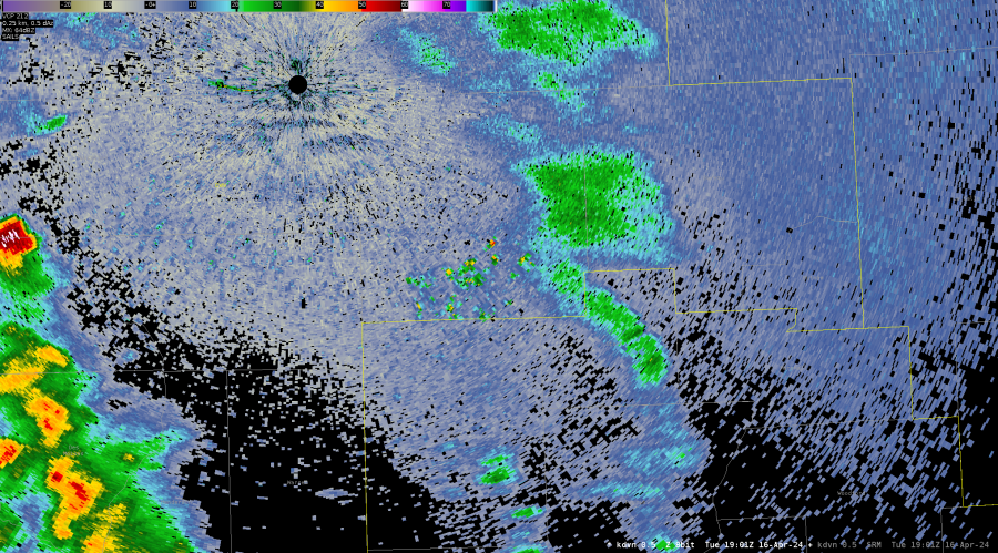
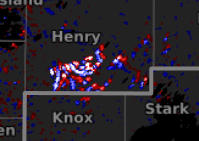
Higher values of AZshear not flagged.
NW Mercer county had some higher values of AZshear appear, but not flagged as an area with TOR potential I’m guessing because it’s in a an area where there is no reflectivity. 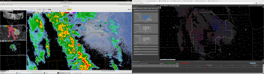
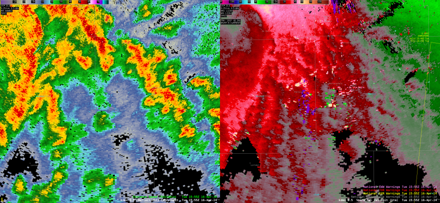
Good Example of Blockage
Beam blockage in velocity data makes it easy to discount AZshear. Screen capture of similar time and blockage – Wildcat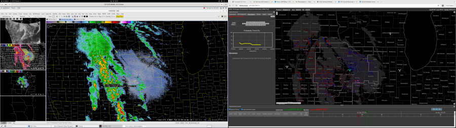
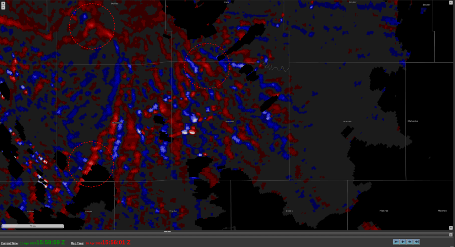
AzShear Artifact?
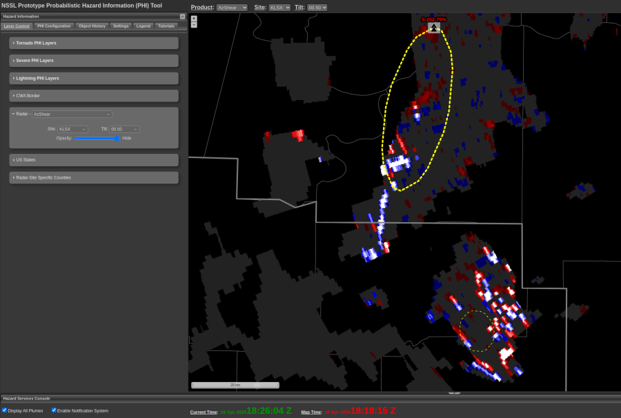
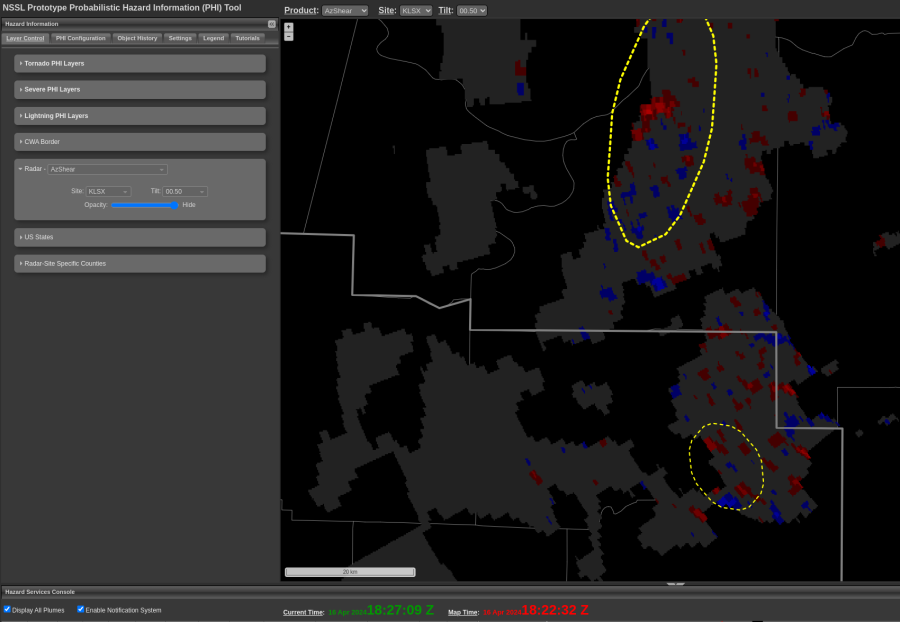
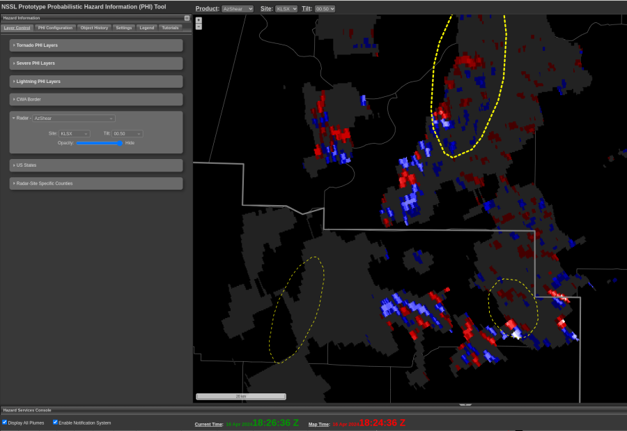
Collection of AzShear images from KLSX between 1818-1824 UTC. Values appear to “flash” from unrealistically high to low values (given background environmental assessment) over successive images. No obvious DA issues in base data/velocity during this period. Radial range from KLSX was ~90-100 km. The most notable instance of this occurred to the southwest of the KLSX RDA. -QLCS
TOR OAX
Not obvious on radar, and likely an EF0, but small probs on AZ shear at time of report. I would not have warned on this and probably would not have warned, but probably would have after the fact given the persistent of similar signal in AZ shear data – Wildcat 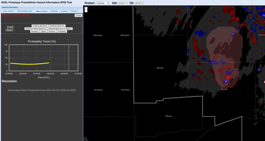
Environmental Data
Along with radar data, near-storm environmental conditions are an integral part of the warning decision, so including it in the TORP display would be very useful to warning forecasters. Contoured plan view data of MUCAPE, MLCIN, 0-1 km helicity, etc should be added to the “Weather Related Overlays” to tell if storms are moving into more/less favorable environments. Some other environmental data items that could be added to the list of graphed data trends: DCAPE, 0-6 km shear, 0-3 km helicity, Other forecasters will have their own preferences for what environmental parameters to include. 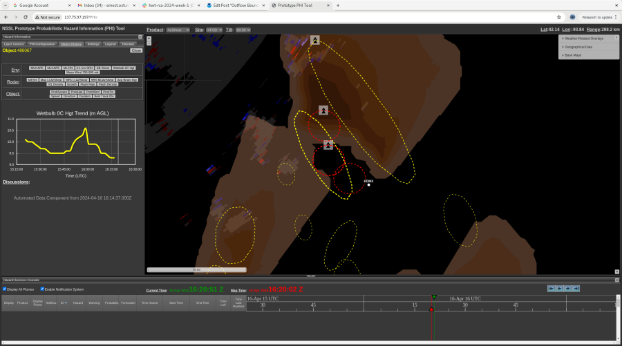
Posted by Rigel
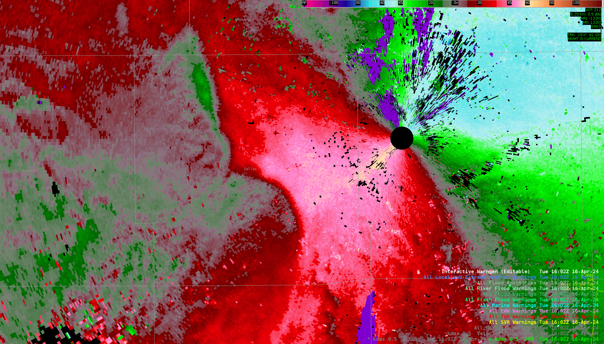
TORP sorts out bad Az Shear couplet
Here’s an example where Az Shear was overly excited by bad Velocity data yet TORP was not tricked. Despite Max Az Shear being the highest ranked predictor for TORP, TORP did not produce an object for said area (at least above the 20% threshold I’m currently viewing). When looking at reflectivity data, clearly there is no developing mesocyclone (or really anything at all) in the Az Shear couplet’s vicinity (not to mention the velocity data is just obnoxiously extraneous).
P.S. I missed a Tor while making this. Whoops!
-Wx Warlock
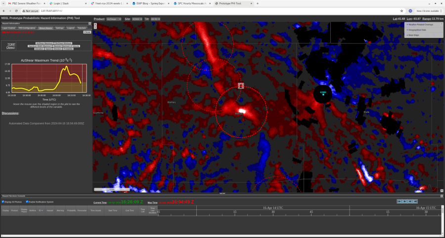
TORP Lead Time vs. Radar Data
A quick spin up occurred just east of the KDMX radar that was difficult to identify on velocity data alone with any amount of lead time. There was some enhancement in surface convergence at the 1604z scan, but potentially not enough to grab your attention or warrant a tornado warning. By the next scan at 1606z, there was a couplet with 30kt+ of Vrot. At the 1607z scan, there was a CC drop collocated with the couplet. It might have been difficult to get much lead time on this tornado with radar data alone. That said, the two screenshots from TORP/AzShear might have led you to issuing, or at least drawing up the warning, at the 1604z scan with the sharp jump in probability and AzShear maximum as noted on the graphs on the left. This is a good example of where the product could have gotten you a minute or two extra of lead time. -newt 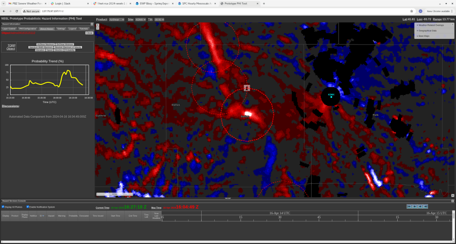
Possible Tor DMX
The trend on this storm has really come up, and a rapid increase was identified. Couplet visible in SRM data as well and I would issue a tor on this storm, and probably would have a scan before based on AZ shear data – Wildcat

Outflow Boundary Vortices
There was a nice example of small vortices forming along an outflow boundary with a line of convection in the FSD county warning area around 1545Z on 16 April. These small vortices are sometimes associated with storm damage from non-supercell tornadoes or “gustnadoes”. The TORP identified one of these circulations with rapid increases in both AzShear and Spectrum Width Maximum trend. 
Posted by Rigel