
Several pop-up storms developed in the Elko forecast area Tuesday afternoon. To provide DSS for the Elko Airshow, we looked at lightning products, such as GLM and LightningCast (shown here). There were noticeable differences in northern Nevada between the GOES East CONUS and GOES West Meso Sector satellites. This provided a bit of a conundrum of which satellite would be best to use for our DSS event. However, we noticed the trends in lightning probabilities (time series shown below) were increasing for the Elko Airport area for both satellites, so we hedged on that and blended both to arrive at probabilities. In this case, Lightningcast proved to be a useful DSS tool, as lightning was observed within 5 miles of the DSS event by 2056Z.
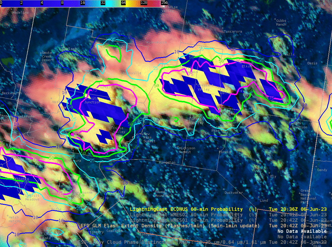

GIF showing the difference between GOES East CONUS and GOES Meso West products over northern Nevada.

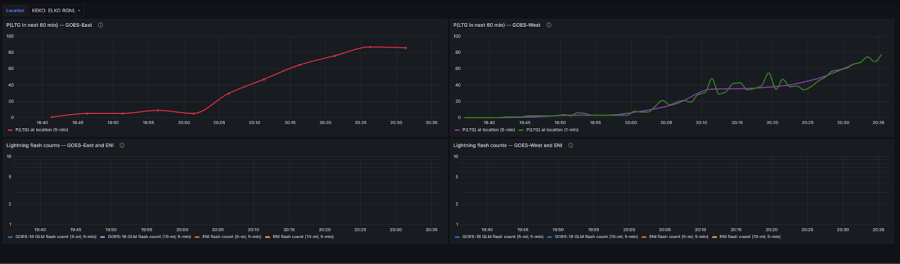

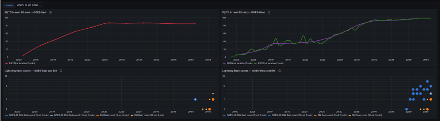

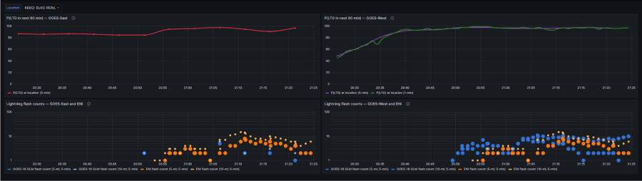

LightningCast time series trends for Elko Airport.
– Bolt and Burton Guster