
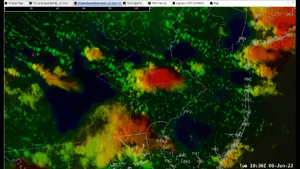
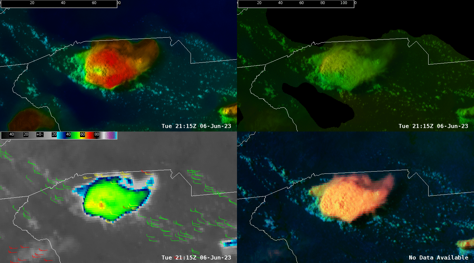
The environment is mostly within northwest flow, so some decently sheared storm tops are noted on the OCTANE speed product, ranging from about 25 kts to 60 kts at anvil/storm top level.
The OCTANE Speed Product over eastern PA.

DSS for Twigs Craft Fair – Speculator, NY.
Increased lightning chances developing and going up over 50% now at our DSS site. This is a concern as people at the festival will likely need to take shelter soon as storms approach from the north. Lightning is possible ahead of the storm given the environment it is in and favorable synoptic setup.
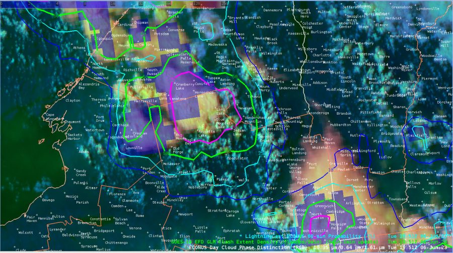

GOES 16 GLM and LightningCAST near our DSS site at Speculator, NY.
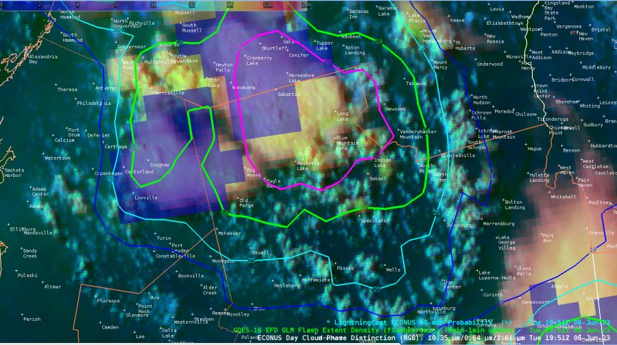

Additional imagery with a zoomed-in view.
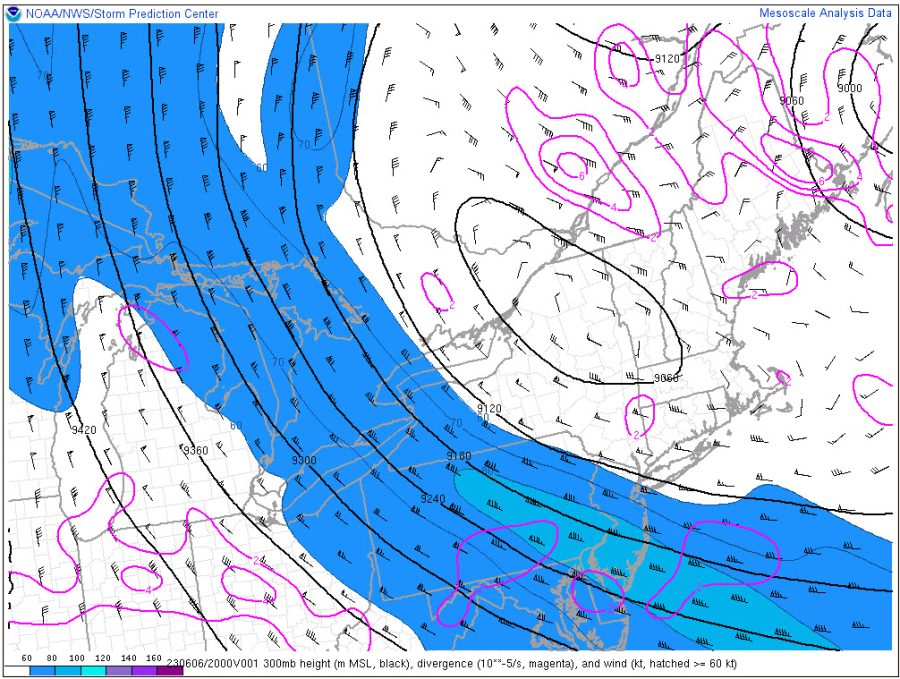
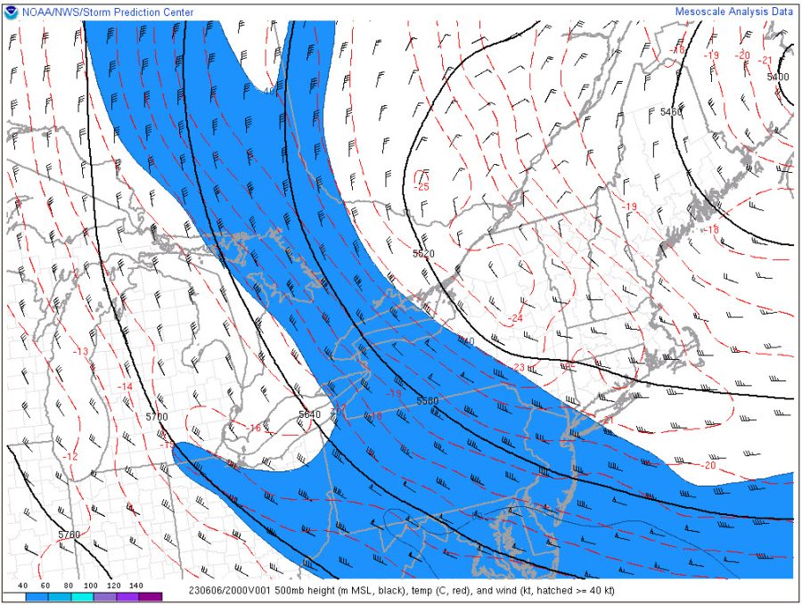
The overall storm top speeds line up fairly well with SPC Mesoanalysis between the 300mb and 500mb layer where speeds of 40-80 kts are noted over eastern PA and western Long Island, NY. Our storms have between 50-70 kts of speed at storm top, so it lines up fairly well with what the RAP mesoanalysis has. Very interesting. See the images below.


3:35pm CT: 1-min LtgCast has increased to ~90% at DSS point, with GLM showing ~1-2 flashes/5min.
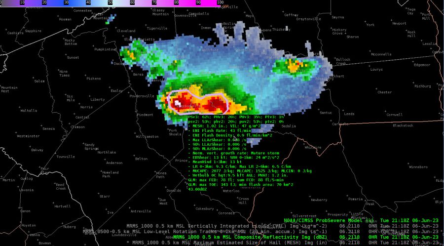
Interesting feature on a storm over upstate South Carolina to the west of Columbia. Some weaker winds aloft behind the overshooting top of the storm. Additionally, cooler cloud top temperatures are noted in the overshooting top. Increase in PSv3 values are notable as well with a ramp up in severe threat. The storm was severe warned at this time.


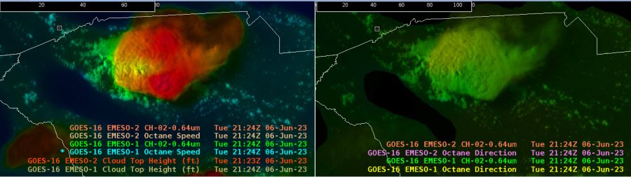

Additionally, you can note the fairly decent divergence aloft at anvil level with the OCTANE direction product.
-Satellite Steve & Displar