
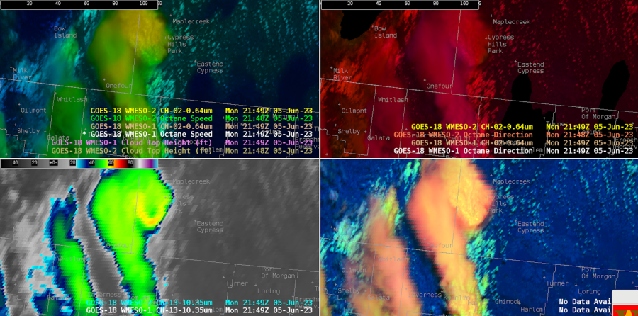
At WFO Great Falls (TFX), we made use of the Octane speed and direction imagery, plus the IR brightness and day-cloud phase distinction to evaluate a cell northeast of Iliad. This imagery helped us screen the multiple cells over the CWA so we could home in on this particular cell. Characteristics that stood out included the higher anvil speeds on this cell, the diffluent cloud top signal on the Octane direction imagery; the cooler cloud tops (around -62C), and new/robust convection noted by DCPD.
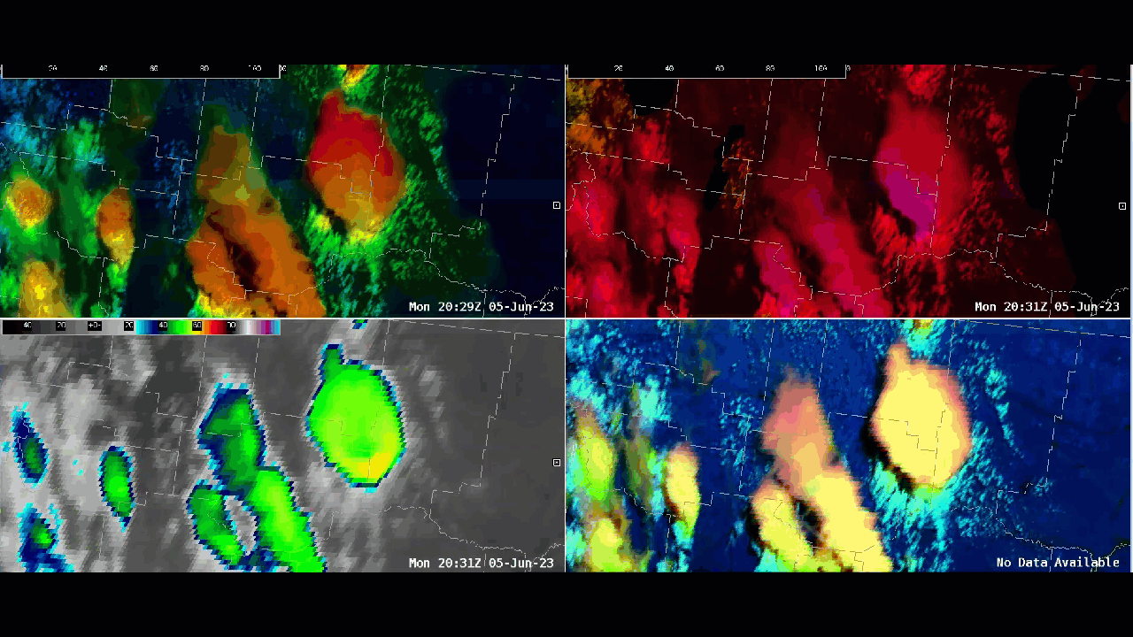

4 Panel OCTANE depiction of severe warned storm near Iliad, MT.
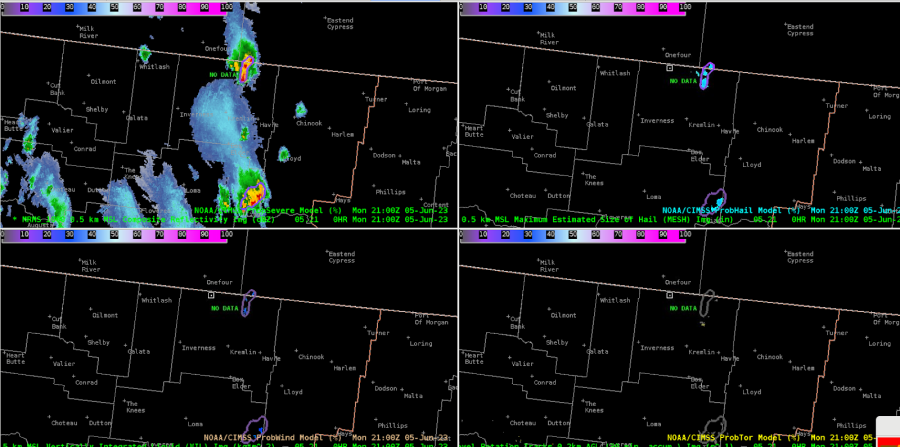
Meanwhile, the cell closer to the Canadian border is becoming stronger. The ProbSevereV3 is trending higher for total severe, up to 19% at 2104Z. The anvil from the storm to the south is beginning to impinge on the cell to the north and somewhat obstruct the view.


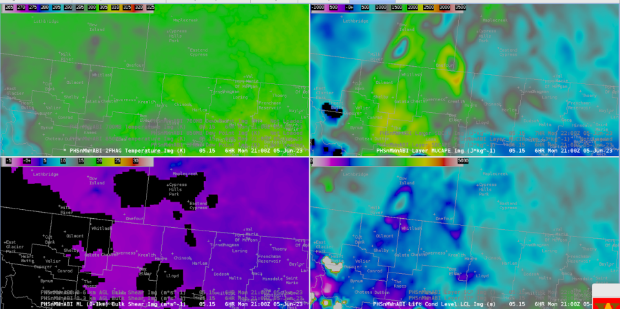
The PHS imagery showed a regional peak in MUCAPE in this area.

Looking a bit later, the total ProbSevere continues to climb. It is well above the individual probabilities, which is curious.


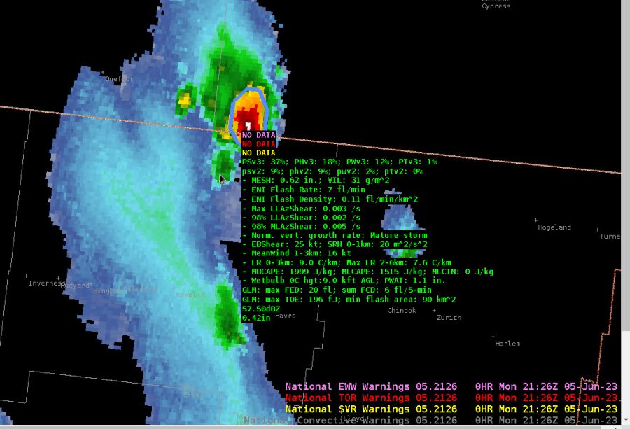
Storms have matured with a notable V notch of cooler cloud tops and warmer tops to the north of the notch. Based on Octane speed, there is a notable difference in speeds from the southern end of the anvil to the northern reaches with 35-40 kts increasing to 65-70 kts. PSv3 does indicate a 50% chance for severe with this storm.


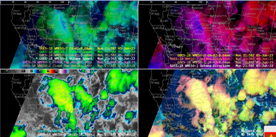
Meanwhile, down in CA, northeast of Sacramento, the Octane direction product is showing an impressive divergence signal!


– Satellite Steve and Edgar