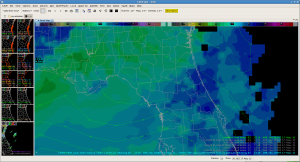
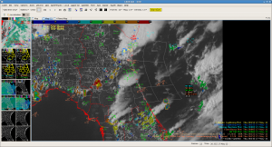
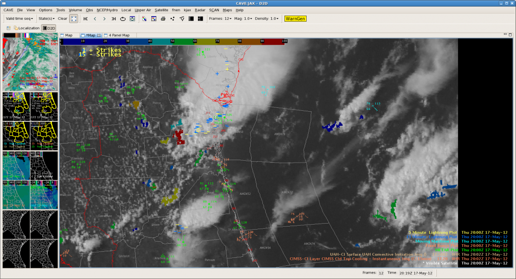
Noticed an interesting diagonal differential heating sort of boundary in across northern Florida where the next round of convection appears to be initiating. It show up well on the nearcast as s thetaE gradient and is now showing up on Vis and CI products…if this end up being the focus of more critical convection later in the afternoon this could be a really good application the nearcast product. There was a similar looking (though not sure if it was the same cause) feature when we were MLB two days ago that was where the bigger stuff triggered. Waiting to see….
JAX – 3D Var vs Dual Pol
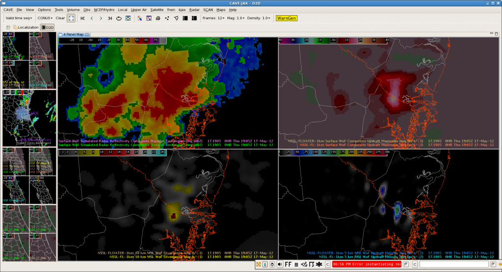
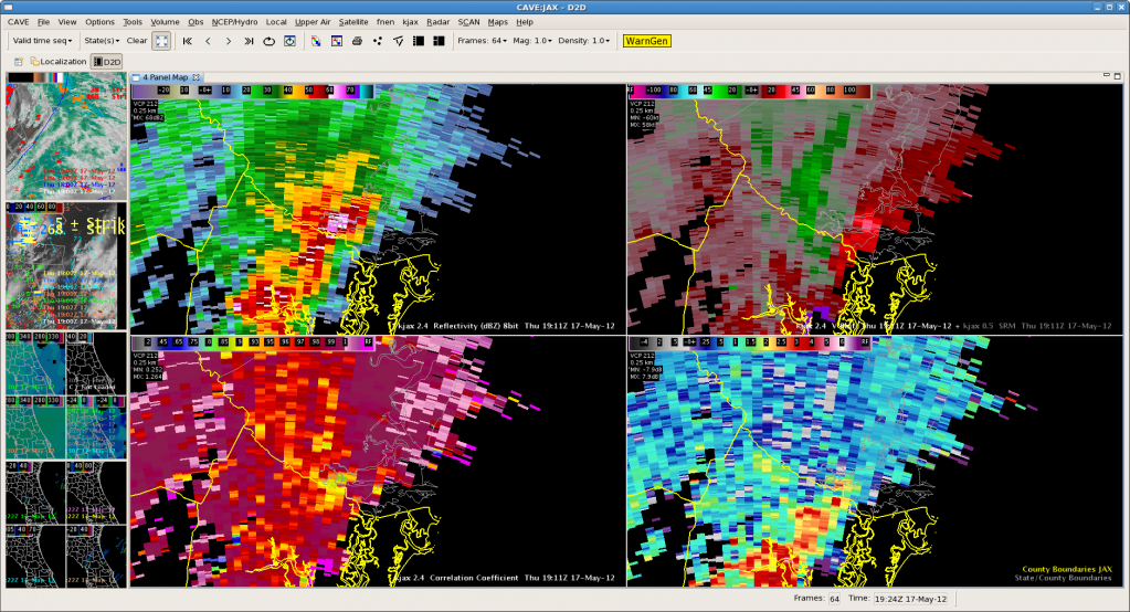
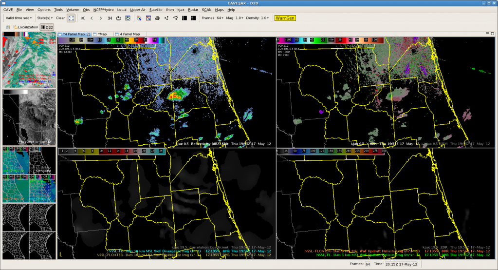
Here is an good example of 3d Var picking up on a strengthening storm and some mid level rotation. The top 4 panel 3 d var from 1905 and the second is radar from 6 minutes later. The updraft strength, updraft helicity and updraft velocity products show a strong signal while the mid level storm relative velocity images (3 and 4 degree scans especially) have good rotation developing. Not much at low levels (images not shown) but nice example of 3-d Var pick up and highlighting mid level rotation. One additional feature that would be very good to have in the 3d var data is something that shows the height of max updraft helicity. Built a 4 panel to compare all tilts radar (top two panels) to 3-d var updraft helicity and storm top (10 km) divergence as they seem to be good parameters to for finding rapidly intensifying/severe storms and will have to see how it works for the next storm. Below is an example of the procedure with interesting gravity wave like features from the previously dissipating storm but nothing much firing yet to see how it works.
Interestingly there is a red (94%) and a few other CI detections in the vicinity of the ‘gravity wave’ looking things. Curious to see how they build…
GOES sounder nearcasting CAPE
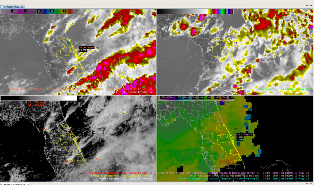
We’ve been keeping an eye on the relationship between the GOES nearcasting CAPE field and the coverage of the developing convection over Florida today. The synthetic satellite imagery has also done a good job on delineating the areal coverage of developing convection. The four-panel image has actual Infrared imagery on the upper left, synthetic satellite imagery on the upper right, visible satellite and lightning data on the lower left and a layered CAPE field derived from GOES-13 sounder nearcasting data. The highest CAPE values, around 1200 joules/kg, are located just to the northwest of Lake Okeechobee, with an axis of lower CAPEs further to the north. There is also a subtle increase in CAPE values over northern Florida, where additional convection is developing. The region with the lower CAPEs has weaker convection at this point. The synthetic satellite imagery is a 12 hour forecast using the 06z run of the WRF model, valid at 18z. It also does a nice job depicting less convection in the region of lesser instability.
Dankers/Kearney
Outlook: 2012 May 18
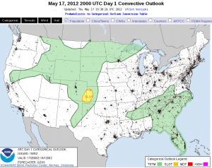
Today’s situational environment remains little changed from our expectations yesterday. An upper-level low has moved in from the Gulf yesterday to South Carolina today. Deep, moist convection (DMC) has already erupted around the perimeter of the upper low. To the south, unusually strong mid-level flow continues along the central Gulf to the FL peninsula. With plenty of moisture resident over FL, and southwesterly low-level flow, it appears we have a good juxtaposition of shear and CAPE in a climatologically unusual location. Supercells are likely, especially where the shear is strongest from St. Augustine and south. However the question of the day is expected coverage of DMC. The coolest air aloft resides close to the upper low meaning that northern FL would see the steepest lapse rates and least inhibition. Early DMC in southeast GA helps confirm this thinking. Further south, the air aloft is warmer and coverage is expected to be less. We’ll also have to rely on the initiation of the west coast seabreeze to help provide the strongest low-level forcing to overcome the greater inhibition to the south. The eastern seabreeze may help to provide enhanced low-level shear but the poor boundary-relative convective steering layer flow will limit residence time of any incipient DMC in its lifting zone. While some time may lapse before we get mature storms in the central FL peninsula, whatever storms that form could turn into supercells, especially if they latch onto the enhance shear along the eastern seabreeze. Damaging winds and large hail are possible with these storms though an unusual intersection between outflows and seabreeze interaction may enhance low-level vertical or horizontal vorticity enough for a tornado.
At this time, Todd and Stephen have localized to MLB while Brian and Julia are covering JAX.
Jim LaDue: EWP week 2 coordinator
First Warning of the Day for JAX
The first severe thunderstorm warning for the day for WFO JAX comes along the JAX-CHS CWA line in Glynn County, GA. The 3DVAR analysis indicates some of the strongest indicators seen this week.
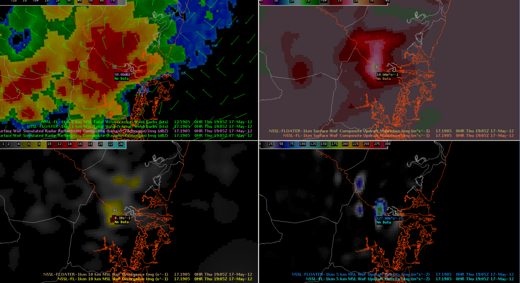
The 1-km U/V winds indicate 30-40 knot winds (perhaps a rear-inflow jet) nearing the coast, 19 m/s composite updraft strength, 159 m/s^2, and 10km divergence of 10.72 s^1. These values (particularly the updraft) are among the stronger storms we’ve seen this week. After some AWIPS 2 problems, a severe thunderstorm warning was issued after confirming these data with the KJAX radar.
NearCasting for JAX
We are focused on the JAX CWA today. While there is convection ongoing in the extreme northern portion of the area (bordering FFC and CHS), the GOES-R NearCast CAPE (new this week) and vertical theta-e difference suggest that the southern half of the JAX CWA is more conducive for new convection.
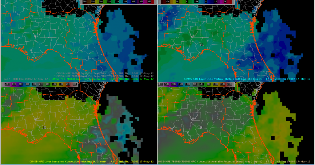
The NearCast has been challenging to interpret this week due to interpretation confusion (are negative versus positive theta-e differences indicative of instability) and then a mid-week visualization change in AWIPS 2. The NearCast shows promise for helping with the tremendously-difficult 1-6 hour timeframe, but the product stability has presented a problem.
EWP Daily summary: 2012 May 16
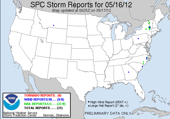
We focused operations in both the Burlington, VT and Albany, NY CWAs ahead of a strong upper-level storm and cold front. Stephen and Todd started issuing warnings with the help of MRMS MEHS product in northern Lake Champlain at 1820z. Shortly afterwards (1915 Z) Brian and Julia issued a SVR warning in Herkimer county, NY following indications of a three-body scatter spike and dual-pol hail signatures. Neither the MRMS or 3DVAR showed strong storm indications. But Brian noticed storm top divergence > 9.5 s^-1 in the storm top. Both storms produced hail ~1″ in diameter but no wind reports. Ten minutes later, the UW CTC showed large negative values in eastern Hamilton County, NY as the storm continued east.
Both teams kept issuing severe tstm warnings as the storms continued east and new ones developed west of Albany. The BTV team noticed that CI was useful for areas where outflow initiated new storms far enough away from old thunderstorm anvils. They also liked using the 3DVAR vertical velocity. One severe storm with a MEHS of 2″ showed updraft strength of 14 m/s at 2018 UTC over Essex County (BTV’s area). They also noticed max updraft preceding max reflectivity by up to 20 minutes. Meanwhile Todd and Julia focused on peak storm top divergence in 3DVAR. Todd believed that product actually helped with lead time before reports arrived. The Albany team thought the MRMS azimuthal shear, and the 3DVAR updraft vorticity was useful in identifying intensifying storms. They also found the nearcast theta-e differences successfully flagged the ridge of instability going up the Hudson Valley.
As the action wound down in BTV, Todd and Stephen worked with the CI team on flagging new convective initiation along the tail end of the front in northeast Arkansas.
Some limitations came out too. Julia found that the 3DVAR barely perturbed the flow around a bow echo east of Saratoga, NY. So she used traditional radar interpretation to assess the storm. The Albany team would also have liked a quick cross-section ability. Julia issued a flash flood warning but didn’t use the new products in the decision-making namely because she had no familiarity with how they may be used for that kind of product.
The Albany team also had issues with CAVE and Warngen with occasional crashes and slowdowns.
The beat GOES on
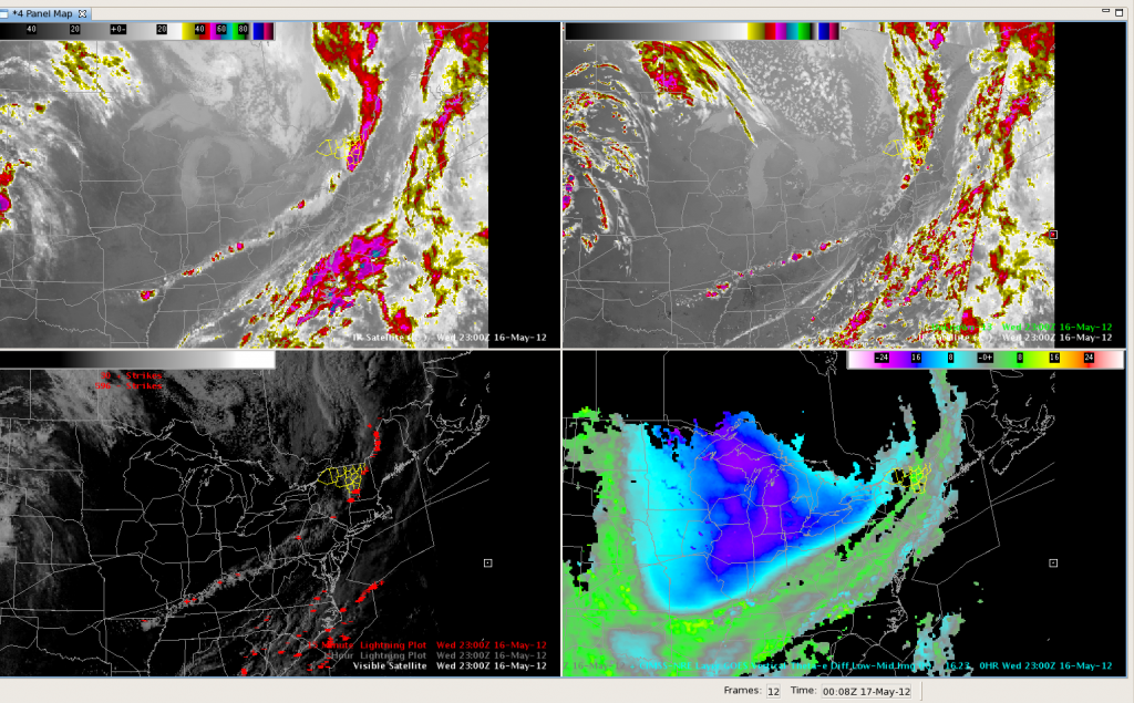
The synthetic imagery did a nice job of placing convection southward along the cold front through the Ohio and Lower Mississippi Valleys. Here’s a screen capture from 2300UTC, with the actual IR on the upper left and the model forecast on the upper right. Visible imagery with lightning is shown in the lower left pane, with the theta-e Nearcast product on the lower right. All in all, the GOES products did well today depicting where convection would be in relation to the cold front. This would be an excellent application to the CWSU environment for air traffic planning purposes.
Max Updraft preceding Max Reflecitity
Late in the afternoon, as convection continued along the southern fringe of BTV’s county warning area, a storm cell began pulsing up and down. This series of images shows how the max reflectivity on radar and the maximum updraft output from 3D-VAR began oscillating. Maximum updraft strength from 3D-VAR would precede a peak in radar reflectivity by about 20 minutes. We issued a warning for a southern BTV county, based on the Max Updraft data. The storm produced 3/4 inch hail.
2205z. Reflectivity is maximizing from a previous pulse, and current Max updraft values are less than 10 m/s.
2235z. Maximum Updraft values around 14 m/s. Max Reflectivity around 56 dbz.
2300z. Max Reflectivity back up to 60 dbz, while Max Updraft Strength continues around 18 m/s.
Dankers/Kearney


