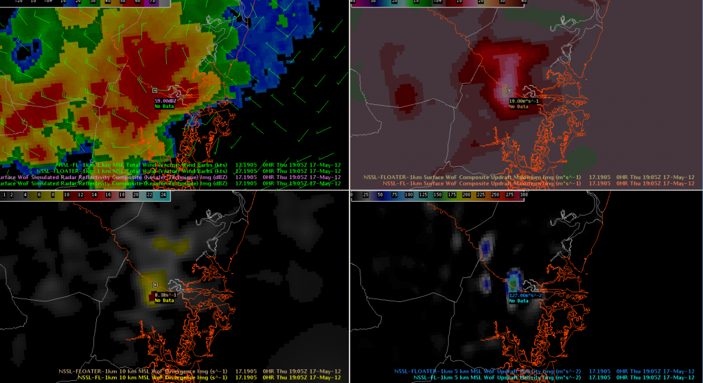
The first severe thunderstorm warning for the day for WFO JAX comes along the JAX-CHS CWA line in Glynn County, GA. The 3DVAR analysis indicates some of the strongest indicators seen this week.

The 1-km U/V winds indicate 30-40 knot winds (perhaps a rear-inflow jet) nearing the coast, 19 m/s composite updraft strength, 159 m/s^2, and 10km divergence of 10.72 s^1. These values (particularly the updraft) are among the stronger storms we’ve seen this week. After some AWIPS 2 problems, a severe thunderstorm warning was issued after confirming these data with the KJAX radar.

