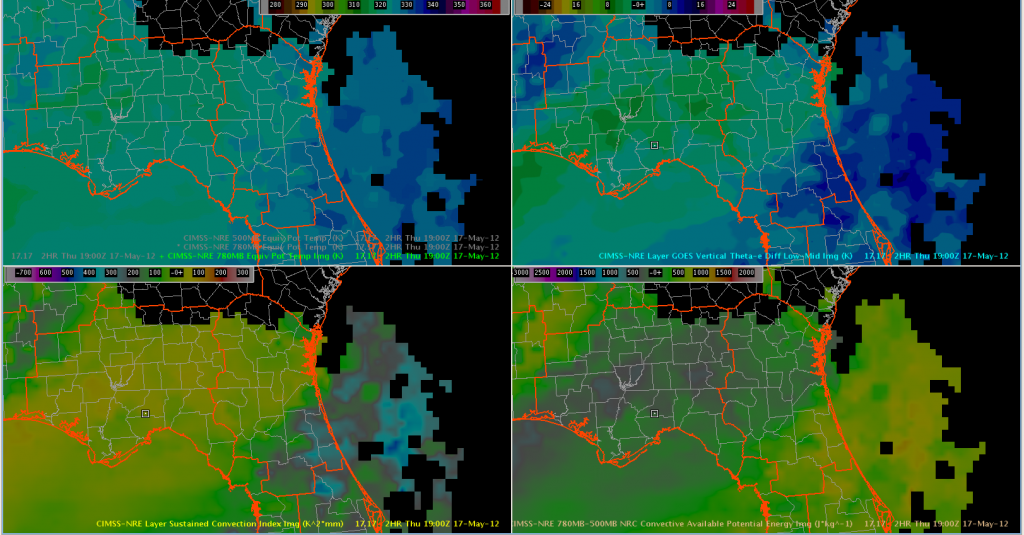
We are focused on the JAX CWA today. While there is convection ongoing in the extreme northern portion of the area (bordering FFC and CHS), the GOES-R NearCast CAPE (new this week) and vertical theta-e difference suggest that the southern half of the JAX CWA is more conducive for new convection.

The NearCast has been challenging to interpret this week due to interpretation confusion (are negative versus positive theta-e differences indicative of instability) and then a mid-week visualization change in AWIPS 2. The NearCast shows promise for helping with the tremendously-difficult 1-6 hour timeframe, but the product stability has presented a problem.

