Daily Summary: Week 1, Day 2

Today we had groups operating in  the Lubbock, Amarillo and Albuquerque CWA’s, where the most active weather was expected to occur. The Lubbock crew had the opportunity to evaluate the PGLM total lightning products which utilizes total lightning information from Lightning Mapping Array’s, one of which is centralized in the Lubbock area. The Albuquerque pair moved to San Angelo as convection advanced eastward through the late afternoon hours. The special, 18z Amarillo sounding provided participants with an opportunity to compare raob data with nearby NUCAPS soundings, which are available over the central US every day at ~19Z.

Tomorrow, we will start activities at 1:30 in the Dev Lab for the daily debrief before moving to the HWT to immediately begin operations. It looks to be an active severe weather day from Texas to Nebraska.
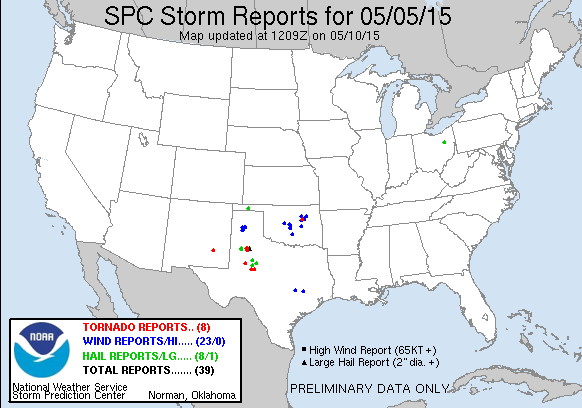
150505_rpts

– Bill Line, SPC/HWT Satellite Liaison and Week 1 EWP Coordinator
Tags: None

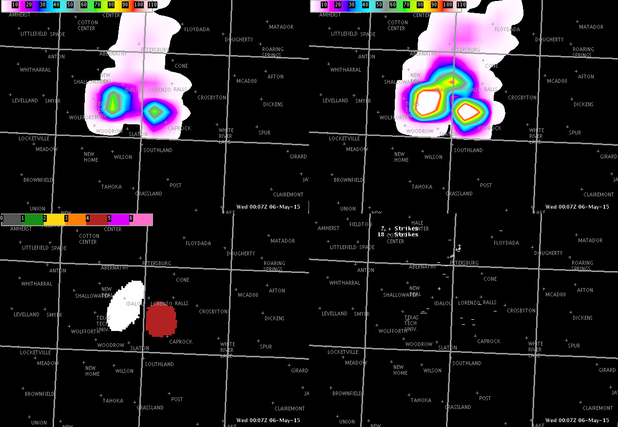
Lightning Jump and Flash Density…then a Tornadic Supercell Develops

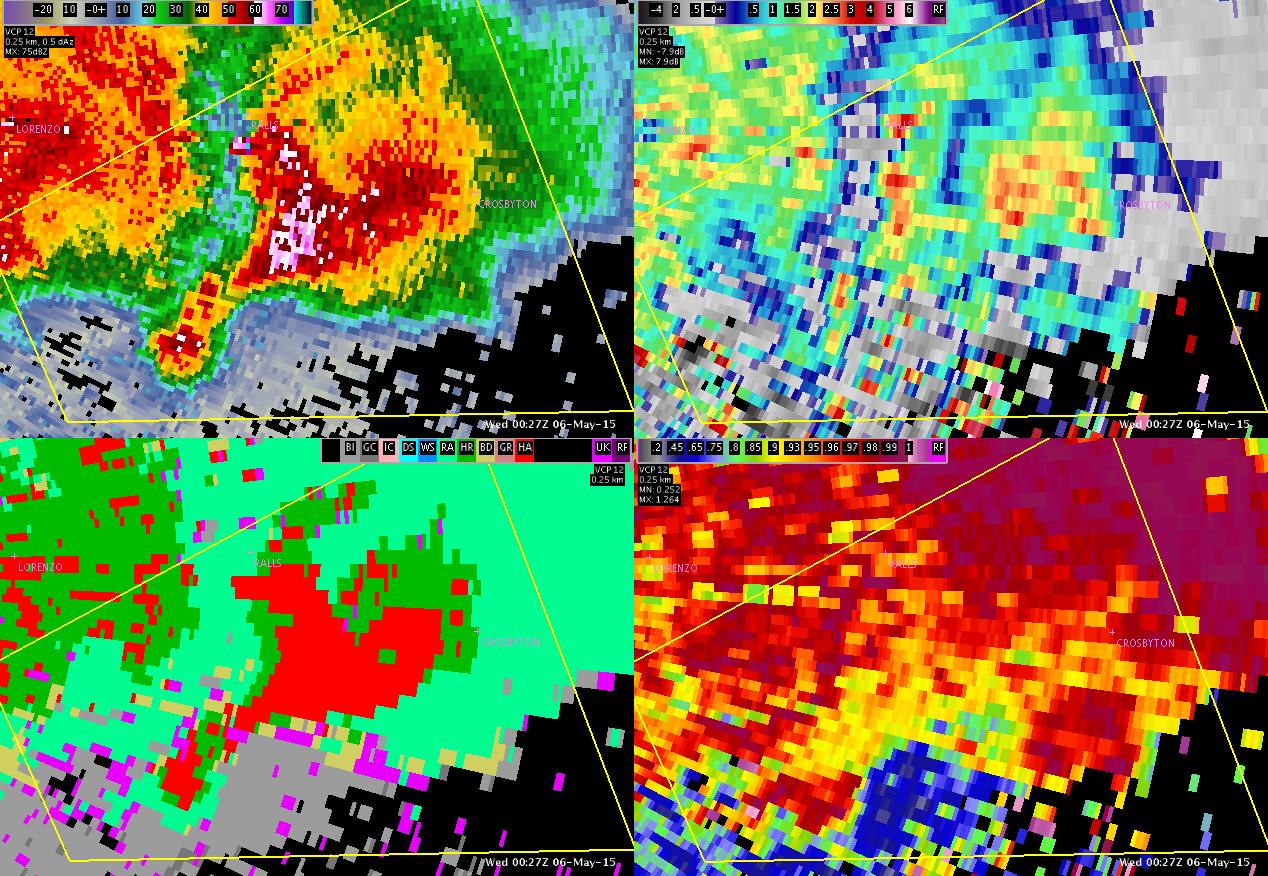
At 2353 UTC, a developing thunderstorm was seen on radar southeast of Lubbock.  At 0007 UTC, lightning jump data increased to 4 sigma.  At this same time, flash density increased to 70-80 flashes.  A warning was issued at 0011 UTC, based off the lightning data and radar data (50 dBz core at 33000 ft per MAF and low Zdr values per LUB).  ProbSevere increased to 87% at 0007 UTC also, and remained above 84%.  The storm took on a classic supercell structure and later produced a tornado.

LBBlightning LBBtornadopng

Tags: None

Update to First SJT Warning

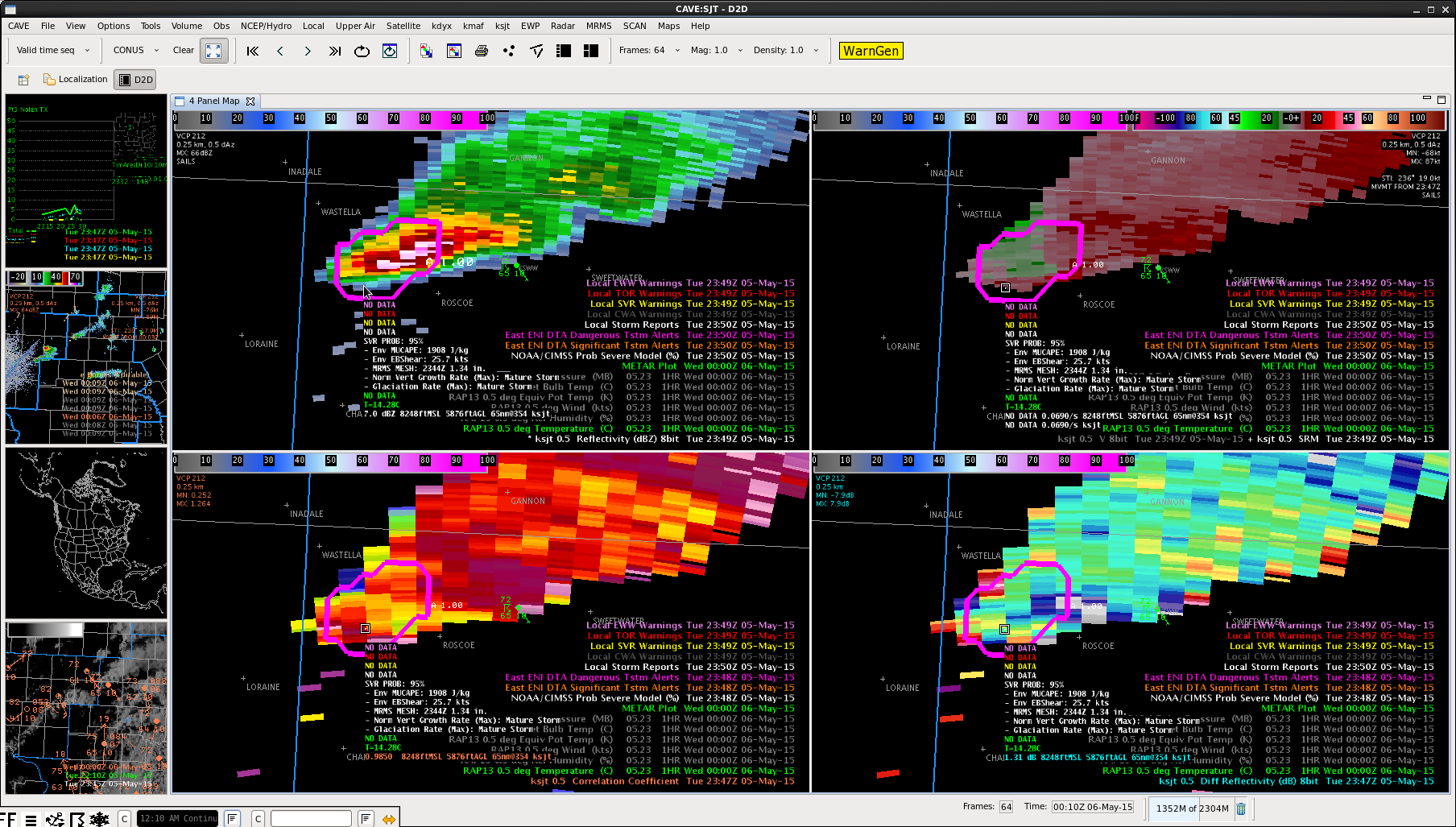
Had a storm report come in from 2mi north of Roscoe at 2350Z with 1″ hail within our warning. As indicated in the image below, the ProbSevere data was still indicating 95% severe probability at that time. That provided around 20 minutes lead time from both when the warning was issued and the ProbSevere value jumped above 90%. It looks like the MRMS MESH data was overestimating the hail size slightly (1.34″). -SRF

20150505_2350z_Radar_LSR

Tags: None

Severe Warning issued for Lubbock County 2323 UTC

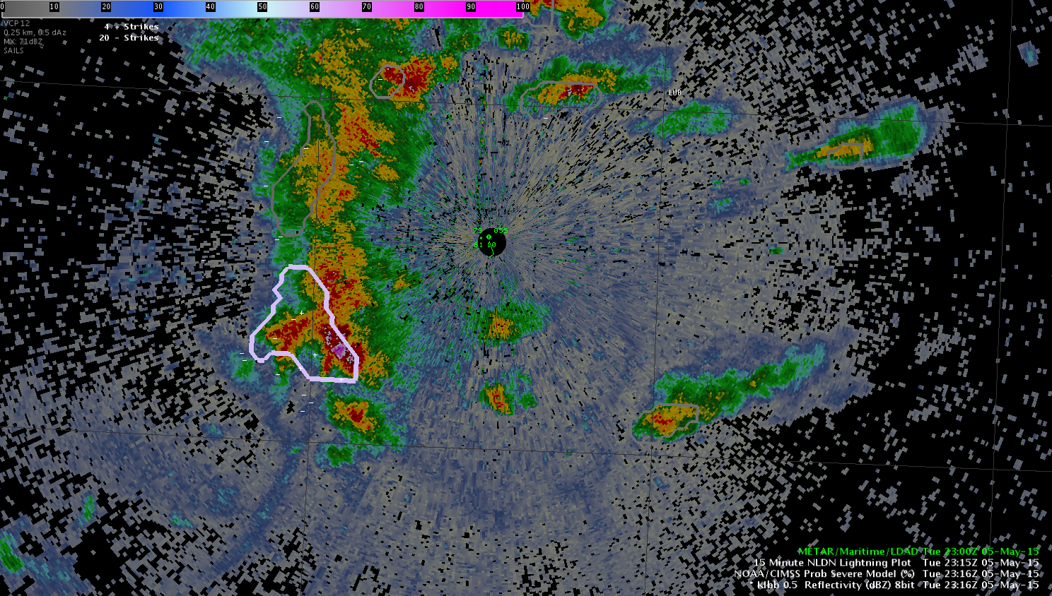
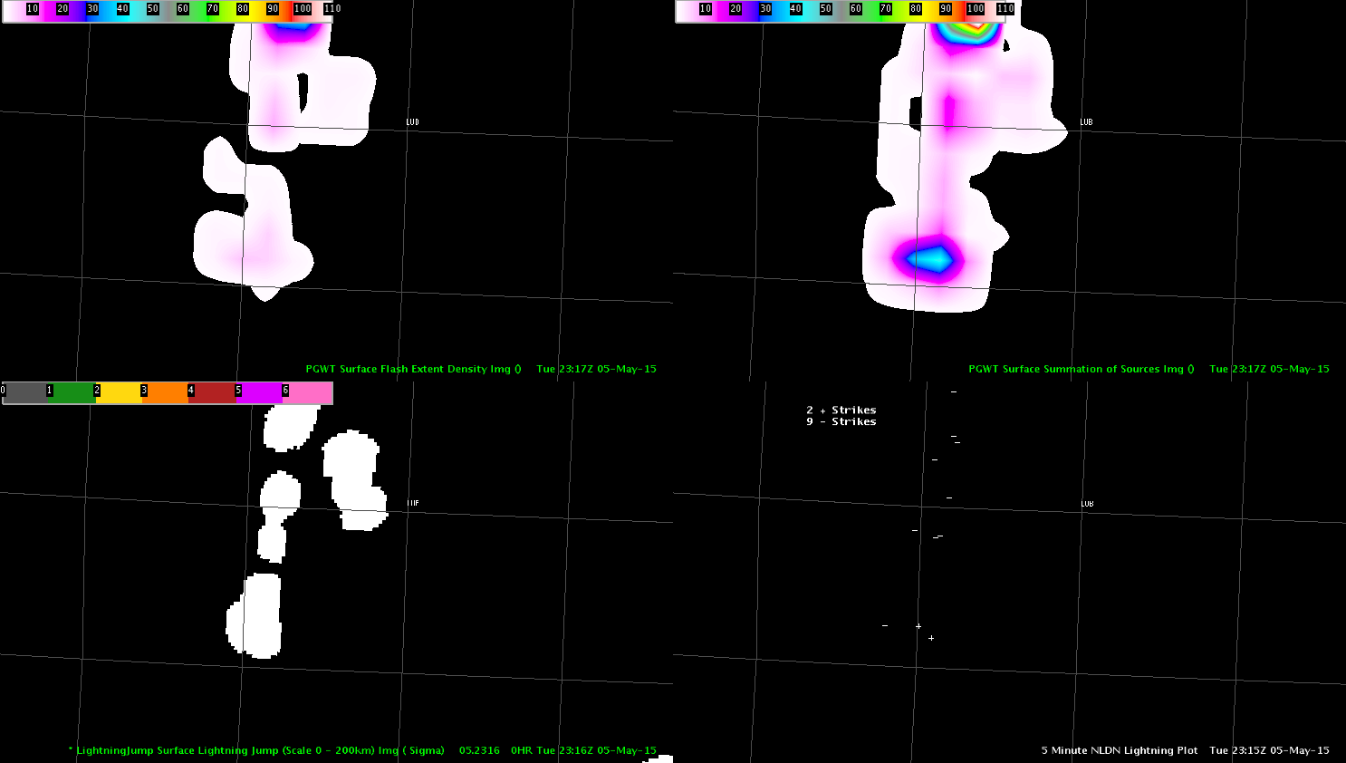
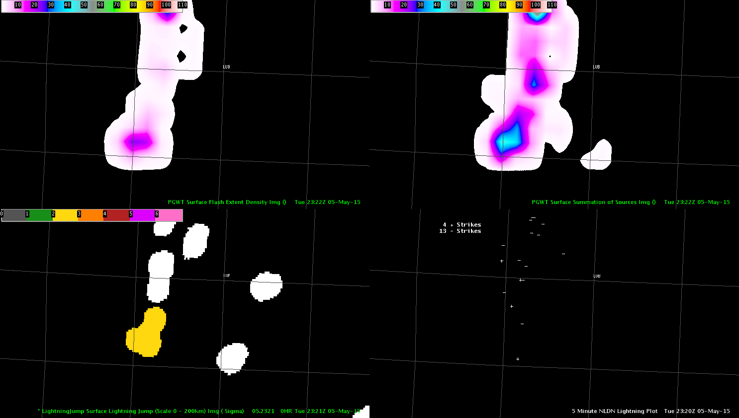
We decided to issue a warning at 2323 UTC for Lubbock county on a storm that was moving eastward towards the city of Lubbock. The ProbSvr increased to around 59% at 2316 UTC with a MESH of 0.76 inches.Radar_Probsvr_2316The PGLM data and Lightning jump data at 2316 UTC were not very impressive with flash density less than 10 flashes (upper left in the image below) and the Lightning jump showing values less than 1 sigma (lower left in the image below).

4pnl_PGLM_LTGjump_2316Based on the base radar data from the all tilts display off of the MAF radar (LBB was too close to the storm and not able to see the top of the storm), we began writing up a severe thunderstorm warning at 2320 UTC which was issued at 2323 UTC.  It was noted that at 2322 UTC the Lightning jump algorithm displayed a 2 sigma value on the storm (we did not see this is real time as we were writing up the warning), while the PGLM showed an increase in flash density to around 23 flashes which was still relatively unimpressive.

4pnl_PGLM_LTGjump_2322In this instance the PGLM and Lightning jump did not really provide any significant factor in the warning decision although the 2 sigma Lightning jump is a positive sign but in this instance did not outperform traditional base data storm interrogation.  A large hail report of 1.75 inches was received just southwest of Lubbock at 2333 UTC.

Jack Bauer

Tags: None

Warning Issued for SJT CWA

The cell that was diminishing as it crossed the border, started to show an increase aloft while finishing my previous post. That can be seen in the 2.4 degree scan from the SJT radar at 2317Z. That increase was noted before the ProbSevere began to increase and at this time it was showing 28%.

20150505_2317Z_SJT_Radar_2_4

That increase continued over the next couple of scans, but unfortunately a data issue with the MESH product (value dropped to 0.00″) caused the ProbSevere to plummet to 10% at 2327Z (after rising to 50% at 2322Z).

20150505_2327Z_SJTRadar_ProbSevere_DropOut

Even with that issue, the continued increase in the radar signature prompted me to issue a SVR for the storm at 2331Z. Right around the time the warning was issued, the ProbSevere quickly jumped to 94% and then 97%.

20150505_2332Z_SJTRadar_SVR

While the ProbSevere data dropped out around the warning issuance time, its arrival with high values right after the warning issuance supported the thoughts I had from the radar data. -SRF

Tags: None

DTA Polygons

If two or more DTA polygons are displayed for the same cell, only display the highest level DTA. This will eliminate some of the clutter due to numerous DTAs.

Multiple polygonsLynford

Tags: None

Surprising Lack of CGs

There has been quite a lack of CG lightning today. This slow moving cell that we have been tracking for hours (just go into our CWA already!) has been producing very little CG flashes. Even during the large lightning jump, there would be a CG flash rate of about 1/min, while IC was over 30 flashes/min.

Flash rate time series
0.5 deg reflectivity and 5 min lightning at 2212Z

Since then the cell has split. The left mover has pretty much dissipated. The right mover began to weaken, but has strengthened again and is finally going to move into the SJT forecast area.

SJT almost here
0.5 deg reflectivity at 2317Z

Maybe we’ll finally get to issue a warning!

-V. Darkbloom

Tags: None

SJT Force Field in Affect

After monitoring the cell over Mitchell County Texas for the last 1.5hrs, it has finally neared the SJT border. Unfortunately, over the last 15 minutes the cell has been quickly diminishing on radar. The first image below is from 2256Z and the second is from 2312Z. Note the drop in ProbSevere from 83% to 37%.

20150505_2256Z_SJT_Radar

20150505_2312Z_RadarSJT

While writing this post, starting to see some growth aloft so we’ll see if we are able to issue a warning on it. -SRF

Tags: None

Suggestion for Cell Flash Rates

We have been watching numerous cell along a line in the western CWA. The display would be less cluttered if the flash rates displayed were above a configurable threshold, for example do not display cells with a rate less than 10.

cluttered flash ratesLynford

Tags: None