


One report of half inch hail northeast of Beloit, KS, matched well with sub-severe base data radar interrogation and ProbSevere values hovering around 33%.

Brick Tamland – I love lamp!
Official websites use .gov
A
.gov website belongs to an official government
organization in the United States.
Secure .gov websites use HTTPS
A
lock (
) or https:// means you’ve safely connected to
the .gov website. Share sensitive information only on official,
secure websites.

One report of half inch hail northeast of Beloit, KS, matched well with sub-severe base data radar interrogation and ProbSevere values hovering around 33%.
Brick Tamland – I love lamp!
Still have a warning in place for the northern OUN storms. The storm farthest to the north has seen a weakening trend as it exited the warning, which matched a lowering in the ProbSevere data. Meanwhile, the other two storms still look severe on radar and match the higher ProbSevere data.

-SRF
While monitoring the two storms moving northward in our area across Saline and Lincoln counties, which is in the most favorable area for shear with effective shear around 300 m2/s2, we received multiple wall cloud reports and one lowering wall cloud report. However, the base data did not really indicate a severe thunderstorm regarding hail as the 50 dBz core was struggling to push through 20kft and no hail signature in the ZDR product and VIL values remaining below 50 kg/m2. Unfortunately, both the ICT and TOP radars were showing range folded data in the SRM product for these storms but both radar bean heights were above 7000 ft anyway and would not be representative near the surface anyway. The ProbSevere values never got higher than 17% on either storm and the ENI flash rates peaked at around 30 flashes with no DTA’s issued.
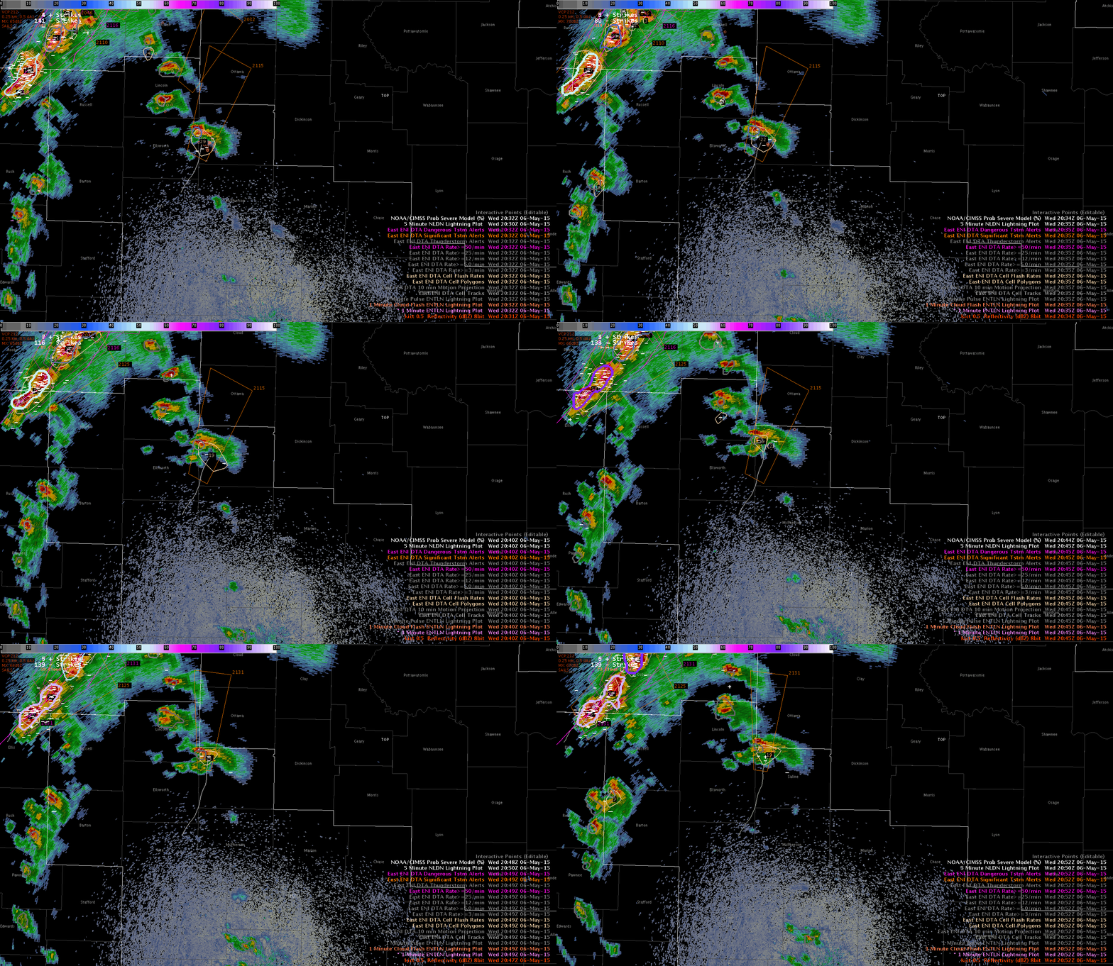
So in this case, I did not see anything in the traditional base radar data that would lead me to issue a warning, and the ProbSevere and ENI data did not support a warning so in this case I might be inclined to consider this a positive null from the experimental data.
Jack Bauer/V. Darkbloom
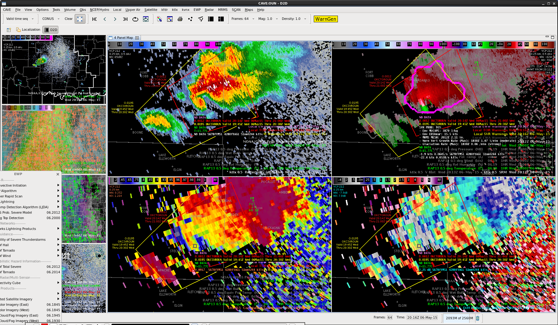
Northern storms have continued to develop and showed 2 sigma lightning jump at 2030z and Prob of SVR as high as 92%.

Lynford
Unfortunately the 1830Z pass of the NPP just barely skimmed the ICT area. The only points available in relatively clear air were on the western edge of the swath, so we are taking the data with a grain of salt.


The sounding after editing the surface data (used the nearby Dodge City obs)
Overall the sounding doesn’t look too terrible. The CAPE is way higher than the GOES-R LAP…in fact it was around double.

To compare a real (and way more impressive) sounding, here is the 18Z KOUN obs:

which had SB CAPE over twice the GOES-R LAPS values There was decent cloud cover at the time.
For what it’s worth, the 18Z RAP analysis was overdone in both locations, though much closer (within ~400 J/kg) near OUN compared to about 1,000 J/kg near our NUCAPS sounding.
-V. Darkbloom
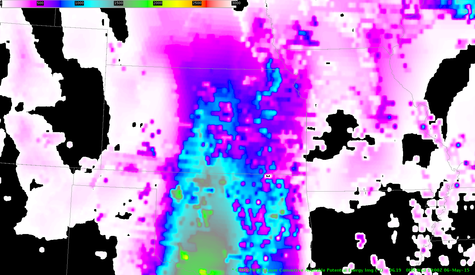
First glance at GOES-R products indicates a CAPE gradient from around 700 J/KG for the southern portions of the GID CWA to about 200 J/KG for the northern portions of the CWA. We had a satellite data outage affecting CAPE/PWATs at 17Z. The southern portions of the CWA remain in an area of confluence between southwesterly flow DDC area and southeasterly flow from the ICT/TOP area. Satellite PWATs remain above 1 inch across the region with surface dewpoints in the upper 50s to lower 60s. Initial look at radar indicates multicellular appearance for southern portions of GID. Viewed the adjusted NUCAPS sounding around 19Z and found CAPE values near 2000 J/KG. Biggest threat appears to be large hail, damaging wind gusts, and isolated tornadoes.

So far have noted a few hail cores aloft with All-tilts though ProbSevere has remained mostly below 50%. The westernmost SVR warning (#2) had 60 dBZ to near -25 C. One cell approaching from the south possessed rotation in the lower levels and thus we issued a TOR warning. ProbSevere for the TOR built as high as 64%.

Brick Tamland/Alexander Darkband
This being my first day really focusing on the ETN data, my initial thoughts on the thunderstorm alerts in the warning operations environment is that is can be useful to identify when storms are becoming electrified but I find myself gravitating to only looking at the DTA (Dangerous Thunderstorm Alerts) as opposed to all three thunderstorm alerts. As others have mentioned I concur that the length of time that the alert boxes remain on the screen is entirely too long (45 minutes). In some cases, the storm has completely dissipated or moved well outside of the alert box and the boxes become more of a distraction in my opinion. I think a reasonable time frame for the alert boxes would be 15 minutes or 20 minutes max.

Jack Bauer
Now evaluating this cell. Rapid intensification past 3 scans. Prob of Svr now 84%. 2 sigma lightning jump. 
Lynford
First warning issued. Solid structure with good storm top divergence and deep mesocyclone. Prob of Svr was 81% at 1944z with a MESH 1.10 inches. 1 sigma lightning jump at 19:37 and 19:39z. 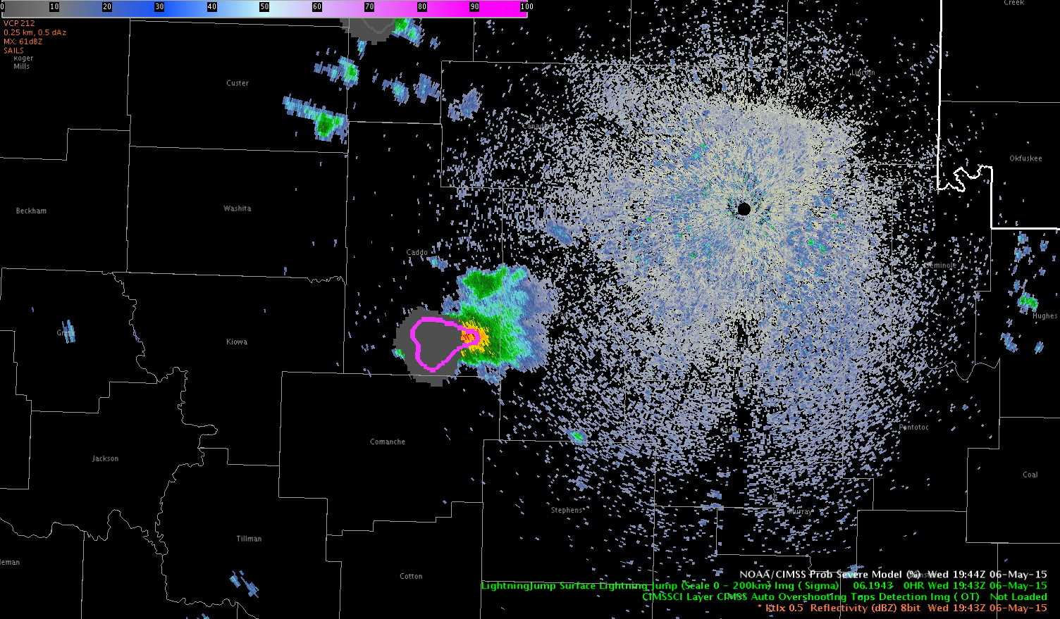
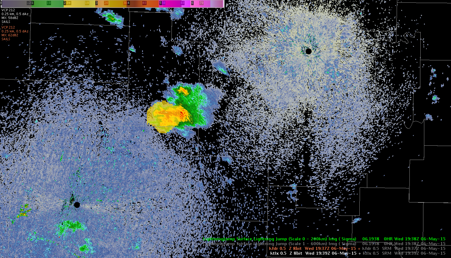
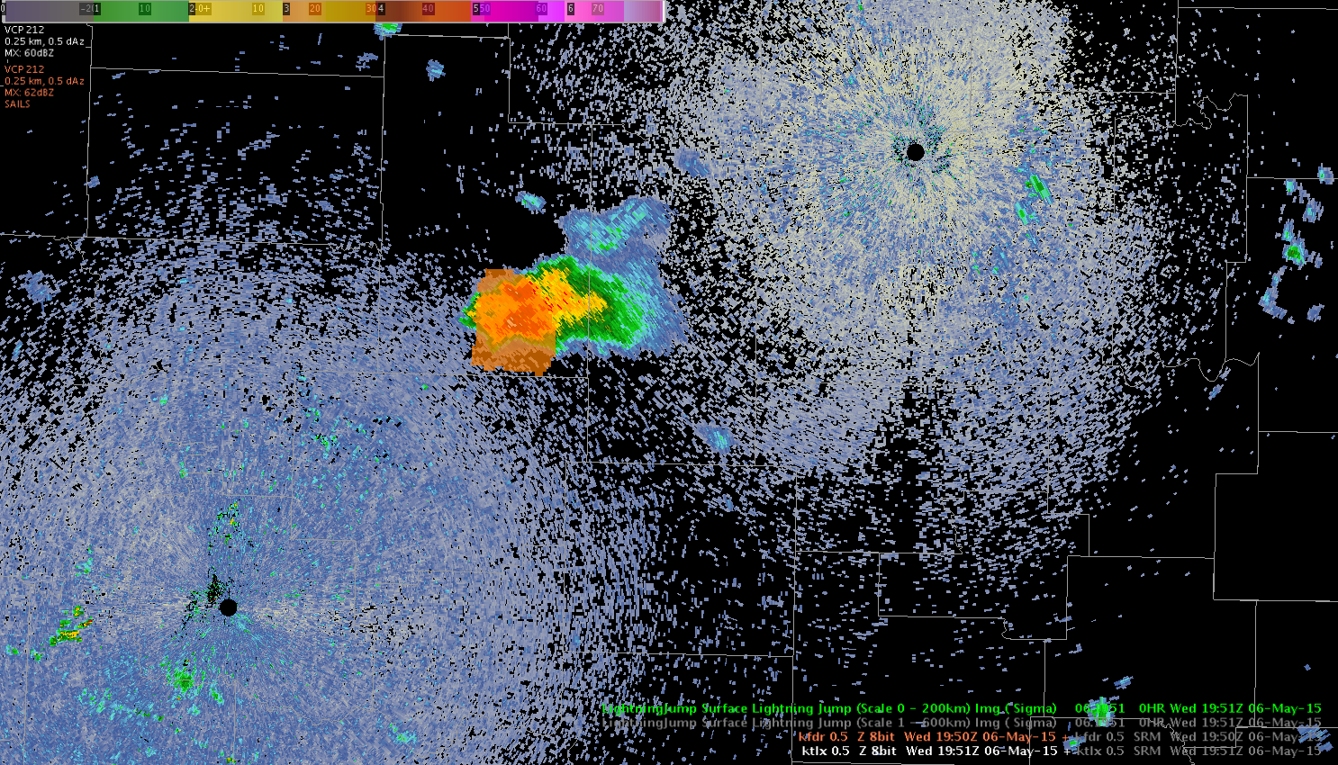
Also saw a 2 sigma jump at 1938Z, seen on the image below.
A tornado warning was issued just after 1950Z based off the latest radar signatures.
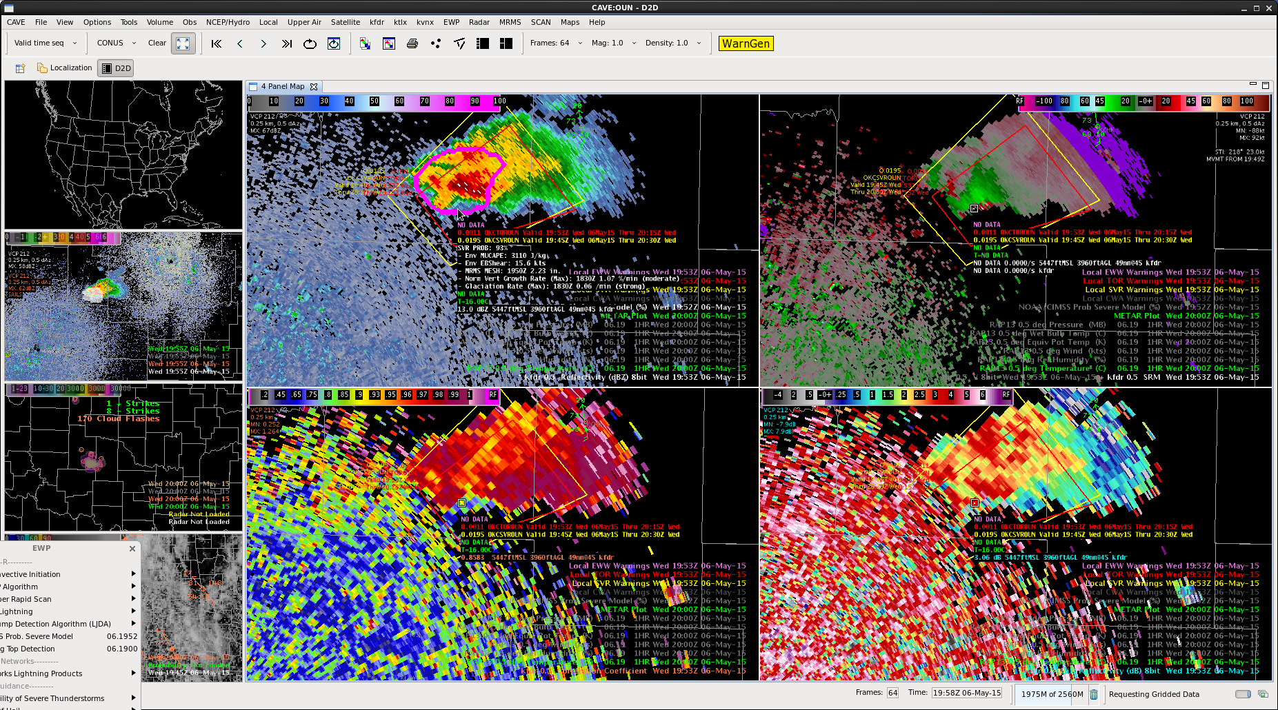
Shortly after that and as the tornado touched down, there was a 3 sigma lightning jump.
classic gate to gate rotation. 2 inch hail reported with this cell.
Lynford/SRF
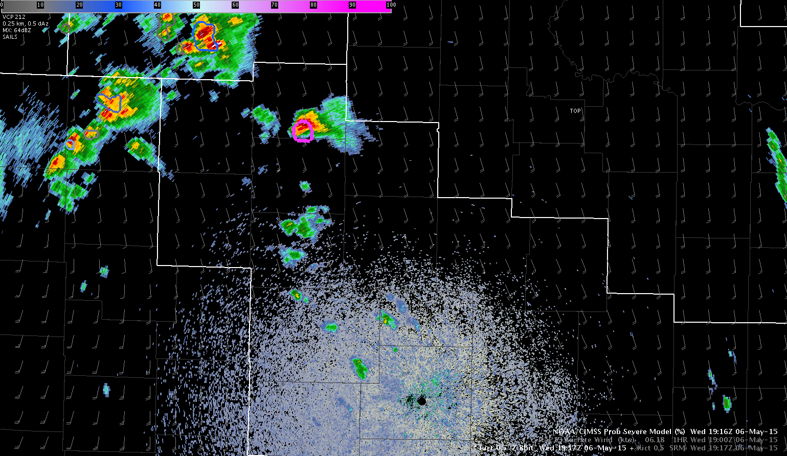
Upon sitting down at the desk today initialized as the Wichita WFO (ICT) there was a tornadic storm already in progress in the northern portion of the CWA, which had a ProbSevere of 82%. Since we are just getting set up and getting familiar with the environment we are going to assume that storm has been covered and monitor new convection as it develops.
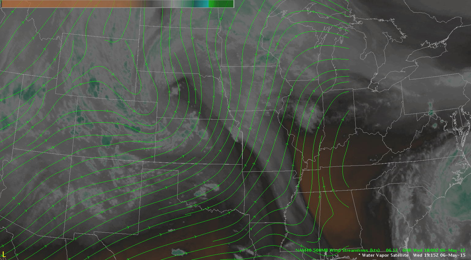
The water vapor imagery is showing a deep upper low over northeast CO with shortwave energy rotating across the central plains which is helping to initiate convection early this afternoon.
A special 18 UTC sounding from OUN shown below revealed strong instability with MUCAPE of around 2200 J/kg and favorable shear for tornadoes with 0-1km SRH values just under 200 m2/s2 and good directional shear in the lowest 2 km.
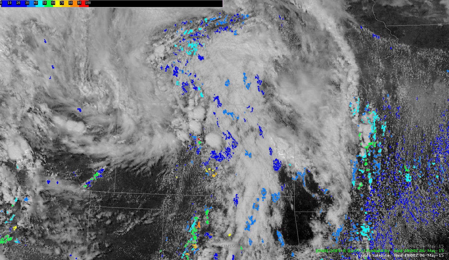
An initial look at the Convective Initiation product revealed some probabilities above 70% near Wichita at 1900 UTC and further to the west over the eastern portion of DDC CWA.
The GOES-R LAP CAPE product reveals instability is not quite as high over our area (but the trend has been increasing with more clearing of the clouds) compared to further south over OK but combined with the shear will be enough to support severe convection through the afternoon.
Jack Bauer/V. Darkbloom