Boulder FA Mesoscale Discussion

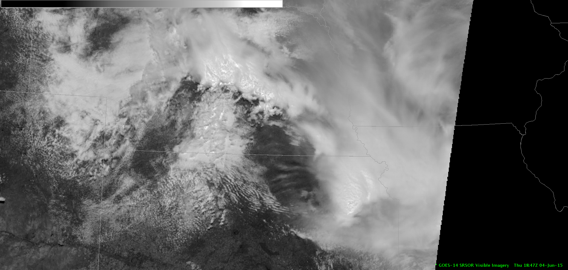
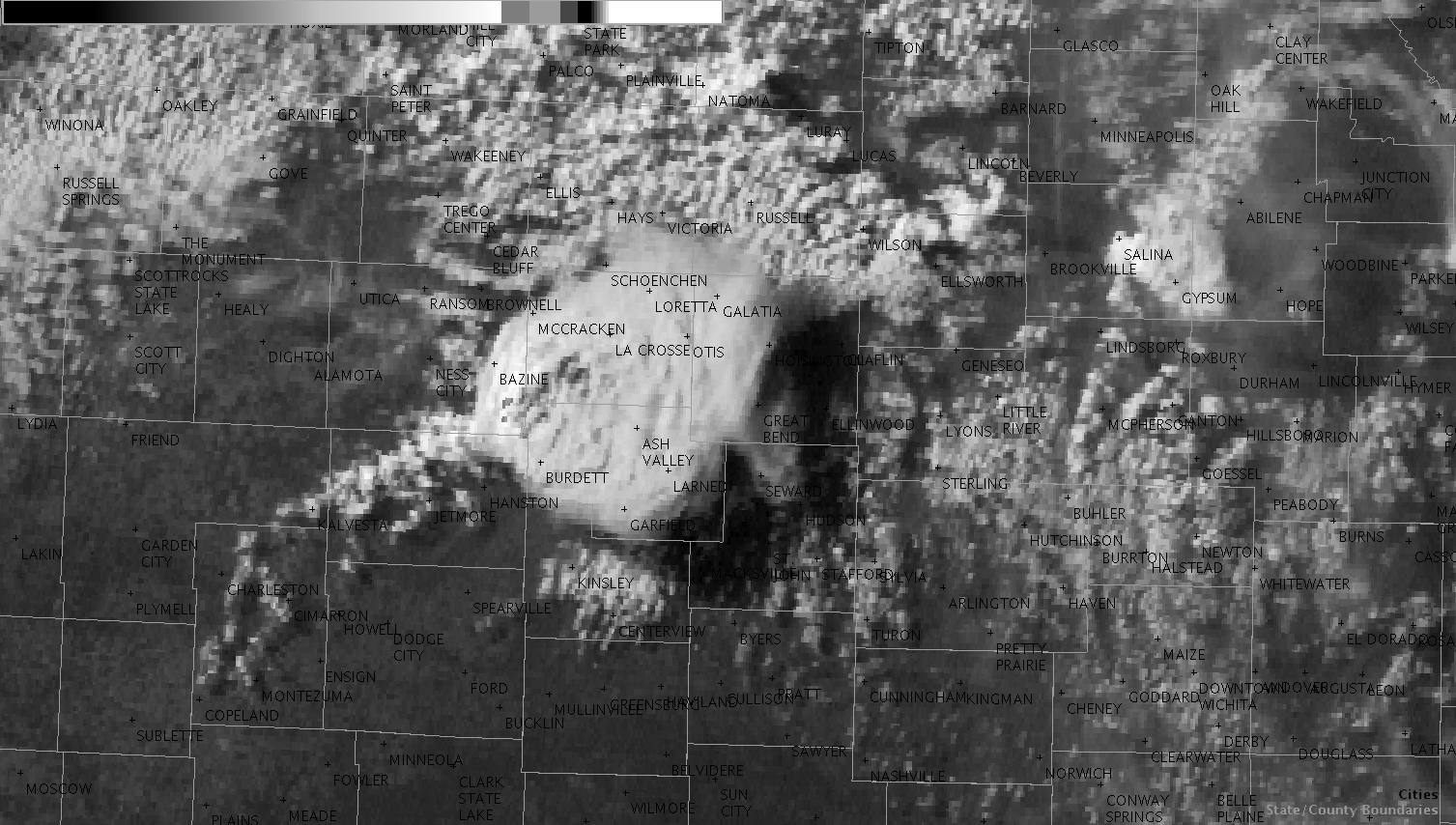
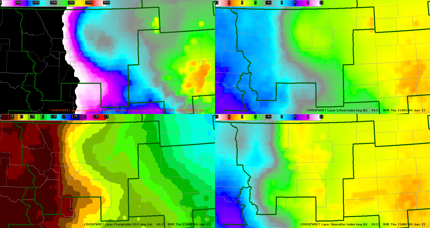
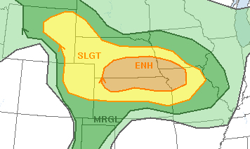
CIMSS products were helpful in determining which portions of the FA are most favorable for convection. The CIMSS PWAT, CAPE, LI, and SI values are all most favorable in the northeastern quadrant. CAPE is up to 2200 J/kg, LI values up to -7 and PWAT up to 1”. My initial analysis of only the CIMSS products is consistent with the SPC Day 1 Categorical Outlook which shows a slight risk over the eastern part of the FA and only a marginal and general area further south and west. 0-6 km bulk shear is also most favorable in the east/northeast quadrant with values up to 40 knots. This shear is sufficient to promote organized convection including supercells. The main threats today will be wind, hail and even tornadoes.

CIMSSBoulder

Screenshot6

-Helen Hunt

Tags: None

GLD AFD

Surface low moving into SW KS; progged to move over CWA through the afternoon and evening. Dew points currently in the 65-70F range in most of the CWA with temps of 75-80F. Cu field ongoing in NW CWA; sfc boundary bisecting from SW to NE both at surface and aloft.

Southwest flow at 500mb with weak shortwave troughs embedded in the flow. 12z DDC sounding has a large amount of CAPE above about 675mb (2700 J/kg) but has a large cap below. Convective temp is 95F.

HRRR shows 850mb winds rapidly increase this evening to 30kt by 00z in the eastern CWA; also indicates this is where convection would take place. NAM also shows this.

Based on surface obs and satellite trends, would expect the eastern CWA to indeed have the highest chance of convection.

Jason Williams & CoonieCatEye

Tags: None

Gravity Waves on SSRO

These gravity waves should lead to an interesting afternoon across the GID CWA.  The one min ssro data is EXTREMELY useful and helpful with trying to figure out what is going on.  I think these waves may lead to some CI or storm intensificationsatlater today.


MacGyver

Tags: None

Daily Summary: Week 4, Day 3

Today’s activities took us to Cheyenne, Boulder, and Jacksonville, with the Cheyenne group moving to Topeka before ending in Dodge City. The PGLM total lightning Flash Extent Density within the Colorado LMA in NE Colorado saw heavy use with storms that developed in the Boulder CWA. It was nice to have a group operate in the Jacksonville today as it allows us to demonstrate the tools in a different region of the US. This is important considering most of the experiment has been spent west of the Mississippi River thus far. This group, however, did not have access to the 1-min imagery, something they missed dearly! The Boulder group found it helpful to monitor the LAP PWAT products as  moisture quickly approached the front range from the east, tightening the moisture gradient leading up to convective initiation. The approaching feature was also apparent in the 1-min imagery. The NUCAPS, CI, ProbSevere and ENI Lightning products all saw use throughout the day as well.

– Bill Line, SPC/HWT Satellite Liaison and Week 4 EWP Coordinator

Tags: None

Warning decision for Camden Cty Cell (JAX)

While monitoring the cell as it shifted SE out of Brantley county, which also had large amounts of total lightning for several volume scans, I noticed that an inflow notch had begun to develop on the backside of the storms.  Having taught many SKYWARN sessions for our CWA, I knew this was indicative of a low level inflow jet working into the storms.  I also noticed that the low level SRM was increasing.  When you see the loop of both the 0.5 degree reflectivity and SRM, you will see the bulge working south out of the storms.  Based on this, I issued an SVR for northwestern Camden county at 730 PM EDT, expiring at 815 PM.

JAX_0.5_Ref_Loop_3Jun15

JAX_0.5_SRM_Loop_3Jun15

WFO JAX received a spotter report of a tree down due to strong thunderstorm winds at 755 PM EDT one mile N of Tarboro.  Verified!

CoonieCatEye

Tags: None

Large increase in pGLM lightning and strong supercell growth.

Saw a rapid increase in pGLM Flashes(106/1min) and then witnessed a very strong increase in reflectivity and supercell with a hook appendage. This definitely got my attention and ended issuing a SVR for it. –CattywampusgGLM2

Fig 1: (Gif loop) Rapid pGLM increase in NE Douglas.

supercell

Fig 2:  (Gif loop) Subsequent supercell development. Loop to long (sorry) its the last warning in the series.


Tags: None

ENI Time Series and Prob Severe Influence Warning Decision

I noticed a very dramatic increase in lightning activity and prob severe as a storm approached the Jacksonville FA (from Lanier County), so I decided to go ahead and pull the trigger on a severe thunderstorm warning. The prob severe didn’t quite make it to the 80% threshold (only 78%), but since it accompanied the ‘lightning jump’, my confidence was higher that it was intensifying and was capable of producing severe weather. There was also an overshooting top associated with this storm as seen by the overshooting top detection.

The warning has not verified yet. ENIlightningjumpprobsvrwarn(Click image to see animation)

-Helen Hunt

Tags: None

Vigorous updraft well sampled on 1 min imagery

dodge

The persistent cell over eastern Kansas shows good evidence of strong updrafts on the shadowed 1 minute imagery.  Deep convection with good evidence of rotation on radar imagery likely is producing severe hail.  CIMSS algorithm currently shows 99 percent likelihood of severe with hail size hear 2 inches.

John Pendergrast

Tags: None

Huge increase on PGLM prior to DRC?

Might have had a DRC from 2346z to 2354z on our middle cell. PGLM values of around 30-40 were present in the storm’s core at 2345z, jumping to 57 two minutes later, 70 at 2350z, and 99 a minute later. Possible hook echo showed up at 2359z and persisted through this post at 0007z.

Jason Williams

Tags: None