Still Watching and Waiting in Amarillo…

Ok, well we’ve gotten some recent cloud-top cooling amounts from clouds in Randall County, TX.  Cloud top cooling rates as low as -17C/15 min were observed in Randall County as the outflow boundary moved across the area, as indicated in the image below.

Image 1.  GOES Visible image and CIMSS Cloud Top Cooling valid 1955 UTC. METAR observations are included.
Image 1. GOES Visible image and CIMSS Cloud Top Cooling valid 1955 UTC. METAR observations are included.

Also, notice the rather distinct theta-e ridge still present and extending into Randall County. per the LAPS data (image 2 below).  We’ll see if these products allow for an appropriate focus and help predict likeliest locations for eventual development.

Image 2.  2014 UTC MRMS Merged Reflectivity QC Composite and 2015 UTC LAPS 2.5km Sfc Theta-e.  METAR observations are included.
Image 2. 2014 UTC MRMS Merged Reflectivity QC Composite and 2015 UTC LAPS 2.5km Sfc Theta-e. METAR observations are included.
Tags: None

For LUB’s CWA, Watch Out Garza and Eastern Lynn Counties (SW of Current Supercells)!

Watching for potential development SSW of current supercells over Floyd, Dickens, and King counties to the NE. CTC shows potential. Cirrus anvil across the NE CWA will likely inhibit any CTC effectiveness. LUBCTC2015Z

Unfortunately, GOES_CIMSS Nearcast (either E or W) data did not extend further enough east across the LUB CWA to be effective with this event. (see 2030 UTC CIMSS W projection below).

LUB_CIMSSNearcast*

If the Garza area was to develop quickly, the OUN_WRF project indicates 0-1KM SRH to 200-260 m2/s2 which mean environment would be favorable for rapid rotation and potential tornadoes like earlier storms to the north.

LUBOUNWRF2130Z

We continue to monitor development closely.l

Martello/Zimmerman


Tags: None

Warning Decision MESH vs HSDA vs Alltilts vs -20C

Slide 1: 1855Z Based on Donovan method we would be issuing a severe thunderstorm warning when the 50 dbz core reached 26,000 to 28,000ft based on a freezing level of around 10,000 to 10,600ft agl. This would have been enough for me to issue a thunderstorm warning at 1855z.

AllTilts

Slide 2: 1858Z HSDA shows large hail for the 1st time.

HSDA1859Z

Slide 3: 1902Z MESH indicates 1″ hail for the 1st time.MESH1902Z

Slide 4: 1918Z The -20C level gets a 60dbz return for the 1st time.

20C1918Z

Summary Verification: Our 1st quarter size severe hail was reported at 1923Z with the first Golf ball size hail report at 2004Z. There was lead time no matter, which method or combination of methods would have been used on warning for this storm. The MRMS products did offer a quicker diagnostic overview of the storm than having to look at multiple height scans as we commonly do with the Donovan method.

Wesely

Tags: None

Tornadic Storm Fires Off Old MCS Outflow Near Floydada, TX

Strong convergences initiated northeast of Lubbock, TX near Floydada in Floyd County.  CTC product caught -16-17K/15 min around 18:15 UTC on this storm. Tornado warning was issued 19:21 UTC which resulted in 1 hr/6 min lead time if you had warned initially off the CTC projection.

LUBCTC

CTC product W/Visible Satellite

The OUN_WRF progged Surface Merged Reflectivity Composite also nailed the point of storm initiation around 1900 UTC(See image below).

OUN_WRF19Z

Below is the 1900 UTC 2.5KM Theta-E image clearly indicate moisture converging near the point where this supercell developed up through Floyd and Brisco counties northeast of Lubbock. Also, the wind fields verify that there was like good moisture convergence in this same area.

2.5KMLAPS19Z

Some of the MRMS (MESH/30 min MESH swath) and HSDA (0.5 degrees showing potential for large hail as well) real-time data gave quick indications that this atmosphere was volatile and showed the storms potential with little latency at 1900 UTC.

LUB4-PanelMRMS_HSDA19Z

This storm has already produced quarter-size hail at 1923Z and a few land spouts (weak tornadoes).


Tags: None

Howdy Y’all! From the TX Panhandle!

Well, there’s a severe thunderstorm down in the Lubbock CWA and all is quiet here on the northern front…way down south in the TX panhandle that is.  Anyway, an outflow boundary has moved across the area and appears to be settling in west-central portions of the TX panhandle so far.  The image below shows the latest GOES-15 Vis image combined with the 2.5km LAPS theta-e (1845 UTC).  METAR observations are laid atop the image (1900 UTC).  Hopefully, you can notice the reddish colors in the southwest part of our CWA just south of the Amarillo area.   A strong theta-e ridge extends from the Lubbock area into the southern portions of our area per the LAPS data.  So, we’ll be watching that area and the leading edge of the cu field in assoc/w the outflow for development.

LAPS 2.5km Surface Theta-e combined with GOES-15 Vis imagery.  METAR obs are included.
LAPS 2.5km Surface Theta-e combined with GOES-15 Vis imagery. METAR obs are included.


Kris

Tags: None

EWP Mesoscale Discussion May 23 2000 UTC

Morning convection has departed the OUN area… and a cooler outflow air mass is now in place across much of Oklahoma.  Warm, humid air is located to the east of a dryline and to the west of the outflow boundary with dew points approaching the mid 60s all the way to the I27 corridor.  East winds are observed ahead of the dryline on LAPS imagery bringing an upslope component to the surface flow.

Convective initiation has begun to develop in Floyd County TX…  and coverage is expected to increase as the afternoon continues along an axis of rich theta-E air indicated on LAPS imagery stretching from Moore County TX to a maximum in Randall County TX and to the south-southeast towards Jones County TX.

1845ZThursThetaEWinds

Early convection has been noted to be fairly robust…  with a -17 C/15 minutes cloud top cooling noted with the Floyd County storm and a MESH exceeding 1 inch about 30 minutes later and now with a MESH of 1.73 inches.

OUN WRF indicates a bigger threat of storm splitting which would suggest the main threat to be large hail…  while the 1 KM LAPS shows robust updraft helicity in the Texas panhandle, suggesting risk of tornadoes in the warm sector air just west of and along the outflow boundary.   One brief touchdown was recently reported near Cedar Hill and mid level rotation tracks have noted to be increasing in strength.

OUNWRFhelicity2115Z

Thurs2000ZLAPShelicity

Simulated satellite imagery and short term models indicate that convection will develop quickly by 23Z along much of the dry line and moving slowly to the east.  In addition to the hail and tornado threat…  as the line congeals into a convective system in the evening hours…  a wind threat is likely to develop as well.

ThursSimSat2300Z

OUNWRFWindThreat

– Sears/McCormick

Tags: None

Initialization in TX Panhandle

Texas panhandle is the area of main focus for the first part of this afternoon. Analyzing CI, as seen below, indicated development was expected to quickly form by 19z.

Image 1 – CIMSS CTC prior to CI around 18z.

beforeCI

Image 2 – Cloud Top Cooling at the time of CI over the central parts of Texas panhandle around 1815z. Values right around -17oC.

afterCI

Image 3 – Vis sat around 1815z, with CI. Vis at 1845z shows the explosion of the storm in the panhandle, with the CTC product thus providing around a 30 mins lead time.

visafterCI

Image 4 – With the radar products unavailable at this time, using MESH and probability of severe hail to show the development of the storm to severe levels.  The CI on CTC developed around an hour prior to the MRMS products reaching severe levels.
meshprobsvrafterCI

Tags: None

EWP Status for 23 May 2013: 1-9 pm Shift

EWP Status for 23 May 2013: 1-9 pm Shift

Action in the TX Panhandle and W OK on Thursday for our last operations shift of EWP2013.  A mid morning MCS over OK may leave an outflow boundary in the eastern PH. As the uppre level ridge axis moves to the east, a more favorable deep layer shear profile will emerge, with a chance of supercells.  Large hail will be the main threat, but tornadoes cannot be ruled out.  Good opportunities for CI produvt and PGLM product evaluation also exist.

Possible CWAs:  Lubbock, Amarillo, Norman

G. Stumpf, Week 3 Coordinator


Tags: None

WRF Simulated Satellite at 23 UTC

The WRF simulated satellite image forecast for 23 UTC (top) compared well with the observed IR satellite (bottom) with respect to the mid-level boundary location across Indiana.  However, it did not handle to convection well which formed over PA.  Instead it showed more convection east of the higher terrain across MD and northern VA.

23zWRFsimIRsat

23zIRsat

Tags: None

EWP Mesoscale Discussion 2200 UTC

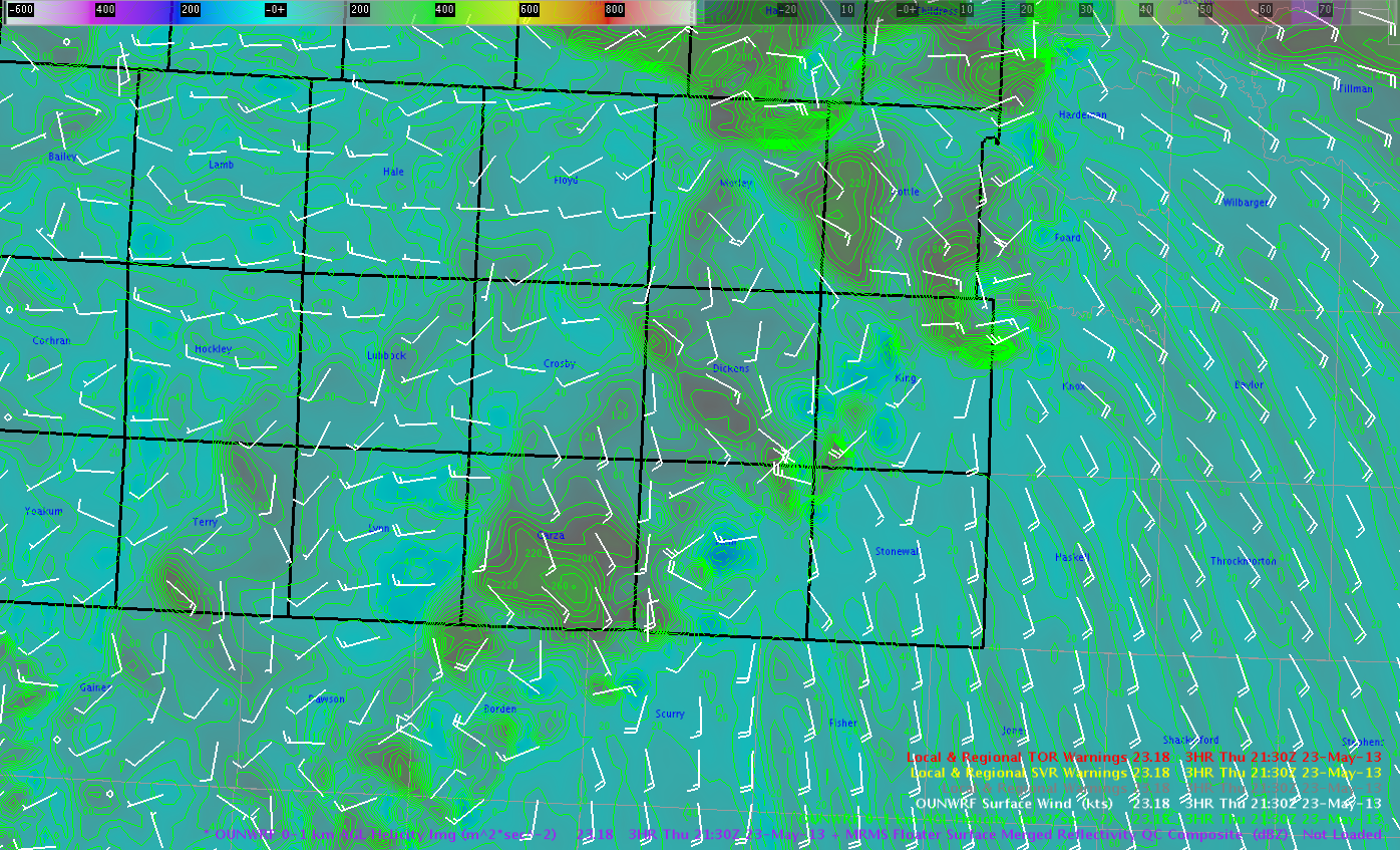
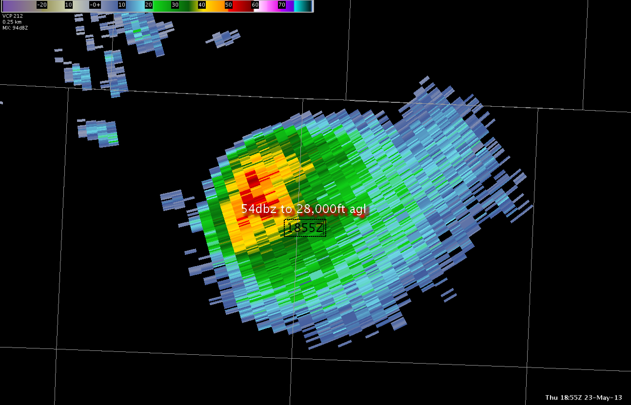
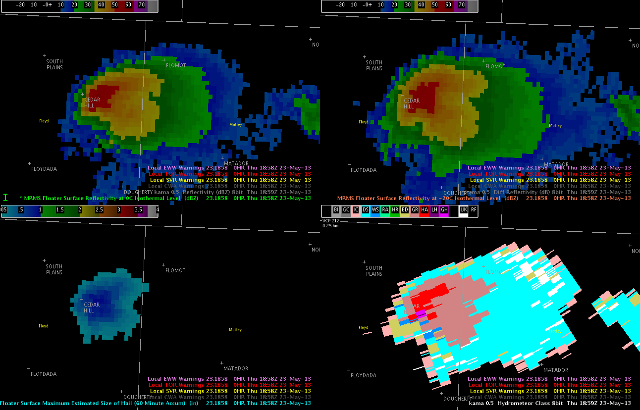
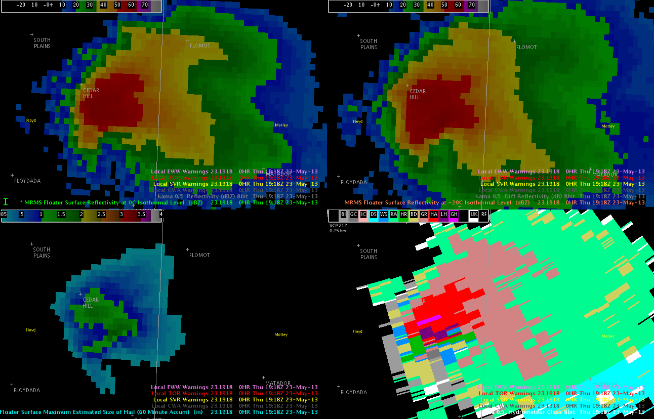
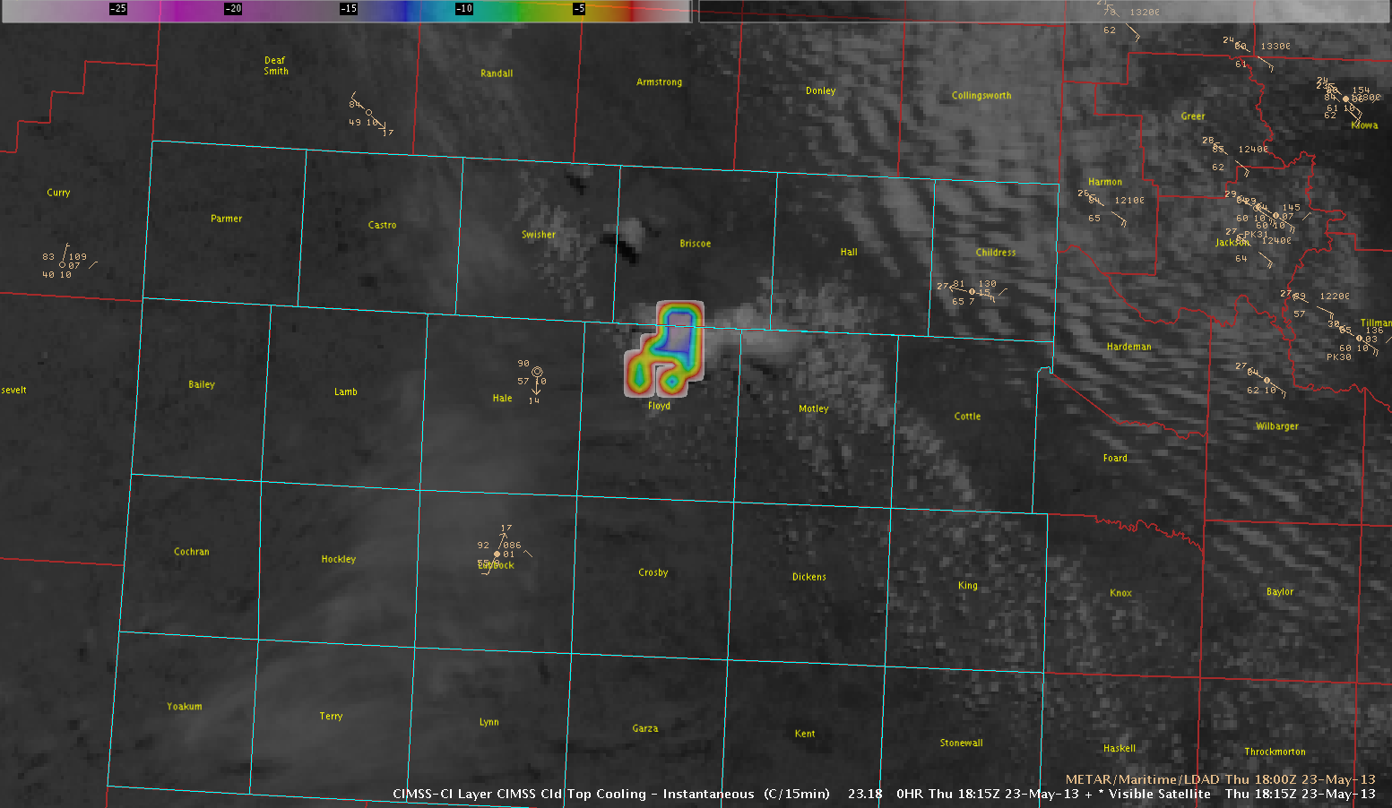
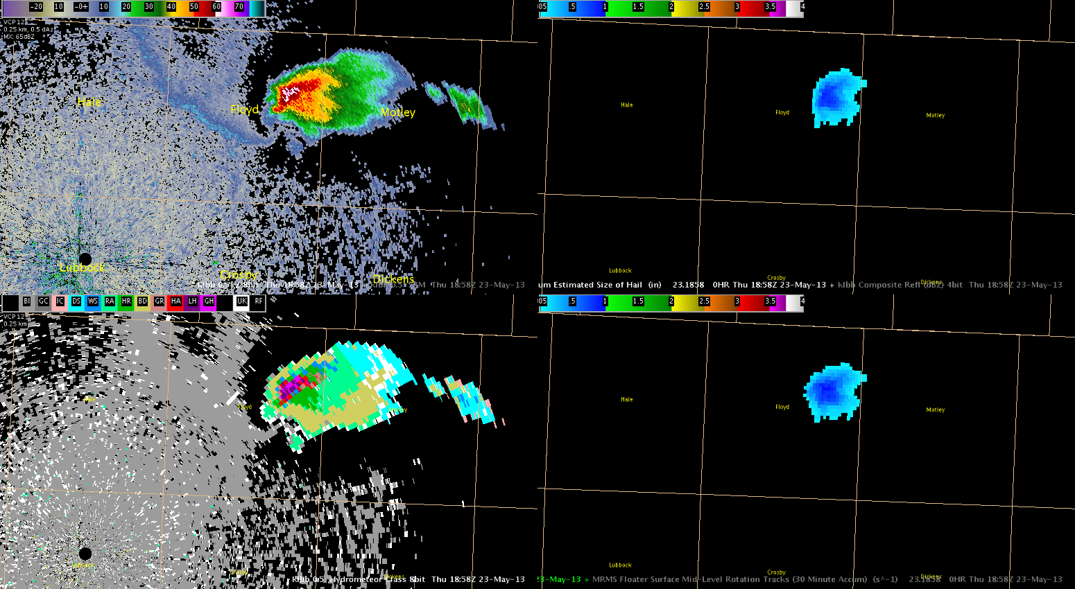
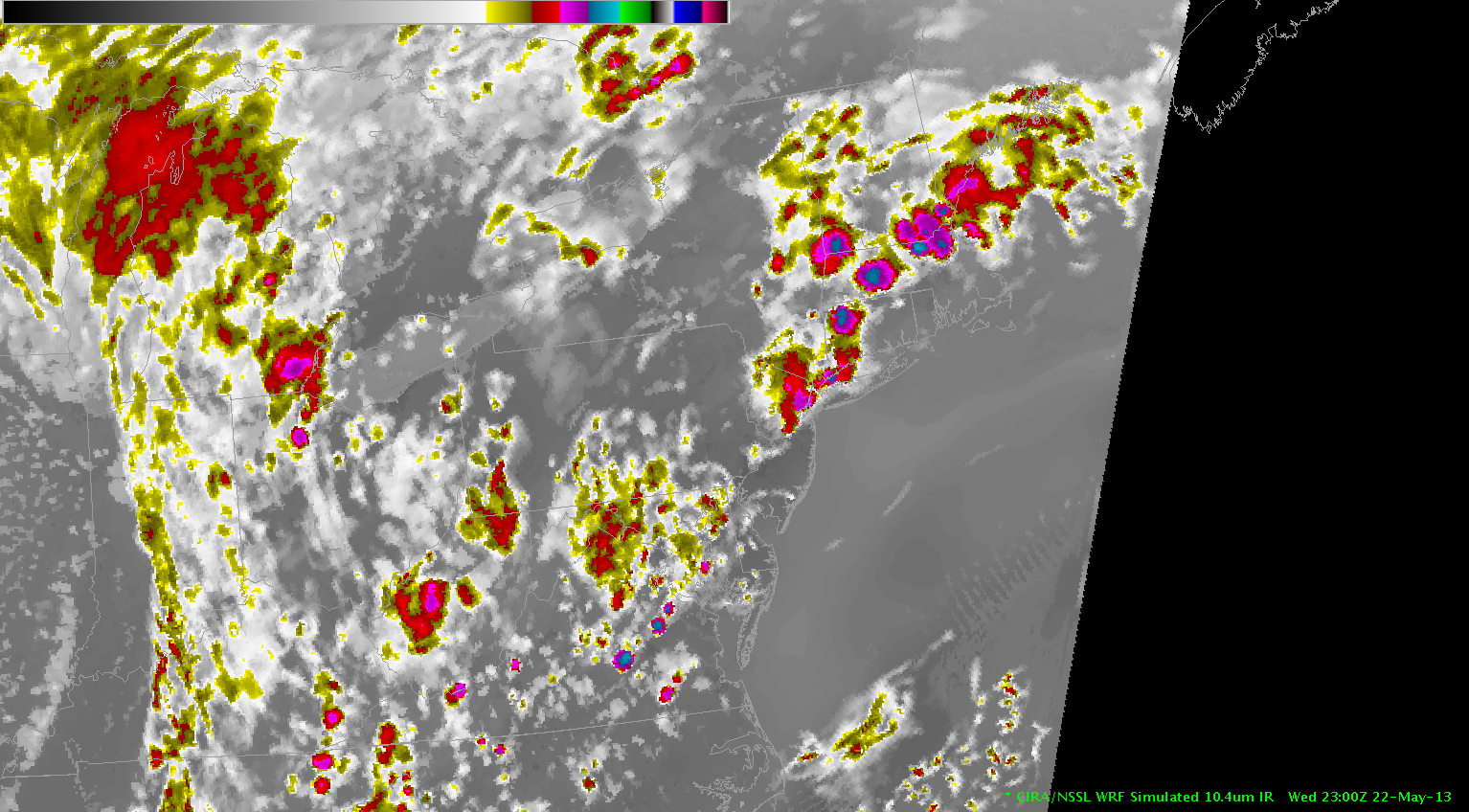
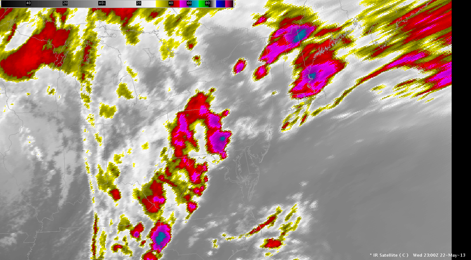
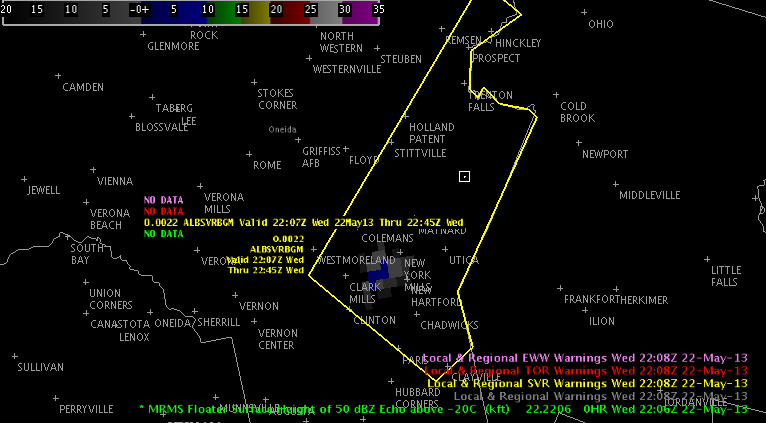
As of 22 UTC isolated convection is occurring across upstate NY.  Most of the cells are rather benign.  However, one stronger cell has developed across Oneida Co. in BGMs forecast area, which has the potential to produce severe hail with some development of the 50 dBZ core above the -20C isotherm.

2208_50above0C

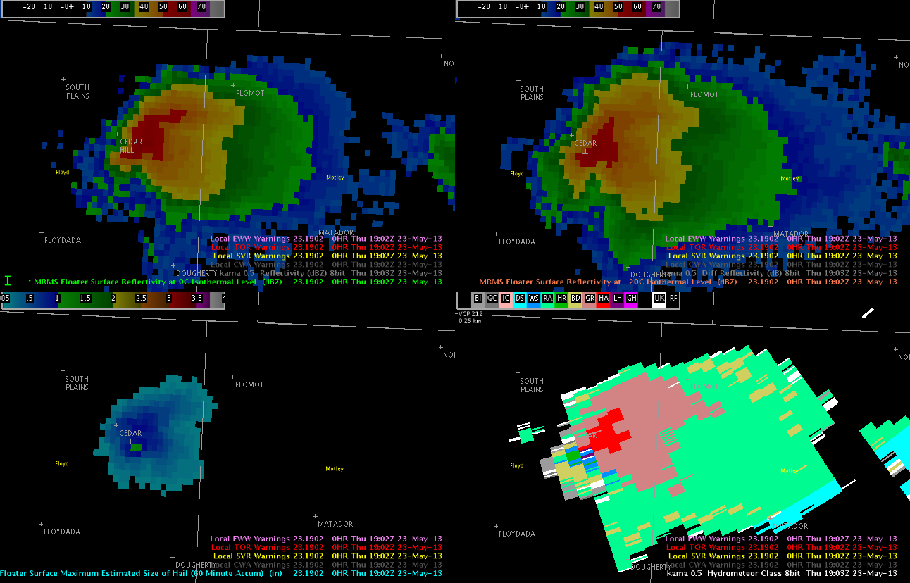
Additional development is occurring along the interface of the lake breeze off Lake Ontario and a moist theta-e axis, which extends north from the mid-Atlantic into upstate NY.  This cell recently has begin to show some potential for hail.

2145radarandlaps

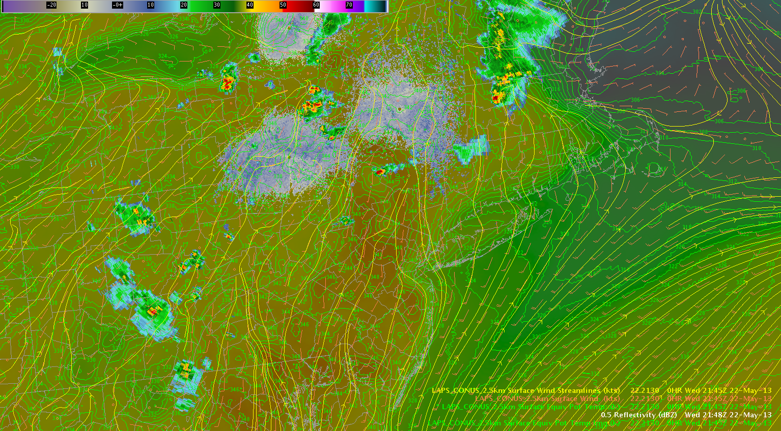
Isolated to scattered thunderstorms should continue to occur over upstate NY along the theta-e axis.  Additionally, the surface streamline analysis per the LAPS shows some convergence across the northern portion of the BGM and eastern portion of the BUF forecast areas, which should help focus the convection.  A modest hail threat will continue along the moist axis during the next few hours, especially closer to the Mohawk River valley and Lake Ontario closer to a belt of stronger westerly deep layer shear over southern ON.

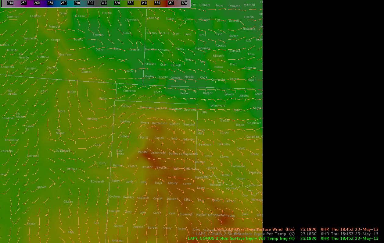
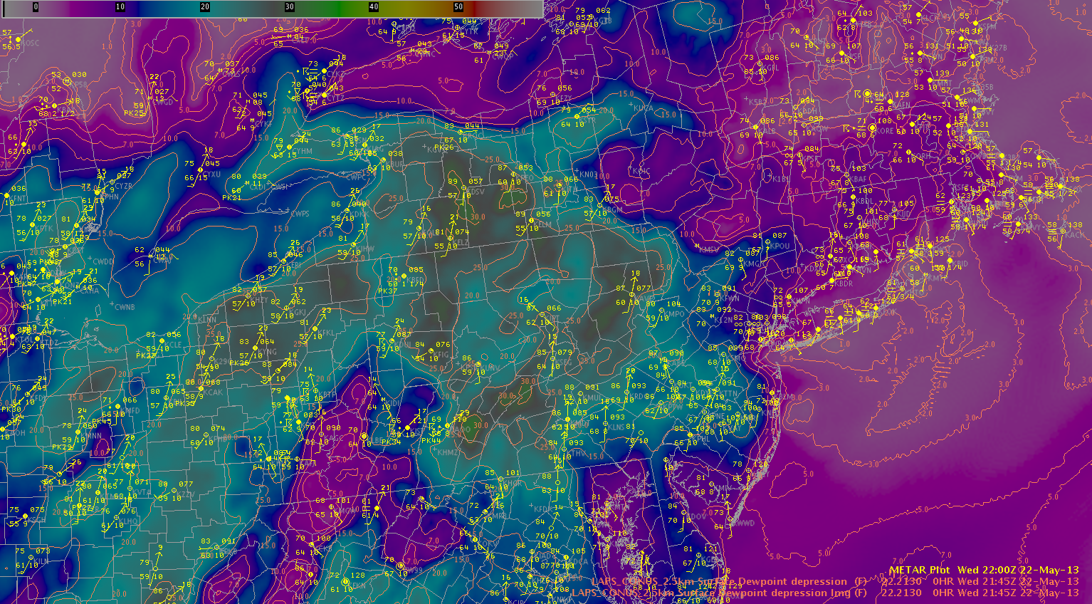
Dry air continues to intrude from the southwest evidenced by large dewpoint depressions (~25-30F) across central PA and western NY.  Thunderstorms have developed across the higher terrain of PA and are tracking northeast toward western NY.  The higher dewpoint depressions correspond to higher downdraft CAPE values, and this could lead to an increasing wind threat over the next few hours for west-central NY.

2145Tddandobs

Zimmerman/McCormick


Tags: None