
The image below shows the following: Height of 50 dBZ above -20C upper left, height of 50 dBZ above 0C lower left, height of 60 dBZ above -20C upper right, and height of 60 dBZ above 0C lower right. This image was taken at 2028 UTC 8min prior to the report (note the height of these cores lowered by the time of the report). At this time the height of the -50 dBZ above -20C was ~13k ft.
Author: Greg Stumpf
Another SVR Warning Using the MRMS Data…
Another warning earlier was successfully made in the south end of the FDW area. The MESH and reflectivity values at the -20C isotherm were used once again, in addition to other standard all-tilts base data. The first image below is the 8.7 degree slice of the all-tilts base data, which showed a relatively high reflectivity ~55 dBZ, which was at about 38 kft AGL at this location.

The next image shows a >1 inch MESH value north of the town of Calvert in Robertson County and corresponding high reflectivity values ~57 dBZ in the same location at 2338 UTC. Earlier reports indicated severe hail was common near these thresholds, so the decision to warn was made. In the first image, notice the MESH (lower right) and the high dBZ at -20C (lower left).

In the next image, the eventual warning box can be seen. This warning was issued shortly after observing the earlier data. Notice that the box was drawn trying to incorporate the areas with reflectivity at the -20C level greater than 55 dBZ. However, notice that the MESH values had decreased a little by the time this image was taken at 2351 UTC.
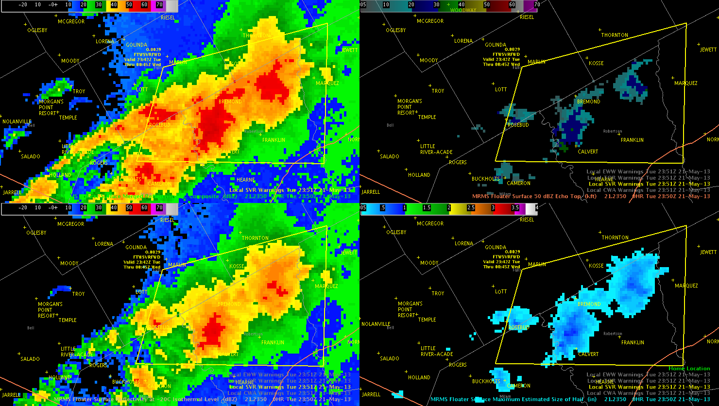
This storm did eventually produce severe hail with the a report of 1.75 inch hail in the southeast corner of the warning box at 0041 UTC.
MESH vs HSDA Berkshire County
Another example of verification comparing the MESH vs HSDA. There was a report of 1 inch hail in Berkshire County around 0050z. The MESH included 1 inch hail but the HSDA did not indicate large hail, but at least indicated hail.
Wesely

MESH vs HSDA
Just a note that MESH was indicating 1 inch hail consistently for a storm despite the HSDA indicating < 1 inch hail. Verification was severe hail for the one storm in Hamilton County. This storm actually produced ping pong ball sized hail.

0024 UTC Hail Analysis in BGM
Traditional radar analysis indicates little potential for severe hail in the NW portion of BGMs area. This is supported by MRMS data as there is a lack of depth in the 50 dBZ core above the 0C isotherm, and MESH shows sub-severe hail.
Scotty, beam us over…to New York State!
The NE TX activity was mostly a “wind bag”, with very little hail or tornado threat any more. So we have opted to complete our shift up in the Empire State. Our new CWAs: Albany, Binghamton.
-gs
Mesoscale update 00z WRF simulated IR_Nearcast
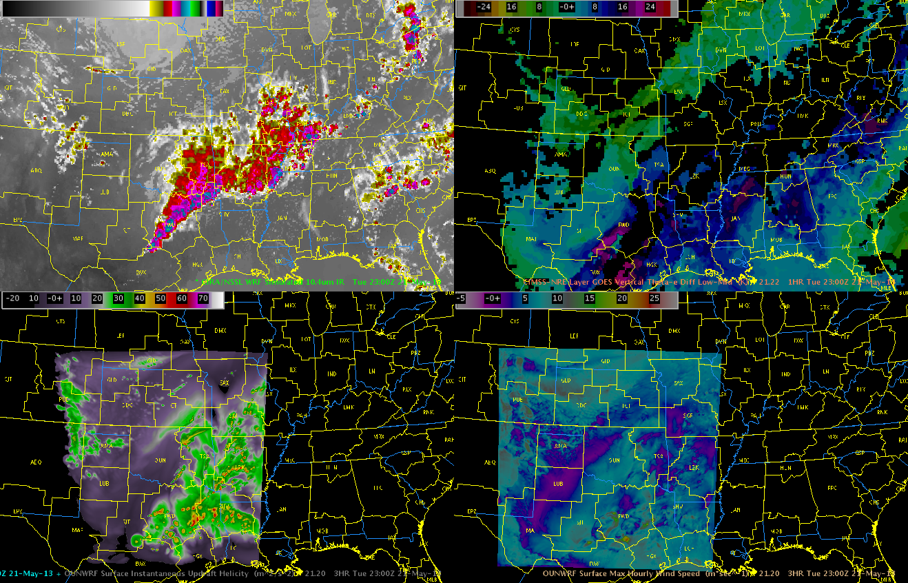
This nearcast shows a very unstable environment through the night, which should sustain the convective bow as it tracks across Louisiana. The instability and environment actually seems to improve based on this Nearcast model. Will see if this verifies.

Wesely
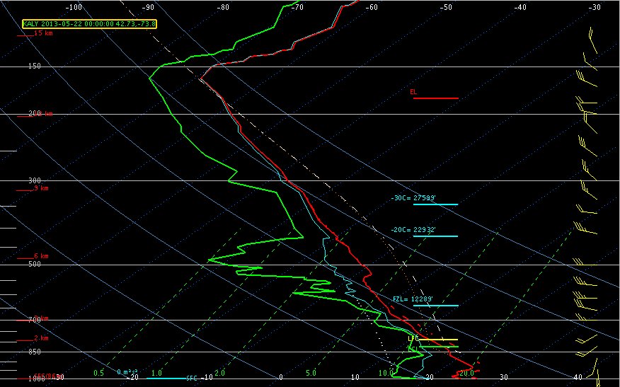
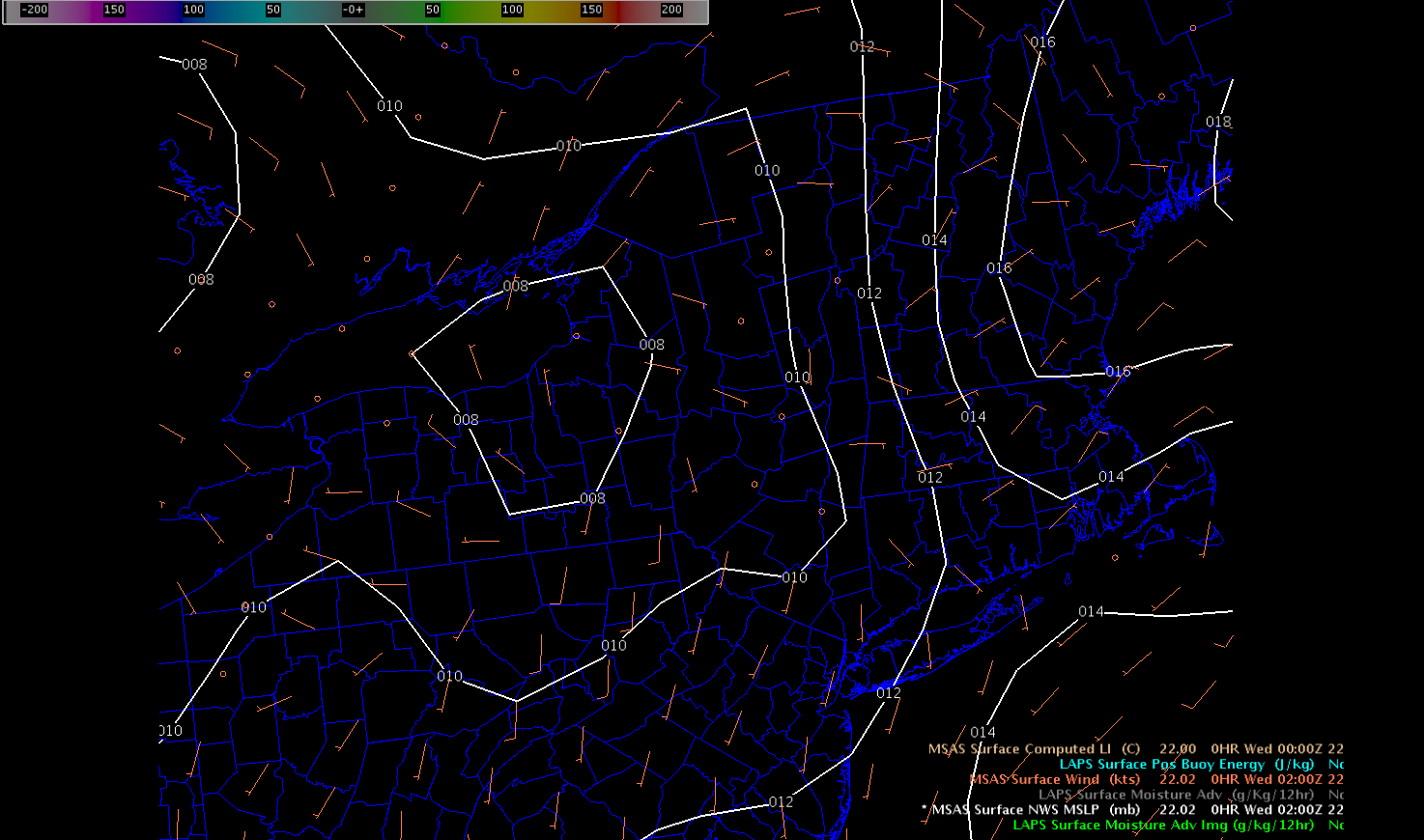
EWP2013 Mesoscale Discussion 22 May 0100 UTC
The 00Z ALY sounding did indicate SBCAPE on the order of 1007 J/KG, but CINH was already increasing to around 202 J/KG, so it is likely that most storms will be elevated in nature above a low level inversion and rooted from 850mb on up. Moderate westerly wind shear profiles 25-35 kts are combining with MUCAPE values near 1800 J/KG which enough for storm clusters to continue in advance of a approaching shortwave. Main threat should be large hail, though localized downbursts are possible with any storms that can get rooted more into the boundary layer.
The probability of severe hail and HDCA algorithms all underestimated hail size quite a bit when ping pong (1.5″ diameter) hail fell in Hamilton Co NY. The MESH was the only parameter that recorded near 1.5″ diameter half potential.
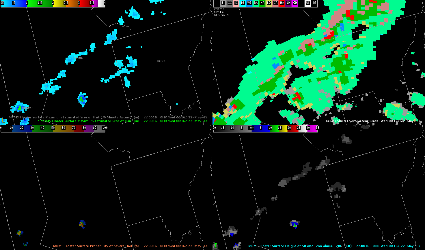
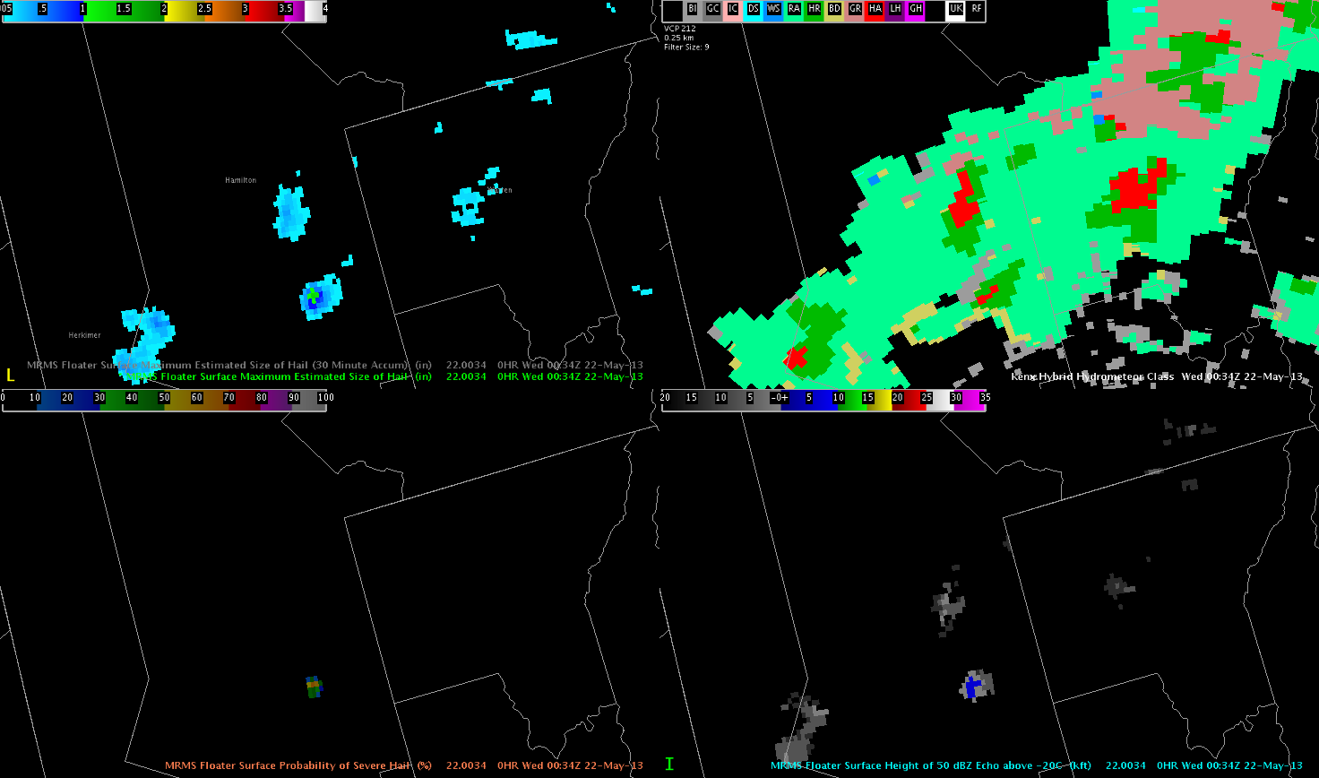
About 20 mins later, another ping pong hail report came in from Hamilton Co and the MESH again outshined the HDSA algorithm which only showed only regular hail(HA).
Storms should maintain for the next several hours, before waning with boundary layer cooling continue to increase and instability aloft weakening somewhat.
HSDA Hail Signature
Large hail signature on Smith/Cherokee county line added confidence in reissuing warnings for Smith and Cherokee counties as new storms approach the area from DFW CWA, at the edge of our radar coverage.
– McCormick