
Watching for potential development SSW of current supercells over Floyd, Dickens, and King counties to the NE. CTC shows potential. Cirrus anvil across the NE CWA will likely inhibit any CTC effectiveness. 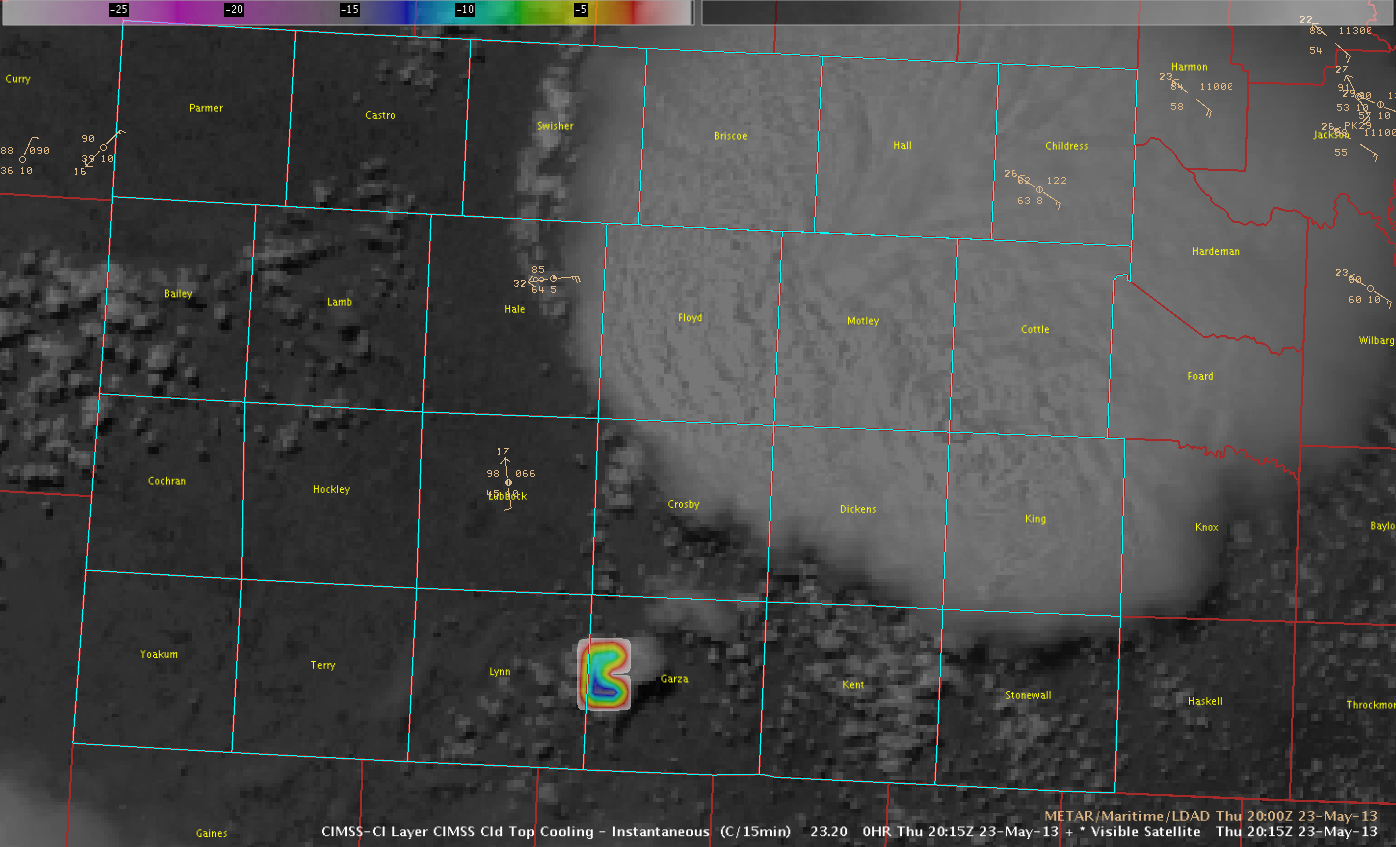
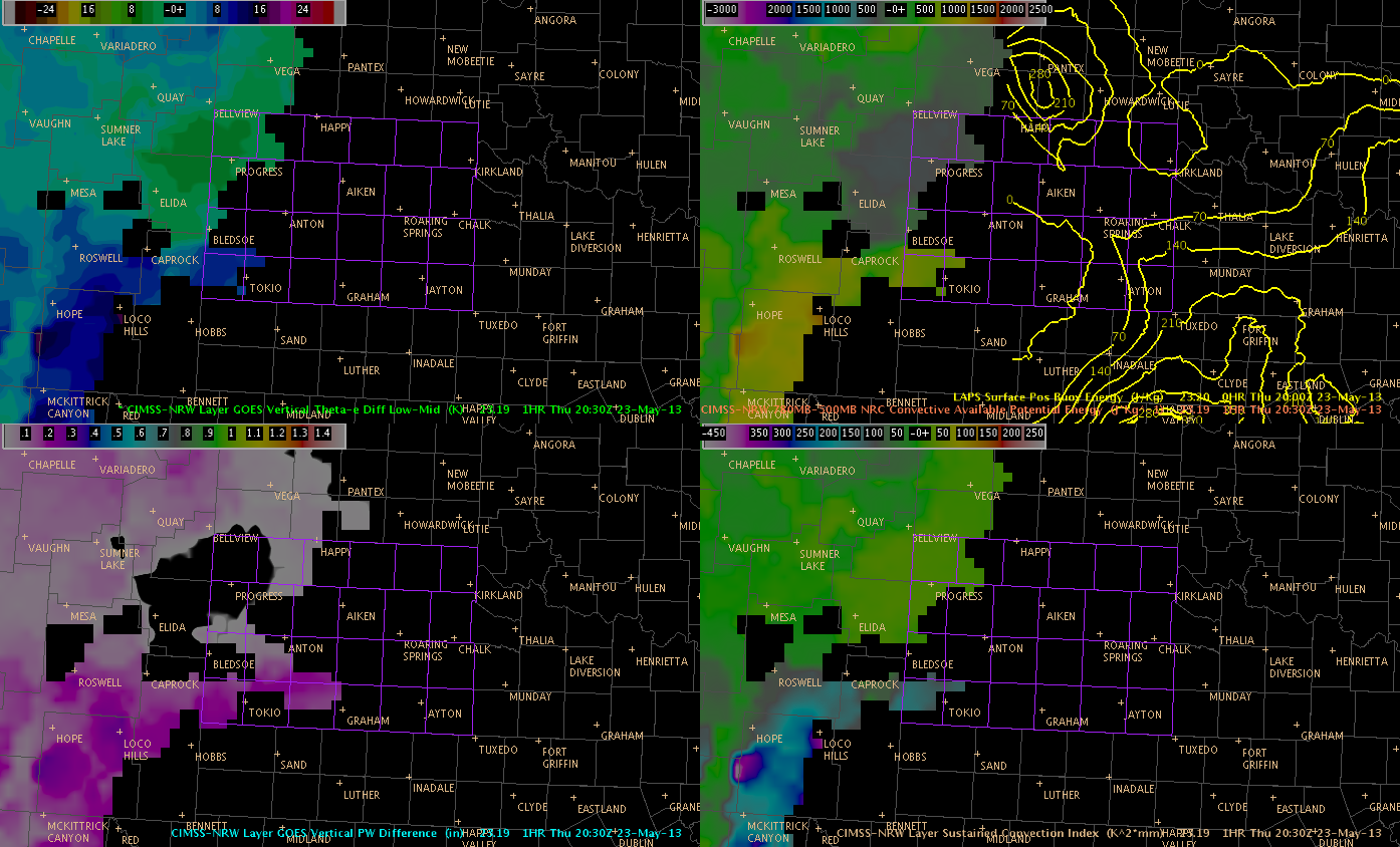
Unfortunately, GOES_CIMSS Nearcast (either E or W) data did not extend further enough east across the LUB CWA to be effective with this event. (see 2030 UTC CIMSS W projection below).
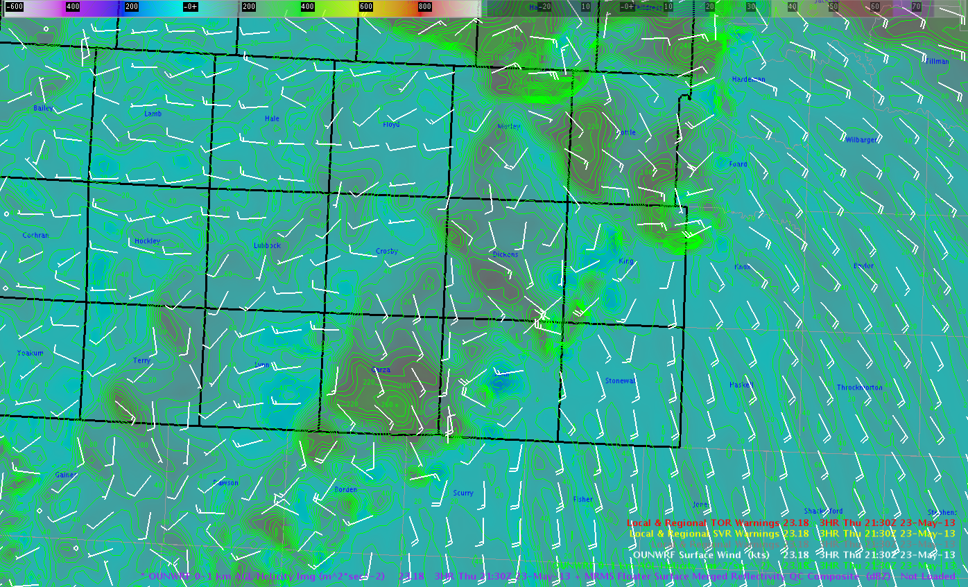
If the Garza area was to develop quickly, the OUN_WRF project indicates 0-1KM SRH to 200-260 m2/s2 which mean environment would be favorable for rapid rotation and potential tornadoes like earlier storms to the north.
We continue to monitor development closely.l
Martello/Zimmerman