Assessing LightningCast in Ongoing Convection

In the Tallahassee CWA, convection was ongoing at about 21z over the western portions of the Florida Panhandle.  In order to get a quick assessment of the convective trends, loading up LightningCast with ProbSevere and MRMS radar is a good start. A loop is provided in Figure 1 below. 

Figure 1: Loop of MRMS reflectivity overlaid with LightningCast and ProbSevere. 

I noticed in southeast Alabama into southwest Georgia that LightningCast was teetering back and forth between the 50 and 75 percentile contours.  LightningCast even went down to the 25% contour for a brief stint at 2041z.  Looking at NLTN data, there was certainly plenty of lightning left within that storm, so I couldn’t quite understand why it went down but then pulsed back up. The other issue I ran into is the contours suggesting lightning, but convection is nowhere near the 75% contour (See Figure 2). 

Figure 2: 2041z LightningCast with ProbSevere and NTLN lightning. 

-Podium 

Tags: None

DFW and TAE HWT Feedback for 6/13

General question overall, can the units be displayed in fraction form instead of with a (-1 or2)?  Such as m/s instead of m*s-1?

PHS

Can temperature units be in F or even C instead of K?

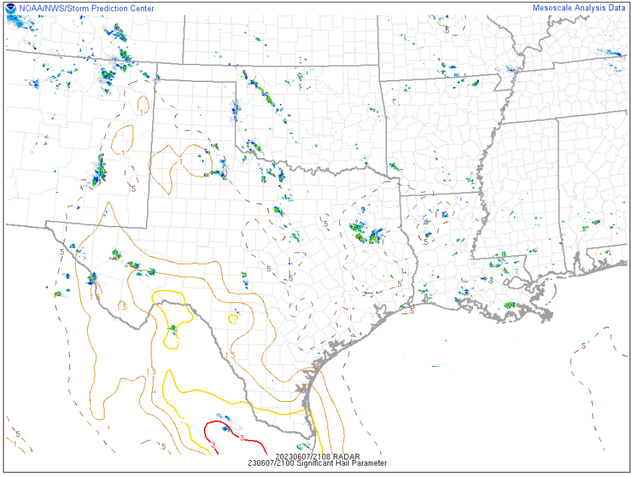
Is 0-1 KM bulk shear AGL?

Could the bulk shear be in knots instead of m/s?

Can the bulk shear vectors and mean cloud wind vector (or 850-300mb wind) also be plotted?  This can help with determining storm mode. 

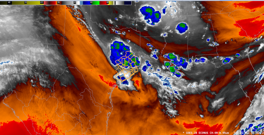
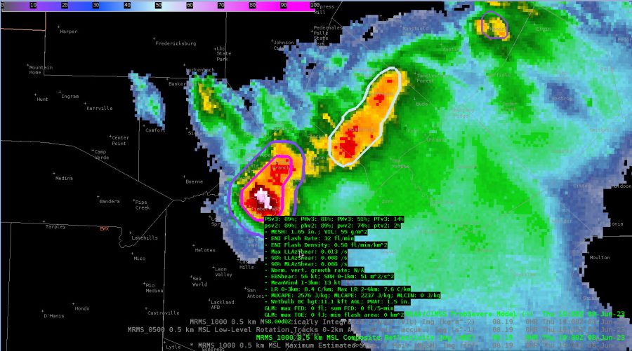
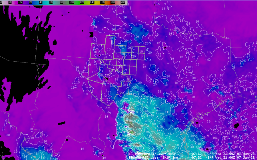
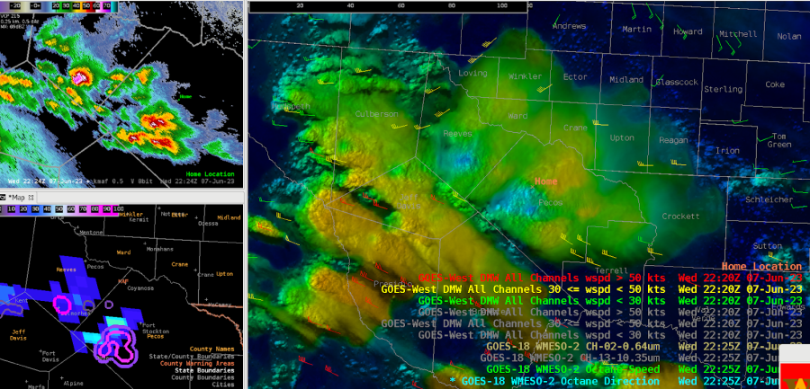
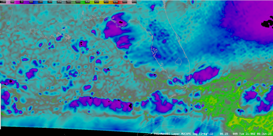
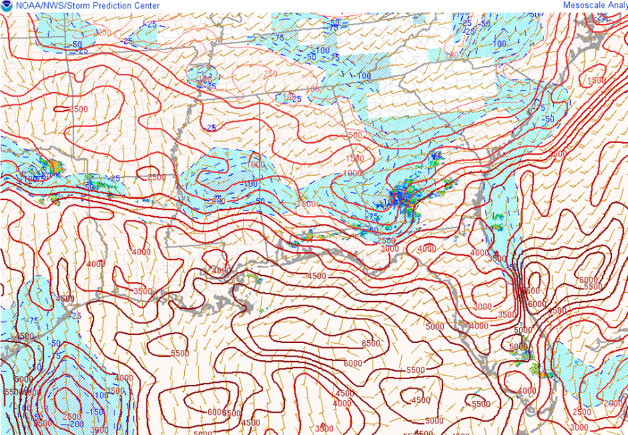
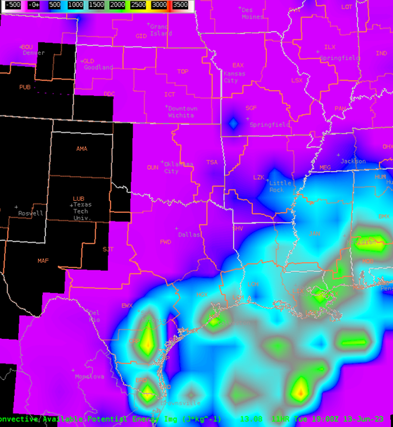
The PHS had storm coverage well matched with radar when simulation started.  However it was about 3 rows of counties too far north than what actually was happening.  This led me to believe that all the other data with PHS was also shifted north for what was actually happening.

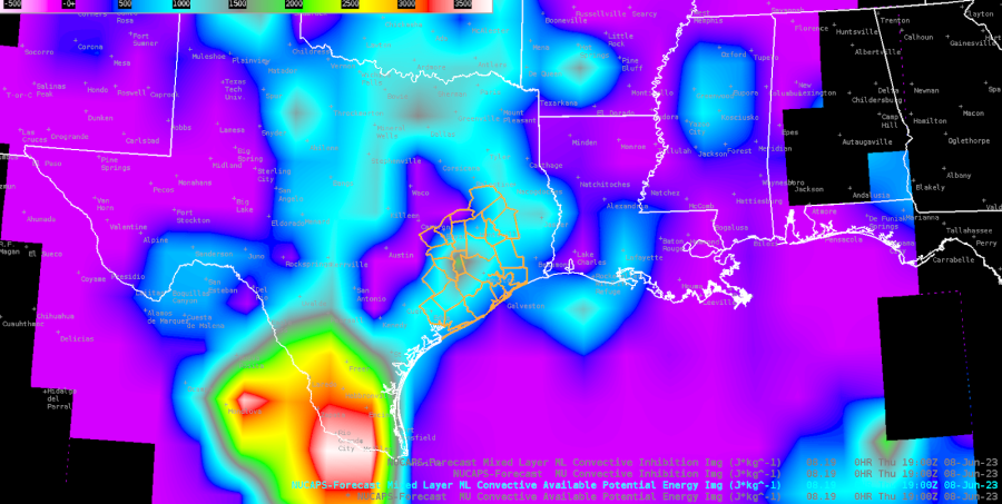
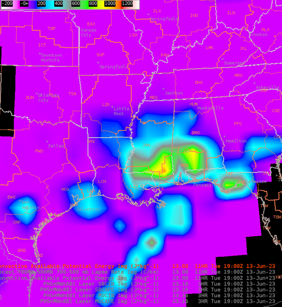
Could mixed layer CAPE/CINH be added to the stability menu?  I think SPC’s mesoanalysis page defaults mixed layer to 100mb.  We use mixed layer CAPE quite frequently at our office.

Having DCAPE as a viewable product would be very helpful to diagnose a severe wind threat from supercells.

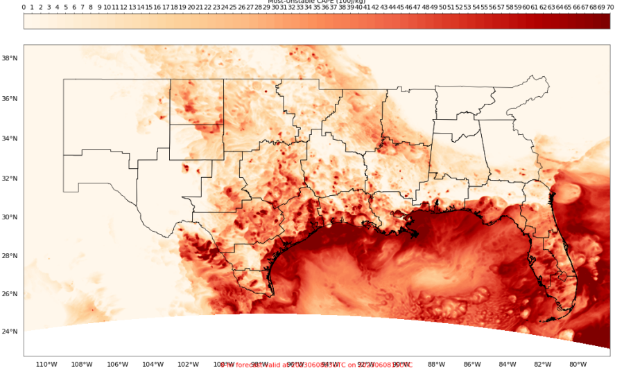
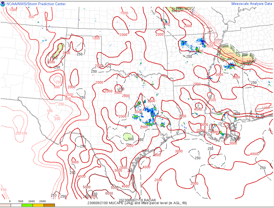
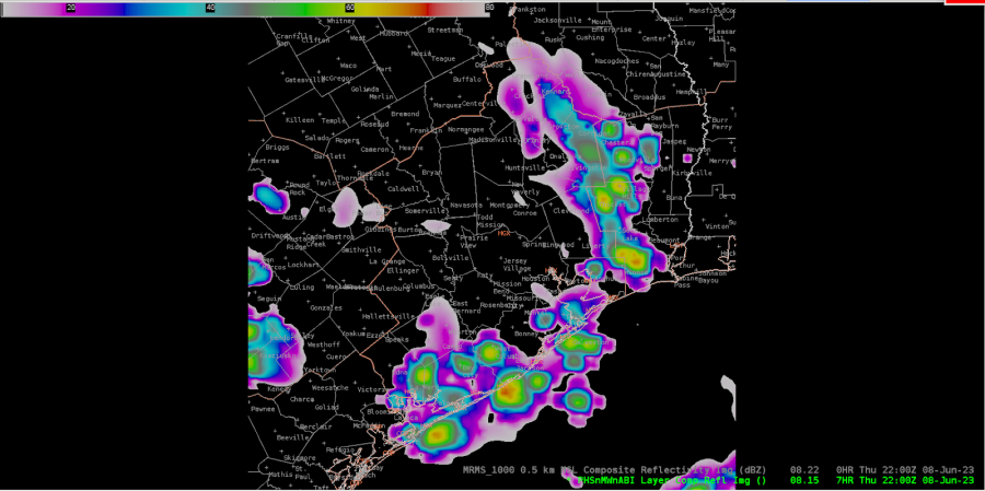
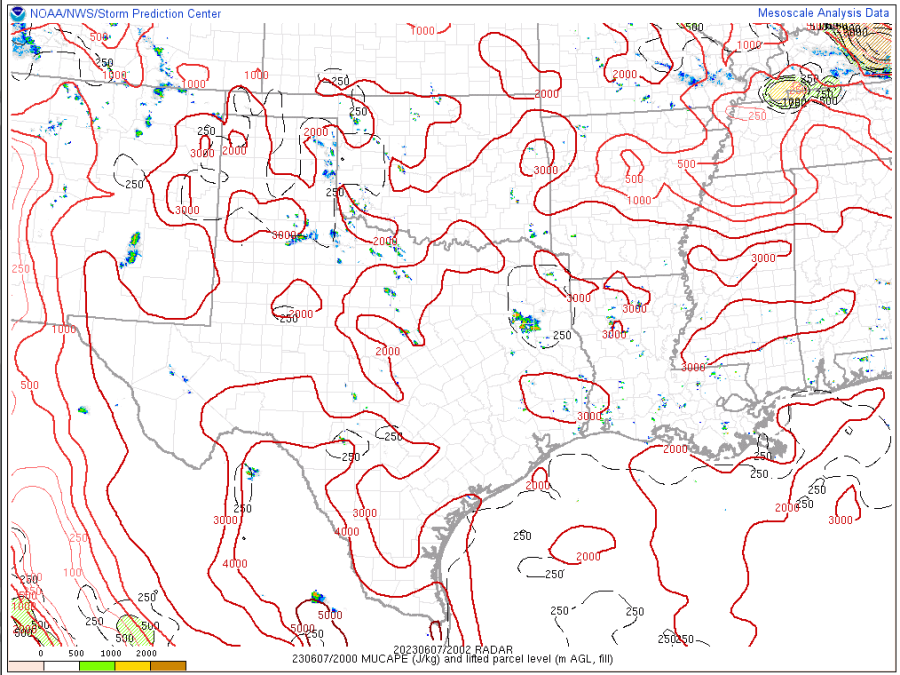
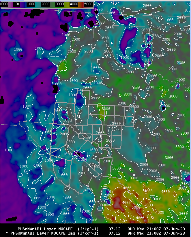
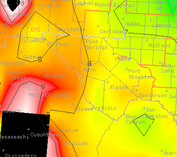
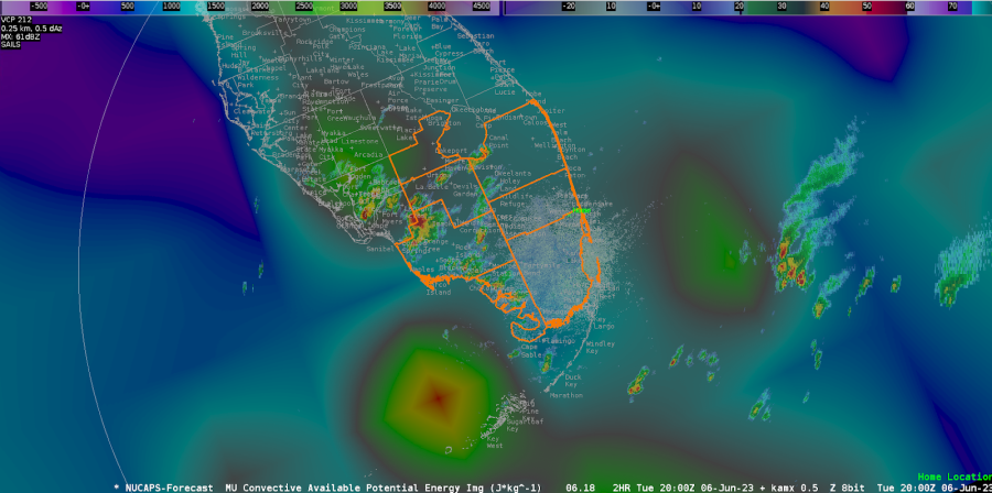
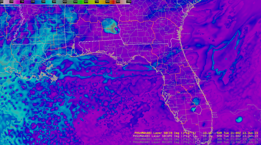
Noticed the PHS surfaced based CAPE/CINH matched quite well with mesoanalysis except for the CAPE/CINH just north of FL.  Both images are from 21z.
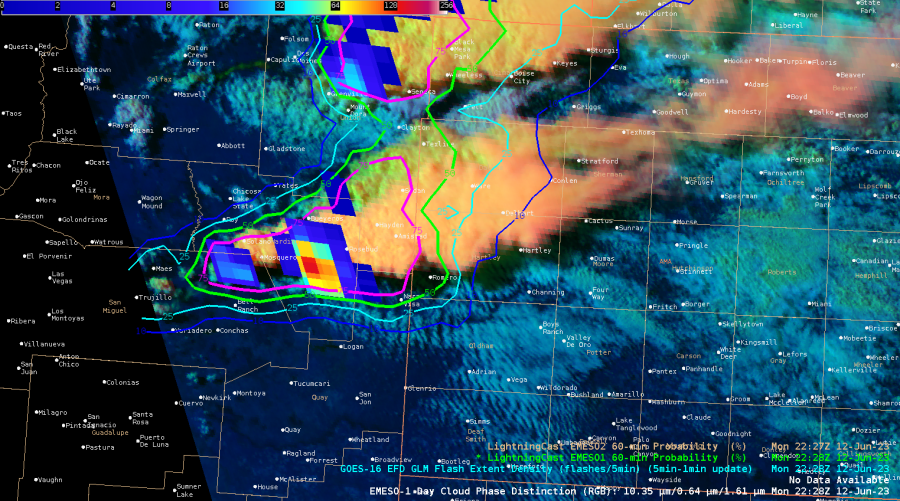
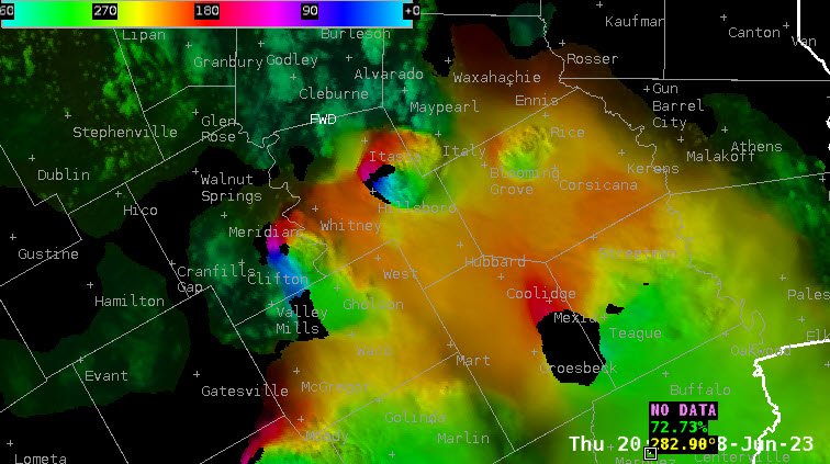
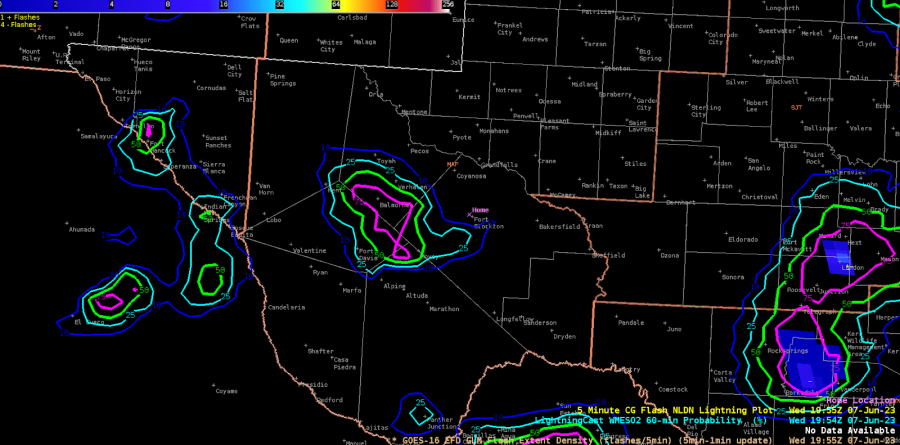
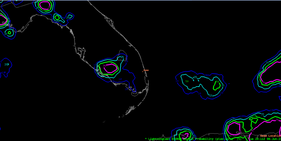
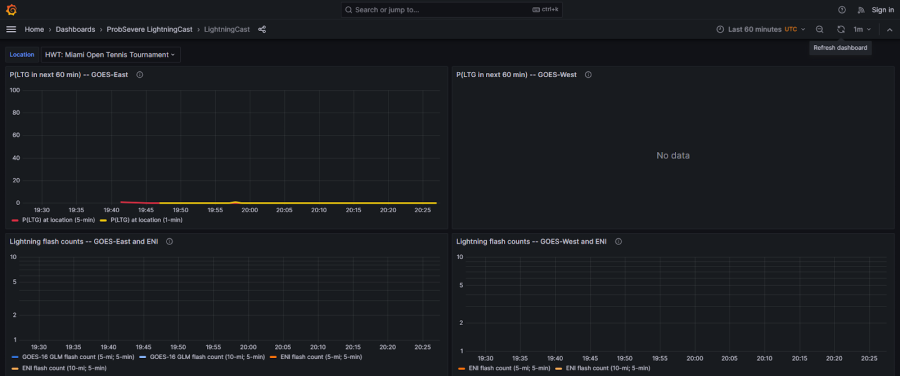
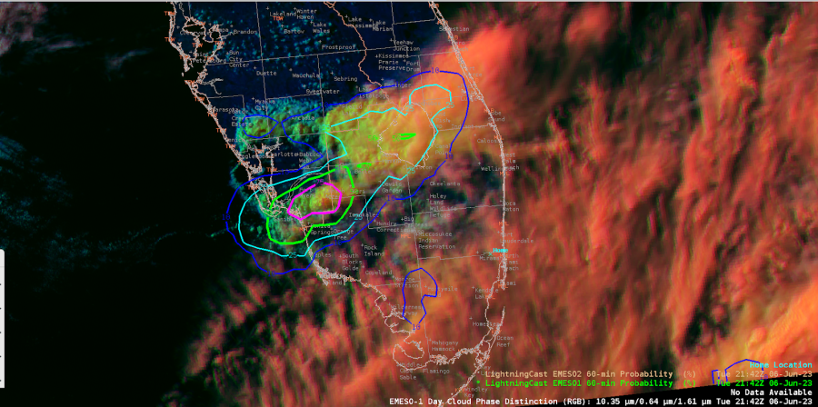
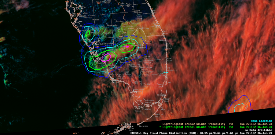
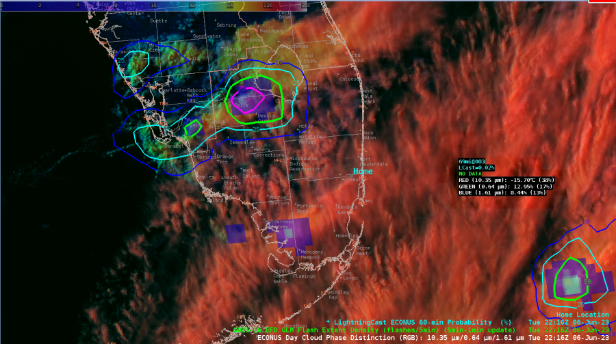
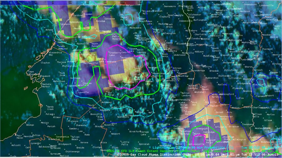
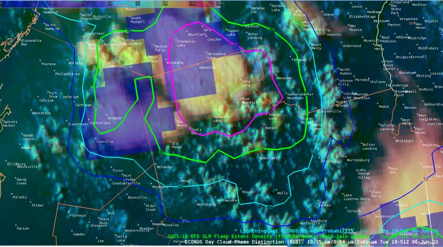
LightningCast

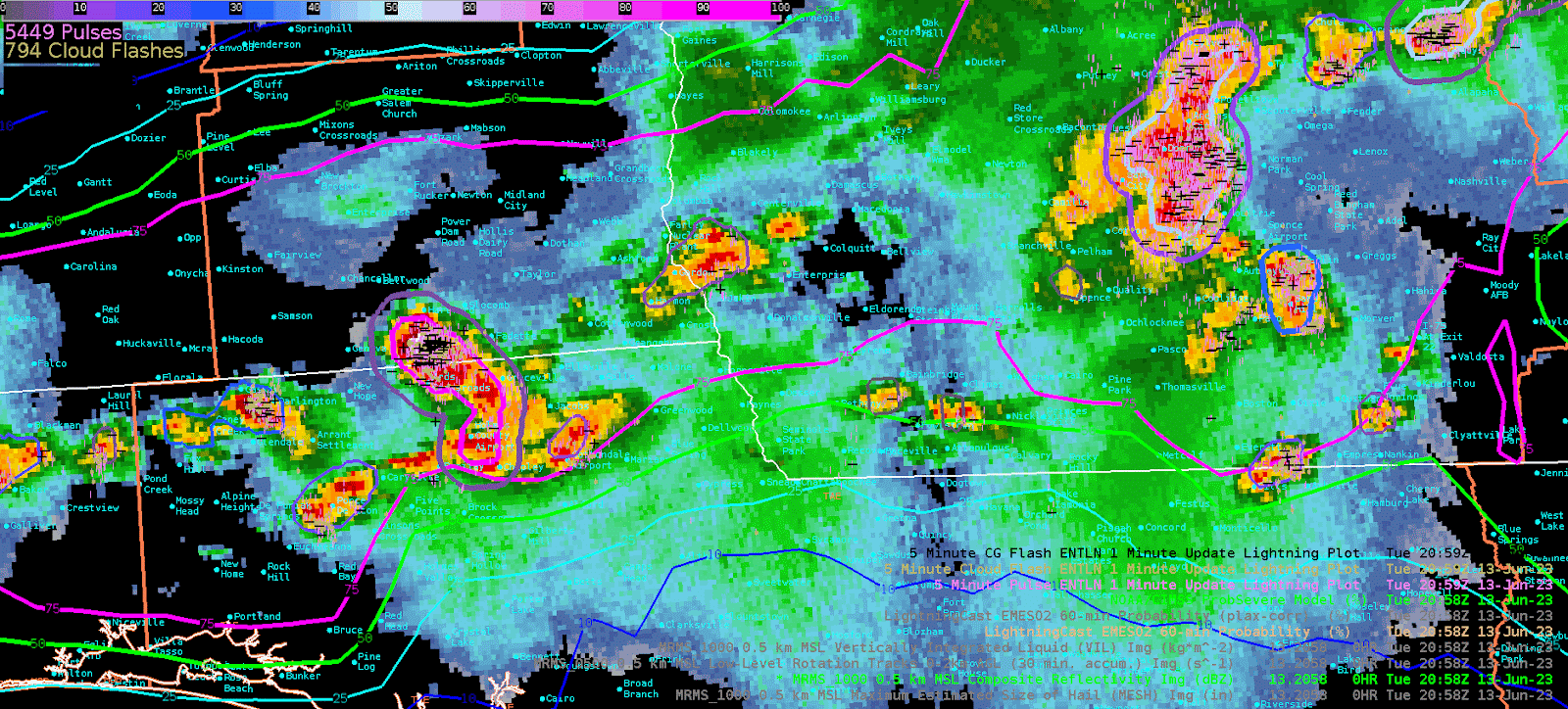
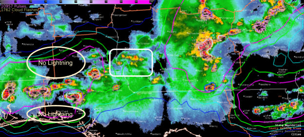
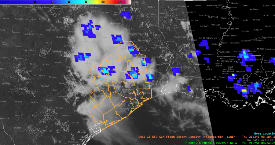
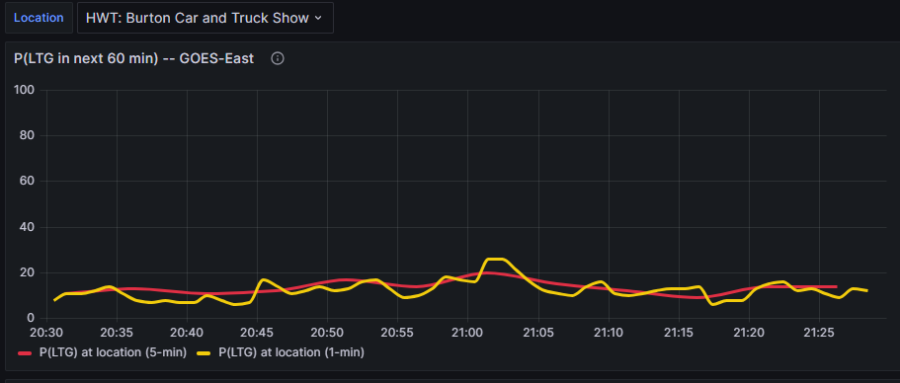
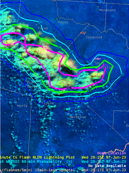
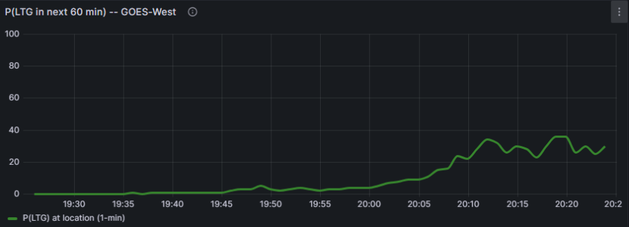
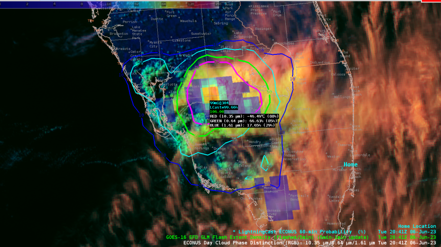
Helped maintain awareness about the overall threat for lightning, especially on the outskirts of the storm.
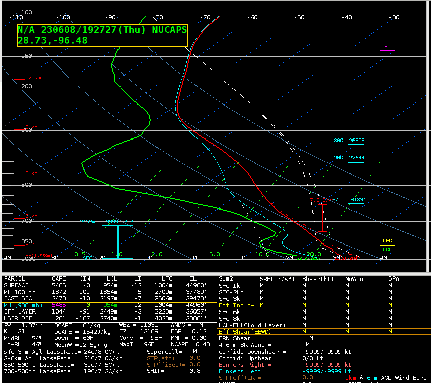
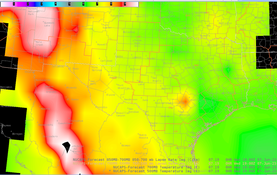
NUCAPS

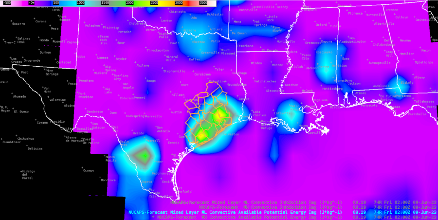
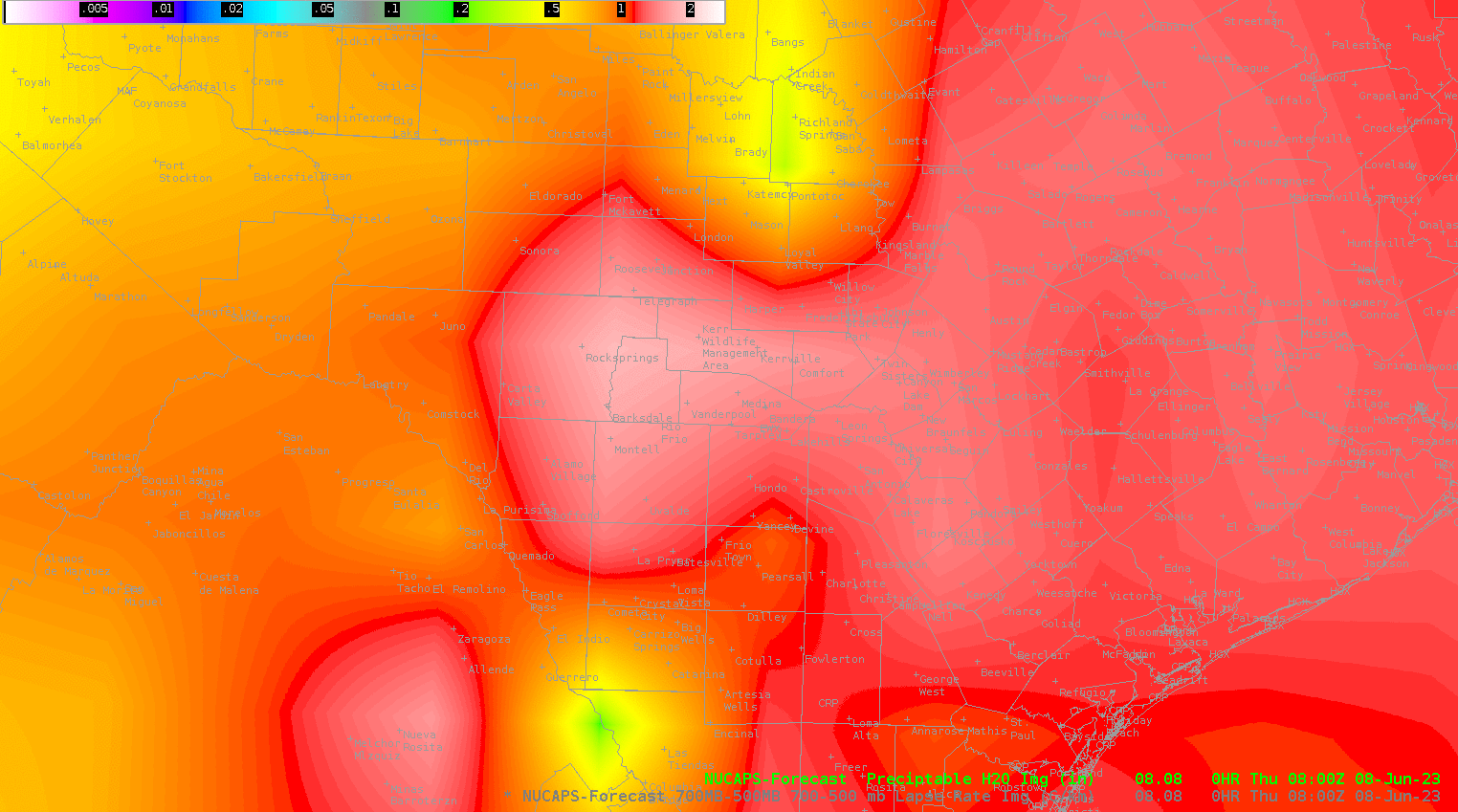
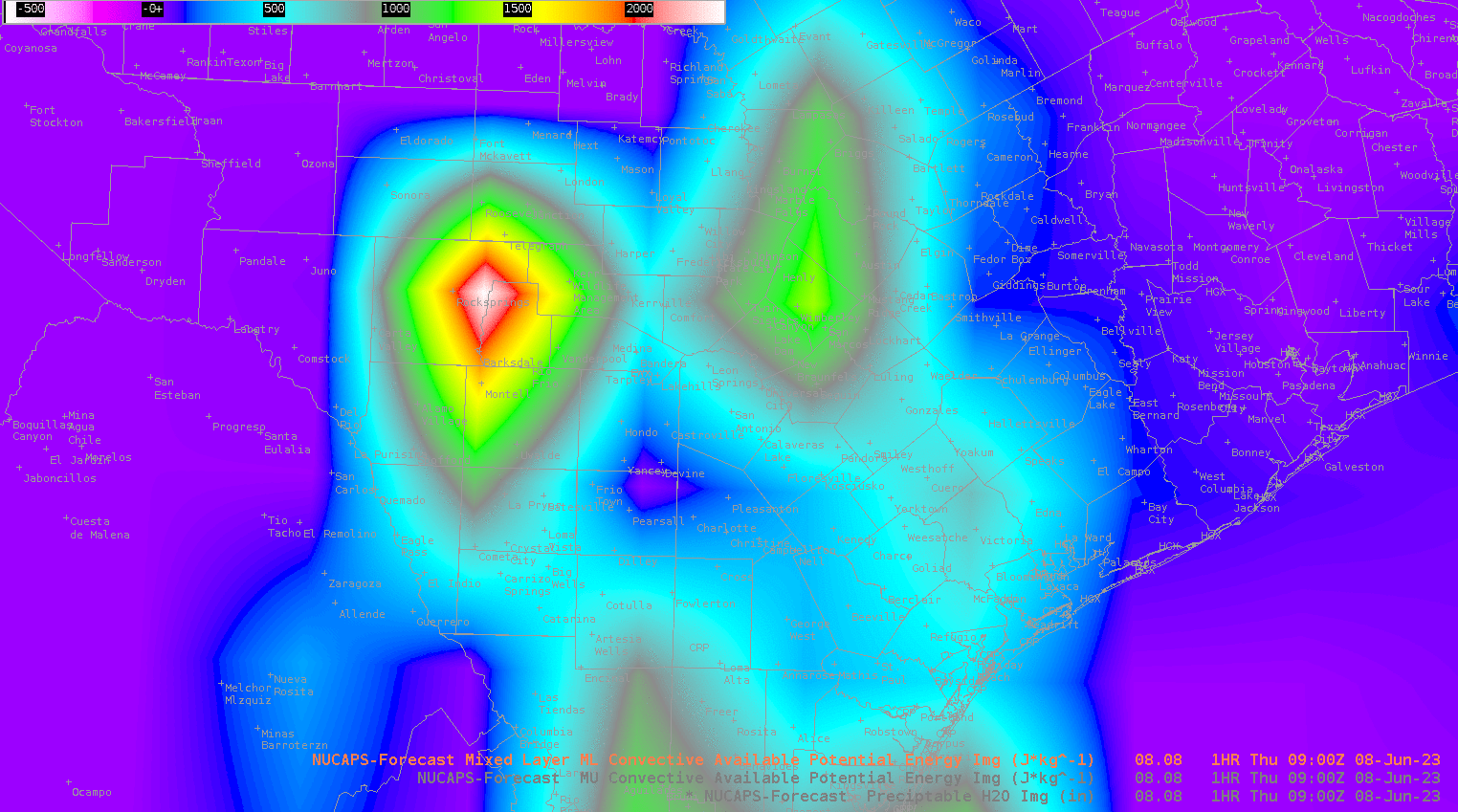
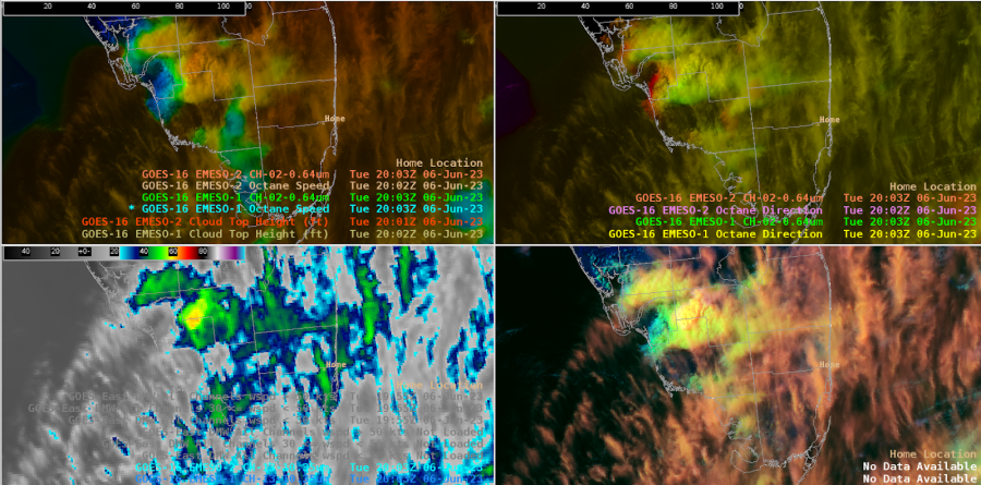
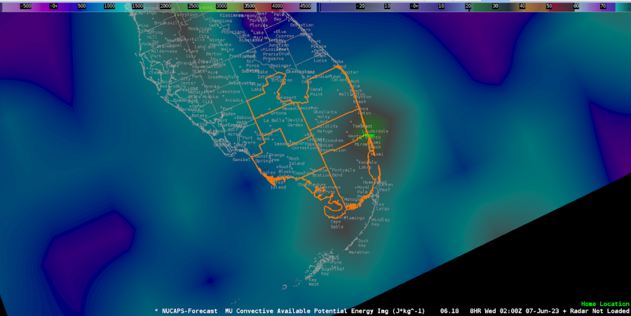
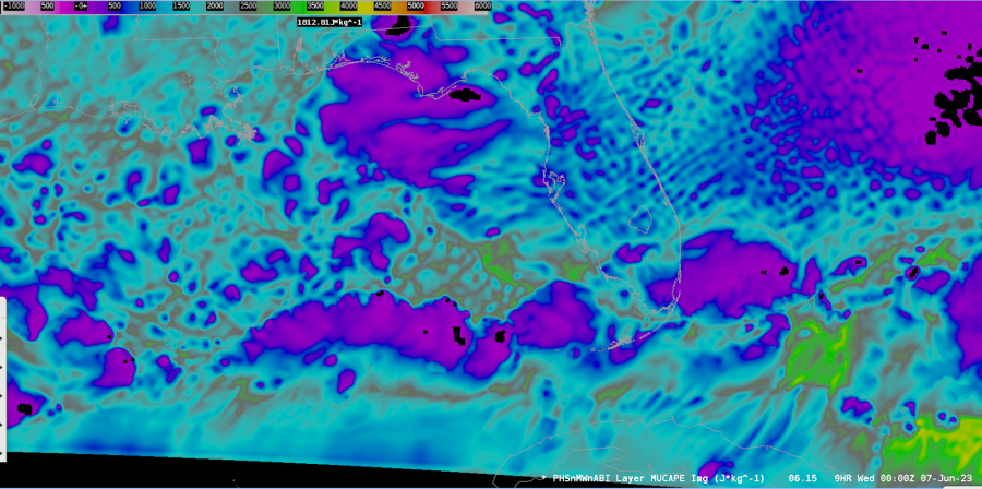
Noticed the ML CAPE was much further east than what happened.  Of course this was from the morning overpass, not the afternoon one.

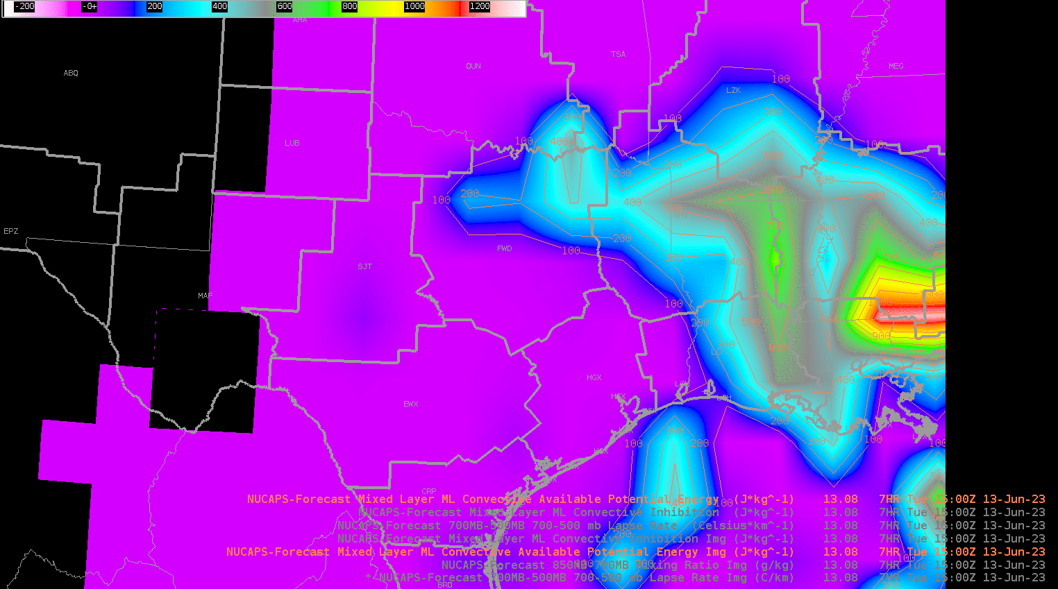
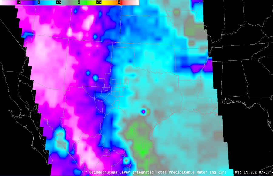
Did notice that the ML CAPE was lower than the surface based and MU CAPE.  Was going to look at a NUCAPS sounding to determine why that may have been the case.  However was not able to do that due to no data aside from the morning run. ML CAPE is on the left, MU CAPE is on the right below.
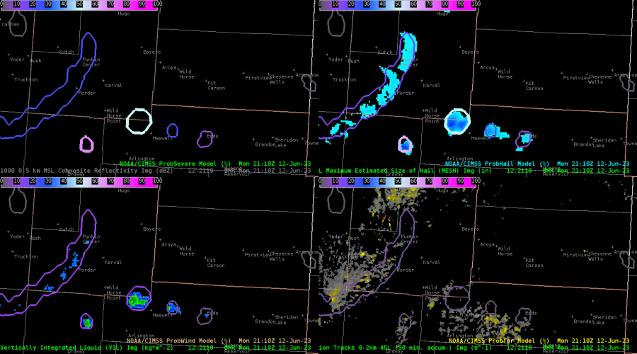
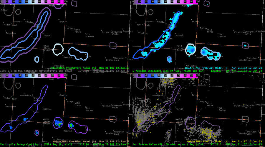
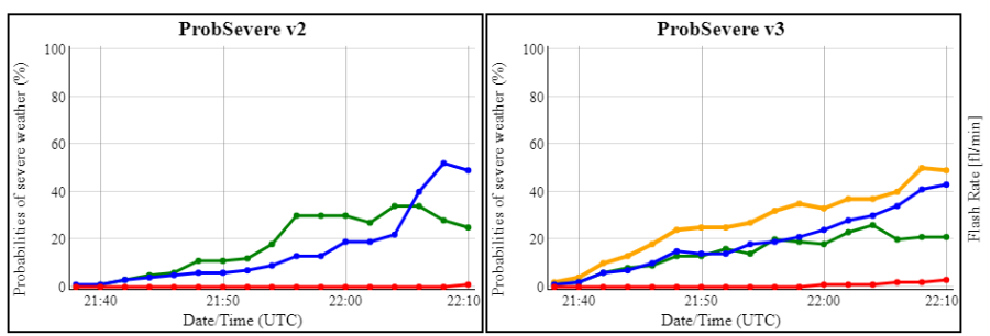
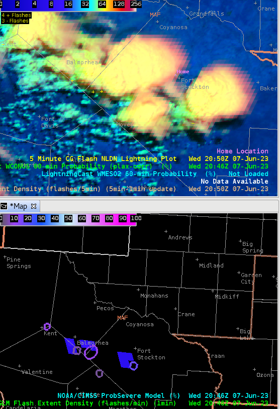
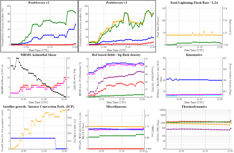
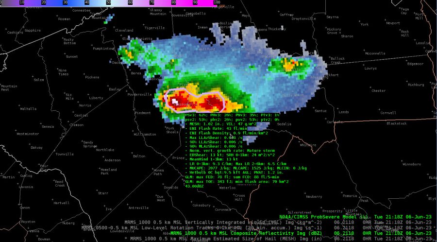
Prob Severe

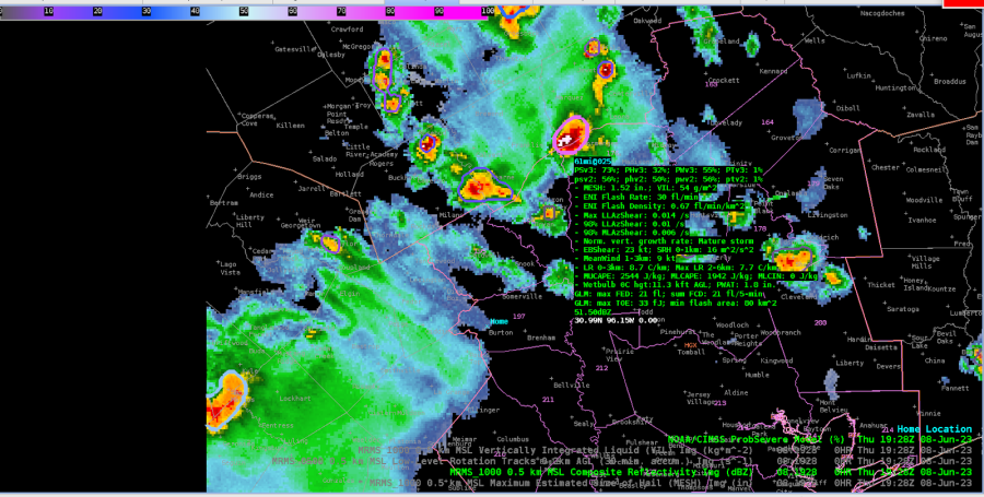
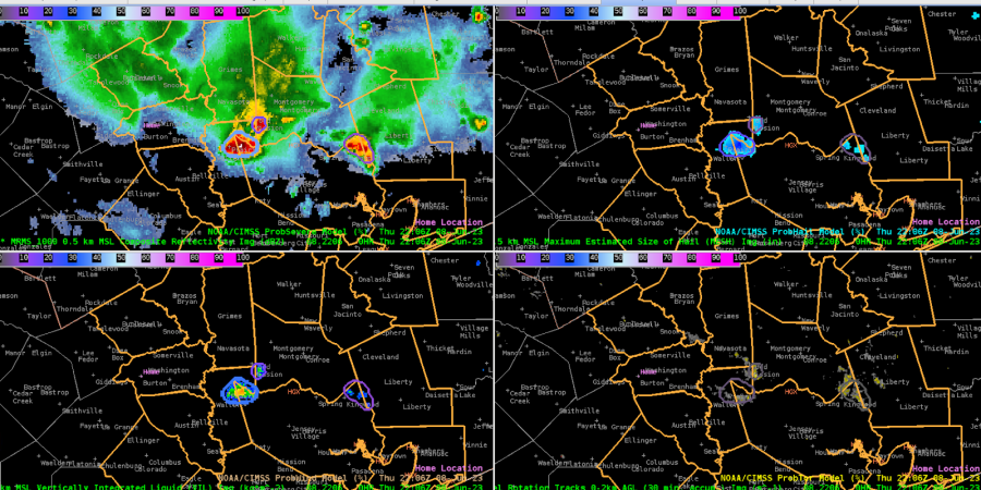
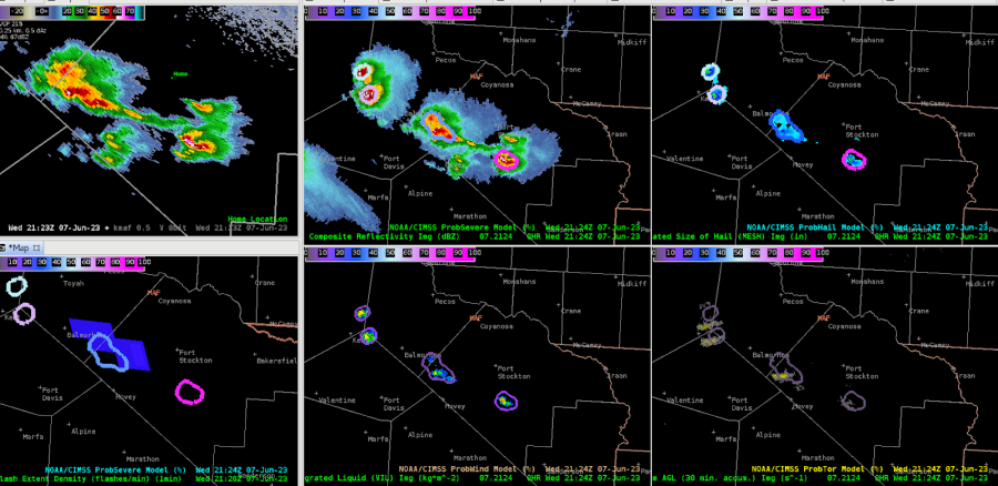
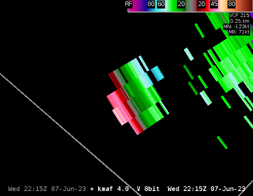
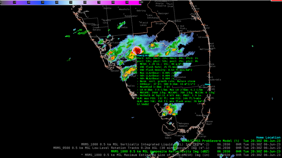
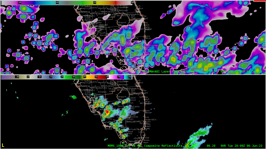
Is there a way to highlight which storm Prob Severe is showing the trends for?  When I am looping the radar with multiple storms on it (example image below), I quickly lose track of which storm I had the trend graph displayed for.  Really like the ability to look at the trends graphically through AWIPS instead of having to go to the webpage to do so.

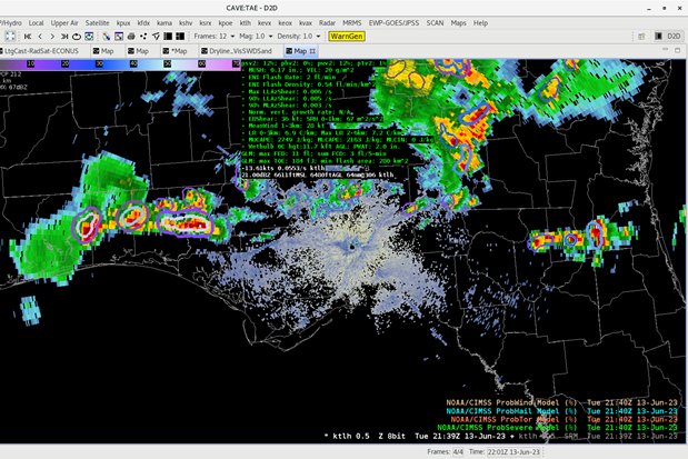
Noticed the readout only displayed above the pointer, not below.  The right image is what happened when I tried to sample the Prob Severe data.

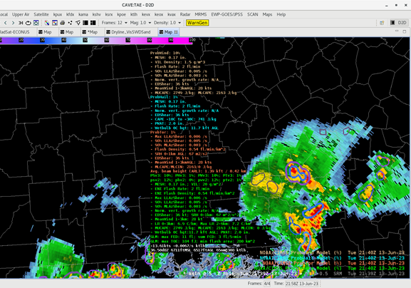
Could there be an option to select the different fields we want Prob Severe/Hail/Tor/Wind to show?  There is a lot of data there, good data, but at the same time too much to look at during storm interrogation.

Does ProbTor calculate QLCS tornado probability?  This would help build confidence for issuing these kind of tornado warnings because the environment can change so rapidly from one radar scan to the next.
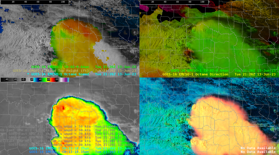
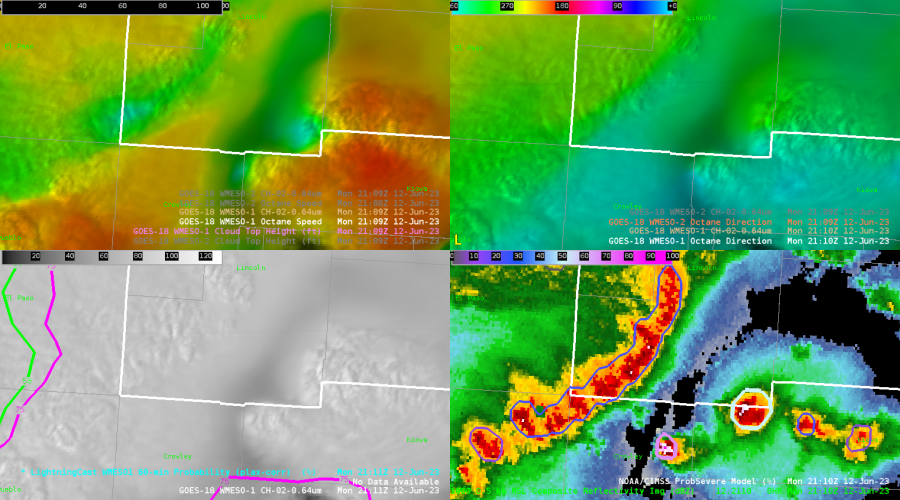
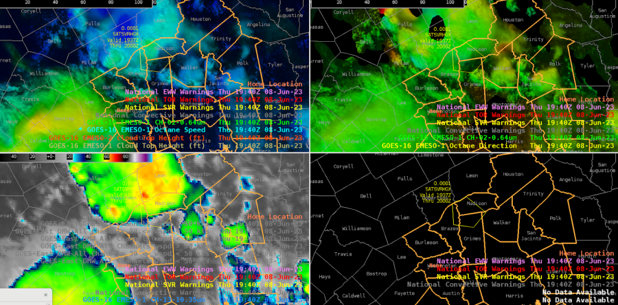
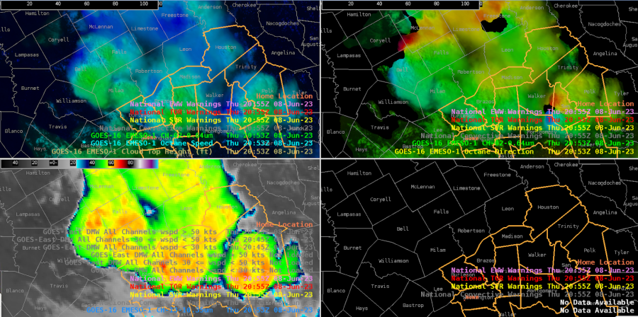
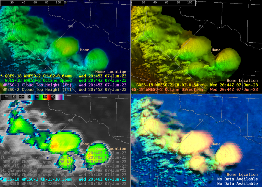
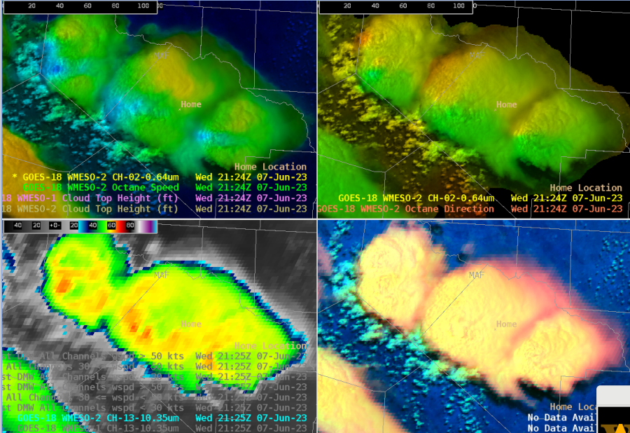
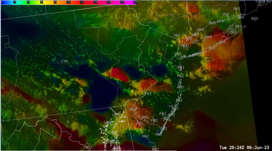
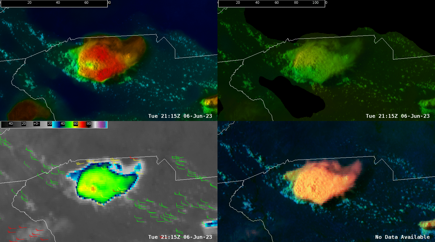
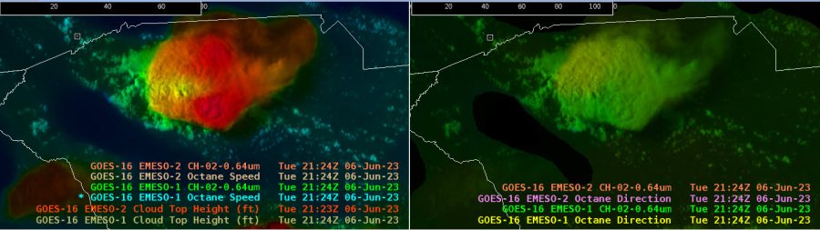
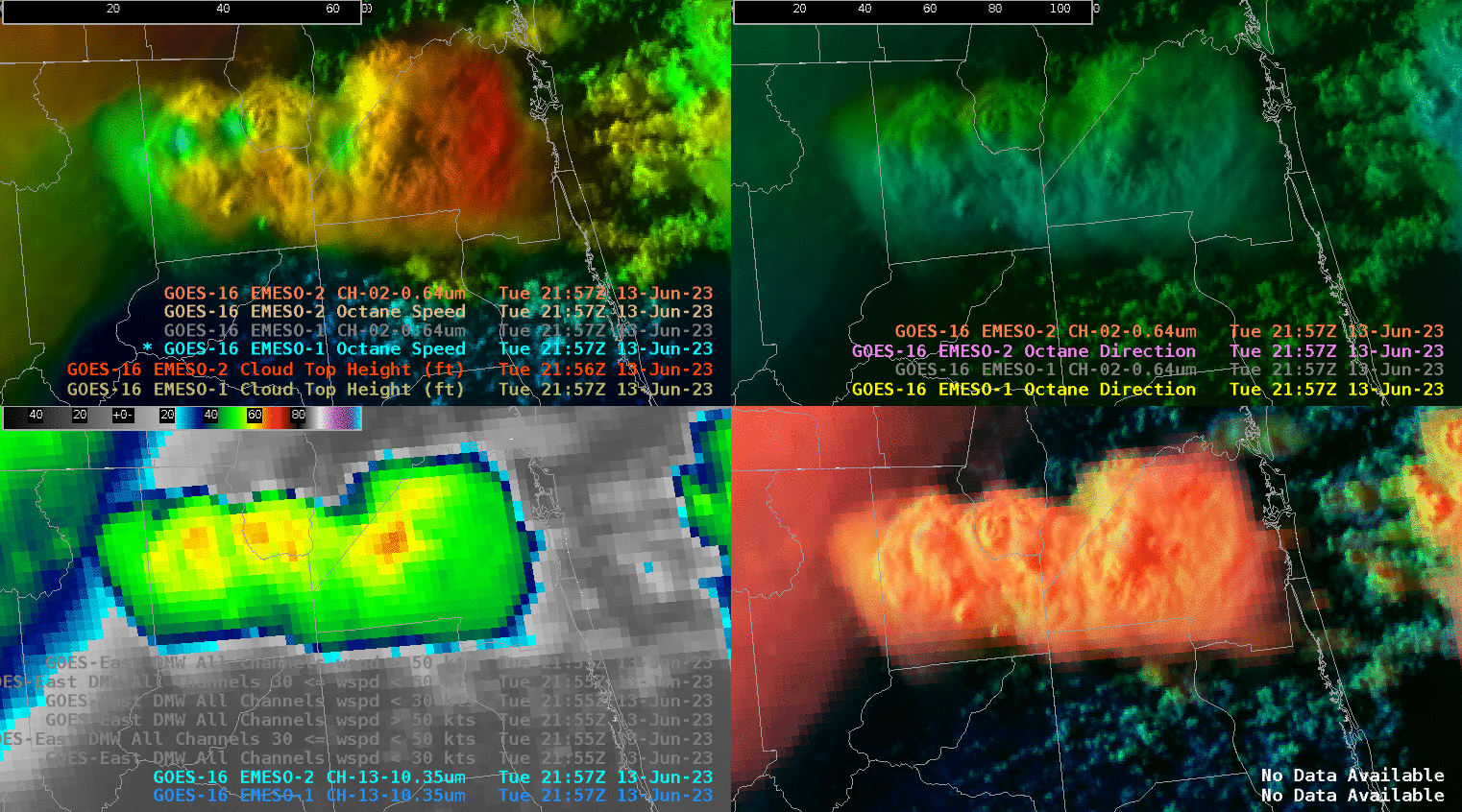
OCTANE

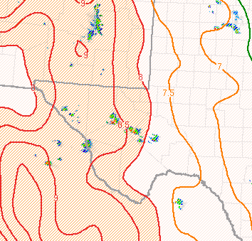
This helped me really see the updraft divergence of the cells.  This was in deep layer shear environment of 20 kts.  Neat to see the divergence weakening on the middle bottom cell in the upper left pane weaken as the cloud top temperatures warmed for that cell, confirming that the updraft was weakening.

– Rainman

Tags: None

6/13/23 EWP Blog Post – SHV

Active CWA assignment today. Warning issuance followed by the log form entry was somewhat cumbersome and time consuming but I understand the reasoning. 

Great interaction with the subject matter experts and their insight and comments were much appreciated. 

Good discussion on the potential uses of the OCTANE data. My CWA partner mentioned constructing real time hodographs that could be sampled. This is a good idea. The mental exercise to visualize the wind profiles from the height / direction/ and magnitude data is taxing to me and I think would be too time consuming in operations. 

Developer stepped through the awips imaging method to highlight specific layer winds and I found this very helpful. A layered wind four panel procedure would be helpful. Also good discussion on reaching for storm scale signals in the wind fields and whether wind speed data bins could be higher resolution than radar at high elevations and distance from radar. An intense left moving storm during this exercise window across NW LA into far SE OK showed strong anvil level divergence that persisted for an extended period.

Screen capture of the ice machine and intense three body scatter spike that persisted for close to an hour at least. Probsevere was very good especially once the tracking element was assigned to just the primary updraft. I issued several warnings during the exercise window and utilized probsevere on each one. The time trend window is great and I hope it gets to the operational version soon.

The PHS idea of better utilizing sampled profiles seems good to me. I would prefer it not be solely validated by WRF model output. I like the idea of showing where the fusion data senses departure from model initial conditions similar to shown on  this website:   cas.hamptonu.edu/~adinorscia/InteractiveMap/FusionMap.html

NUCAPS data today  was from the previous run with the 10-12 hour forecast near the exercise valid time. I compared the 11 hour NUCAPS forecast to the zero hour RAP analysis for MUCIN across the exercise domain. There was a large discrepancy between the two. Due to convection that had spread across this region earlier in the day I discounted the NUCAPS data. In this instance the NUCAPS forecast would have been viewed as suspect and likely would not have been used.

– jbm

Tags: None

Day 1 Observations

The one thing I found today from looking at PUB CWA, was that the Octane satellite image may have been picking up on areas of intensification before it was radar indicated. The areas of interest lie on the Lincoln, Cheyenne, Kiowa county lines and Lincoln, Kiowa lines as seen in the upper left image below. There is a gradient between the yellow and blue which identifies areas of divergence.  The bottom right image is the radar showing that there are cells in the area.

This next image shows the probsevere predictability at the time of the above image. Note the values, especially on the prob hail (upper right)

The next image below shows that the probsevere values actually did increase in under 10 minutes on ProbSevere (Top Left and Prob Hail Top Right) The intensification could be from locally enhanced wind shear as Octane shows convection developing locations of strong shear in the localized areas of divergence aloft. It will be interesting to see if this trend continues throughout the week.

-Tornader

Tags: None

6/12 Observations from ABQ CWA

OCTANE

Have knots abbreviated as “KTS” instead of “KN”

Change direction of movement from to lettered degrees instead of a numerical value

This product does help me become more aware, in realtime of the winds vertically.  However, not entirely sure how to adapt this into my forecasting routine yet.

NUCAPS

Great to see the better sampling/readout of the data compared to what it was 2-3 years ago

The parcel count is a great way to help me gauge the validity of the data (confidence in how accurate it is)

Overlaying a NUCAPS forecast field with the parcel count allows me to sample what the field has and what the parcel count is so I can have more of less confidence in the data

No less than six hours for operational needs.  9 hours might be the perfect duration.  I usually don’t use hourly data much beyond 9 hours due to my lack of confidence in the reliability of the data.

Hourly data is very nice.  Half hour spacing is a bit too much data for that duration.
-Something to consider is could there be half hour spacing in the data for the first three hours?  However I don’t know if that would be enough of a benefit to use.

I would use the 700-500mb lapse rates, ML CAPE, temp and dew point, and parcel count most often.

PHS

Very easy to look at; very smooth data

Didn’t have much time to look at the data

Lightningcast

Noticed on a well defined supercell the lightning probability is not over 80% despite lightning ongoing.  Does the program cap at 75-80%?
-Have GLM ligthning data displayed too

Otherwise this does help draw my eye to where lightning could occur in the near future.

Prob Severe

Didn’t have time to look at it much. Did notice the storm in eastern CWA had higher values for version 3 than for version 2

– Rainman

Tags: None

HGX Convection impacting the Car and Truck Show in Burton, TX

Initial setup for the HGX vicinity showed several cells to the north and east of the DSS site, propagating southeastward. The strongest cell, pictured below, had a PSv3 of 73%, while PSv2 remained as 56%.

We issued a warning for a northern cell moving into the CWA into Madison county, based on a -70C cloud top brightness temp and PSv3 total prob over 70% (had been climbing from the 50s fairly steadily). But the cloud top shear noted by Octane was not strong (~20-25 kts), so the warning was very borderline. Just a couple scans later, it lost most of its texture on the vis imagery and lost its shear in the Octane direction product. Cloud tops warmed a bit as well.

00H NUCAPS-Forecast (NF) is showing moderate CAPE now (1st image below), which may help explain the messy sub-severe multicell clusters, but the forecast valid at 02z this evening shows a resurgence in the CWA (2nd image below).

Looking to our NW, one of the stronger cells is outside our CWA, but the Octane direction is showing good cloud top diffluence.

The PHS SCP forecast valid at 20z looks to be around 2-4 over our area, although this doesn’t match well with the SPC meso page SCP, which focuses high values W of our CWA.

The 21z PHS MUCAPE (15z run) looks like it has insane values of 6000-7000 J/kg near the coast and just offshore. This is much higher than the SPC meso page, showing 3000-4000 J/kg at most.

Looking at the optimal application of LightningCast, it seems that the point-based meteogram would work best for CI and in situ developing convection, versus storms propagating into the area. In our case here, at the DSS site, the point-based LC probs are low, suggesting little concern. But we can see from the GLM FED data that there are mature cells with lightning just to the NE that will probably move near the site in the next hour, which certainly poses a safety concern.

The NUCAPS sounding near Victoria (far SW CWA) showed a lot of CAPE and DCAPE, but a rather dry profile. This is confirmed by WV imagery over much of far S TX.

22z PHS Composite Reflectivity (above image) compared to 22z MRMS Composite Reflectivity (below image ) depicting PHS struggling on timing as the cluster of thunderstorms propagate from northwest to southeast.

Late in the event, this cell is showing slow strengthening on PS — currently both v3 and v2 have 40% total.

– Edgar and Harvey Specter

Tags: None

Severe Storms over Central Texas.

Storms over northern Bexar and southern Comal have had hail up to golfball size reported. This is in good agreement with the MESH signature. Additionally, Prob hail for both v3 and v2 are up over 80%, so in good agreement with the algorithm.

Animation of storms with the latest OCTANE. Looks like storm top divergence can be inferred from 70 kt anvil level winds to the south and 30 knot winds to the northwest. Would equate to strong divergence aloft and indicative of a severe storm.

The 08Z Pass of NUCAPS shows a rather impressive PWAT/Moisture gradient this morning, which would likely lead to increased storm chances along the theta gradient over the Hill Country and stretching eastward into the I-35 Corridor. The gradient ranged from 1.25” over the Coastal Plains to .50” over the Edwards Plateau and western EWX CWA.

This ties in nicely with the MLCAPE available this morning.

Storms going up in a weaker shear environment with a rainbow color distribution all around the storm from the OCTANE direction window. Very interesting. You may actually be able to infer the type of storm/environmental conditions just based on OCTANE direction depending on the situation.

– Satellite Steve, StormofCentury , Bolt

Tags: None

MAF Convection

Convection has been slow to initiate in W TX, but we’re finally seeing some vertical extension and greater texture in the CU field on the NE side of the mountains. LightningCast is now showing higher probabilities in this area, after several scans of sub-50% contours.

We are seeing good destabilization. The PHS MUCAPE compares quite well to the SPC mesoanalysis.

LightningCast probabilities continue to climb, and we’re finally seeing a few flashes on GLM imagery.

Our LightningCast meteograms are finally showing some higher probs in the next hour near our DSS site in Fort Stockton.

We’re now seeing more defined features in the Octane imagery, including cloud top divergence signals and cooler brightness temps, down to -63C. But our ProbSevere markers remain low.

Looking at the NUCAPS-Forecast initialization at 19z, the mid level lapse rates are lower in areas NE of the higher terrain, where convection has been a bit slower to strengthen, as compared to the storms to our SW over Mexico, where MLLRs are higher.

The new TPW imagery from NUCAPS shows well the delineation of the moist air to the E and drier air to the W.

The PHS SHiP pattern looks good, but its magnitudes appear way off, compared to the SPC meso page and how SHiP is calculated.

Hail probs are exceeding 80% now on ProbSevere, although our GLM lightning is rather low! Interesting how assumed large hail presence doesn’t necessarily equate to classic charge separation that would prompt high electrification.

21z 700-500mb comparison of SPC Meso (top) vs 21z NUCAPS-Forecast (bottom)
    – Some differences in lapse rates between the two, with NUCAPS about .5-1°C/km  lower than SPC Meso page. 

ProbSevere, Octane, and IR imagery supports warning issuances for Reeves and Pecos counties.

With the warning now out for Reeves and Jeff Davis counties, this storm continues to exhibit high hail probabilities on PSv3.

Up to 120 kts of ST divergence with the warned cell (at about 50 kft).

Interesting how ProbSevere identifies objects. There appears to be 3 separate updrafts in Pecos county, however PS is seeing one object.

– Edgar and StormofCentury

Tags: None

Monitoring South FL Convection for the Miami Open

We’re closely monitoring for CI near the Miami Open Tennis Tournament (location noted by the Home marker). Thus far this afternoon, the deepest convection has been in the west, NE of Naples, where the Band 13 imagery shows high cloud tops with cool brightness temps (-66C), and Octane imagery shows a good divergent signal.

So far, LightningCast has focused on the convection in the western peninsula, with the maximum slowly translating inland and to the N along the inland-tracking sea breeze.

This is further confirmed by the lightning meteogram for the DSS site. Looks like they can keep playing tennis for a little bit longer!

Looking at the storm clusters back west, a NUCAPS sounding near that cell shows plenty of CAPE.

The NUCAPS-Forecast MUCAPE confirms the high CAPE invof the storms.

Let’s see what the forecast shows for our DSS event. By 02z this evening, it shows increasing CAPE invof the DSS event. They are not out of the woods yet!

However, ProbSvr3 and LightningCast continue to provide a general idea that the strongest cell remains north and west of the Miami Open, limiting any impacts during the event.

Looking at the PHS imagery, it shows continued moderate CAPE extending into SW FL invof the ongoing convection, with much lower CAPE near our DSS event.

And the projections for 00z this evening show CAPE lowering further.

20z PHS Composite Reflectivity compared to MRMS Composite Reflectivity persistently highlights a lot of noise. Understanding from a forecaster’s perspective, this can be mentally filtered out, but at the same time, remains to be a distraction from the overall product’s use.

The warned cell over Glades county weakened and merged with other convection, and accordingly, the LightningCast probs declined. But we’re seeing new vigorous convection to the WSW just north of Bonita Springs.

One interesting note. There are new cells developing in far SW FL with lightning noted on GLM, however the cirrus canopy there is too thick to allow LightningCast to detect this convection.

– Edgar and Harvey Specter

Tags: None

Albany and Columbia WFO for the HWT Testbed

The environment is mostly within northwest flow, so some decently sheared storm tops are noted on the OCTANE speed product, ranging from about 25 kts to 60 kts at anvil/storm top level.

The OCTANE Speed Product over eastern PA.

DSS for Twigs Craft Fair – Speculator, NY.

Increased lightning chances developing and going up over 50% now at our DSS site. This is a concern as people at the festival will likely need to take shelter soon as storms approach from the north. Lightning is possible ahead of the storm given the environment it is in and favorable synoptic setup.

GOES 16 GLM and LightningCAST near our DSS site at Speculator, NY.

Additional imagery with a zoomed-in view.

The overall storm top speeds line up fairly well with SPC Mesoanalysis between the 300mb and 500mb layer where speeds of 40-80 kts are noted over eastern PA and western Long Island, NY. Our storms have between 50-70 kts of speed at storm top, so it lines up fairly well with what the RAP mesoanalysis has. Very interesting. See the images below.

3:35pm CT: 1-min LtgCast has increased to ~90% at DSS point, with GLM showing ~1-2 flashes/5min.

Interesting feature on a storm over upstate South Carolina to the west of Columbia. Some weaker winds aloft behind the overshooting top of the storm. Additionally, cooler cloud top temperatures are noted in the overshooting top. Increase in PSv3 values are notable as well with a ramp up in severe threat. The storm was severe warned at this time.

Additionally, you can note the fairly decent divergence aloft at anvil level with the OCTANE direction product.

-Satellite Steve & Displar


Tags: None