
Active CWA assignment today. Warning issuance followed by the log form entry was somewhat cumbersome and time consuming but I understand the reasoning.
Great interaction with the subject matter experts and their insight and comments were much appreciated.
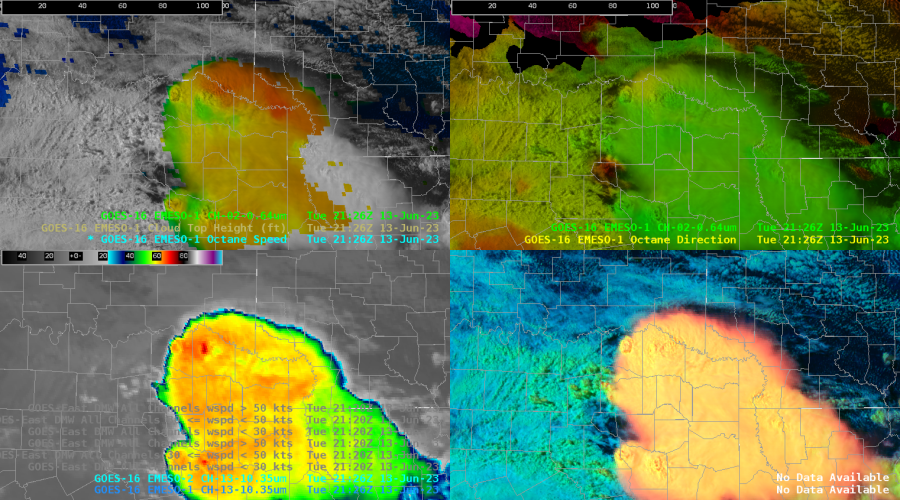
Good discussion on the potential uses of the OCTANE data. My CWA partner mentioned constructing real time hodographs that could be sampled. This is a good idea. The mental exercise to visualize the wind profiles from the height / direction/ and magnitude data is taxing to me and I think would be too time consuming in operations.
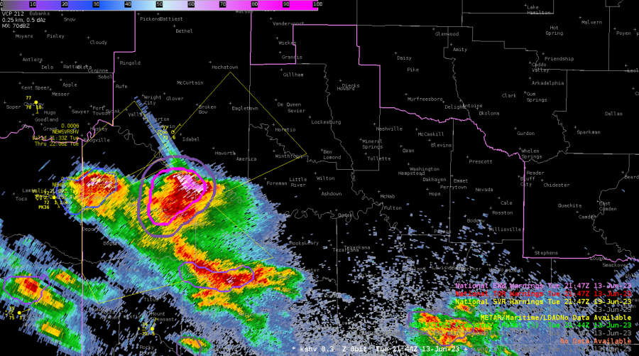
Developer stepped through the awips imaging method to highlight specific layer winds and I found this very helpful. A layered wind four panel procedure would be helpful. Also good discussion on reaching for storm scale signals in the wind fields and whether wind speed data bins could be higher resolution than radar at high elevations and distance from radar. An intense left moving storm during this exercise window across NW LA into far SE OK showed strong anvil level divergence that persisted for an extended period.
Screen capture of the ice machine and intense three body scatter spike that persisted for close to an hour at least. Probsevere was very good especially once the tracking element was assigned to just the primary updraft. I issued several warnings during the exercise window and utilized probsevere on each one. The time trend window is great and I hope it gets to the operational version soon.
The PHS idea of better utilizing sampled profiles seems good to me. I would prefer it not be solely validated by WRF model output. I like the idea of showing where the fusion data senses departure from model initial conditions similar to shown on this website: cas.hamptonu.edu/~adinorscia/InteractiveMap/FusionMap.html
NUCAPS data today was from the previous run with the 10-12 hour forecast near the exercise valid time. I compared the 11 hour NUCAPS forecast to the zero hour RAP analysis for MUCIN across the exercise domain. There was a large discrepancy between the two. Due to convection that had spread across this region earlier in the day I discounted the NUCAPS data. In this instance the NUCAPS forecast would have been viewed as suspect and likely would not have been used.
– jbm