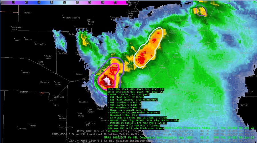
Storms over northern Bexar and southern Comal have had hail up to golfball size reported. This is in good agreement with the MESH signature. Additionally, Prob hail for both v3 and v2 are up over 80%, so in good agreement with the algorithm.

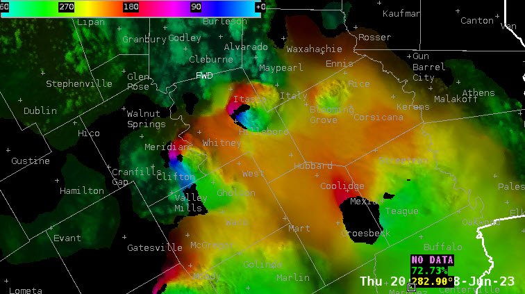
Animation of storms with the latest OCTANE. Looks like storm top divergence can be inferred from 70 kt anvil level winds to the south and 30 knot winds to the northwest. Would equate to strong divergence aloft and indicative of a severe storm.

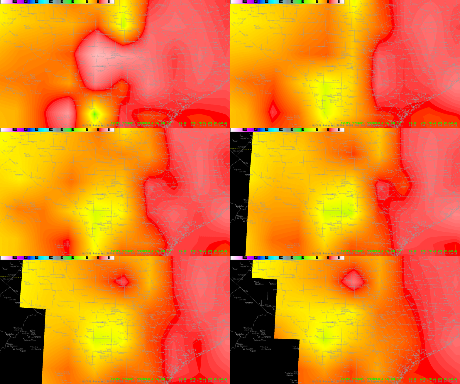
The 08Z Pass of NUCAPS shows a rather impressive PWAT/Moisture gradient this morning, which would likely lead to increased storm chances along the theta gradient over the Hill Country and stretching eastward into the I-35 Corridor. The gradient ranged from 1.25” over the Coastal Plains to .50” over the Edwards Plateau and western EWX CWA.

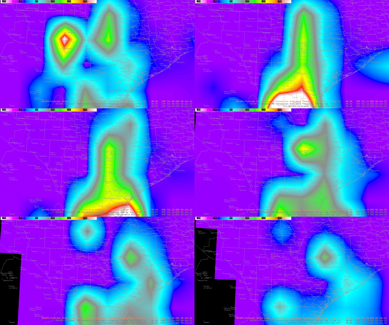
This ties in nicely with the MLCAPE available this morning.

Storms going up in a weaker shear environment with a rainbow color distribution all around the storm from the OCTANE direction window. Very interesting. You may actually be able to infer the type of storm/environmental conditions just based on OCTANE direction depending on the situation.

– Satellite Steve, StormofCentury , Bolt
