
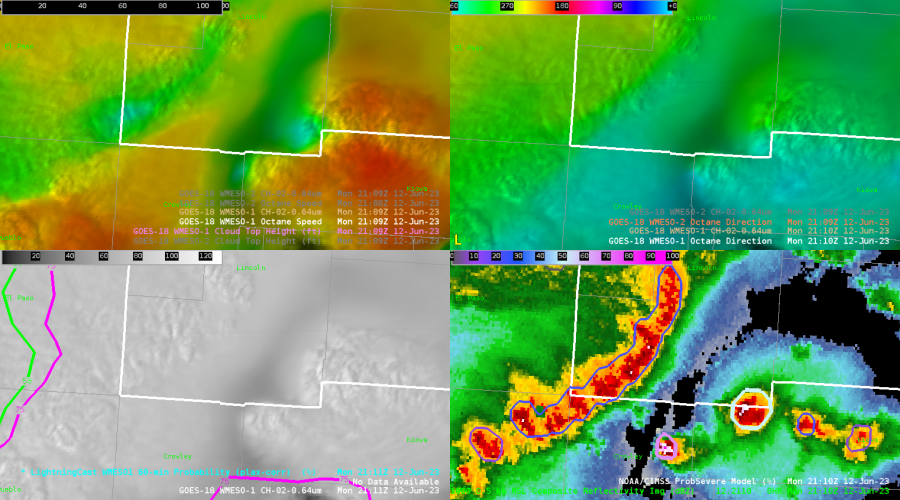
The one thing I found today from looking at PUB CWA, was that the Octane satellite image may have been picking up on areas of intensification before it was radar indicated. The areas of interest lie on the Lincoln, Cheyenne, Kiowa county lines and Lincoln, Kiowa lines as seen in the upper left image below. There is a gradient between the yellow and blue which identifies areas of divergence. The bottom right image is the radar showing that there are cells in the area.
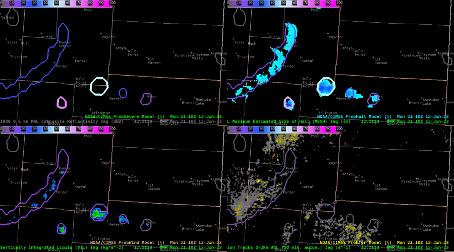
This next image shows the probsevere predictability at the time of the above image. Note the values, especially on the prob hail (upper right)
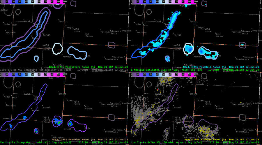
The next image below shows that the probsevere values actually did increase in under 10 minutes on ProbSevere (Top Left and Prob Hail Top Right) The intensification could be from locally enhanced wind shear as Octane shows convection developing locations of strong shear in the localized areas of divergence aloft. It will be interesting to see if this trend continues throughout the week.
-Tornader