
In the Tallahassee CWA, convection was ongoing at about 21z over the western portions of the Florida Panhandle. In order to get a quick assessment of the convective trends, loading up LightningCast with ProbSevere and MRMS radar is a good start. A loop is provided in Figure 1 below.
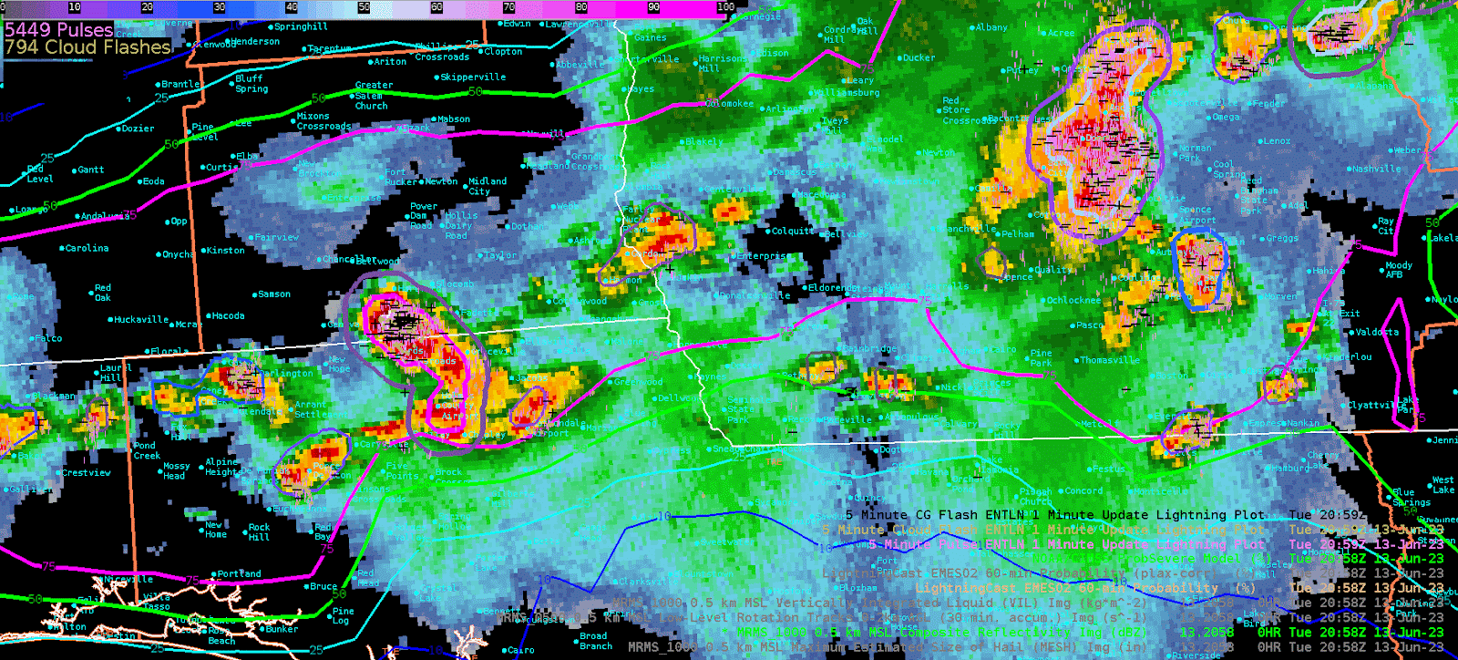
Figure 1: Loop of MRMS reflectivity overlaid with LightningCast and ProbSevere.
I noticed in southeast Alabama into southwest Georgia that LightningCast was teetering back and forth between the 50 and 75 percentile contours. LightningCast even went down to the 25% contour for a brief stint at 2041z. Looking at NLTN data, there was certainly plenty of lightning left within that storm, so I couldn’t quite understand why it went down but then pulsed back up. The other issue I ran into is the contours suggesting lightning, but convection is nowhere near the 75% contour (See Figure 2).
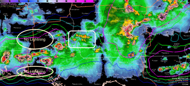
Figure 2: 2041z LightningCast with ProbSevere and NTLN lightning.
-Podium