
Widespread severe storms have been ongoing over portions of the southeast CONUS nearly all afternoon. ProbTor was doing a decent job with picking up on a couplet in Montgomery county Alabama around 1950Z. Overall it seemed that ProbTor V3 was giving higher tornado probabilities than V2. It was noted that V3 is based off of the HRRR whereas V2 is based off of the RAP. So that was rather interesting to me that the HRRR was potentially picking up on better areas of rotation.
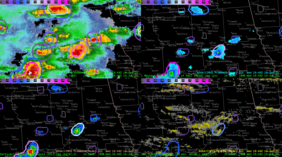
Image of ProbSevere with ProbTor in the bottom left
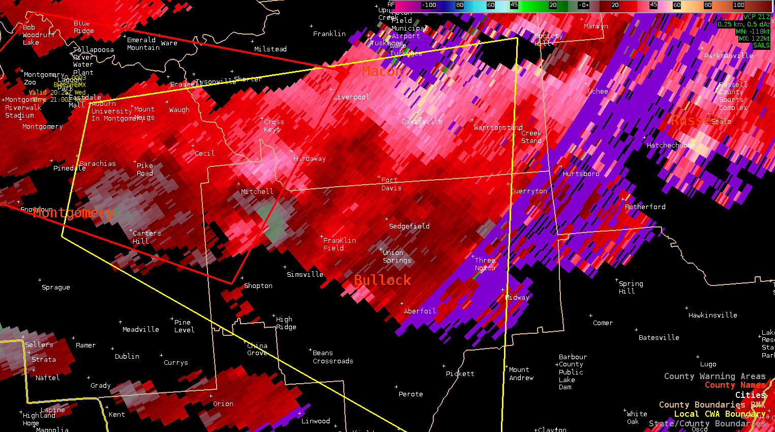
Loop of tight couplet that ProbSevere V3 was picking up on
The other really interesting feature I noticed on the part of Octane. The Octane vertical divergence fields which is noted by a sharp gradient of blue in the coloring. This was occurring around the same times as cooling cloud tops that were seen on IR imagery. This also seemed to be a precursor to when storms began to intensify on radar. Along with that intensification was when a better couplet began appearing on radar and an increase in ProbTor V3. Overall I thought that those three correlations were rather neat to see in real time. If this correlation does continue to show up then this has the potential to be another important feature of the Octane product.
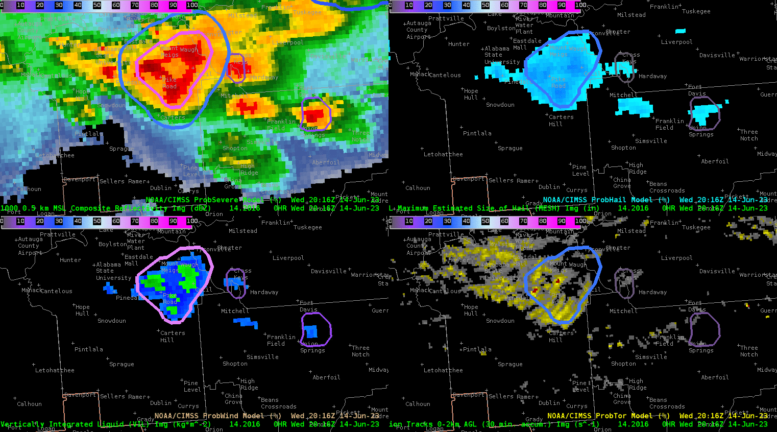
Loop of Probsevere with intensifying cluster of storms
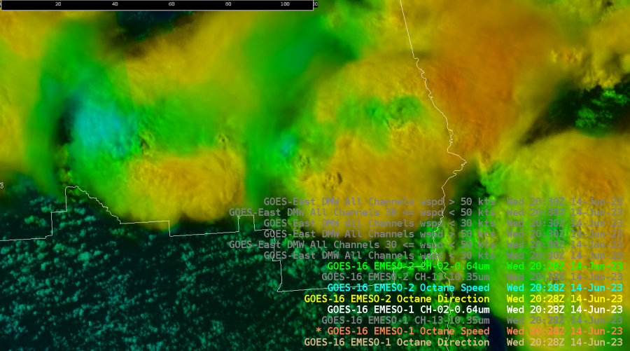
Still image of Octane showing the “Blue” Divergence aloft features
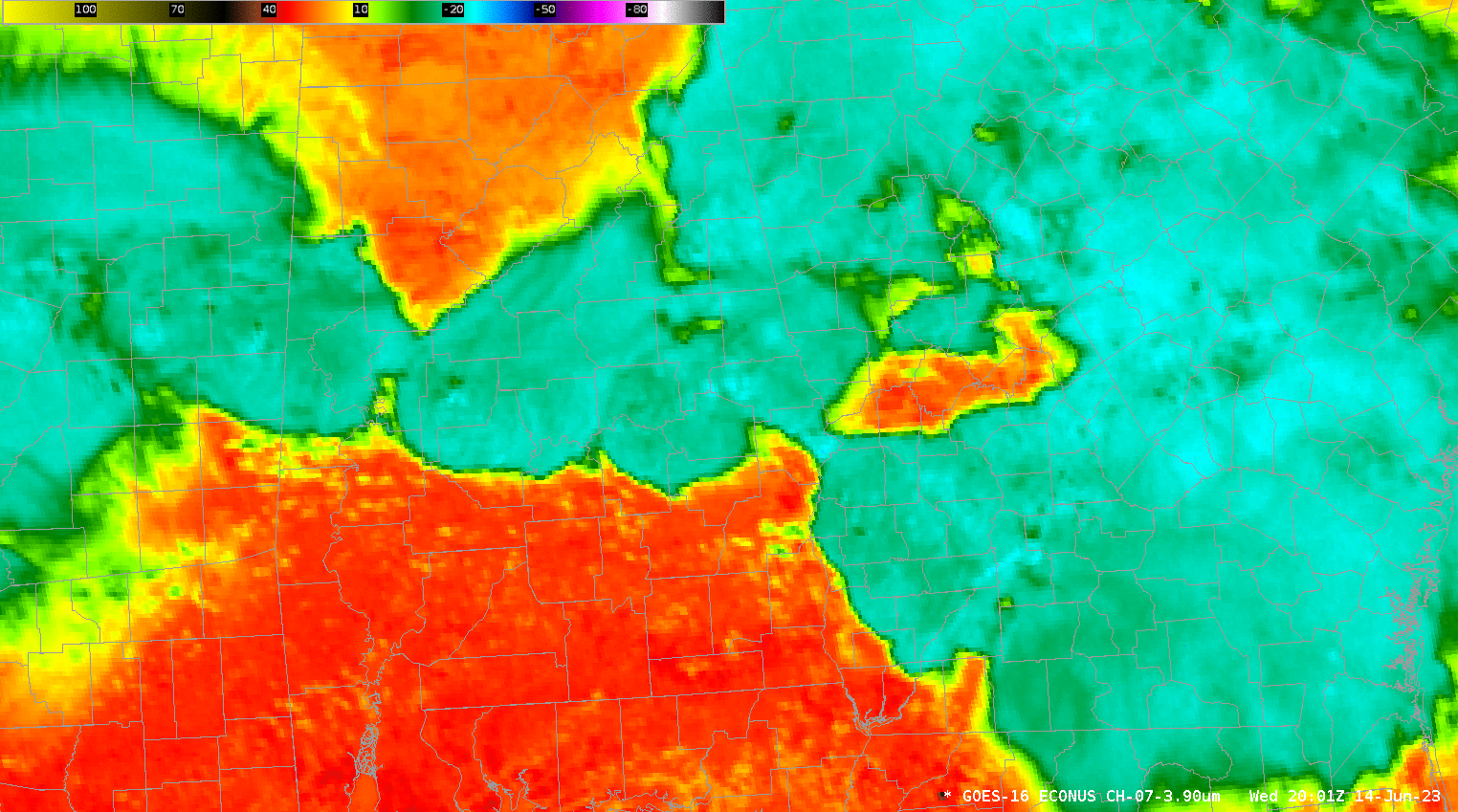
Loop of cooling cloud tops via IR
– Tor Nader