
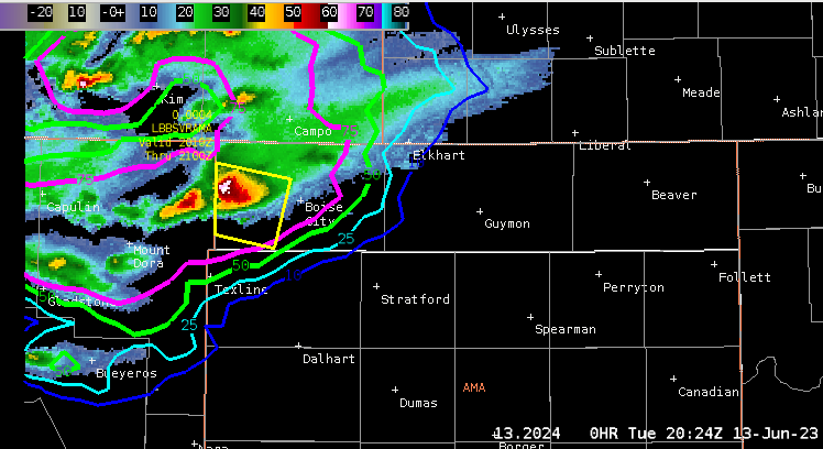
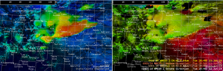
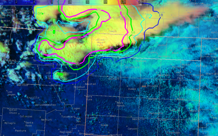
Based on the latest satellite and radar data, a supercell thunderstorm has moved into the very northwestern corner of our cwa (northwest of Boise City). A Severe Thunderstorm Warning has been issued for the Boise City area with the greatest threat being large hail, damaging winds, and maybe an isolated tornado. Echo (cloud) tops are ranging between 40-50 kft. LightningCast data is showing lightning activity increasing over that area as CAPE values have increased to 2,000 J/kg.Based off the OCTANE Motion and Speed Sandwich product, storm top divergence is evident near Boise City with the tight color gradient with winds to the north of Boise City at 234 degrees vs 188 degrees south of Boise City. This activity is being driven by a surface low near the TX/OK state line. As this feature continues to shift to the east-northeast there is the potential for this storm to strengthen and/or for additional showers and thunderstorms to develop across the area.
-SATGLM_84