
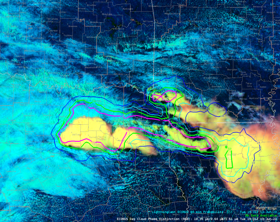
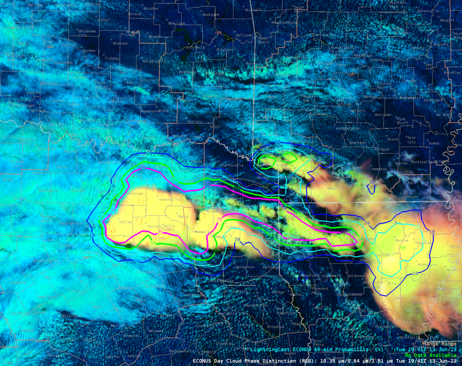
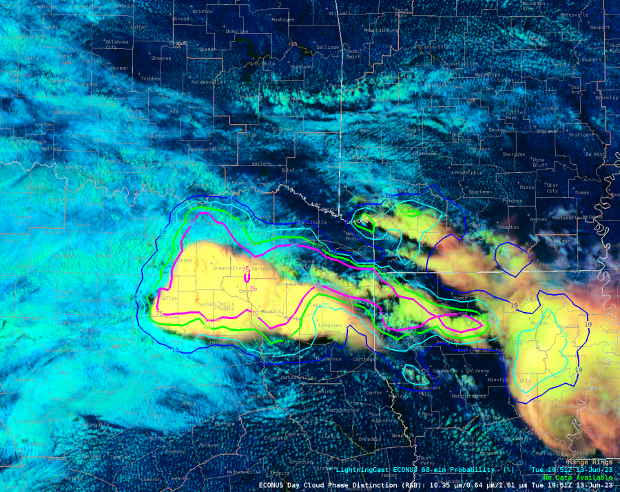
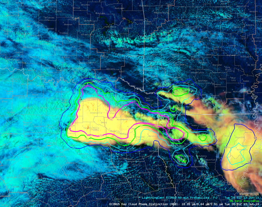
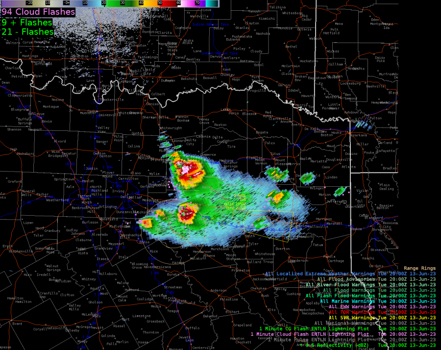
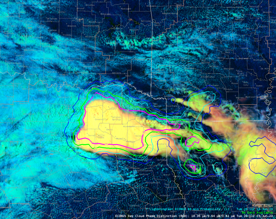
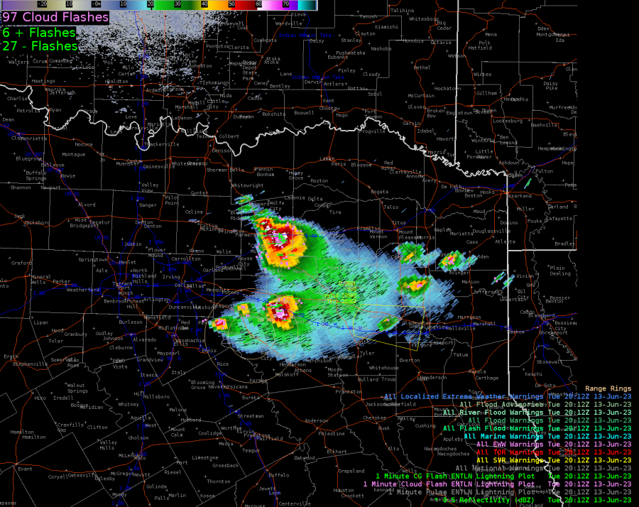
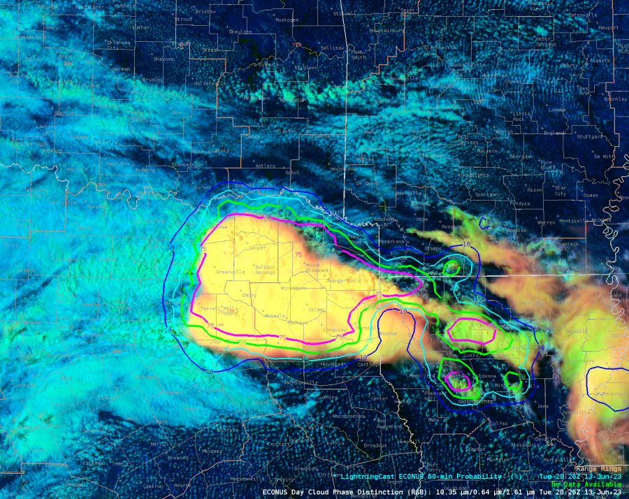
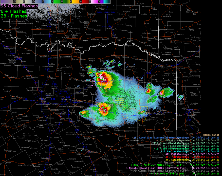
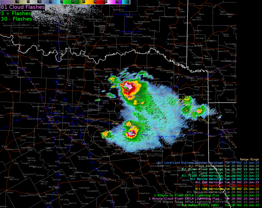
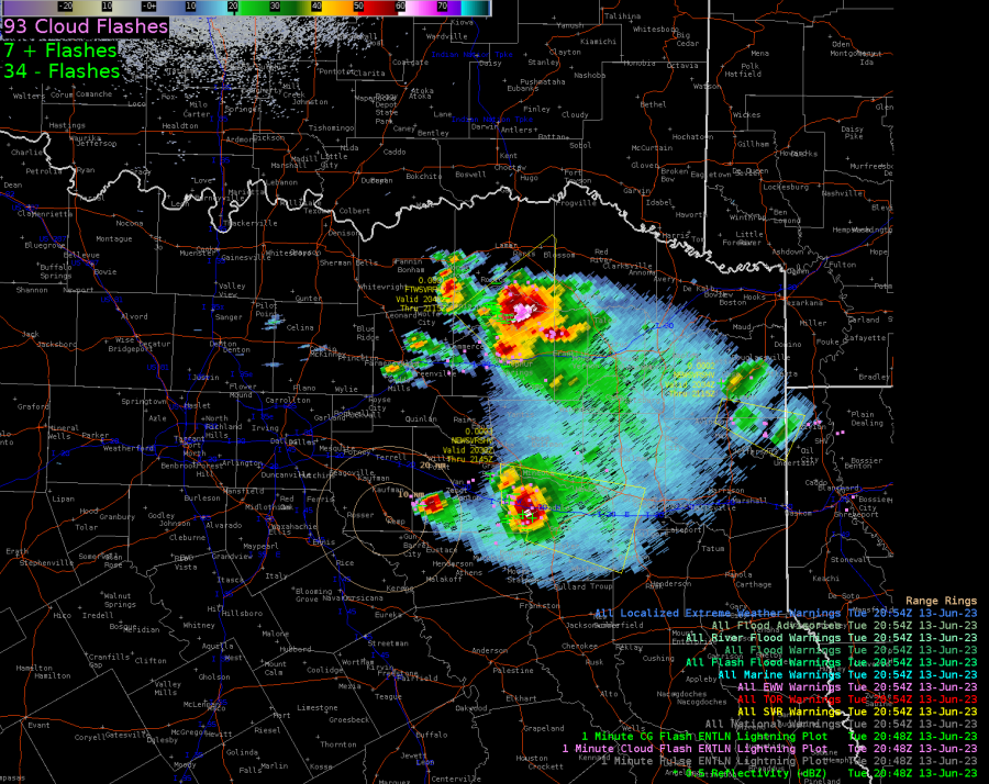
LtgCast gave advanced indication (about an hour) in the FWD region that the northern storms were diverging to the north away from the original track that was more easterly. Below you can see the LtgCast extending to the north into clear skies in the first two images. The next four pairs of images are the LtgCast paired with the radar at about the same time. The last two images are the next 20 minutes of radar.

In the TAE area, the LtgCast wasn’t as effective. Behind the storms, LtgCast kept >75% probs for lightning in clear air as seen in satellite imagery, possibly as much as 50 miles or more. This was odd in that it usually quick to pull in the probs behind the storms. It wasn’t that the storms were slow moving or inconsistent in their motions; they were moving uniformly to the southeast at a constant rate (didn’t measure the speed, but would estimate the line speed 20 kts or more).
– Super Bolt