Outlook – 4 June 2009

Running PAR/CASA archive cases for the next 1-2 hours. Will attempt to run IOP at 4 PM for the BOU CWA.  Good hodographs (very straight lines) could mean splitting storms with 40 kts 0-6 km shear and 1000-1500 J/kg CAPE.  No CIN to speak of.  Need to get further heating N of the Palmer Divide and with the low clouds burning off this should happen by 4 PM.  Radars running at KFTG, KPUX, KGLD, and KCYS.  VORTEX 2 is also in the area east of Denver.

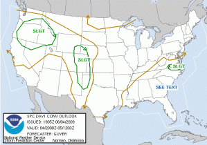
June 4 Day 1 Outlook

Liz Quoetone and Paul Schlatter (EWP Weekly Coordinators, 1-5 June 2009)

Tags: None

Outlook – 3 June 2009

June 3 Day 1 Outlook

Once again, the LWX CWA and the LMA domain is active with a SVR watch already out.  SBCAPE is around 2000 across VA, particularly well south of the quasi stationary frontal boundary that has been around for several days.  This will primarily be a wind threat with a marginal hail threat.  With very high CAPE possible across E. VA, SPC issued a 2% tornado threat.  Deep layer shear is once again paltry, with around 30 kts.  Areas with weak easterly winds, near the frontal boundary, will see the greatest deep layer shear.  The group will work an LMA IOP for the Sterling CWA until dinner time (5 or 530ish), then work a PAR/CASA tag team archived event.

1900 UTC Surface Map

Medford will again see severe storms this evening, but it was decided to focus on the LMA network and PAR/CASA archived events.  Tomorrow Medford is once again in a slight risk, so that could be an alternate IOP to the very weak CAPE/Shear expected in eastern Colorado (see graphic below).

June 3 Day 2 Outlook

Schedule:

230-500 PM: LMA IOP for the LWX Domain
500-530 PM: Dinner
530-700 PM: PAR/CASA Archived event tag team (one group on PAR, other on CASA, then switch at 700)
700-830 PM: PAR/CASA Archived event tag team

Liz Quoetone and Paul Schlatter (EWP Weekly Coordinators, 1-5 June 2009)

Tags: None

Outlook – 2 June 2009

There are numerous possibilities inside the SPC slight risk area.

Day 1 Outlook
Day 1 Outlook

There are  4 potential targets for a late afternoon/early evening IOP.

  1. Atlantic Seaboard LWX/PHI CWA:  SVR watch issued just before 19 UTC.  Main threat appears to be straight line winds given moisture pooling along weak frontal boundary and 30-35 flow around 500 mb.  Storms moving pretty fast and contain lightning, thus LMA should be able to show “something”.
  2. S. Oregon MFR CWA:  This would represent the first time HWT had a potential W. US event.  SBCAPE approaching 2000 J/kg in and around the Rogue River Valley in S. Oregon.  30 kt 0-6 km bulk shear out of the southeast is available as a large (spatially, but not particularly intense) vorticity maximum approaches from the south-southwest.  Timing should be near max diurnal heating for the west coast, meaning around 00 UTC.  Storms should move out of the SE and primary threat would be marginally severe hail (1″ criteria) and some marginally severe winds given the potential for good downdrafts.
  3. LUB CWA:  Extreme SBCAPE approaching 4000 J/kg exists across the S. TX panhandle.  Wind shear is borderline (30-35 kts 0-6 km).  Models break out precip around 00 UTC and move the storms to the east. SPC has a 5% tornado threat here, hatched hail box (30%), and 15% straight line winds.  If storms can become surface bases here, would be a good IOP for severe and the best chance for any tornadoes.
  4. OUN CWA PAR/CASA:  Storms will form along and ahead of the cold front this evening and well into the night.  Models seem to be overpredicting the amount of CAPE ahead of the front. Wind shear is around 30 kts 0-6 km out of the west.  Most likely time is 00-03 UTC across the CASA network as storms fire in NW OKlahoma and propagate with the gustfront/synoptic front to the southeast across the CASA network.

2:00-3:00 PM LMA training
3:00-4:00 PM LMA IOP in the Sterling, VA CWA inside current SVR watch
4:00-??? PM TBD:  We’ll need to pick an IOP target early and monitor for any potential changes, especially for PAR/CASA operations.

Liz Quoetone and Paul Schlatter (EWP Weekly Coordinators, 1-5 June 2009)

Tags: None

Outlook – 1 June 2009

SHORT:  Most likely IOP will be for multi-radar/multi-sensor product evaluation along frontal boundary in C. Iowa and E Nebraska during the 5-9 PM timeframe.  PAR and CASA operations are not anticipated today.

LONG:  The strong northerlies are still north of the border in Canada, but thankfully there is enough moisture around to at least get deep moist convection in the CONUS.  A weak vorticity max (weak even for early June standards) will move NE out of the 4-corners region, helping to increase low-level moisture across the central plains.  At 1600 UTC quasi-stationary front was draped across C Nebraska, C Iowa and S. Wisconsin/N. IL.  The warm sector south of the boundary should remain mostly clear and with dewpoints in the low 60s should be more than enough CAPE to get things going today in that area.

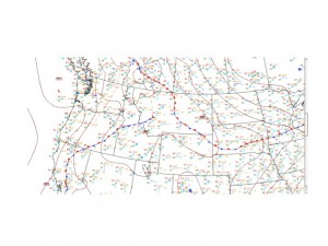
1600 DSM Surface Obs

Depth of low level mosture is of some concern in terms of overall risk of severe weather and the threat of more than just gusty outflow winds.  There is a fair amount of moisture aloft, leading to PWATs around 1.5 inches across NE and IA, and just above the shallow moist layer there is a stout EML.  Along the surface boundary storms should form in the early evening hours right around peak heating and have a decent chance of becoming severe with good threat of severe hail (assume 1 inch criteria) and straight line winds.  Wind shear is marginal in the area near and south of the surface boundary, with ~30-35 kts 0-6 km bulk shear.  Low level shear and helicity are low everywhere, thus tornadic threat from supercells would be small.  Near the surface boundary would still need to be monitored however and locally enhanced helicity/low level shear could be present.  Primary storm mode would be quasi-linear with bowing segments and perhaps 1 or 2 embedded supercell-like structures.  Here are the SPC convective outlooks issued 1300 UTC:

Day 1 Outlook: Issued 1300 UTC
Day 1 HAIL Probabilities
Day 1 Wind Probabilities
Day 1 Tornado Probabilities

The boundary is expected to lift a little north throughout the evening until/unless reinforced by convection.  Though very unlikely, there is at least a VERY small chance things might fire south into Western Oklahoma so will need to keep an eye on that area in case something gets going, but the threat of severe weather is pretty slim even if storms do form.

Next update will be during the live briefing in the NSSL dev. Lab, ~130 PM.

Paul Schlatter and Liz Quoetone (EWP Weekly Coordinators, 1-5 June 2009)

Tags: None

Outlook – 21 May 2009

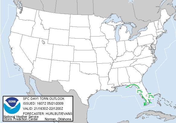
Although we anticipate working through a number of archive cases on all 4 projects today, we have decided to jump on the opportunity for a real-time IOP in Florida, where ongoing thunderstorms and others later this afternoon will carry threats for tornadoes and marginally severe hail.

Day 1 Tornado Probabilities Issued 1630Z on May 21, 2009

The team of Mike and Rob will take on this IOP once the HWT becomes initialized to the Tampa Bay CWA.  On the other side of the room, the team of Les and Matthew will work with the CASA project leads, and our guest, Ed Cravens, the emergency manager for McClain County, Oklahoma.  Ed’s presence this afternoon really represents an effort to bring end users into the research and development phase of new weather-related technologies.  The CASA group will perform warning operations using an archived data set.

Patrick Burke (EWP Weekly Coordinator, 18-22 May 2009)

Tags: None

Outlook – 20 May 2009

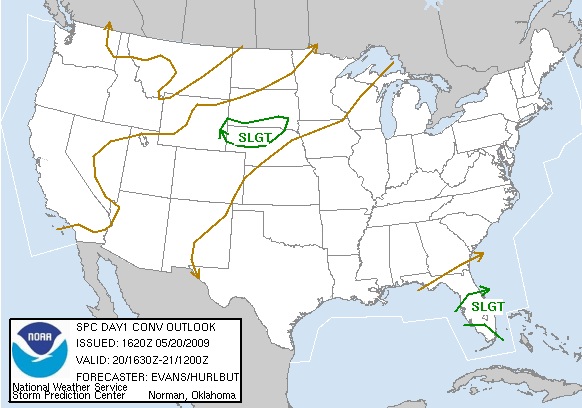
For the first and likely only time this week, we have Slight Risk areas in the Day1 Outlook from the SPC.  We will use our time this afternoon to prep the HWT systems for a MRMS IOP to take place in Wyoming/Nebraska.  The Florida Slight Risk is also intriguing, with several slow moving storms acting at times like supercells.  Lapse rates are not very steep, so the main hazard is tornadoes.  This event was ongoing early in the afternoon, however, and the risk area on the central High Plains syncs better with our operations and the availability of technical support in the HWT.

Categorical Day 1 Convective Outlook Issued 1630Z on May 20, 2009

Surface analysis revealed low pressure along a cold front in the eastern Dakotas.  A pre-frontal trough extended through central Nebraska.  Our focus for convection, though, will be the front and a deeply mixed boundary layer just south of the front in southeast Wyoming.

18 UTC surface map from the HPC

Models are consistent with a QPF signal developing in southeast Wyoming…and progressing along the stalled or slowly moving cold front in northern Nebraska and far southern South Dakota late this afternoon and this evening.

NAM Radar Reflectivity Valid at 03Z 5/21/09

This looks to be our best opportunity for a real-time IOP this week.  VORTEX2 will also be operating in our target area.

Patrick Burke (EWP Weekly Coordinator, 18-22 May 2009)

Tags: None

Outlook – 19 May 2009


We begin today wrapping up loose ends from Monday.  Forecasters will navigate some archived LMA data for the first time, just to get a feel for the data.  We will then spend 45 minutes completing an archive CASA case that was suspended at the end of yesterday, while the PAR group conducts a second archive case.  At that point, around 3:30 pm CDT, we hope to attempt a real-time Intensive Operations Period (IOP) for the Multi-Radar/Multi-Sensor project.  Today’s target is the Intermountain West, and perhaps the plains of southeast Montana.

Day 1 Categorical Convective Outlook and Hail Probabilities from the SPC issued 1630Z

The region from northern Utah across Idaho/Wyoming and into Montana, is in the warm sector ahead of an advancing Pacific cold front and associated upper level trough.  Scattered thunderstorms are forecast to form within a deeply mixed boundary layer.  Weak to low-end moderate CAPE and cloud-layer shear of 25 to 40 knots should be sufficient for organized multicell storms with marginal wind and hail threats.  There is a chance for a supercell in southeast Montana if storms can root close to the surface…where greater dewpoints to near 50 F have pooled along a quasi-stationary front.

HPC Surface Analysis Midday

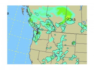
NAM 6-hr Precip from 18-00 Z May 19, 2009.  Image from UCAR

NAM 6-hr Precip from 18-00 Z May 19, 2009. Image from UCAR

Patrick Burke (EWP Weekly Coordinator, 18-22 May 2009)

Tags: None

Outlook – 18 May 2009

Our visiting forecasters/scientists arrived at the National Weather Center just before 1 pm.  This week we have Rob Handel from the Peachtree City, Georgia, NWS Forecast Office, Matthew Kramar from the Sterling, Virginia, Office, Mike Vescio from the Pendelton, Oregon, Office, and Les Lemon from the NWS Warning Decision Training Branch.

The group was met today with dry and sunny air, clear blue skies, and little prospect for thunderstorms this week in a 200 mile radius from Norman, OK.  Live operations are unlikely in the CASA and PAR networks, but the group will participate in a variety of warning simulations using archived data from these networks.  The outlook is similar for the LMA testbeds.  An elongated upper ridge will build from Oklahoma toward the Washington D.C. area testbed, keeping the weather dry there.  A broad upper level circulation developing in the eastern Gulf will remain stationary or retrograde slightly, but the chance of significant thunderstorms in the Huntsville, Alabama, LMA testbed is low.  LMA research will likely be based in archived data this week.

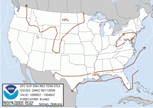
Multi-Radar, Multi-Sensor (MRMS) warning operations, however, may be supported in real time from any WSR-88D in the continental U.S.  Currently, the most likely opportunities for real-time MRMS operations appear to be Tuesday evening in Montana, and either Wednesday or Thursday evening in the central High Plains, just east of the Colorado and Wyoming front range.  Below is the probabilistic outlook for severe thunderstorms on Tuesday, forecast by the Storm Prediction Center:

day2probotlk_1730_any.gif

Patrick Burke (EWP Weekly Coordinator, 18-22 May 2009)
Tags: None

Outlook – 11 May 2009

For week 3, the participants are Steve Hodanish NWS PUB, Chris Wielke EC Edmonton, Kevin Brown NWS OUN, and John Billet NWS AKQ.

This is orientaton day.  The IOP begins at 5:30 pm Four projects are on tap for week 3 of the 2009 EWP.

Stabilized air over OK in the wake of last night’s MCS precludes the possibility of convection over TX .  Overnight, lee troughing in the high plains will help lift the front in central TX northward toward the Red River Valley.  An intensifying LLJ interacting with the front could create another MCS over OK after the planned IOP closes.  No IOP is likely for CASA, PAR or the OK LMA region.

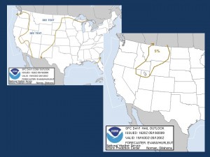
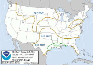
Of the HSV and IAD LMA regions, only the IAD region has the potential for convection.  A weak midtropospheric shortwave trough is expected to cross the IAD region accompanied by weak instability and marginally strong enough convection to product lightning.  However the possibility for severe weather events is too low to consider an LMA IOP there.  The following graphics show the SPC general thunder risk (left, top) and the day 1 outlook (right, bottom).

The four EWP participants will go through a CASA and a PAR case.

Jim LaDue (EWP Weekly Coordinator, 11 – 15 May 2009)

Tags: None

Outlook – 7 May 2009

It looks like a return to North Carolina today.  Currently, SPC’s day 1 outlook is on the fringes of all of our LMA network domains and the timing is not there for a possible real-time PAR exercise as the models have convection late on the edge of the PAR domain.  However, per NSSL WRF and NWSFO RAH’s local WRF, it appears we will have another opportunity at storms in North Carolina today.  These models are suggesting storms will develop in central NC in the 18-20Z timeframe and then move east.  The models also suggest a complex of storms will form before moving off the coast.  This allows for the possibility of an extended MR/MS IOP with a good mix of storm mode, including supercells.

Kiel Ortega (EWP Weekly Coordinator, 4 – 8 May 2009)

Tags: None